


From the beautiful Haldensee to the Edenbachalm. A beautiful alp embedded between a magnificent mountain scenery. During the ascent or descent you can enjoy the magnificent view of the Haldensee.

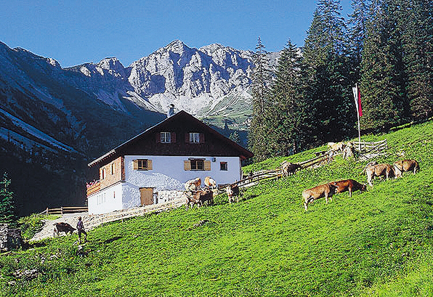
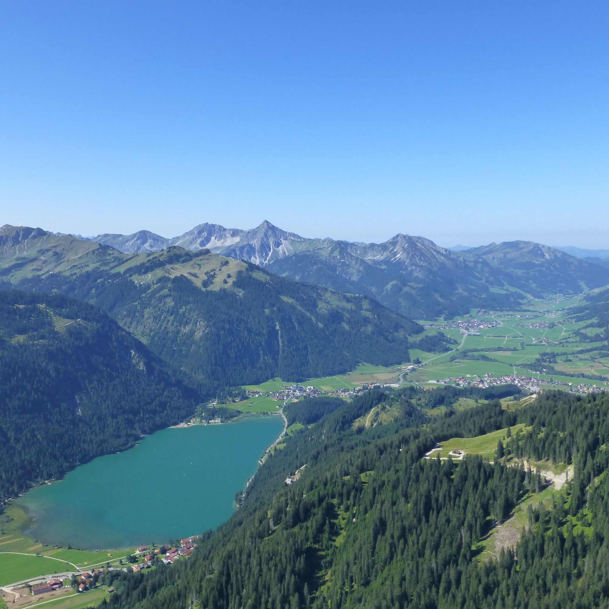
From the lakeside parking lot we start towards the south. Past the Bloderteich pond we follow the signs to the Edenbachalm. The generous path runs serpentine uphill. We do not climb steeply and comfortably. Take your time and enjoy the wonderful view of the clear blue Haldensee. Soon you will reach the alp. And after an excellent stop for refreshments we start downhill again on the same path.
Yes
Yes
The personal mountaineering equipment must be safe and serviceable and meet the relevant technical standards. Every hiker is recommended to obtain information about the planned tours from specialist alpine literature or on site.
General valid and customary rules of conduct
It should be noted that in mountaineering there is an increased risk of accidents and injuries. Despite careful route planning, a basic risk always remains. Tour preparation through endurance sports, appropriate technical training and further education as well as personal prudence reduces the danger of accidents and risks. However, please never forget that the weather in the mountains can change very quickly. Stay on the marked hiking trails.
On the motorway A7 at the exit "Oy-Mittelberg" on the B310 towards Wertach and to Oberjoch. There follow the signposting "Tannheimer Tal" B199 until Haldensee. From the Tyrolean side via Reutte on the B198 towards Lechtal until Weißenbach, over the Gaichtpass along the B199 until Haldensee.
By train to Sonthofen, Pfronten/Ried or Reutte, then by bus to Haldensee.
Seeparkplatz Haldensee - parking fee
Great snacks and dishes on the Edenbachalm.
Webcams of the tour
Tannheim
Neunerköpfle Mittelstation
Haldensee - Neunerköpfle
Grän - Almdorf Tirol
Neunerköpfle Mittelstation
Neunerköpfle Mittelstation
Neunerköpfle Mittelstation
Neunerköpfle Mittelstation
Neunerköpfle Mittelstation
Neunerköpfle Mittelstation
Neunerköpfle Mittelstation
Grän - Hotel Bergblick
Füssener Jöchle Bergstation
Füssener Jöchle Bergstation
Füssener Jöchle Bergstation
Füssener Jöchle Bergstation
Füssener Jöchle Bergstation
Tannheimertal
Füssener Jöchle Bergstation
Füssener Jöchle Bergstation
Haller
Haller
Haller
Haller
Haller
Popular tours in the neighbourhood
- 4,2
Three-lake route (awarded the Tyrolean Hiking Trail Seal of Quality)
mediumHiking14,8 km - 4,2
Höllschlucht hike » Water & Forest
mediumHiking7,38 km - 4,6
3-Seen Rundtour Vilsalpsee / Schrecksee / Traualpsee
mediumHiking17,1 km - 4,8
3-Gipfel-Tour
mediumHiking11,2 km - 4,5
Mountain hike to the Aggenstein
heavyHiking15,3 km - 4,0
From Tannheim to the Sulzspitze
mediumHiking15,6 km - 4,8
Around Weißensee
lightHiking6,12 km - 5,0
Hiking tour to Breitenberg
heavyHiking15,6 km - 5,0
Gemeinde Grän, Tirol/Österreich Aggenstein Rundtour über Höhenweg
mediumHiking9,84 km - 4,8
To the Bad Kissinger Hut via the Gräner Höhenweg
mediumHiking13,0 km

Hiking & Tracking


Don't miss out on offers and inspiration for your next holiday
Your e-mail address has been added to the mailing list.