


The old Traunsteiner Hut stands together with 14 alpine huts in Austrian territory. The New Traunsteiner Hut is located on German territory. In addition to the diverse mountain flora, the extensive dwarf...
The old Traunsteiner Hut stands together with 14 alpine huts in Austrian territory. The New Traunsteiner Hut is located on German territory. In addition to the diverse mountain flora, the extensive dwarf pine fields and the beautiful stands of Swiss stone pine are particularly worth seeing.

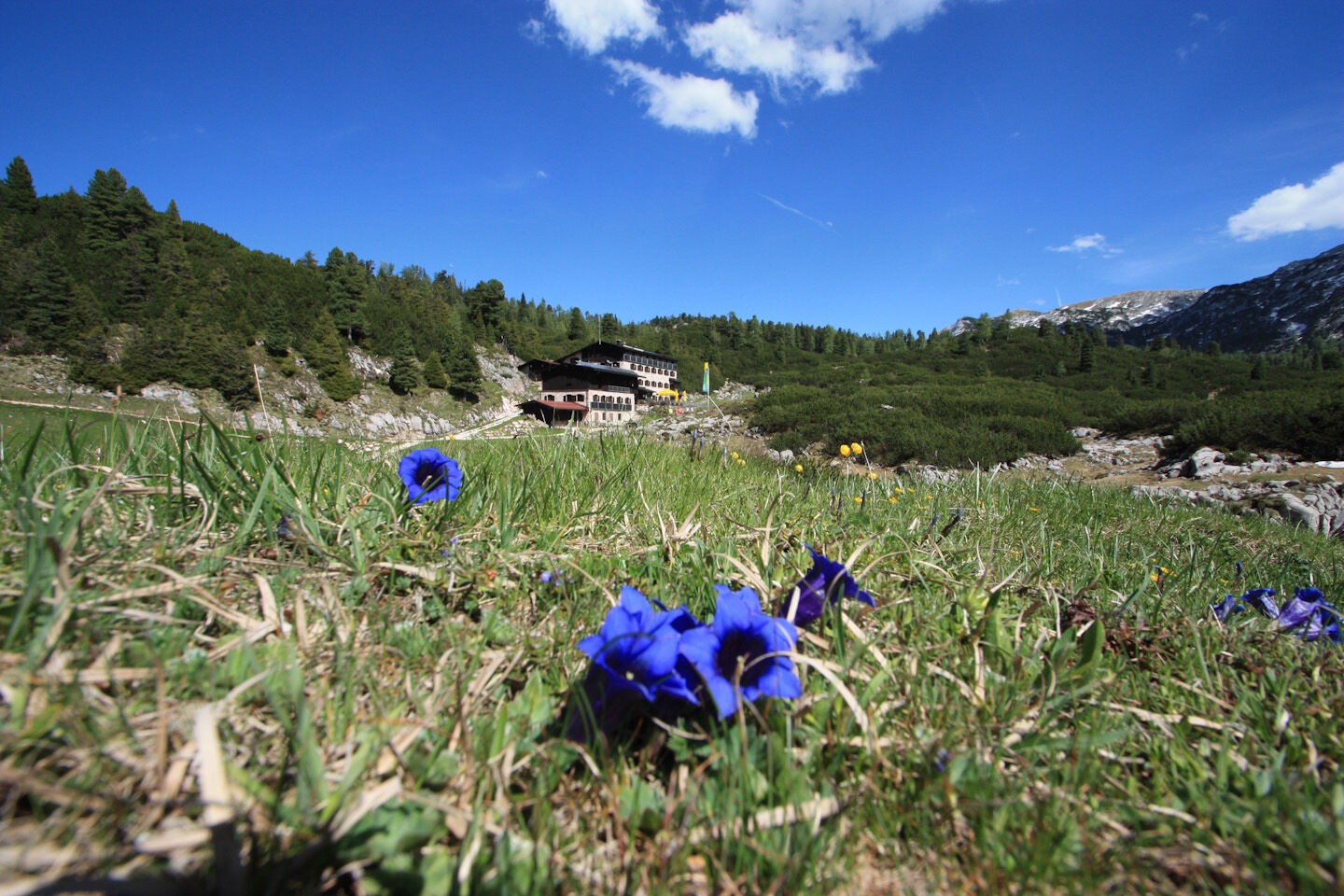
From Reith, follow the marked forest road along the Donnersbach until you reach a cattle path (Alpasteig) that leads up to the Alpaalm. From here, you ascend through terrain with dwarf pine until the edge of the plateau. Finally, you follow a red-marked path over alpine meadows to the New Traunsteiner Hut
Clothing: Comfortable hiking shoes, breathable clothing depending on the weather (T-shirt, lightweight pants).
Equipment: Small backpack, sunscreen, hat or cap, first-aid kit, mobile phone.
Supplies: Sufficient water, snacks (energy bars, nuts, dried fruits).
Navigation aids: Map or hiking app, compass (optional).
Other: Light pocket knife or multitool, insect repellent (if needed).
As needed: Rain jacket, sunglasses.
From Salzburg or Zell am See to Reith near Unken (directions)
By line bus 260 (Salzburg - Lofer - Zell am See) to the stop Unken Reith (timetable)
Parking lot directly after the Reither bridge, free parking, limited capacity
Easy-to-walk, very scenic hike!
Popular tours in the neighbourhood
- 3,2
From Heutal to Sonntagshorn in the Salzburger Saalachtal
mediumHiking11,7 km - 4,5
Rundweg vom Hintersee zur Halsalm
mediumHiking9,53 km - 4,4
Wimbachgrieshütte
Hiking8,30 km - 4,9
von Schönau am Königssee zum Watzmannhaus und zurück
mediumHiking17,1 km - 5,0
Watzmann Überschreitung an einem Tag
heavyHiking23,9 km - 4,2
Halsalm
Hiking6,43 km - 5,0
Sonntagshorn über Hochalm (Unken, Heutalbauer)
mediumHiking11,2 km - 4,9
Blaueishütte
mediumHiking11,4 km - 3,8
Durch die Hochalmscharte
mediumHiking12,1 km - 2,8
Almerlebnisweg Ramsau
Hiking11,8 km
Hiking & Tracking


Don't miss out on offers and inspiration for your next holiday
Your e-mail address has been added to the mailing list.