Križna Gora above Škofja Loka
light
Navigate
Navigate
Get this tour on your mobile
Križna Gora above Škofja Loka
light
Hiking
4,72
km
Scan the QR code and start navigation in the bergfex app

Hiking & Tracking


Distance
4,72
km
Duration
01:50
h
Ascent
440
m
Sea level
381 -
807
m
Track download
Križna Gora above Škofja Loka
light
Hiking
4,72
km


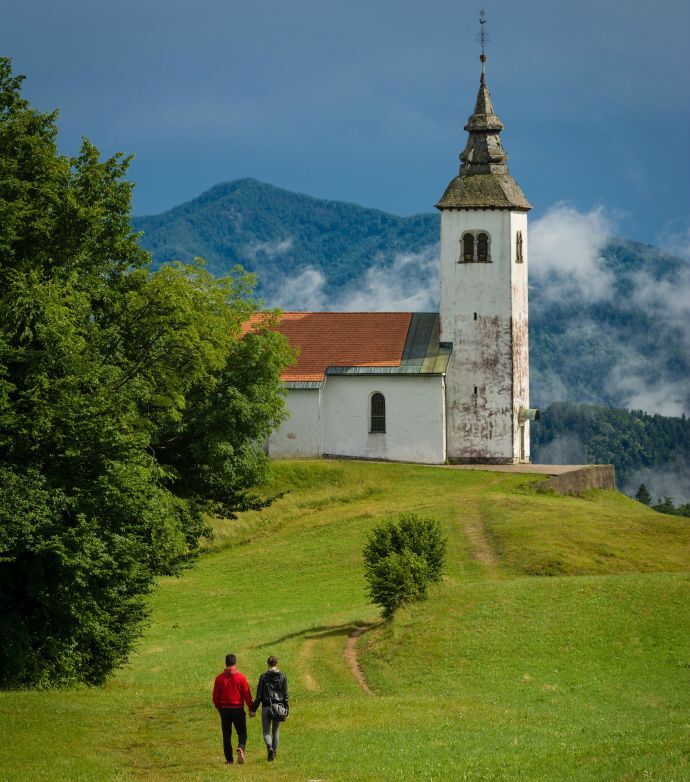
A pleasant hike from Škofja Loka past Pevno toCrngroba and the ascent past the Church of the Annunciationthrough the forest to Planica. Descent along the ridge to Križna goraand past the hamlet of Cavrn...
Description of the
A pleasant hike from Škofja Loka past Pevno toCrngroba and the ascent past the Church of the Annunciationthrough the forest to Planica. Descent along the ridge to Križna goraand past the hamlet of Cavrn to the starting point.
Route
Moškrin
(382 m)
Village
0,0 km
Planica
(823 m)
Summit
3,9 km
Cerkev Svetega nadangela Gabrijela
(823 m)
Place of worship
4,0 km
Route
Križna Gora above Škofja Loka
light
Hiking
4,72
km
Moškrin
(382 m)
Village
0,0 km
Križna Gora
(682 m)
Village
2,2 km
Luže
(729 m)
Summit
2,6 km
Planica
(823 m)
Summit
3,9 km
Cerkev Svetega nadangela Gabrijela
(823 m)
Place of worship
4,0 km
Planica
(736 m)
Settlement
4,5 km
Author
Provided by Slovenia Outdoor
The tour Križna Gora above Škofja Loka is provided by outdooractive.com.

Route information
Summit tour
Yes
Safety instructions
No safety issues
Arrival information
Arrival
20 minutes from Ljubljana (towards Medvode)
Public transport
You can reach Škofja Loka with bus from Ljubljana
Parking
Available
No reviews yet
Popular tours in the neighbourhood
Circular route to Jamnik
mediumHiking10,7 kmKaravanke Trail- STAGE 3: Kranj - Tržič
mediumLong-distance walking trail28,6 kmRatitovec
lightHiking5,06 km- 5,0
Karavanke Trail - STAGE 2: Preddvor - Kranj
lightLong-distance walking trail13,4 km Skofia Loka - Blegos-Tour mit Wanderung auf den Blegos
mediumE-MTB53,2 km- 5,0
Blegoš
mediumHiking4,67 km Ena loška krožna
lightHiking14,3 kmBOHINJ I3C: Rovtarica - Dražgoše - Radovljica
mediumCycling27,7 kmSlovenian mountain trail
heavyLong-distance walking trail615,4 kmCycling path Kranj - Preddvor - Kranj
lightCycling27,0 km
Hiking & Tracking

Over 550.000 tour suggestions, detailed maps and an intuitive route planner make the app a must-have for all nature enthusiasts.

Don't miss out on offers and inspiration for your next holiday
Subscribe to the newsletter
Error
An error has occurred. Please try again.Thank you for your registration
Your e-mail address has been added to the mailing list.
Tours throughout Europe
Austria Switzerland Germany Italy Slovenia France Netherlands Belgium Poland Liechtenstein Czechia Slovakia Spain Croatia Bosnia and Herzegovina Luxembourg Andorra Portugal Iceland United Kingdom Ireland Greece Albania North Macedonia Malta Norway Montenegro Moldova Kosovo Hungary San Marino Romania Estonia Latvia Belarus Cyprus Lithuania Serbia Bulgaria Monaco Denmark Sweden Finland