
- Brief description
- Difficulty
-
medium
- Rating
-
- Starting point
-
Črni Kal
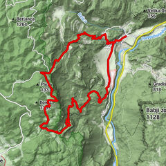
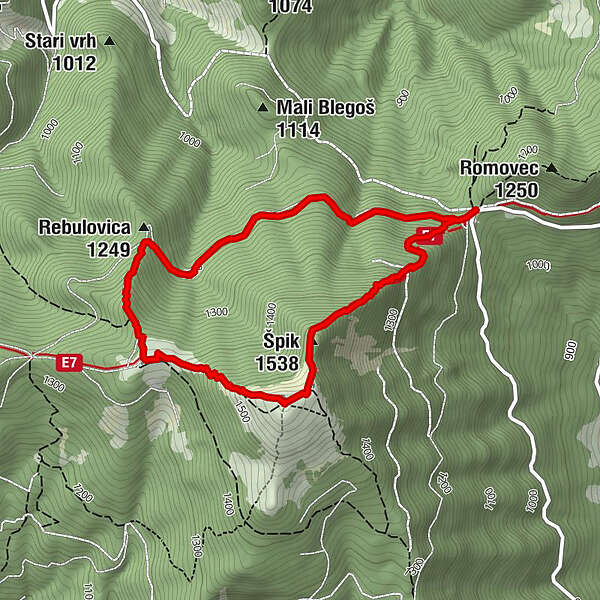
- Route
-
Špik (1,538 m)1.1 kmBlegoš (1,562 m)1.4 kmKoča na Blegošu2.2 kmČrni kal (1,112 m)4.5 km
- Best season
-
JanFebMarAprMayJunJulAugSepOctNovDec
- Description
-
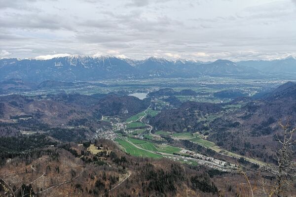
Blegoš, with an elevation of, is the second highest peak in the Škofja Loka Hills of Upper Carniola, after Ratitovec. From the summit it is possible to see the highest Slovenian mountain groups in the Julian Alps, the Karawanks and the Kamnik–Savinja Alps
You can make a round trip on this popular hiking spot. You will hike up the mountain on a direct path to the top of mountain. The trail is quite steep, heading through the forest. Top of Blegoš is without forest, only covered with grass. Along the way and on the top you will find a range of military bunkers, remains of Rupnik defence line from before the WW2. With a torch and caution, you can go explore them.
From the top opens a beautiful view on the mountains – Julian Alps, Karawanks and Kamnik-Savinja Alps.
A bit lower you will find a mountain hut for refreshment and rest, and from there you return to the parking via macadam road, or return on the same way you came up.
- Directions
-
From the parking lot, you will see the sign above the road that says " We walk from here". At the sign find a trail heading up in the forest, and it will take you to the top. On the top follow the markings towards the hut.
From there descend on the wide hiking trail and road back to the parking lot at Črni Kal.
- Highest point
- 1,547 m
- Endpoint
-
Črni Kal
- Height profile
-
 © outdooractive.com
 - Equipment
-
Hiking equipment and a headlight or a torch.
- Safety instructions
-
When heading into the bunkers, take extreme caution not to fall into shafts or injure yourself on rusted iron.
- Tips
-
Take a torch or a headlamp with you on this trip, so that you will be able to visit old bunkers and tunnels.
- Additional information
-
Slovenian writer Ivan Tavčar describes and glorifies mountain Blegoš in his famous work Autumn blossoms. Part from the book:
»Among Slovenian mountains Blegoš is not giant! And is not encased with magnificence, which encases our snow-whites and of what his neighbour Ratitovec has. It is encased only with humble beauty of humble Slovenian mountain pasture, which does not know ethernal snow, neither infertile scree slopes and neither wild precipices. Despite this in his own humble pays off hundredth the effort full path, which you had to walk to his grassy roof«
- Directions
-
Thorugh Škofja Loka, Gorenja Vas, Poljane, Blegoš, Črni Kal
- Public transportation
-
No public transport to the starting point. Available bus connections to Škofja Loka.
- Parking
-
Free parking available at Črni Kal
- Author
-
The tour Blegoš is used by outdooractive.com provided.