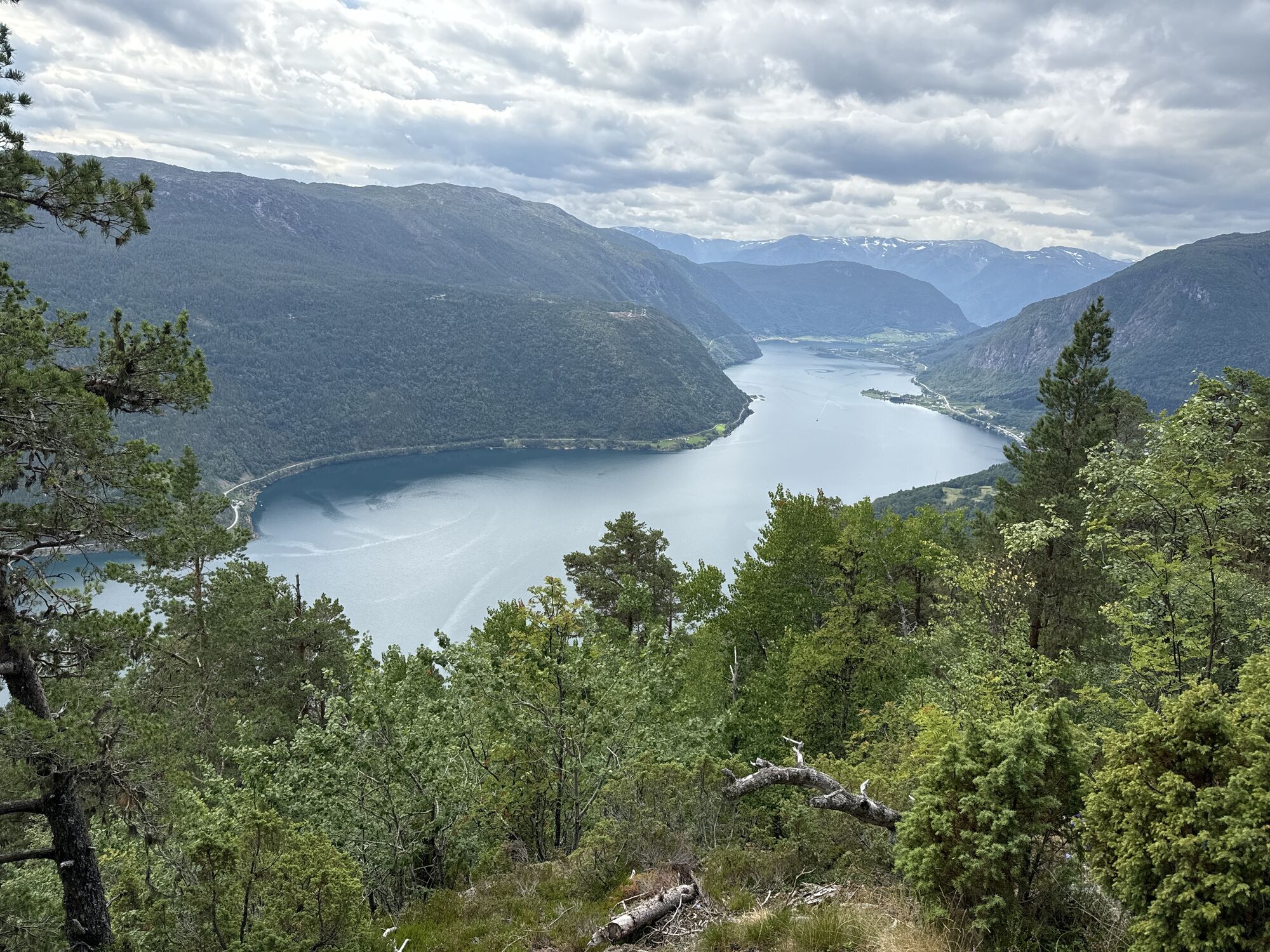
Sogndal - Stedje kyrkje - Dagsturhytte Stedjestova - Stedjeåsen
heavy
Navigate
Navigate
Get this tour on your mobile
Sogndal - Stedje kyrkje - Dagsturhytte Stedjestova - Stedjeåsen
heavy
Hiking
18,31
km
Scan the QR code and start navigation in the bergfex app

Hiking & Tracking


Distance
18,31
km
Duration
05:20
h
Ascent
731
m
Sea level
-
m
Track download
Sogndal - Stedje kyrkje - Dagsturhytte Stedjestova - Stedjeåsen
heavy
Hiking
18,31
km


Route
Sogndal
(13 m)
City
0,0 km
Stedje kyrkje
(35 m)
Place of worship
0,7 km
Stedje
(34 m)
Neighbourhood
0,9 km
Dagsturhytte Stedjestova
(301 m)
Refuge (unmanaged)
2,0 km
Utsikten
(593 m)
Viewpoint
3,6 km
Stedjeåsen
(620 m)
Corridor/terrain
3,9 km
Fardal
(8 m)
Neighbourhood
10,9 km
Route
Sogndal - Stedje kyrkje - Dagsturhytte Stedjestova - Stedjeåsen
heavy
Hiking
18,31
km
Sogndal
(13 m)
City
0,0 km
Stedje kyrkje
(35 m)
Place of worship
0,7 km
Stedje
(34 m)
Neighbourhood
0,9 km
Dagsturhytte Stedjestova
(301 m)
Refuge (unmanaged)
2,0 km
Utsikten
(593 m)
Viewpoint
3,6 km
Stedjeåsen
(620 m)
Corridor/terrain
3,9 km
Fardal
(8 m)
Neighbourhood
10,9 km
Stedje
(34 m)
Neighbourhood
17,7 km
Sogndal
(13 m)
City
18,3 km
No reviews yet
Popular tours in the neighbourhood
Sogndal - Stedje - Dagsturhytte Stedjestova - Stedjeåsen
mediumHiking7,29 kmSogndal - Dagsturhytte Stedjestova - Stedjeåsen - Utsikten
mediumHiking6,15 kmSogndal - Storehaugen
mediumHiking10,6 kmSogndal - Dueskardhøgdi
mediumHiking14,5 kmLuster - Store Haugmelen
heavyHiking22,3 kmStedje - Stedje kyrkje - Sogndal
lightHiking6,65 kmØlnes - Grushola - Sogndal
heavyHiking18,5 kmSogndal - Amla - Kaupanger - Knaken
lightHiking4,79 kmSolvorn - Kvitabui Matnaust og Galleri - Galten - Walaker Hotell
lightHiking5,04 kmSogndal - Bjørgahaug
mediumHiking6,14 km
Hiking & Tracking

Over 550.000 tour suggestions, detailed maps and an intuitive route planner make the app a must-have for all nature enthusiasts.

Don't miss out on offers and inspiration for your next holiday
Subscribe to the newsletter
Error
An error has occurred. Please try again.Thank you for your registration
Your e-mail address has been added to the mailing list.
Tours throughout Europe
Austria Switzerland Germany Italy Slovenia France Netherlands Belgium Poland Liechtenstein Czechia Slovakia Spain Croatia Bosnia and Herzegovina Luxembourg Andorra Portugal Iceland United Kingdom Ireland Greece Albania North Macedonia Malta Norway Montenegro Moldova Kosovo Hungary San Marino Romania Estonia Latvia Belarus Cyprus Lithuania Serbia Bulgaria Monaco Denmark Sweden Finland