


Allgemeine Beschreibung: Startpunkt der Tour ist der Gasthof Kühle Rast (1191 m) westlich von Gmünd bei Gerlos. Von hier wandern wir am Weg Nr. 8 entlang des Schwarzachbaches über die Schwarzachbachlaste...
Allgemeine Beschreibung:
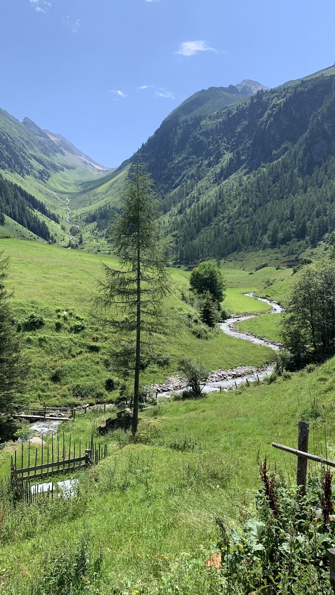
Startpunkt der Tour ist der Gasthof Kühle Rast (1191 m) westlich von Gmünd bei Gerlos. Von hier wandern wir am Weg Nr. 8 entlang des Schwarzachbaches über die Schwarzachbachlaste zur Jausenstation Schwarzachalm (1378 m).
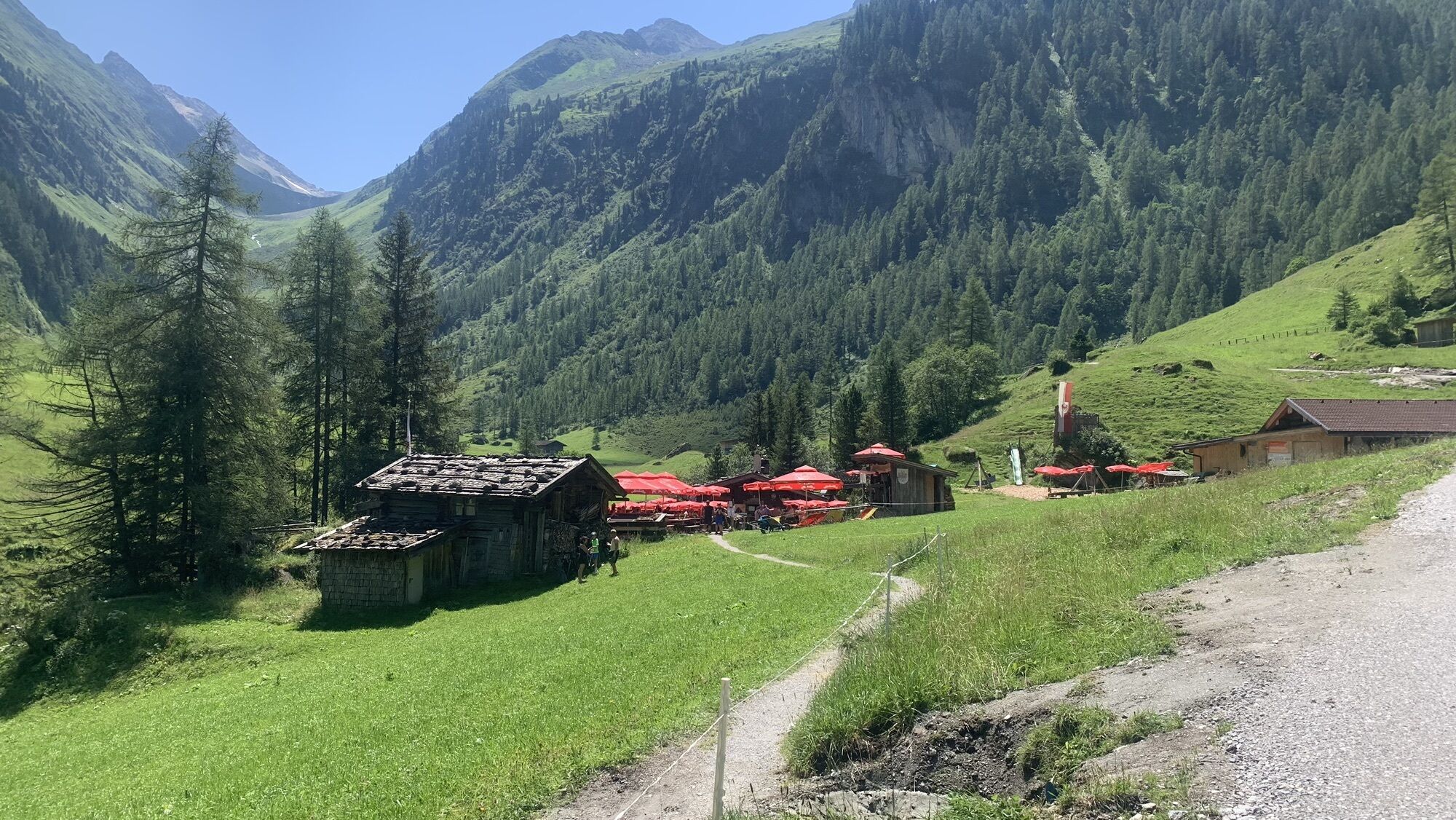
bergaktiv-Tip: Auf der Schwarzachtalalm werden die Gäste vom „Urviech Hans“ mit Tiroler Köstlichkeiten verwöhnt. Zünftige Hüttengaudi ist garantiert, wenn der Hans zum Singen anfängt!
Von der Schwarzachtalalm folgt man dem Schwarzachtal bis zum Talschluss und erreicht das Ziel der Tour – die Schwarzachtalscharte auf 2475 m. Zurück auf dem selben Weg.
Bemerkungen:
Nur für geübte Wanderer!


Kombinationsmöglichkeiten / Varianten:
Tour zum Brandberger Joch oder auf den Brandberger Kolm.
Schwarzachtalalm
Yes
An der Abfahrt Achensee/ Zillertal von der A12 abfahren. Dem Zillertal auf der B169 Richtung Süden über Fügen bis nach Zell am Ziller folgen. Von dort auf der B165 Richtung Osten über Hainzenberg nach Gerlos.
Popular tours in the neighbourhood
- 4,7
Zittauer Hütte
mediumHiking6,85 km - 4,3
Krimmler Tauernhaus
mediumHiking10,4 km - 4,3
Krimml Waterfall Path (full tour)
mediumHiking4,74 km - 3,9
Edelhütte
lightHiking3,16 km - 4,0
Durlassboden Reservoir (full tour)
lightHiking10,7 km - 4,5
Mayrhofen-Stilluptal
mediumMountainbike18,4 km - 4,7
Krimmlerwasserfälle
mediumHiking10,5 km - 4,7
Der Krimmler Wasserfallweg
mediumHiking7,19 km - 4,4
Untere Wasserälle Krimml Krimml, Österreich
lightHiking5,04 km - 4,5
Ahornspitze
mediumMountain hiking14,2 km
Hiking & Tracking


Don't miss out on offers and inspiration for your next holiday
Your e-mail address has been added to the mailing list.