


From the chapel at Rettenbach Glacier you follow the walking trail to Pitztaler Jöchl car park where the gravel trail to Pitztaler Jöchl starts (in early summer there might be a snow field). In late summer...
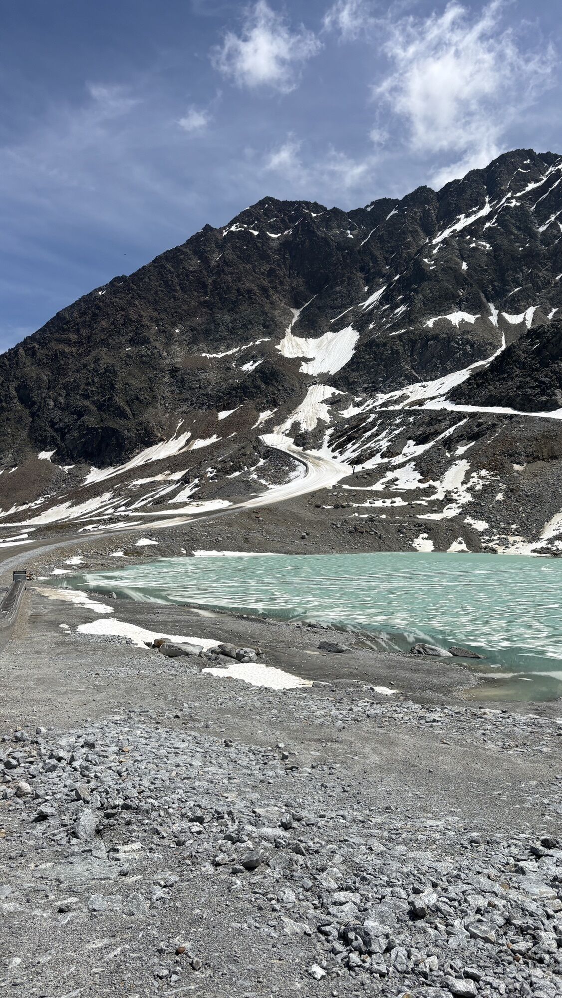
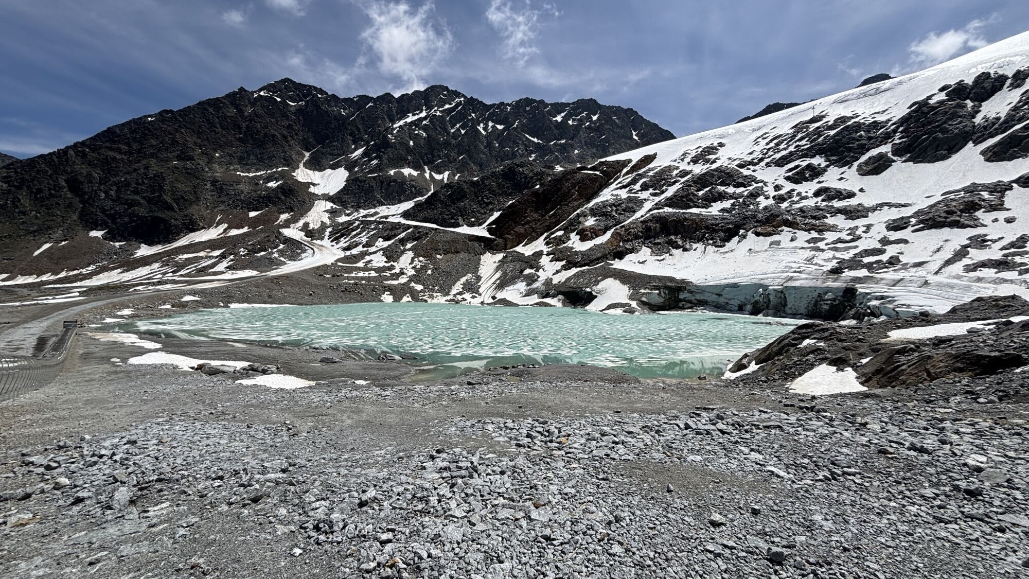
From the chapel at Rettenbach Glacier you follow the walking trail to Pitztaler Jöchl car park where the gravel trail to Pitztaler Jöchl starts (in early summer there might be a snow field). In late summer you continue on the cart trail, crossing the marked glacier field towards Rettenbachjoch saddle. The panoramic trail across ridges takes walkers directly to the hut.


From the chapel at Rettenbach Glacier you follow the walking trail to Pitztaler Jöchl car park where the gravel trail to Pitztaler Jöchl starts (in early summer there might be a snow field). In late summer you continue on the cart trail, crossing the marked glacier field towards Rettenbachjoch saddle. The panoramic trail across ridges takes walkers directly to the hut.
It is recommended to wear hiking equipment such as breathable and weather-adapted outdoor clothing, ankle-high mountain boots, wind, rain and sun protection, cap and possibly gloves. It is also important to have enough food, as well as a first-aid package, a cell phone and a hiking map.
For experienced mountaineers that are free from vertigo & surefooted, Very good physical condition, mountain experience & mountain equipment (see notice equipment) necessary, such as alpine security material, good weather conditions recommended. Please pay attention to the current weather report:
The car drive to the Ötztal valley. Situated in Tirol, the Ötztal valley set off in southerly direction and is the longest side valley in the Eastern Alps. The journey with the car leads you through the Inntal valley to the entrance of the valley and further on through the valley. Among the toll motorways you can also use the country roads. A route planner will show you the easiest and most convenient way: www.google.at/maps
Travel safe and comfortable with the train to the Ötztal Bahnhof train station. Last stop and exit point is the train station Ötztal Bahnhof. Afterwards you can travel smoothly and quick with the public transport or our local taxi companies through the valley to your desired destination. Please find the current bus timetable here: http://fahrplan.vvt.at
The following parking facilities are available in Sölden: Parking lot parking lot Stiegele stair parking Giggijochbahn + underground garage Gaislachkoglbahn + underground garage
All parking is free during the day.
Parking for several days (eg hike tour):
Parkticket either online or directly at the cash desk of the Gaislachkoglbahn
More details about hiking In Ötztal: https://www.oetztal.com/wandern
Popular tours in the neighbourhood
- 5,0
Kreuzspitze
heavyHiking11,6 km - 4,4
Rundwanderung Hängebrück3
lightHiking6,32 km - 4,5
Nederkogl
heavyHiking6,22 km - 4,8
Vent - Martin Busch Hütte - Similaunhütte
mediumHiking13,7 km - 4,5
Lake Gaislachsee
mediumHiking4,04 km - 5,0
07. 19.07.19 - Langeggbahn-Rotkogel–Schwarzsee-Schwarzkogel-Giggijochbahn
mediumHiking6,67 km - 3,5
Timmelsjoch - Brunnenkogelhaus
heavyHiking8,47 km - 4,8
Aufstieg zur Rüsselsheimer Hütte
lightHiking3,28 km - 4,0
E5 - 4. Etappe: Zams - Braunschweiger Hütte
mediumLong-distance walking trail5 km - 5,0
Rotkoglhütte
lightHiking3,67 km
Hiking & Tracking


Don't miss out on offers and inspiration for your next holiday
Your e-mail address has been added to the mailing list.