Vuotinperä route, Pyhäjoki
light
Navigate
Navigate
Get this tour on your mobile
Vuotinperä route, Pyhäjoki
light
Mountainbike
5.57
km
Scan the QR code and start navigation in the bergfex app

Hiking & Tracking


Distance
5.57
km
Duration
00:30
h
Ascent
13
m
Sea level
26 -
42
m
Track download
Vuotinperä route, Pyhäjoki
light
Mountainbike
5.57
km


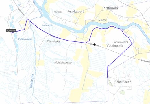
The Vuotinkylä route
Length 6,0 km, route colour-coded red
Ends at Ristivuori and joins the Ristivuori route at Uimusharju
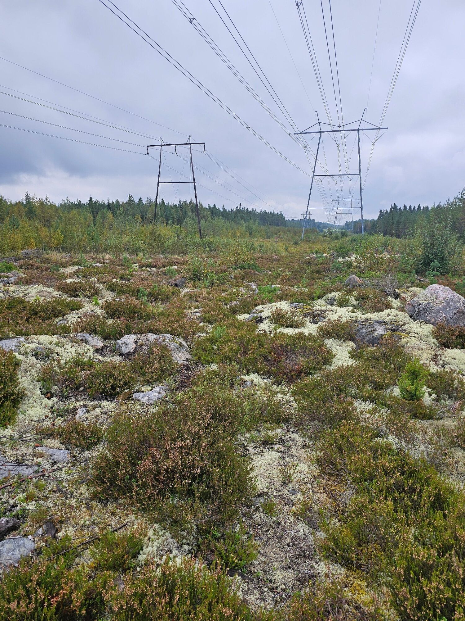
Difficulty: easy, the base of the big power line is quite challenging, rocky and...
Description of the
The Vuotinkylä route
Length 6,0 km, route colour-coded red
Ends at Ristivuori and joins the Ristivuori route at Uimusharju
Difficulty: easy, the base of the big power line is quite challenging, rocky and wet
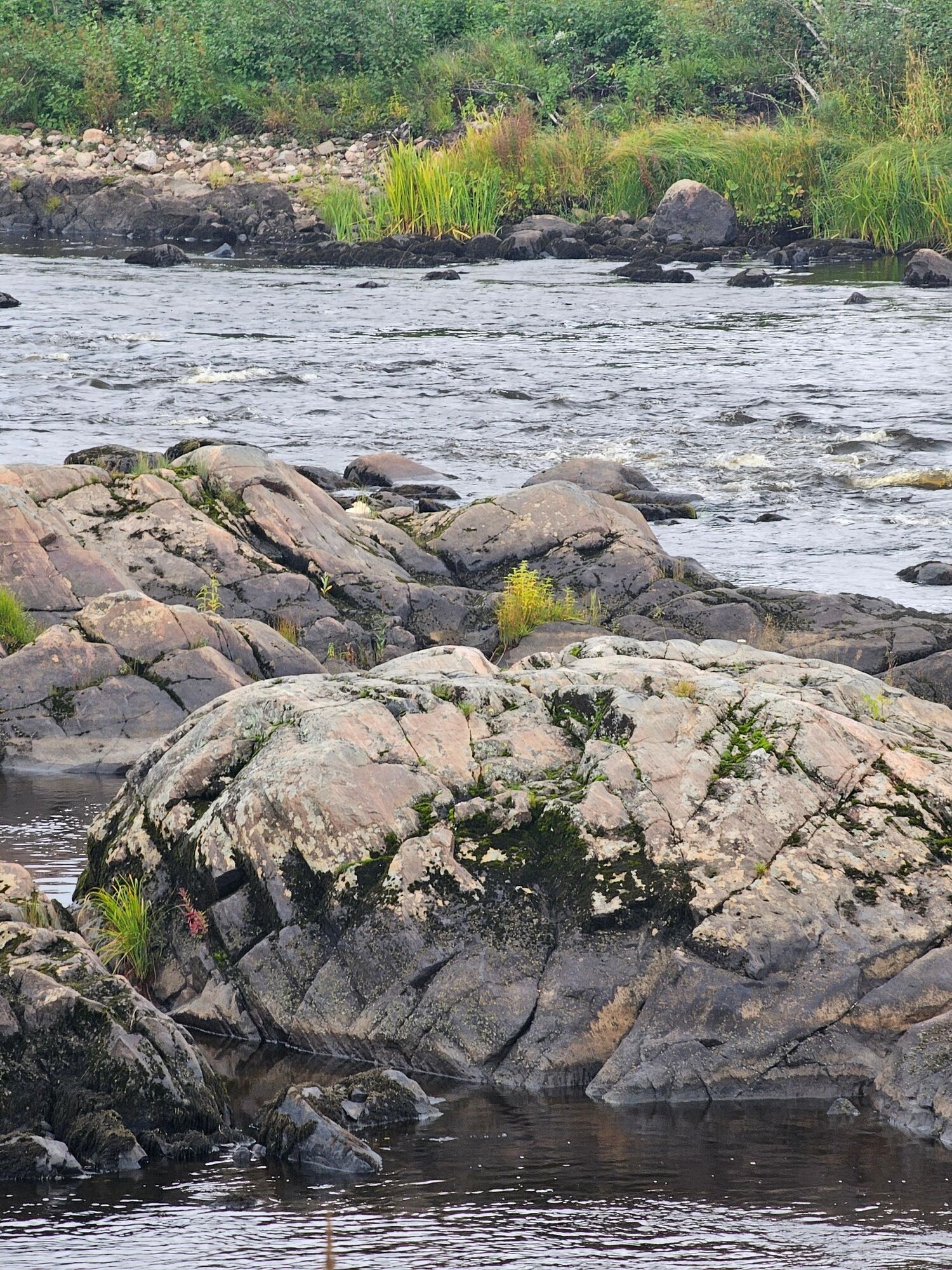
Sights to see: Tolpankoski rapids in Pyhäjoki, the village of Vuoti and the mouth of the Tähjä River
Caution: Crossing the Oulaistentie road and Oulaistentie road traffic
Additional information & tips
Additional information
Route operator Pyhäjoki Municipality
Route maintenance Putkivoima Oy 045 6503486
No reviews yet
Popular tours in the neighbourhood
Pyhäjoki river route
lightCycling22.5 kmPirttikoski art route, Pyhäjoki
lightCycling11.7 kmHalusen route, Pyhäjoki
lightMountainbike9.79 kmTervaneva route, Pyhäjoki
mediumMountainbike5.15 kmParhalahti route, Pyhäjoki
lightMountainbike13.2 kmSyölätti route, Pyhäjoki
mediumHiking15.1 kmRistivuori route, Pyhäjoki
lightMountainbike11.8 kmThe route of Nikula's cabin, Pyhäjoki
lightMountainbike2.39 kmLiminkajärvi route, Pyhäjoki
mediumHiking12.1 kmNasi route, Pyhäjoki
lightMountainbike13.7 km

Hiking & Tracking

Over 550.000 tour suggestions, detailed maps and an intuitive route planner make the app a must-have for all nature enthusiasts.

Don't miss out on offers and inspiration for your next holiday
Subscribe to the newsletter
Error
An error has occurred. Please try again.Thank you for your registration
Your e-mail address has been added to the mailing list.
Tours throughout Europe
Austria Switzerland Germany Italy Slovenia France Netherlands Belgium Poland Liechtenstein Czechia Slovakia Spain Croatia Bosnia and Herzegovina Luxembourg Andorra Portugal Iceland United Kingdom Ireland Greece Albania North Macedonia Malta Norway Montenegro Moldova Kosovo Hungary San Marino Romania Estonia Latvia Belarus Cyprus Lithuania Serbia Bulgaria Monaco Denmark Sweden Finland