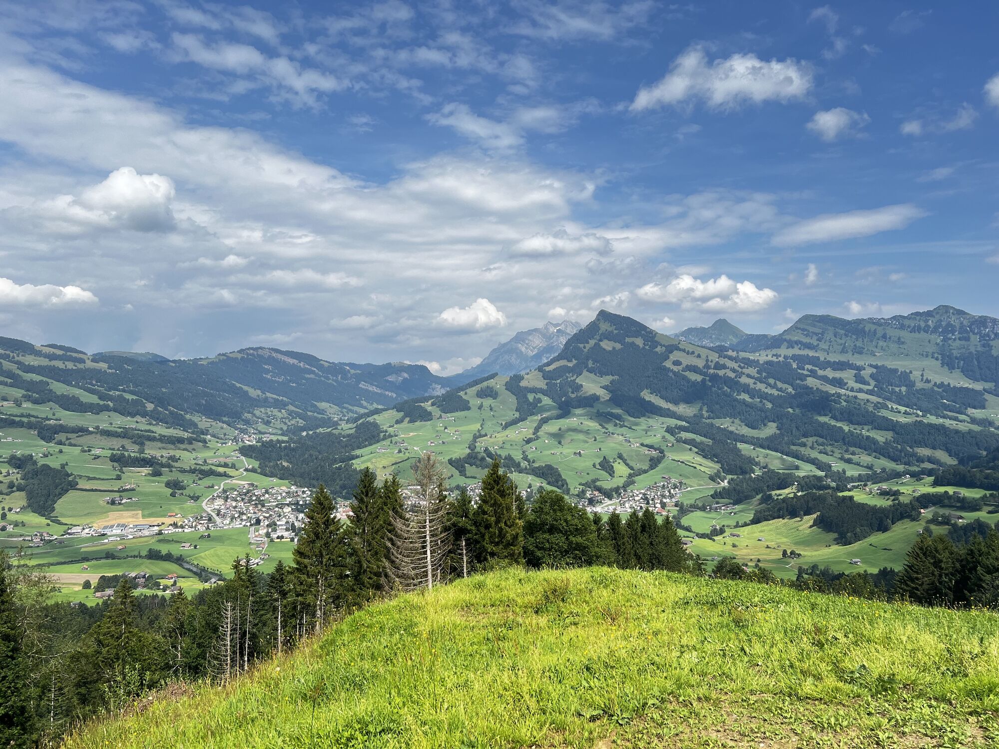
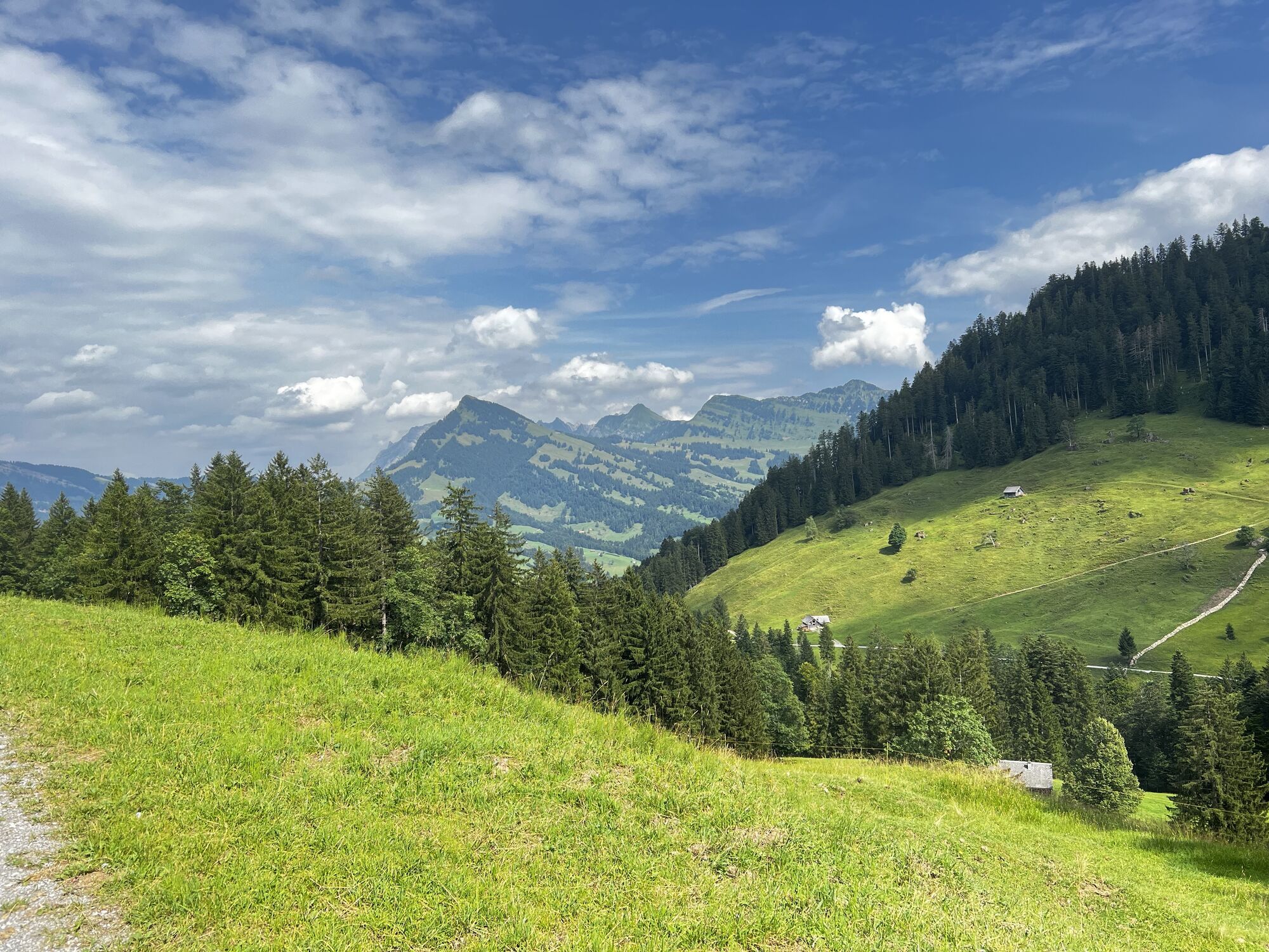
Wattwil Mountainbiken
medium
Navigate
Navigate
Get this tour on your mobile
Wattwil Mountainbiken
medium
Mountainbike
31,45
km
Scan the QR code and start navigation in the bergfex app

Hiking & Tracking


Distance
31,45
km
Duration
02:02
h
Ascent
777
m
Sea level
616 -
1.152
m
Track download
Wattwil Mountainbiken
medium
Mountainbike
31,45
km


Route
Kappel
(632 m)
Village
2,4 km
Ebnat-Kappel
(632 m)
Village
3,0 km
Ebnat
(638 m)
Village
3,9 km
Blomberg
(729 m)
Settlement
7,3 km
Brunnen
(723 m)
Settlement
8,5 km
Inselikapelle
(745 m)
Place of worship
12,2 km
Chatzenstofel
(878 m)
Corridor/terrain
14,9 km
Route
Wattwil Mountainbiken
medium
Mountainbike
31,45
km
Kappel
(632 m)
Village
2,4 km
Ebnat-Kappel
(632 m)
Village
3,0 km
Gasthaus Sternen
(634 m)
Restaurant
3,8 km
Ebnat
(638 m)
Village
3,9 km
Die Fabrik
(637 m)
Restaurant
4,0 km
Blume
(687 m)
Restaurant
5,6 km
Blomberg
(729 m)
Settlement
7,3 km
Türler
(705 m)
Corridor/terrain
8,0 km
Türli
(735 m)
Corridor/terrain
8,1 km
Krummenau
(713 m)
Village
8,3 km
Brunnen
(723 m)
Settlement
8,5 km
Krümmenswil
(732 m)
Gondola station
8,9 km
Kammern
(744 m)
Corridor/terrain
9,6 km
Thurrain
(758 m)
Corridor/terrain
10,2 km
Vor dem Bach-Bühl
(758 m)
Corridor/terrain
10,8 km
Bühl
(759 m)
Corridor/terrain
11,0 km
Bühlerbrugg
(742 m)
Corridor/terrain
11,1 km
Au-Bühl
(743 m)
Corridor/terrain
11,6 km
Inselikapelle
(745 m)
Place of worship
12,2 km
Nesslau
(760 m)
Village
13,0 km
Chatzenstofel
(878 m)
Corridor/terrain
14,9 km
Laui
(1.136 m)
Corridor/terrain
17,9 km
Spicher
(1.114 m)
Corridor/terrain
19,1 km
Allmen
(1.121 m)
Corridor/terrain
19,6 km
Mettler-Steintal
(849 m)
Corridor/terrain
23,5 km
Flecken
(834 m)
Corridor/terrain
24,0 km
Letz
(738 m)
Corridor/terrain
25,1 km
Die Fabrik
(637 m)
Restaurant
26,4 km
Ebnat
(638 m)
Village
26,5 km
Gasthaus Sternen
(634 m)
Restaurant
26,7 km
Ebnat-Kappel
(632 m)
Village
27,4 km
Kappel
(632 m)
Village
28,0 km
Sonnenblick
(622 m)
Neighbourhood
30,9 km
Ulisbach
(640 m)
Village
31,0 km
Valuations
1 Comment
Baumann Martin
09. Aug. 2025
MTB Tour
Kurze Steigung und einige nicht fahrbare Abschnitte bei denen das Fahrrad gestossen werden muss.
Popular tours in the neighbourhood
- 4,5
Weesen - Quinten - Walenstadt
heavyHiking20,6 km - 4,6
Säntis
mediumMountain hiking17,5 km - 3,3
Seerenbach waterfalls
lightHiking4,38 km - 4,0
Amden - Speer (Rundkurs)
lightHiking17,6 km - 5,0
Wanderung Chatzenloch mit Hängebrücke
lightHiking5,91 km - 4,6
Schwägalp - Berggasthaus Tierwies - Girenspitz - Säntis
heavyHiking4,83 km Bergtour über die Tierwis auf den Säntis
heavyHiking8,20 km- 4,8
Kronberg - Schwaegalp
lightHiking5,90 km - 4,0
Schönengrund - Hochhamm - Schönengrund
mediumHiking9,51 km - 5,0
200627 Thur Wasserfälle
lightHiking1,49 km
Hiking & Tracking

Over 550.000 tour suggestions, detailed maps and an intuitive route planner make the app a must-have for all nature enthusiasts.

Don't miss out on offers and inspiration for your next holiday
Subscribe to the newsletter
Error
An error has occurred. Please try again.Thank you for your registration
Your e-mail address has been added to the mailing list.
Tours throughout Europe
Austria Switzerland Germany Italy Slovenia France Netherlands Belgium Poland Liechtenstein Czechia Slovakia Spain Croatia Bosnia and Herzegovina Luxembourg Andorra Portugal Iceland United Kingdom Ireland Greece Albania North Macedonia Malta Norway Montenegro Moldova Kosovo Hungary San Marino Romania Estonia Latvia Belarus Cyprus Lithuania Serbia Bulgaria Monaco Denmark Sweden Finland