If you long for natural peace and are looking for a new hiking route without crowds, this route offers both. The terrain varies from lush lake shores to dry pine forests.
The route is suitable for a 2-3...
If you long for natural peace and are looking for a new hiking route without crowds, this route offers both. The terrain varies from lush lake shores to dry pine forests.
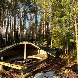
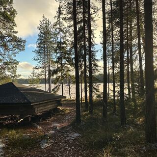
The route is suitable for a 2-3 day hike. Along the trail, there are two lean-tos, at Kivijärvi and Onkimaanjärvi. Both lean-tos have dry toilets, campfire sites, and wood supply. The route is marked with blue squares and green Hämeen Ilvesreitti signs.
Mountain biking on the route
The route is primarily also suitable for slightly more experienced mountain bikers. At Keritty, vegetation is abundant at the edges of the path, which challenges cycling. At the Kurkisuonlahti area of Onkimaanjärvi, the bridge crossing the river is not suitable for cycling, but the bike can be led over it. The route mostly runs near roads, so if needed, it is easy to move from the trail to a more open path.

At the parking area there is space for about 20 cars, and there is an information board at its corner. When heading forward, first follow Antinsuontie about 200 meters west, then turn right onto a narrow path winding through forest clearings of different ages and forest islands left in between.
The trail's width and terrain difficulty remain fairly consistent throughout the route, so you get a good sense of the route's difficulty right at the beginning. The route is clearly marked with blue squares along the entire length.
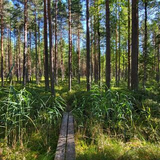
The path soon crosses a gravel road, and after 1.3 km it crosses a power line. The terrain is rolling. There are boardwalks in some swampier parts.
After the power line, the route becomes a bit easier and the path descends through a more open pine forest to Herttuantie. The route runs briefly through spruce forest west of the road until it crosses the road again at a T-junction, continuing northeast uphill. Soon, it crosses the previous power line again.
The path first winds through young pine forest, then mixed forest, and crosses the road. Shortly afterward, it crosses Syrjälänpuro over a small bridge, after which the route continues straight first along a forest clearing edge and then through an old commercial forest.
After crossing two roads, you walk about 600 meters along a gravel road to a turning point, from which a forest path continues towards Heinissuonlammia. About 250 meters before the pond shore, you find Ilvesreitistö signs; here turn right following the Kivijärvi sign.
The path rises gently, winds through forest, and crosses a forest clearing. About 900 meters later at Levoniemi, follow the road for a few dozen meters before turning left onto a path descending to the swampy and reed-covered shore of Lake Levoniemi.
After crossing Riimalantie, the route closely follows Pyhälammintie towards Kivijärvi. The route is swampy and difficult to walk in some spots, where you can opt to walk along the road.
Rest / overnight spot at the Kivijärvi lean-to
From the Ilvesreitistö markings, turn right onto a path marked with yellow squares, which reaches the Kivijärvi shore in less than 400 meters. Here you find an atmospheric lean-to, as well as an outhouse and wood shed. There are also tent sites around the lean-to. The bottom of Kivijärvi is muddy, and the shore is shallow.
Return the same path back to Pyhälammintie, and the route continues on its north side, climbing steeply through beautiful mossy forest. Kivijärvi shimmers from the top of a small hill.
The forest landscape is varied, and the path is still narrow but from here slightly clearer and more traveled than before.
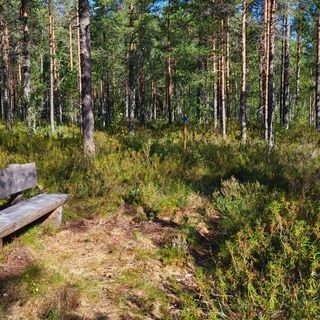
After crossing a road, the route circles the shore of Käyrälammi, scented with swamp rosemary, and reaches Pikkulammi, where there is a bench for a snack break. Next to the bench are Ilvesreitistö signs: follow the Kivisammaljärvi sign.
Ascend to Kivisammaljärvi and descend steeply through mossy spruce forest shade.
After a short road section, at the end of the lake, there is an information board with parking space for two cars. The route follows the south shore of the lake, and there is another bench at the other end.
Kivisammaljärvi connects to Keritty, whose shore is followed for a long distance southward.
The lakeshore path is somewhat wider and smoother compared to earlier sections. At Suutarinnokka, a swamp is crossed, and at Leponokka, there is a nice spot to have a snack break.
Before Riimalanlahti, a small detour is made past a red house, going around a private plot, then returning briefly to the swampy shore where there is a bench. Behind Keritty, the terrain is hilly and mossy. After the grassy turning point, first follow the track of a forest machine and then again a forest trail.
The path crosses Riimalantie (where there is parking space for a few cars) and follows the right side of Hiilikämpäntie. Between Isomäki and Korkeamäki, forest clearings cause some disruption making walking a bit difficult. The path first rises gently and then more steeply up to the top of Korkeamäki. You can see far through the trees.
From the hill, descend steeply through a short but wet swamp section to a road, which is followed left about 500 m to a turning point. From there, a somewhat grassy path leads through pine forest to the shore of Onkimaanjärvi, where there is a bench and Ilvesreitistö signs.
The shore continues to the right. A narrow path runs right along the shore and offers beautiful lake views. At the head of Kurkisuonlahti, there is a bridge with stairs.
From the bridge, it is still 1.5 km to the Onkimaanjärvi lean-to. Here you can enjoy a break, and overnight stays are possible. Behind the lean-to, there is an outhouse and a wood shed.
From the lean-to, a flat and easy forest logging road is followed about 1.5 km back to the Tervalamminsuo parking area.
Hiking boots or well-soled sneakers are recommended. Weather-appropriate gear makes hiking comfortable.
There are no wells for water extraction along the trail.
The trail is mostly well-marked, though in some places forest clearings slightly complicate finding the path.
Fire-making is allowed only at the campfire sites of the lean-tos. Always check the current forest fire warning before making an open fire!
Route parking area: Antinsuontie 402, 31350 Tammela
Space for 20 cars.
Second parking spot: Pyhälammintie 667, Loppi.
Map coordinates: N 60° 41.9072' E 24° 4.3188'
No visible parking lot. There is a small widening on the road near the starting point. Space for two cars.
Along the route, there are a couple of heavily shrubby sections south of Lake Keritty and near the western end of the circuit at Puukolanmäki. The trail also contains several sections that become heavily overgrown during the summer months. It is wise to carry a map of the area or a phone map application when the path threatens to become overgrown with dense vegetation.
There is a great resting spot on the shore of Keritty in Leponokka. Keritty is part of the national shore protection program.
Keppana Kellari west of Herttuanjärvi is a local favorite restaurant offering food, drinks, and accommodation.
Popular tours in the neighbourhood
Don't miss out on offers and inspiration for your next holiday
Your e-mail address has been added to the mailing list.


