


The starting point of this leisurely and multifaceted hike can be accessed by gondola from Grindelwald to First. After a short but steep ascent to the Gummihütte, the trail rolls along gently until reaching...
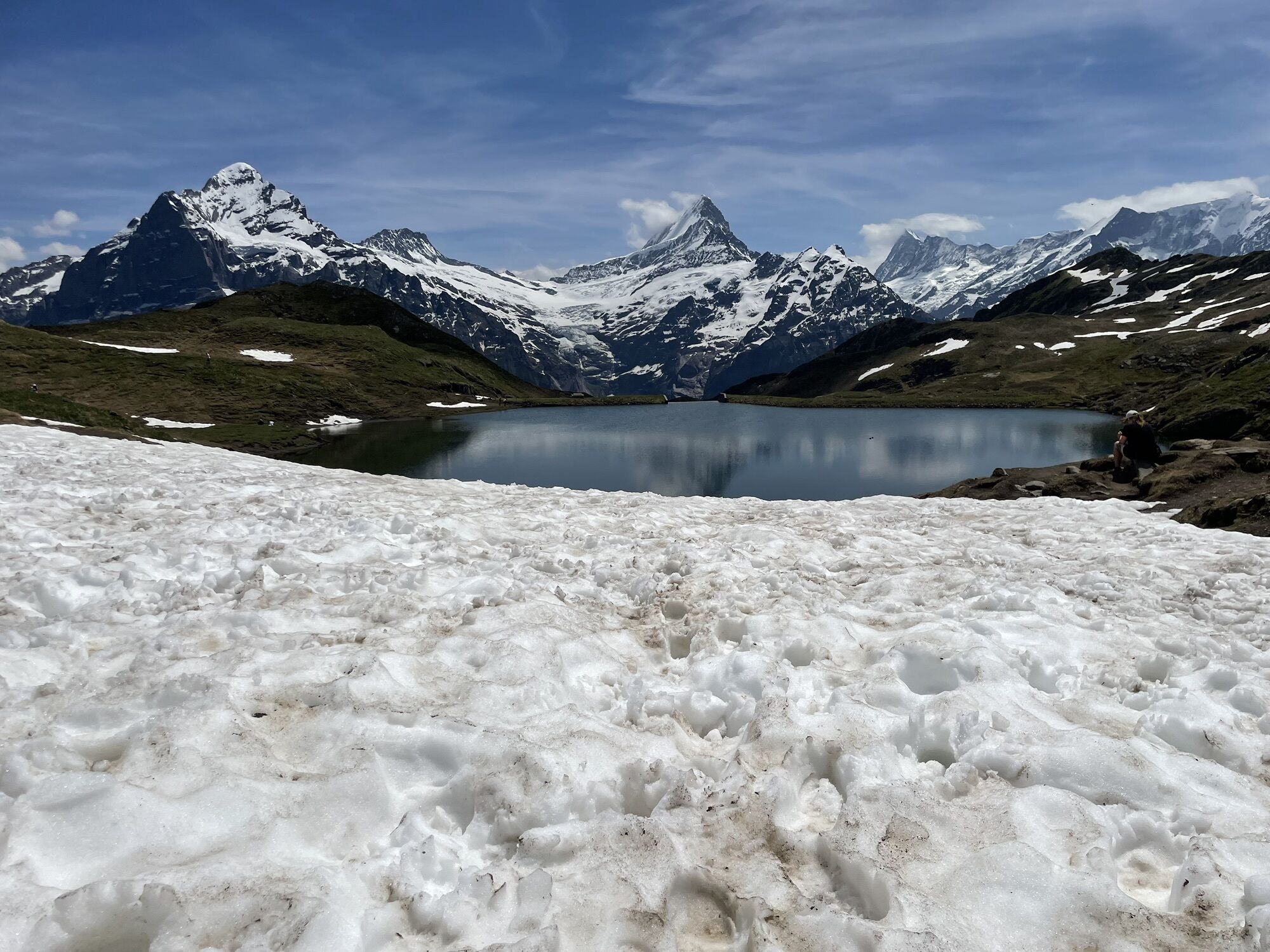
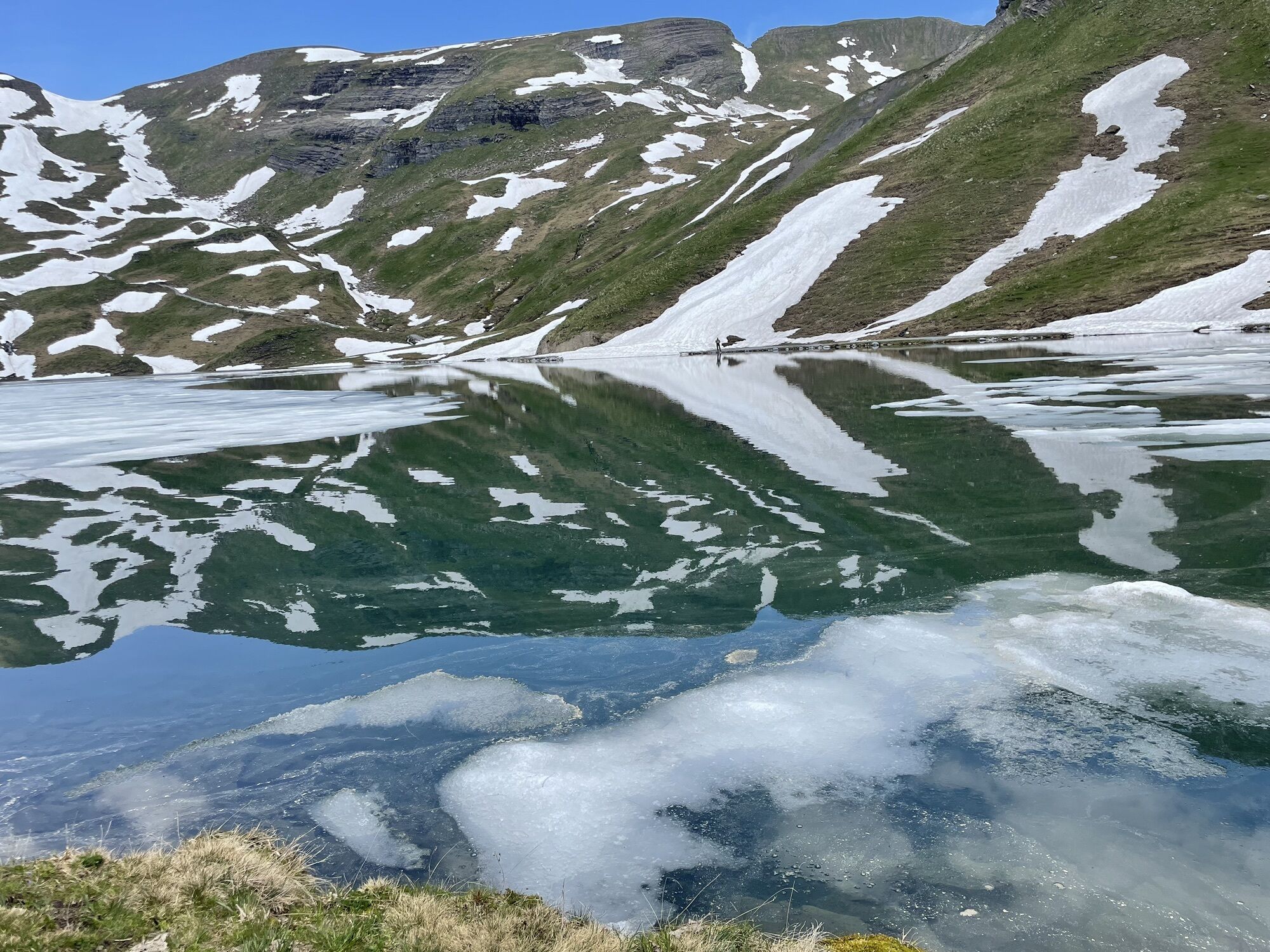
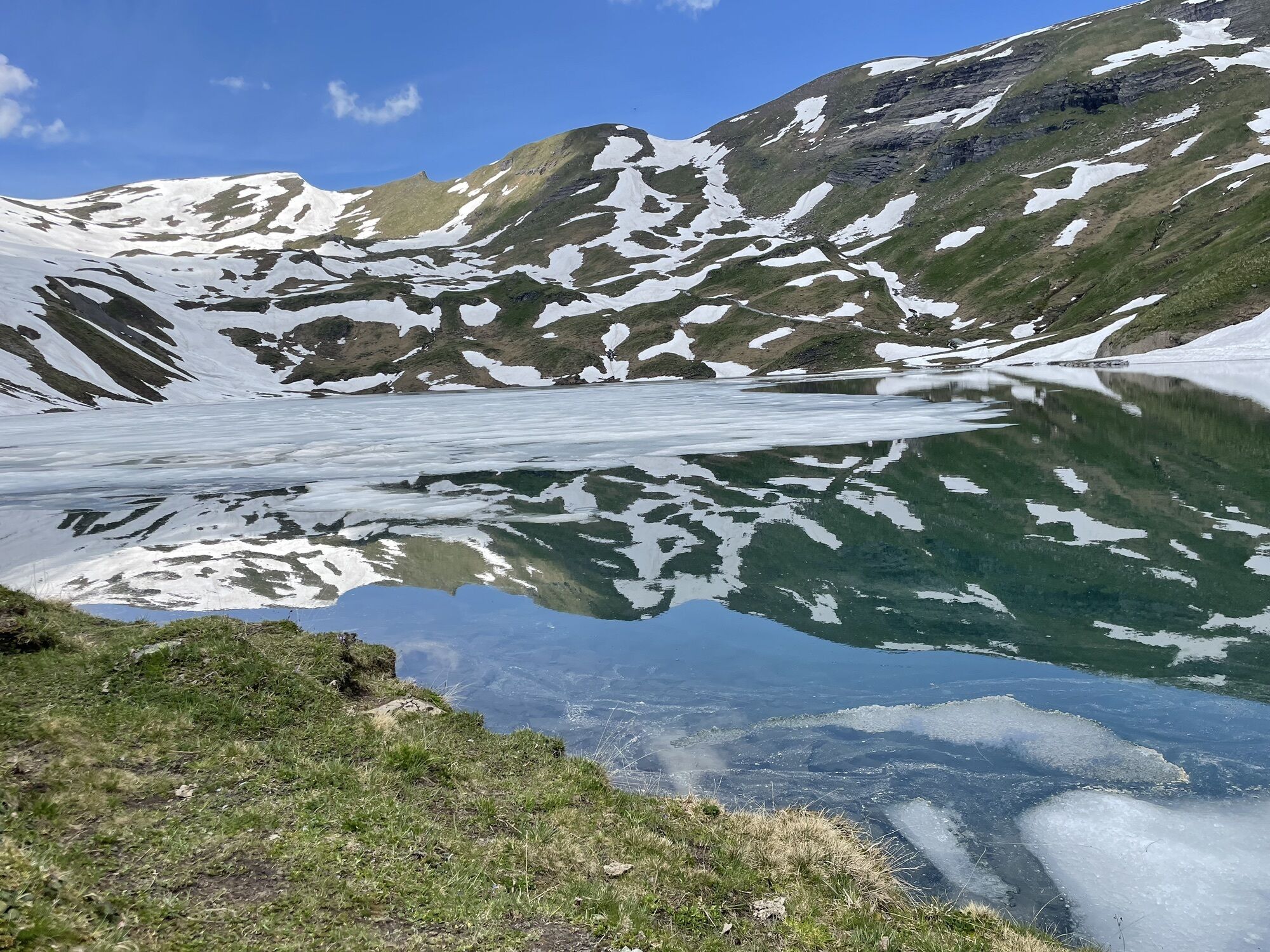
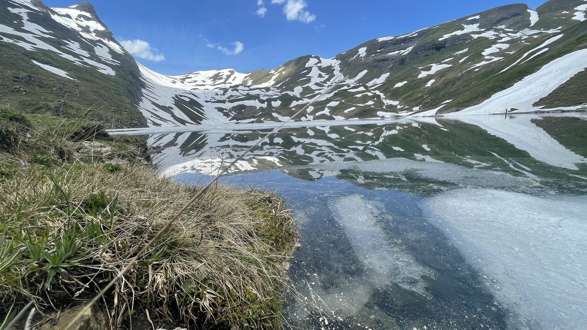
The starting point of this leisurely and multifaceted hike can be accessed by gondola from Grindelwald to First. After a short but steep ascent to the Gummihütte, the trail rolls along gently until reaching Lake Bachalp. The impressive peaks of the Wetterhorn, Schreckhorn and Finsteraarhorn rise up to greet hikers on the other side of the valley. The Grindelwald-First ski area offers a variety of hiking and sledging trails as well as places to stop for a bite to eat and full-day packages.
Click here for the status of the winter hiking trails.

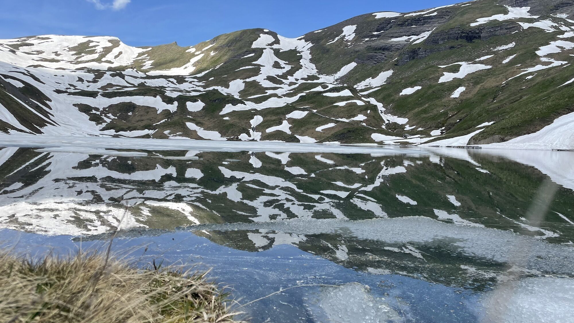
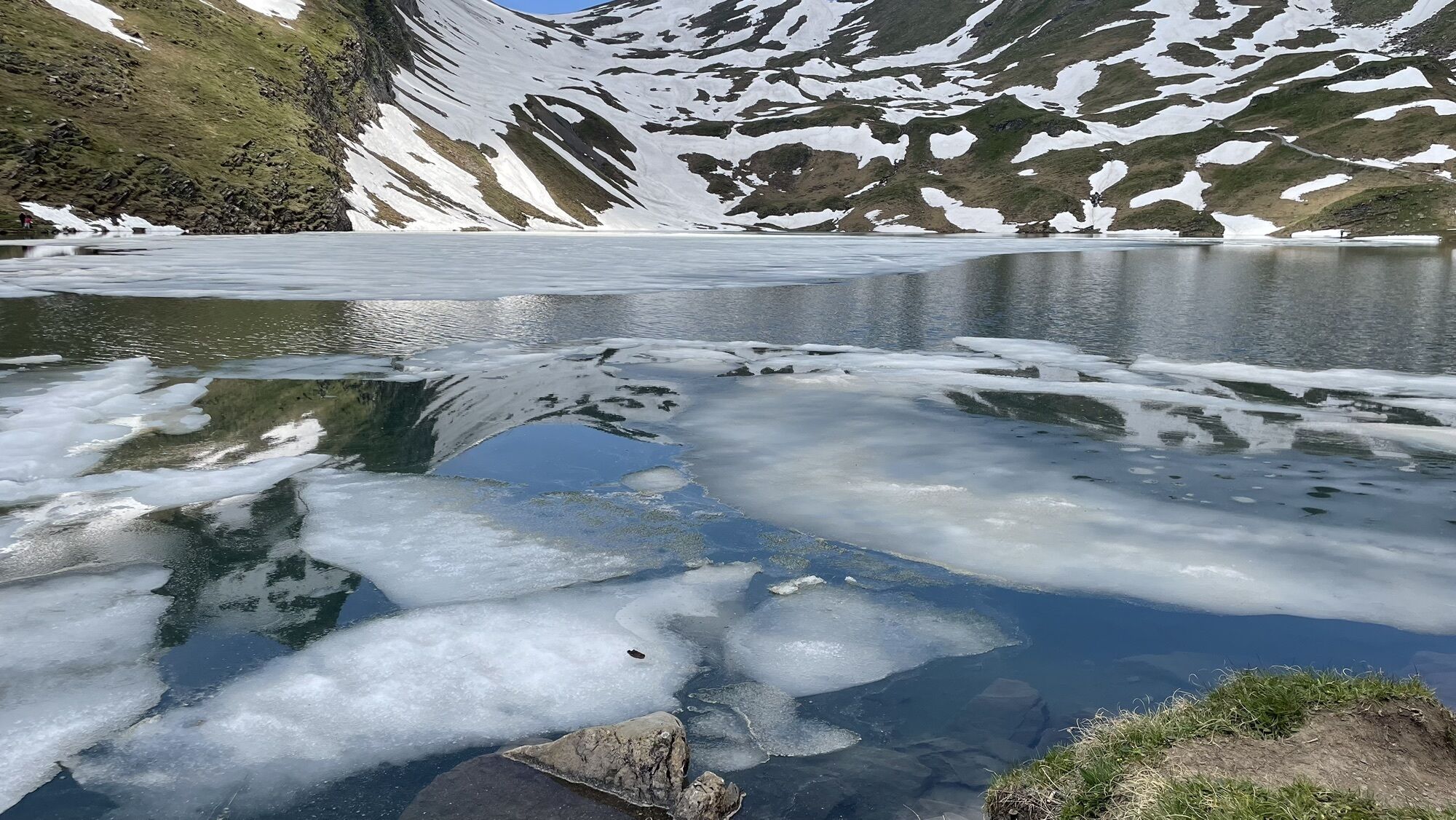
First - Bachalpsee
The sun’s rays are more intense in the mountains. Don’t forget to bring sunscreen with a high protection factor, a hat and sunglasses with UV protection.
We recommend bringing warm clothing and rain gear even in summer and in good weather in winter. We recommend layering your clothing.
Charged mobile phone
First-aid kit
Winter shoes with non-slip sole
Drinks and snacks
If available: hiking sticks
After a snowfall, the ground can be softer and more difficult to walk on.
Ab Basel und Genf führt der schnellste Weg in die Jungfrau Region über Bern. Ab Zürich ist die Strecke via Luzern und den Brünigpass zu empfehlen. Der Pass ist ganzjährig offen.
Von Süden führt die Anreise via Grimsel- oder Sustenpass in die Jungfrau Region. Beide Pässe sind nur im Sommer offen. Als Alternative bietet sich der Simplonpass mit anschliessendem Autoverlad durch den Lötschbergtunnel an.
Grindelwald
Ab Interlaken folgen wir der Hauptstrasse nach Zweilütschinen. Hier biegen wir links Richtung Grindelwald ab. Die ganze Fahrt dauert ca. 30 Minuten und führt über eine teilweise kurvige Strecke.
Arrival Grindelwald Arrival by car video Jungfrau Region Autoverlad Lötschberg
Dank der zentralen Lage in Europa wird die Schweiz von über 12 Ländern mit internationalen Zügen bedient. Innerhalb der Schweiz fahren Intercity-Züge von Basel und Luzern direkt in die Jungfrau Region. Reisende ab Zürich steigen in Bern um. Die Züge verkehren im Halbstundentakt.
Grindelwald
Ab Bahnhof Interlaken Ost erreichen wir Grindelwald ohne umzusteigen mit der Berner Oberland Bahn (BOB). Wichtig: In den hinteren Teil des Zuges einsteigen, da sich dieser in Zweilütschinen teilt. Wer vorne einsteigt, landet in Lauterbrunnen. Die Fahrt dauert 30 Minuten bis Grindelwald Terminal (V-Bahn). Drei Minuten später sind wir an der Endstation im Dorf.
In Grindelwald gibt es drei Bahnhöfe (Terminal, Grund und Dorf). Die Endstation (Dorf) befindet sich im Zentrum von Grindelwald.
Timetable and ticket purchase SBBArrival by train video Jungfrau RegionEs gibt drei öffentliche Parkhäuser: Parkhaus Eiger+ (252 Parkplätze), Parkhaus Sportzentrum (160 Parkplätze) sowie das neue Terminal Parking (1000 Plätze) der V-Bahn. Alternativ können wir auch den Parkplatz in Grindelwald Grund benützen.
Thrill-seekers can get a kick off with slopes on the First Flyer. During the winter season, it is free of charge if you have a valid Jungfrau or Grindelwald-Wengen Sportpass (Sportpass for 1 day or more).
Popular tours in the neighbourhood
- 4,2
Schnitzlerweg Axalp - extended
mediumHiking11,2 km - 3,2
Höhenwanderung Brienzer Rothorn
mediumHiking9,16 km - 3,8
Öpfelchüechliweg
lightHiking4,70 km - 5,0
Schynige Platte - Faulhorn - First
heavyHiking16,8 km Vom Brienzer Rothorn bis Interlaken
heavyHiking21,1 km- 3,5
Axalp - Tschingel- Axalphorn- Axalp
mediumHiking13,5 km - 5,0
Brienzer-Rothorn via Lättgässli
mediumHiking13,3 km - 4,4
Gletscherschlucht - Pfingstegg - Rundweg
mediumHiking5,84 km - 5,0
Rundweg Interlaken-Harder Kulm
lightHiking10,9 km - 5,0
Augstmatthorn
lightHiking10,9 km

Hiking & Tracking


Don't miss out on offers and inspiration for your next holiday
Your e-mail address has been added to the mailing list.