


Starting from Colle Bettaforca at 2727 meters, reachable on foot from the dirt road from Staffal or comfortably with the Monterosa Ski lifts.
From the arrival of the chairlift, follow the dirt road to...
Starting from Colle Bettaforca at 2727 meters, reachable on foot from the dirt road from Staffal or comfortably with the Monterosa Ski lifts.
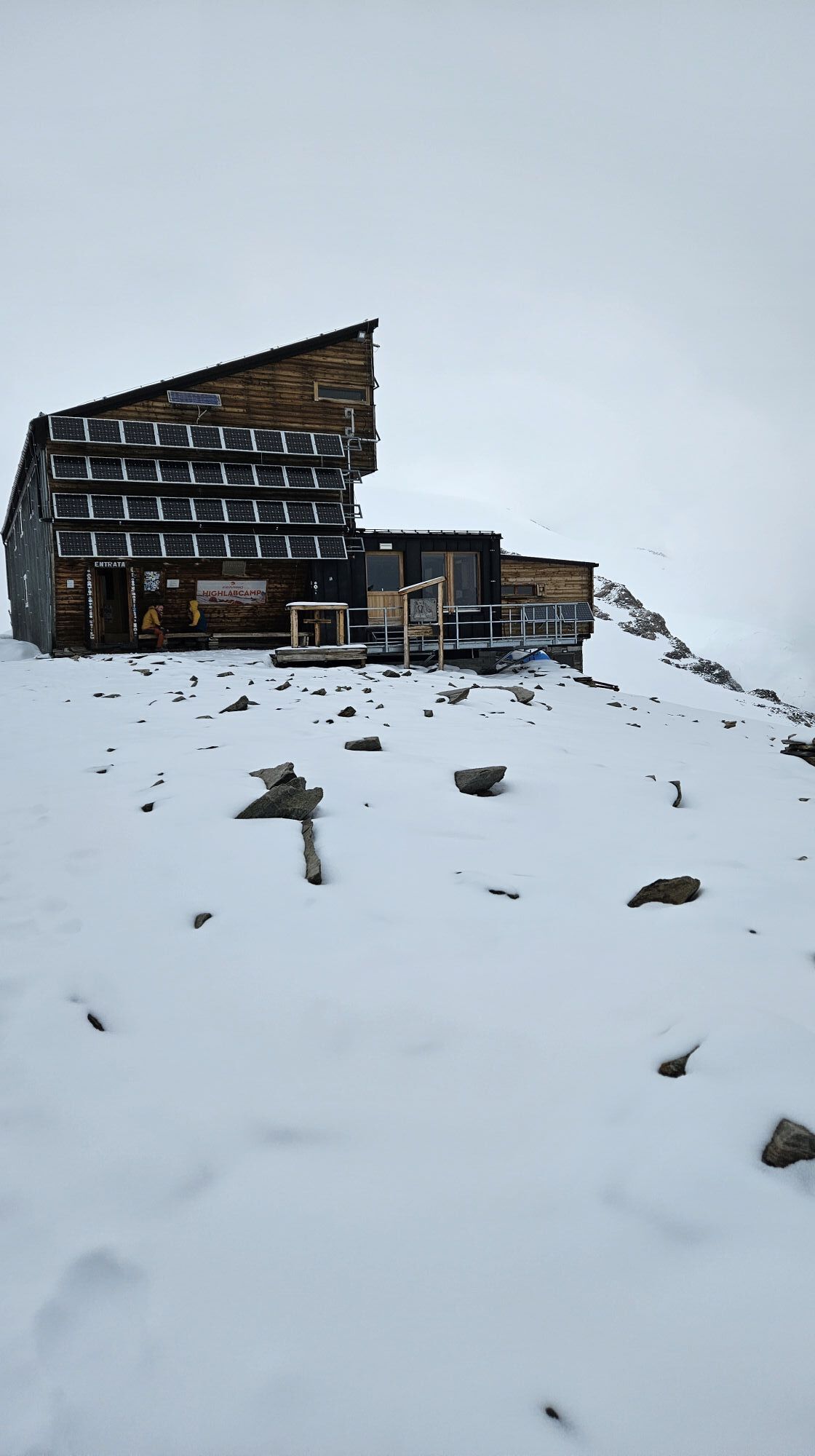
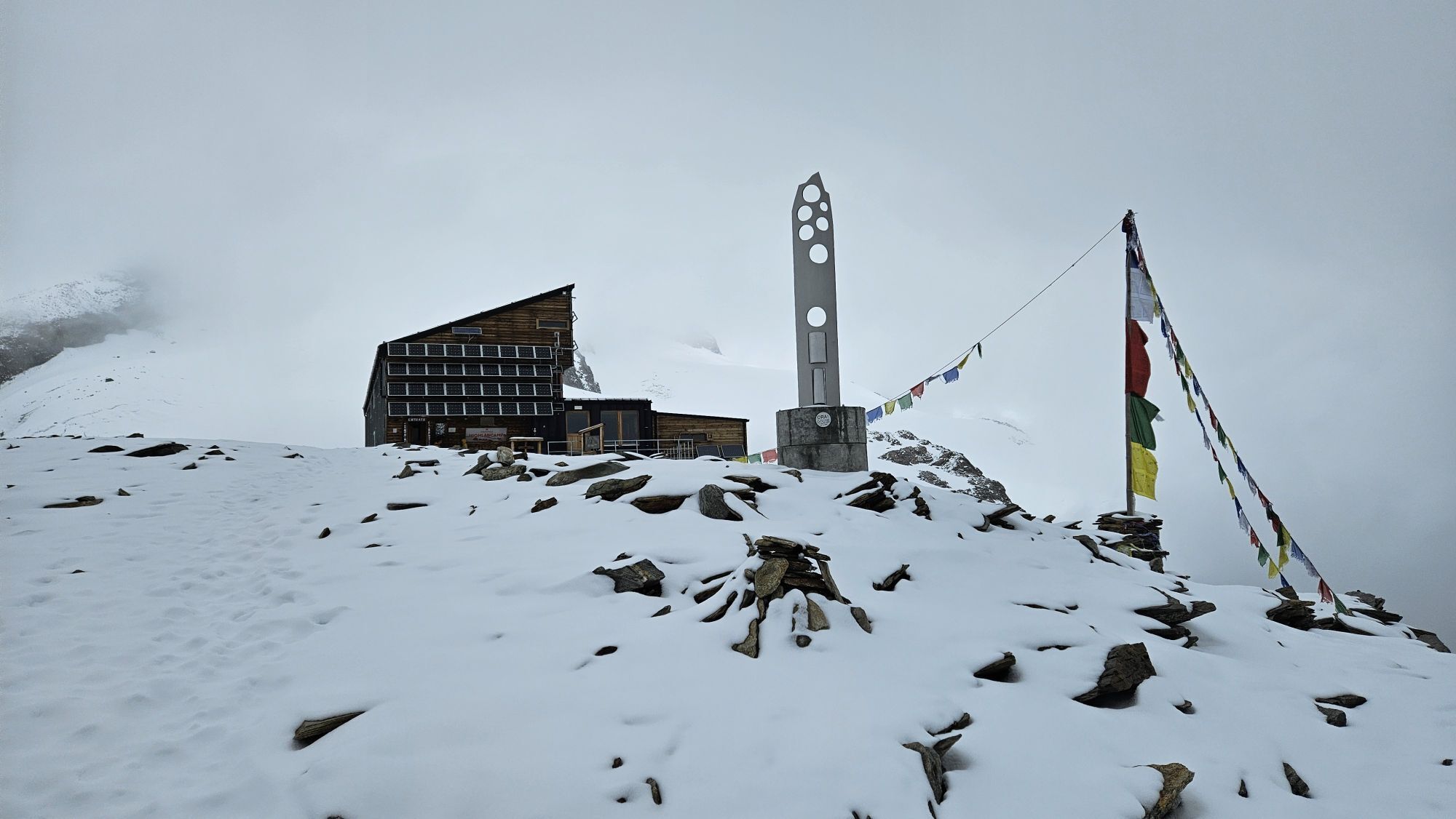
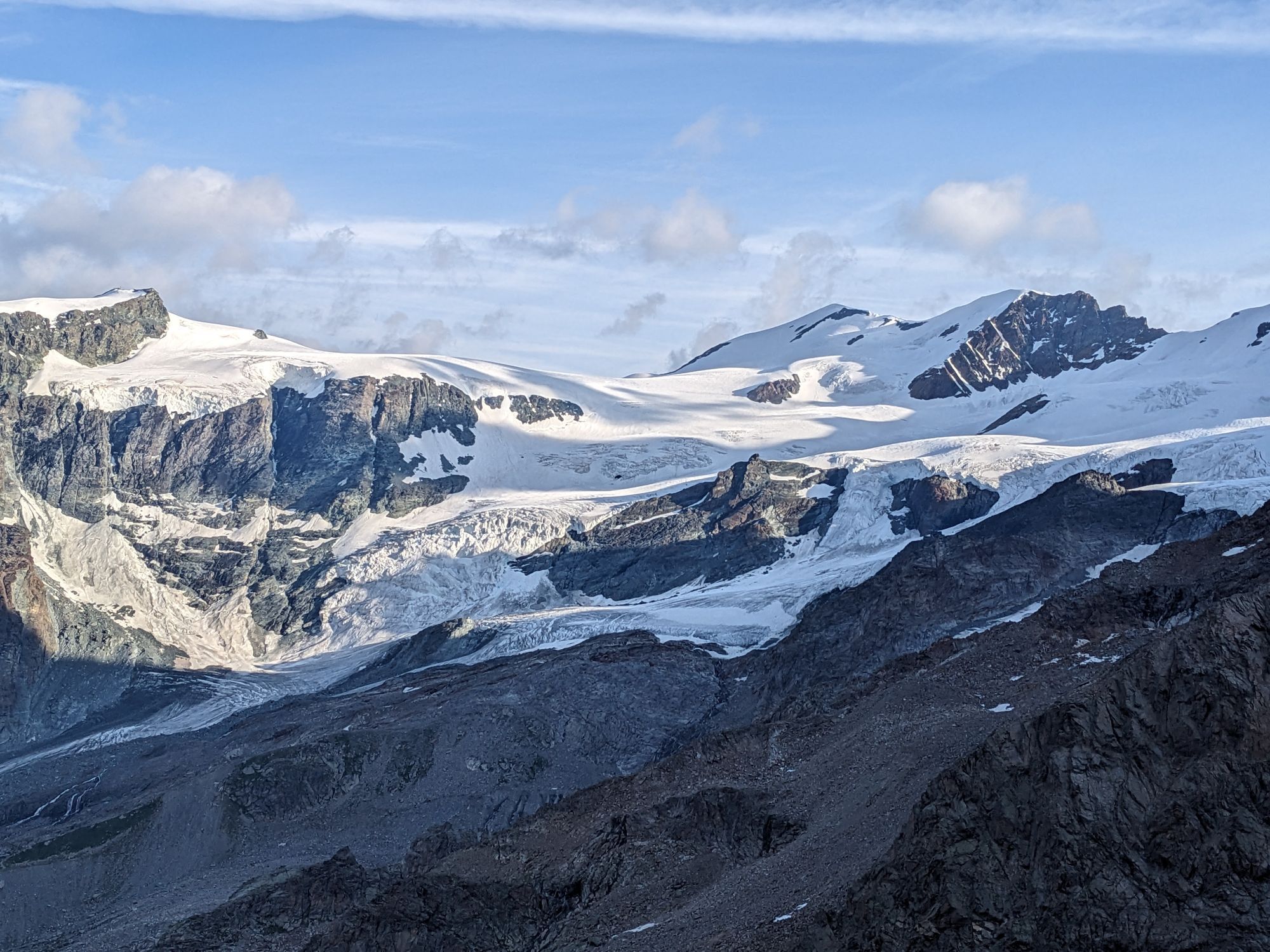
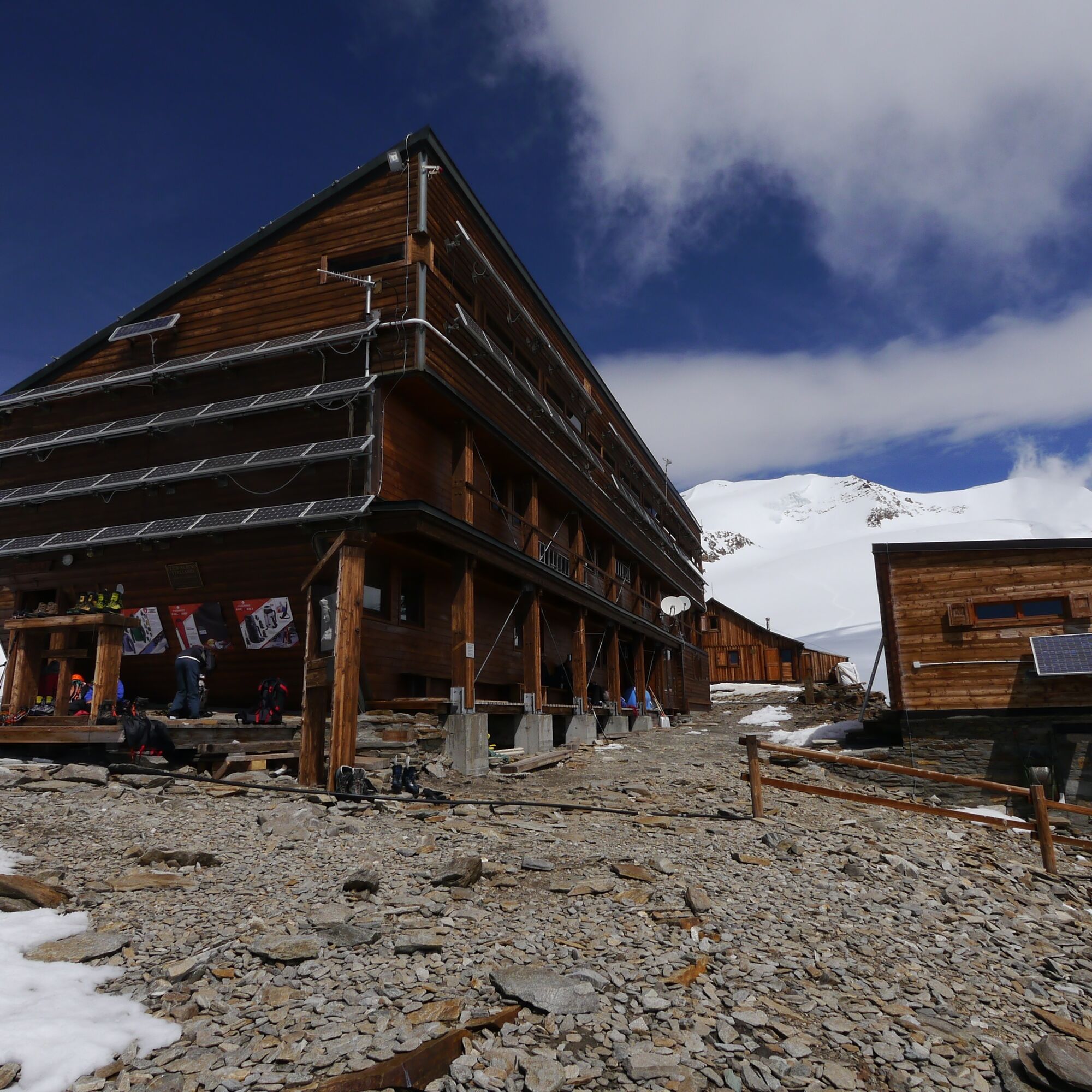
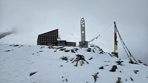
From the arrival of the chairlift, follow the dirt road to the right, continuing to the left you reach the two passes of the lower and upper Bettolina; beyond the Bettolina you cross a plateau rich in water pools and snowfields, after a steep path you arrive on a particularly airy and panoramic ridge that acts as a watershed between the Gressoney Valley and the Ayas Valley. Following the ridge equipped with fixed ropes, chains, and a small wooden bridge you arrive at a rocky plateau where the Quintino Sella hut is located, an excellent starting point for the ascent of some Monte Rosa 4000-meter peaks such as Castor and the two Lyskamm.
From Colle Bettaforca take path number 9 to the right and continue on the unmarked EEA section to the equipped ridge that leads to the hut.
Yes
Yes
Yes
Alpinism for experts. Boots, crampons, ice axe, ropes, harnesses, wind jacket, and everything useful in mountain environments above 3000 meters.
Alpinism equipment is required and it is highly recommended to rely on a mountain guide.
Gressoney Guide Society www.guidemonterosa.info e-mail info@guidemonterosa.info Tel: +39 3475898120
Guidemonterosa srl www.guidemonterosa.com e-mail info@guidemonterosa.com Tel: +39 0125 366019 – +39 349 3674950
Turin-Aosta highway exit Pont S. Martin, State Road 505 direction Gressoney.
Pass Gressoney-La-Trinité and arrive at Staffal.
Railway line connecting Milan and Turin to the Aosta Valley with a stop at Pont-Saint-Martin.
From Pont-Saint-Martin station, take the Vita line bus towards Gressoney and get off at the last stop in the Staffal area of Gressoney La Trinité.
Large parking lot in the Staffal area of Gressoney La Trinité.
Gressoney Guide Society www.guidemonterosa.info e-mail info@guidemonterosa.info Tel: +39 3475898120
Guidemonterosa srl www.guidemonterosa.com e-mail info@guidemonterosa.com Tel: +39 0125 366019 – +39 349 3674950


Popular tours in the neighbourhood
-
4.8
Zermatt Hörnlihütte
mediumHiking 4.12 km -
5.0
Monte Rosa - Signalkuppe
mediumHigh tour 12.7 km -
5.0
Trockerner Steg nach Matterhorn (Hornlihütte)
lightHigh tour 12.2 km -
4.9
Klein Matterhorn - P3824 - Breithorn Occidentale / Westgipfel
mediumHigh tour 5.53 km -
Riffelalp - Gornergrat
mediumHiking 6.22 km -
Cervinia Rif. D'Abruzzi und Gletscherseen
mediumE-MTB 32.3 km -
Schwarzsee - Schwarzsee paradise - Hörnlihütte - Matterhorn
heavyHigh tour 6.48 km -
4.5
Quintino Sella al Felik 16 08 22
mediumHiking 4.42 km -
2.0
Zermatt Tour
lightHiking 15.2 km -
Zermatt - Gornergrat
heavyMountain hiking 12.5 km

Hiking & Tracking


Don't miss out on offers and inspiration for your next holiday
Your e-mail address has been added to the mailing list.