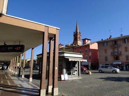
Barberino di Mugello - Monte Nonascoso - Merlano - Deniz Kebab
heavy
Navigate
Navigate
Distance
85.62
km
Duration
04:56
h
Ascent
2,329
m
Sea level
107 -
938
m
Track download
Barberino di Mugello - Monte Nonascoso - Merlano - Deniz Kebab
heavy
Racing
85.62
km
Photos from our users
Route
San Martino
(766 m)
Place of worship
10.6 km
La Ca'
(753 m)
Settlement
13.1 km
Chiesa di San Giorgio
(696 m)
Place of worship
20.1 km
Molinelli
(290 m)
Settlement
30.9 km
Casa Monari
(272 m)
Settlement
50.5 km
Monte Nonascoso
(710 m)
Summit
63.2 km
Vignola
(125 m)
City
85.4 km
Route
Barberino di Mugello - Monte Nonascoso - Merlano - Deniz Kebab
heavy
Racing
85.62
km
Albergo Ristorante Gualtieri
(700 m)
Restaurant
0.0 km
Santa Lucia
(700 m)
Settlement
0.0 km
Albergo
(766 m)
Restaurant
1.2 km
Monte di Fo'
(764 m)
Settlement
1.2 km
Il Voltone
(820 m)
Corridor/terrain
2.0 km
L'Apparita
(880 m)
Settlement
2.8 km
Fratte
(811 m)
Settlement
8.7 km
Da Paco
(758 m)
Restaurant
10.6 km
Bruscoli
(765 m)
Village
10.6 km
San Martino
(766 m)
Place of worship
10.6 km
Ristorante l'Appennino
(753 m)
Restaurant
10.7 km
La Ca'
(753 m)
Settlement
13.1 km
Ginestrella
(700 m)
Settlement
14.4 km
Calcinaia
(718 m)
Settlement
14.6 km
Fontanelle
(680 m)
Settlement
15.1 km
Bel Poggio
(630 m)
Neighbourhood
16.4 km
La Serra
(595 m)
Neighbourhood
16.5 km
Pian Del Voglio
(605 m)
Village
16.5 km
La Penna
(625 m)
Neighbourhood
16.7 km
Saletto
(595 m)
Neighbourhood
16.7 km
La Rovina
(575 m)
Neighbourhood
16.9 km
Campovecchio
(595 m)
Settlement
17.6 km
Montefredente
(693 m)
Village
20.0 km
Chiesa di San Giorgio
(696 m)
Place of worship
20.1 km
Sant'Andrea
(589 m)
Village
23.4 km
Campiano
(553 m)
Village
25.0 km
Bar Trattoria Bivio
(497 m)
Restaurant
25.2 km
Il Bivio
(497 m)
Corridor/terrain
25.4 km
Trastullo
(532 m)
Settlement
25.5 km
Pian di Lama
(316 m)
Settlement
30.4 km
Molinelli
(290 m)
Settlement
30.9 km
Rioveggio
(251 m)
Village
33.5 km
Fiorina
(223 m)
Restaurant
37.1 km
Gardeletta
(192 m)
Village
37.3 km
La Quercia
(219 m)
Village
39.1 km
La Gardenia
(149 m)
Restaurant
47.2 km
Pian di Venola
(150 m)
Village
47.2 km
Molinelli
(250 m)
Settlement
50.2 km
Ca' di Comastri
(268 m)
Settlement
50.3 km
Montasico
(358 m)
Village
50.5 km
Casa Monari
(272 m)
Settlement
50.5 km
Il Borlengo
(276 m)
Restaurant
50.5 km
Vedegheto
(432 m)
Village
54.1 km
Il Poggio
(487 m)
Settlement
55.4 km
Casello di Sotto
(540 m)
Corridor/terrain
56.1 km
Casello di Sopra
(561 m)
Corridor/terrain
56.4 km
Casa Costa
(603 m)
Village
57.0 km
Case Bortolani di sotto
(644 m)
Corridor/terrain
58.2 km
Cà Bortolani
(684 m)
Village
58.6 km
Il Tagliere
(689 m)
Restaurant
58.8 km
Monte delle Pradole
(689 m)
Corridor/terrain
61.9 km
Monte Nonascoso
(710 m)
Summit
63.2 km
Ca' dei Bianchi
(573 m)
Corridor/terrain
64.8 km
Merlano
(537 m)
Place of worship
65.3 km
Casa Stella
(312 m)
Corridor/terrain
67.4 km
Violina
(300 m)
Corridor/terrain
67.5 km
Savigno
(262 m)
Village
68.1 km
Querciola
(247 m)
Corridor/terrain
68.9 km
Tiola
(400 m)
Settlement
71.1 km
Sant'Apollinare
(191 m)
Settlement
75.5 km
Al Mercatello 748
(186 m)
Restaurant
76.1 km
Mercatello
(197 m)
Village
76.3 km
Castello di Serravalle
(182 m)
Village
78.1 km
La Rasdora
(118 m)
Restaurant
83.9 km
Formica
(118 m)
Village
84.0 km
La Formica
(112 m)
Restaurant
84.3 km
Vignola
(125 m)
City
85.4 km
Deniz Kebab
(124 m)
Restaurant
85.5 km
No reviews yet
Popular tours in the neighbourhood
Don't miss out on offers and inspiration for your next holiday
Subscribe to the newsletter
Error
An error has occurred. Please try again.
Thank you for your registration
Your e-mail address has been added to the mailing list.
Tours throughout Europe
Austria
Switzerland
Germany
Italy
Slovenia
France
Netherlands
Belgium
Poland
Liechtenstein
Czechia
Slovakia
Spain
Croatia
Bosnia and Herzegovina
Luxembourg
Andorra
Portugal
Iceland
United Kingdom
Ireland
Greece
Albania
North Macedonia
Malta
Norway
Montenegro
Moldova
Kosovo
Hungary
San Marino
Romania
Estonia
Latvia
Belarus
Cyprus
Lithuania
Serbia
Bulgaria
Monaco
Denmark
Sweden
Finland


