Airolo - Oratorio dei Santi Gervasio e Protasio - Föisc - Rifugio Föisc
heavy
Navigate
Navigate
Get this tour on your mobile
Airolo - Oratorio dei Santi Gervasio e Protasio - Föisc - Rifugio Föisc
heavy
Hiking
26,86
km
Scan the QR code and start navigation in the bergfex app

Hiking & Tracking


Distance
26,86
km
Duration
08:11
h
Ascent
1.262
m
Sea level
1.117 -
2.196
m
Track download
Airolo - Oratorio dei Santi Gervasio e Protasio - Föisc - Rifugio Föisc
heavy
Hiking
26,86
km


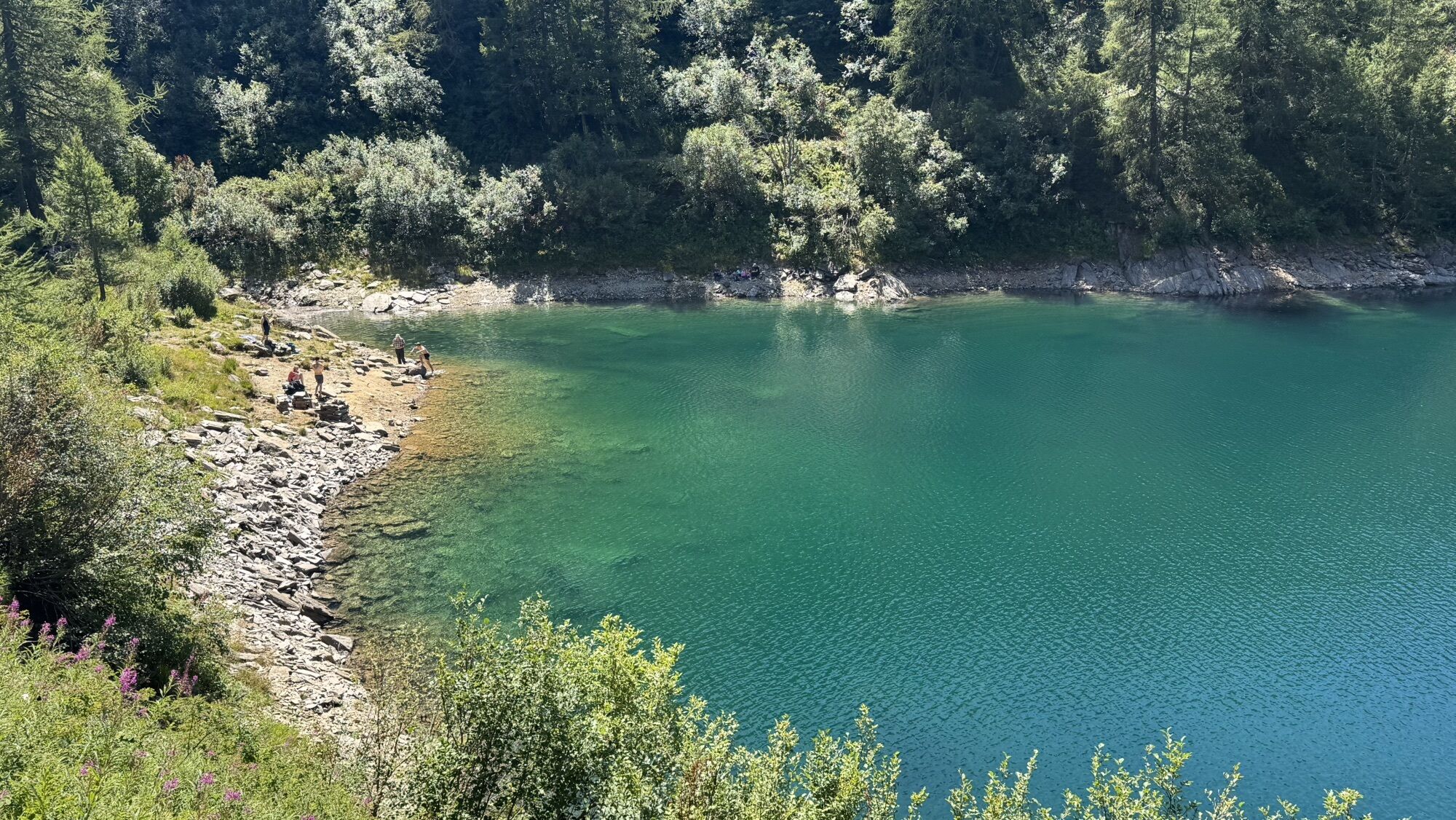
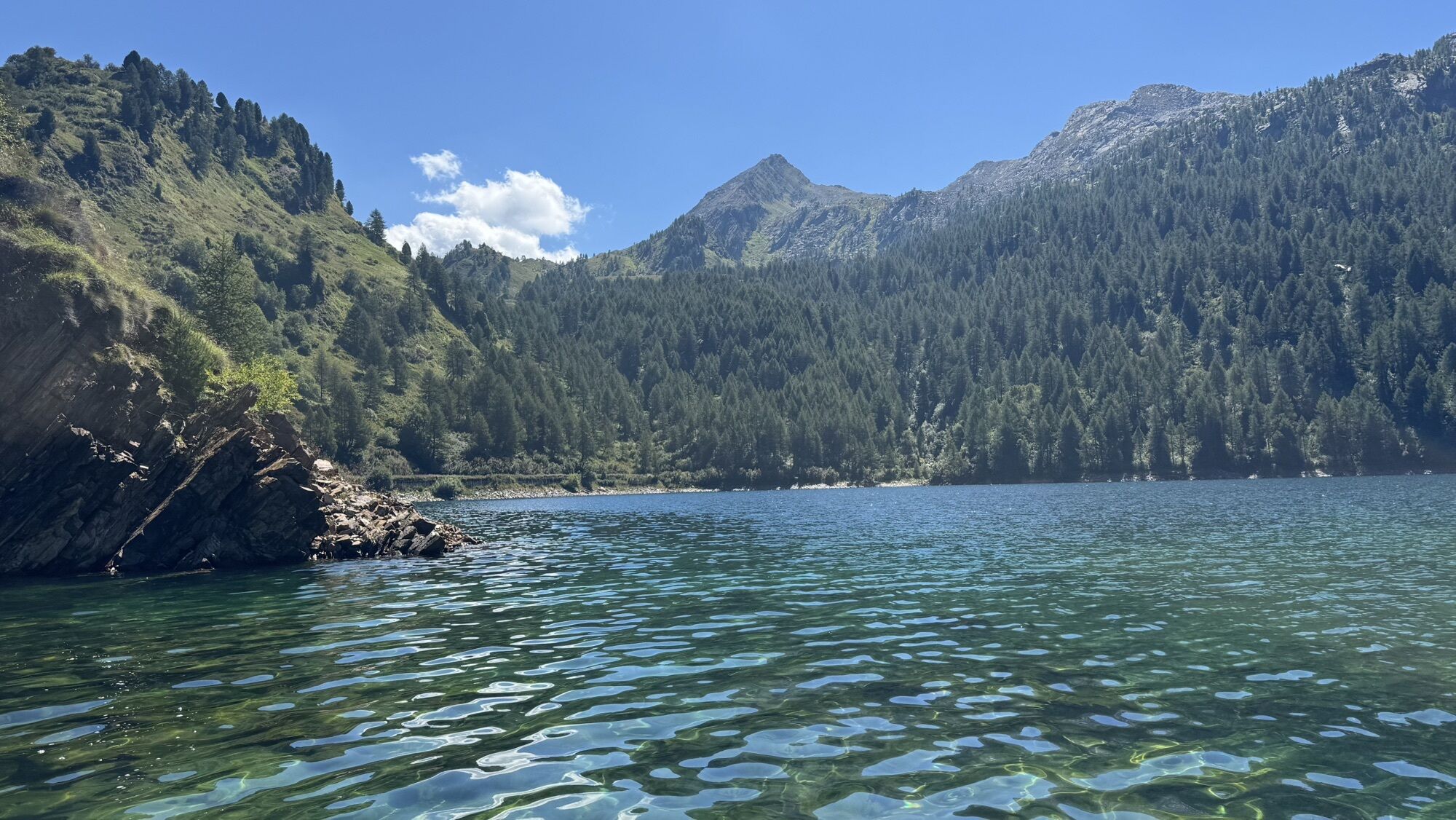
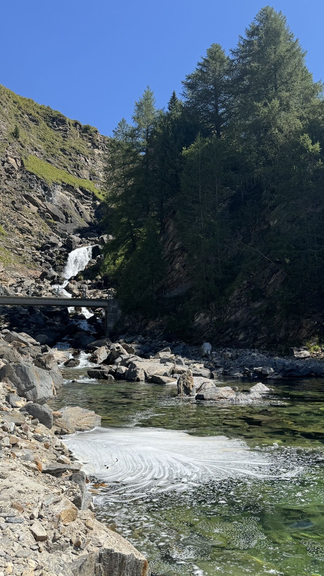
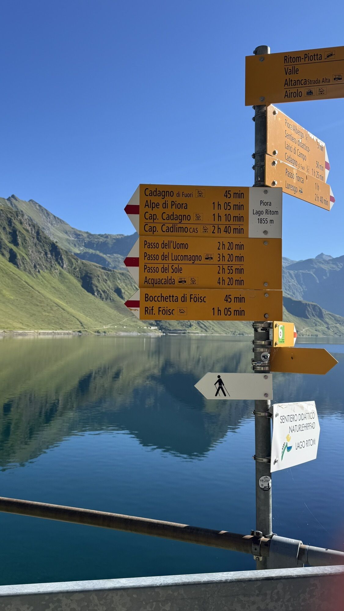
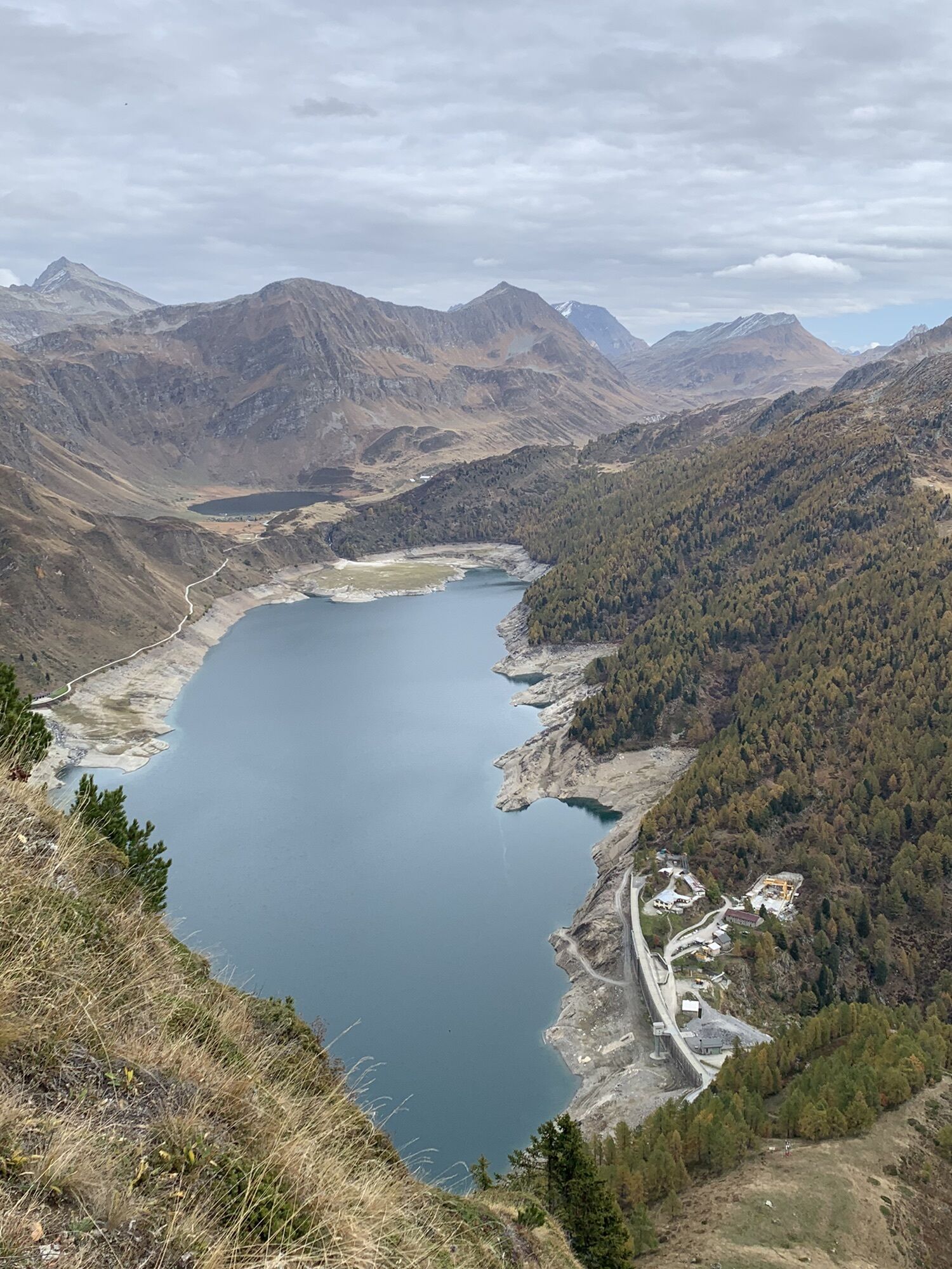
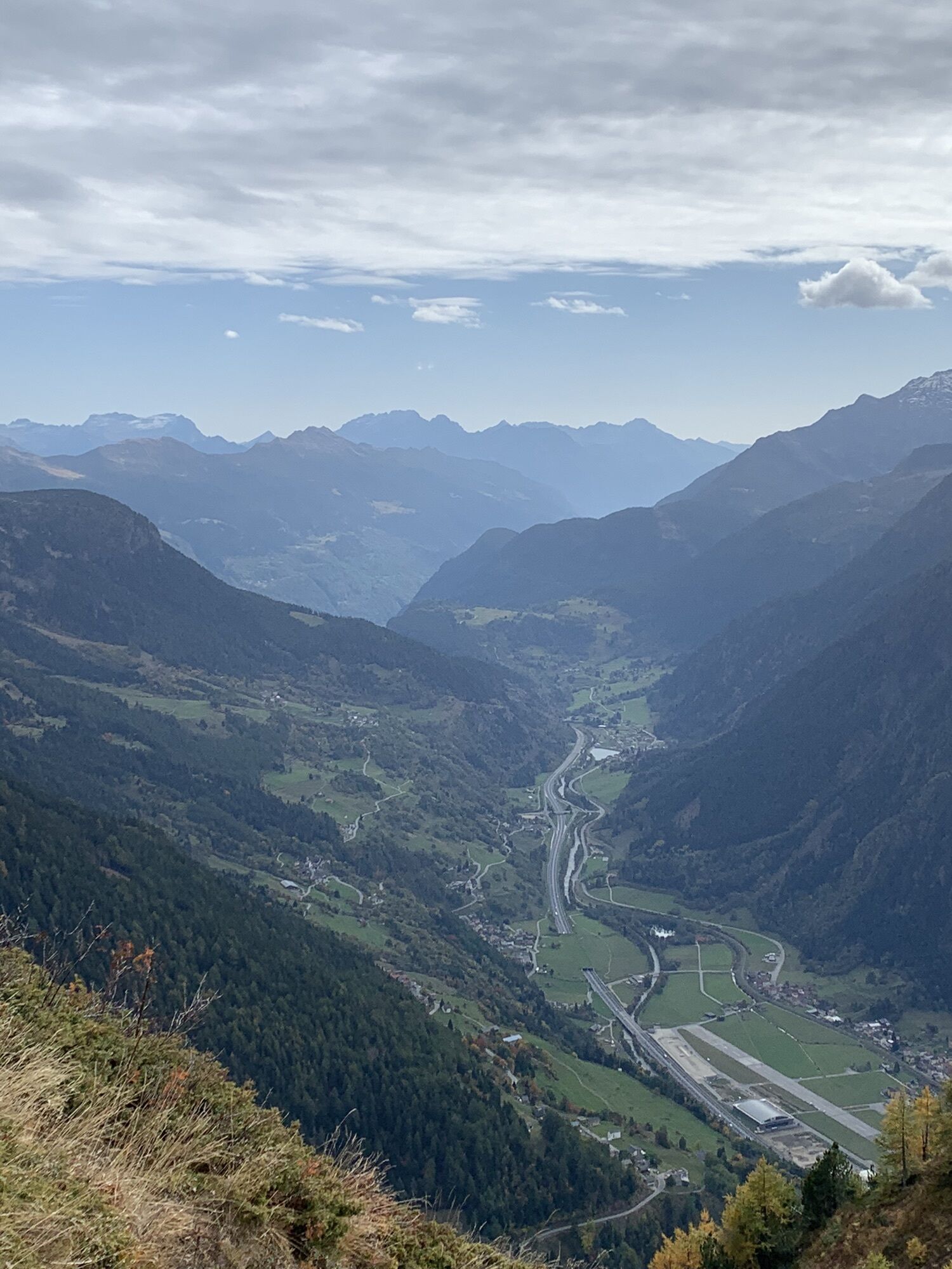
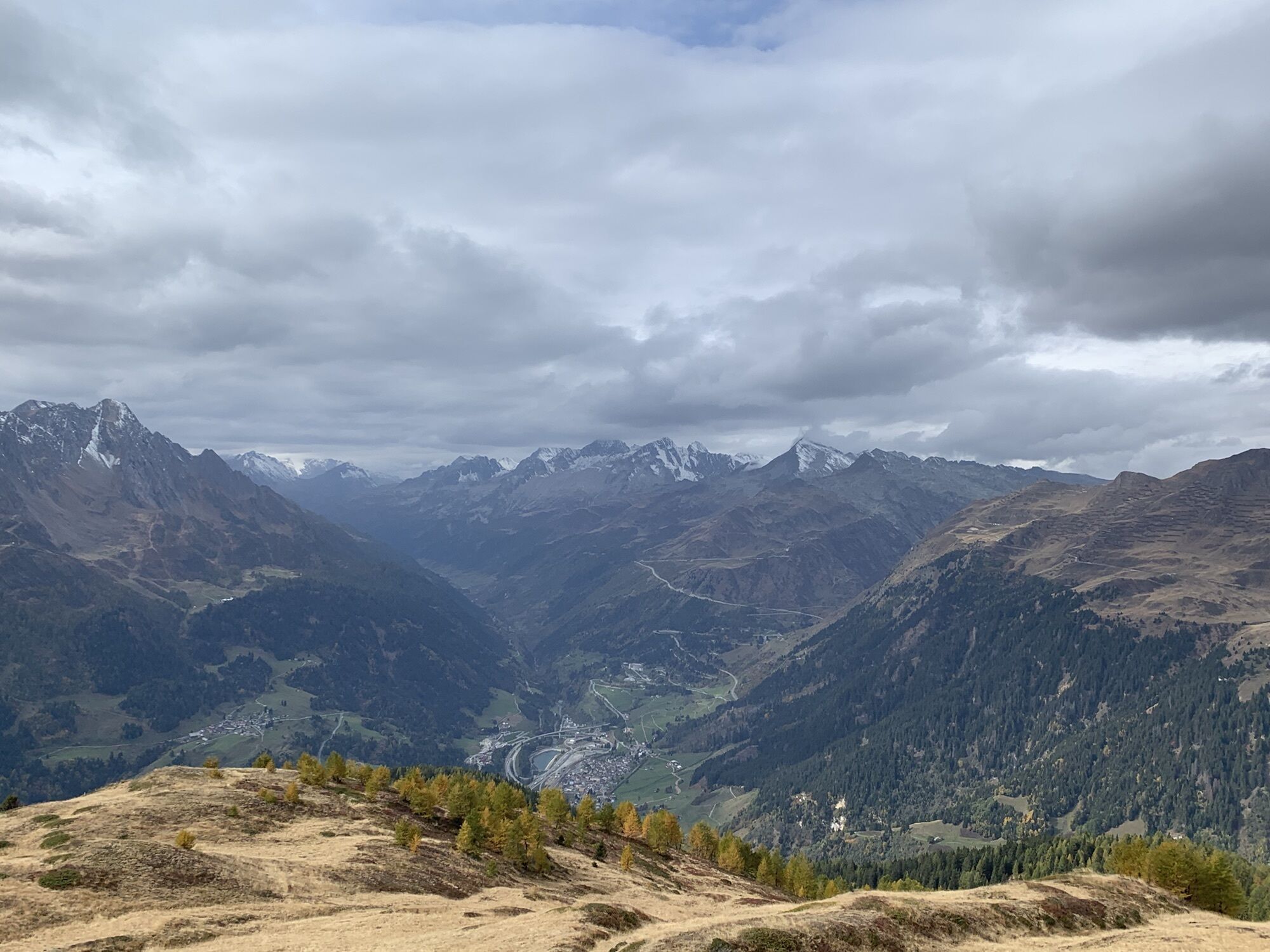
Photos from our users
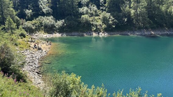
 © Marco MusioCreated on 08.08.2025
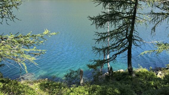 © Marco MusioCreated on 08.08.2025
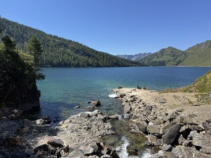 © Marco MusioCreated on 08.08.2025
 © Marco MusioCreated on 08.08.2025
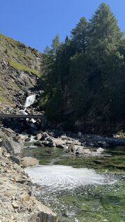 © Marco MusioCreated on 08.08.2025
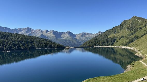 © Marco MusioCreated on 08.08.2025
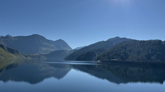 © Marco MusioCreated on 08.08.2025
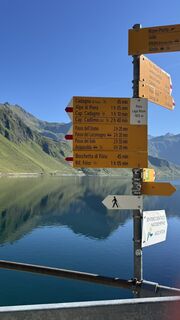 © Marco MusioCreated on 08.08.2025
 © Reto KloterCreated on 08.10.2022
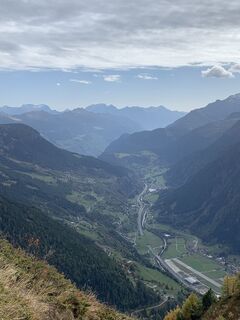 © Reto KloterCreated on 08.10.2022
 © Reto KloterCreated on 08.10.2022


Route
Airolo
(1.175 m)
Village
0,0 km
Muron
(1.161 m)
Neighbourhood
0,9 km
Oratorio dei Santi Gervasio e Protasio
(1.159 m)
Place of worship
2,0 km
C'ampöi
(1.448 m)
Corridor/terrain
4,7 km
Föisc
(2.208 m)
Summit
18,2 km
Töi
(1.867 m)
Corridor/terrain
20,9 km
Oratorio dei Santi Gervasio e Protasio
(1.159 m)
Place of worship
24,8 km
Route
Airolo - Oratorio dei Santi Gervasio e Protasio - Föisc - Rifugio Föisc
heavy
Hiking
26,86
km
Airolo
(1.175 m)
Village
0,0 km
Muron
(1.161 m)
Neighbourhood
0,9 km
Valle
(1.181 m)
Settlement
1,5 km
Oratorio dei Santi Gervasio e Protasio
(1.159 m)
Place of worship
2,0 km
Madrano
(1.161 m)
Settlement
2,0 km
Brugnasco
(1.396 m)
Settlement
4,0 km
C'ampöi
(1.448 m)
Corridor/terrain
4,7 km
Mundòra
(1.513 m)
Corridor/terrain
5,6 km
Alla Diga
(1.833 m)
Corridor/terrain
9,8 km
Bocchetta di Föisc
(2.122 m)
Mountain saddle
17,9 km
Föisc
(2.208 m)
Summit
18,2 km
Rifugio Föisc
(2.208 m)
Shelter
18,2 km
Töi
(1.867 m)
Corridor/terrain
20,9 km
Cé
(1.729 m)
Corridor/terrain
22,0 km
Prati di Cé
(1.651 m)
Corridor/terrain
22,4 km
Madrano
(1.161 m)
Settlement
24,7 km
Oratorio dei Santi Gervasio e Protasio
(1.159 m)
Place of worship
24,8 km
Valle
(1.181 m)
Settlement
25,3 km
Muron
(1.161 m)
Neighbourhood
25,8 km
Airolo
(1.142 m)
Railway station
26,8 km
No reviews yet
Popular tours in the neighbourhood
Rheinquelle - Lai da Tuma
mediumHiking5,67 kmVal Piora lakes route
mediumHiking15,8 km- 4,7
Fusio-Lago Mognola-Fusio
mediumHiking8,94 km - 1,0
Lutersee
mediumHiking6,11 km - 4,5
Lakes Orsino, Orsirora and Valletta Route
Hiking12,8 km Lai Blau
Hiking8 kmLago del Naret-Sasso Nero-Lago del Naret
mediumHiking8,55 km- 5,0
Lukmanier Pass - Cadlimo Hut
mediumHiking9,80 km Mognola Rock Climbing
Climbing8,93 kmLukmanier Alps
mediumHiking13,2 km
Hiking & Tracking

Over 550.000 tour suggestions, detailed maps and an intuitive route planner make the app a must-have for all nature enthusiasts.

Don't miss out on offers and inspiration for your next holiday
Subscribe to the newsletter
Error
An error has occurred. Please try again.Thank you for your registration
Your e-mail address has been added to the mailing list.
Tours throughout Europe
Austria Switzerland Germany Italy Slovenia France Netherlands Belgium Poland Liechtenstein Czechia Slovakia Spain Croatia Bosnia and Herzegovina Luxembourg Andorra Portugal Iceland United Kingdom Ireland Greece Albania North Macedonia Malta Norway Montenegro Moldova Kosovo Hungary San Marino Romania Estonia Latvia Belarus Cyprus Lithuania Serbia Bulgaria Monaco Denmark Sweden Finland