Stabio - Chiesa Santi Giorgo e Vittore - Chiesa dell'Ascensione - San Siro
heavy
Navigate
Navigate
Get this tour on your mobile
Stabio - Chiesa Santi Giorgo e Vittore - Chiesa dell'Ascensione - San Siro
heavy
Cycling
69.79
km
Scan the QR code and start navigation in the bergfex app

Hiking & Tracking


Distance
69.79
km
Duration
06:30
h
Ascent
1,623
m
Sea level
199 -
1,108
m
Track download
Stabio - Chiesa Santi Giorgo e Vittore - Chiesa dell'Ascensione - San Siro
heavy
Cycling
69.79
km


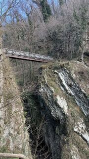
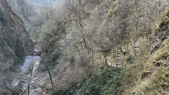
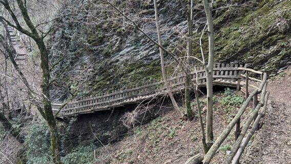
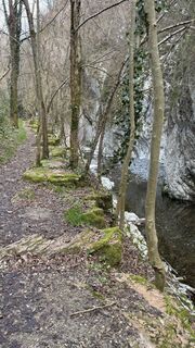
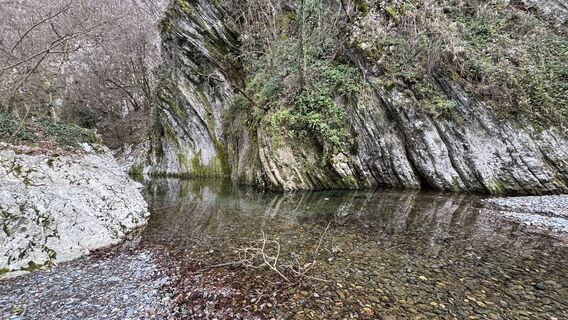
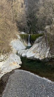
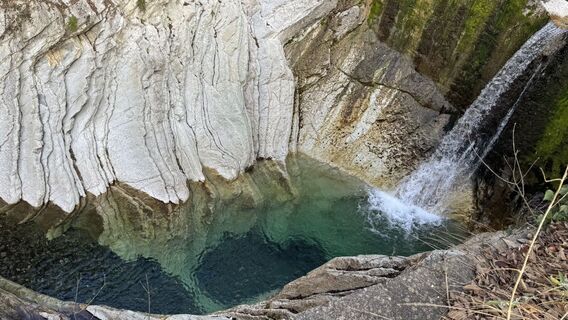
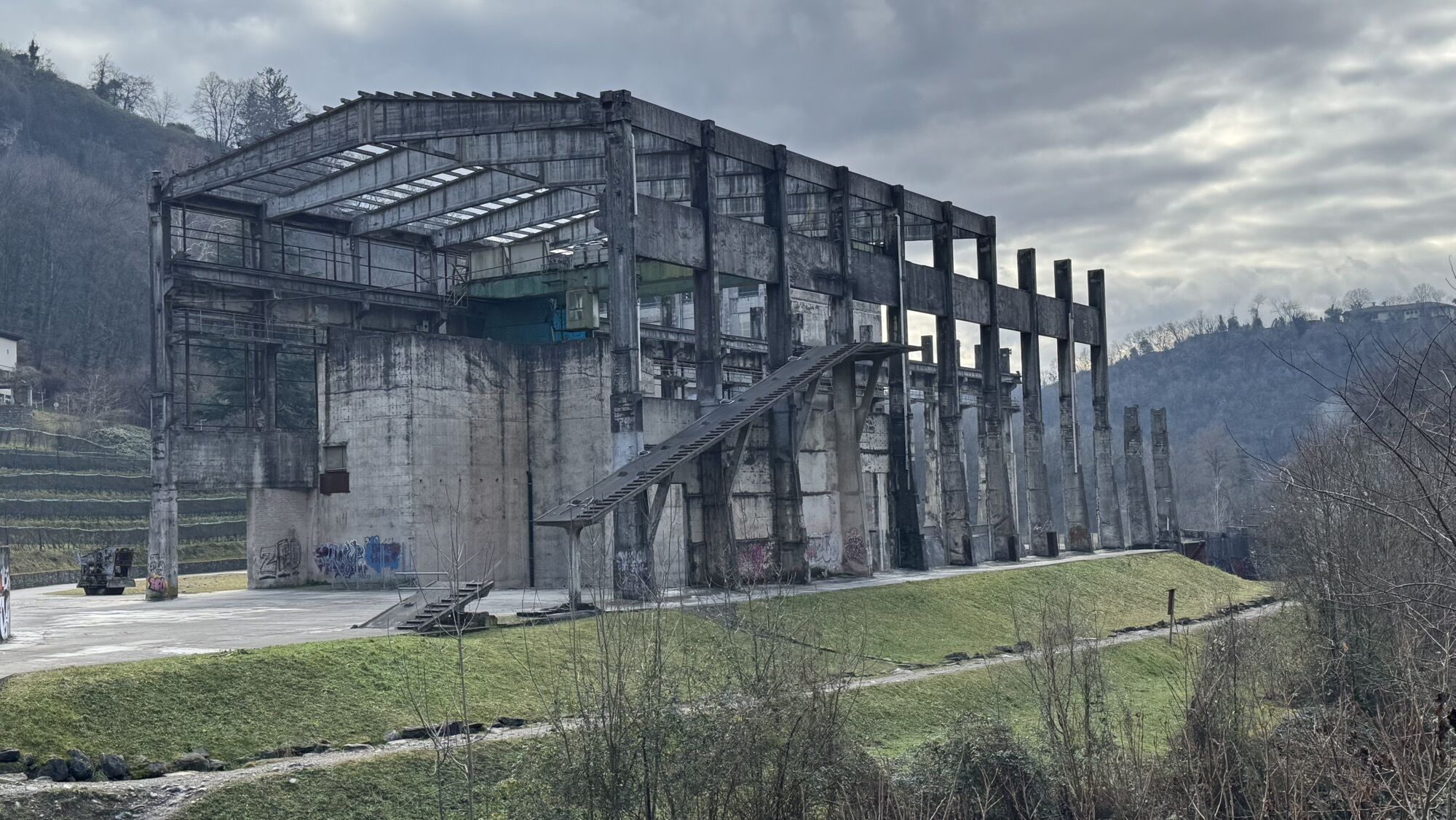
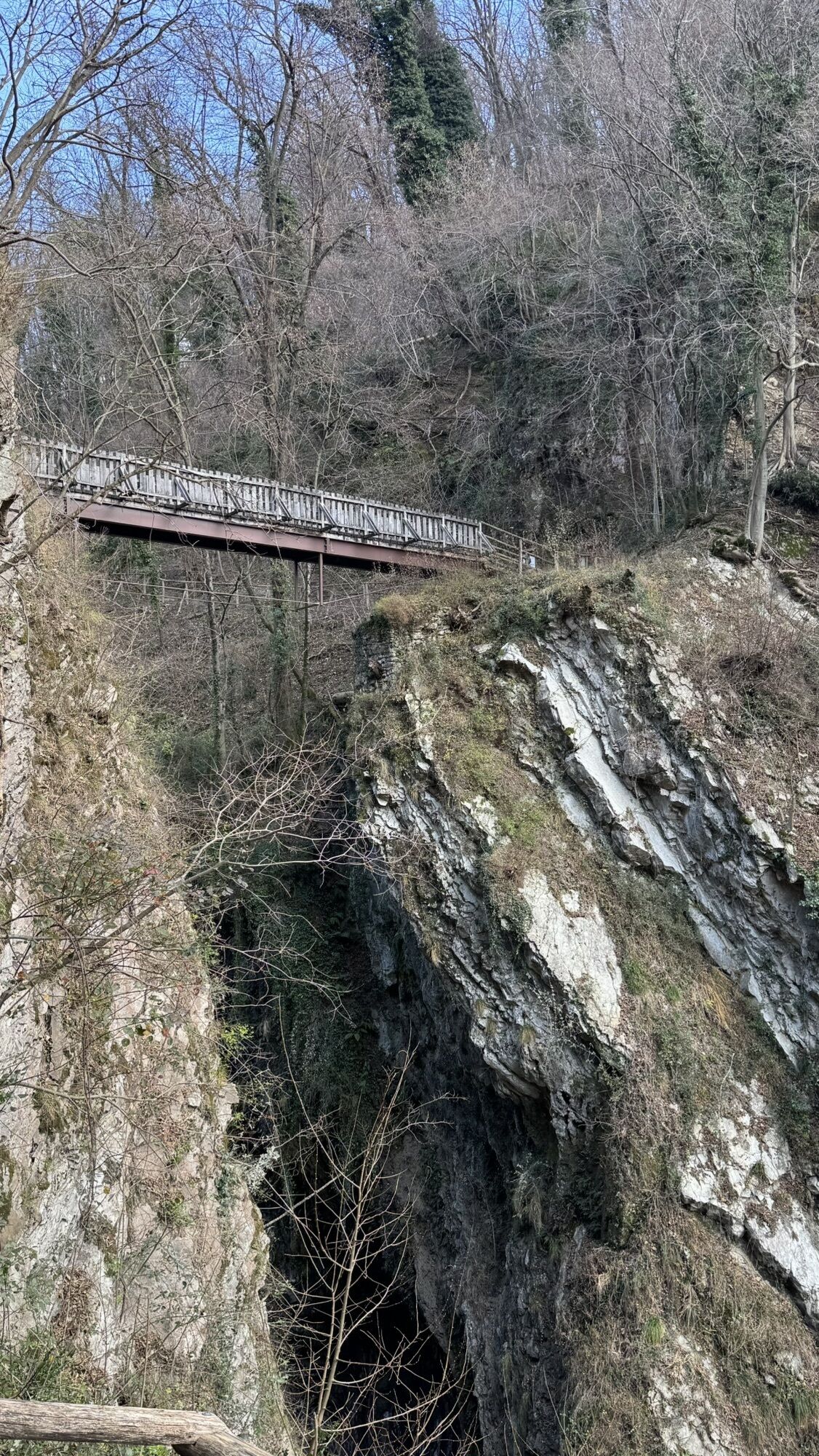
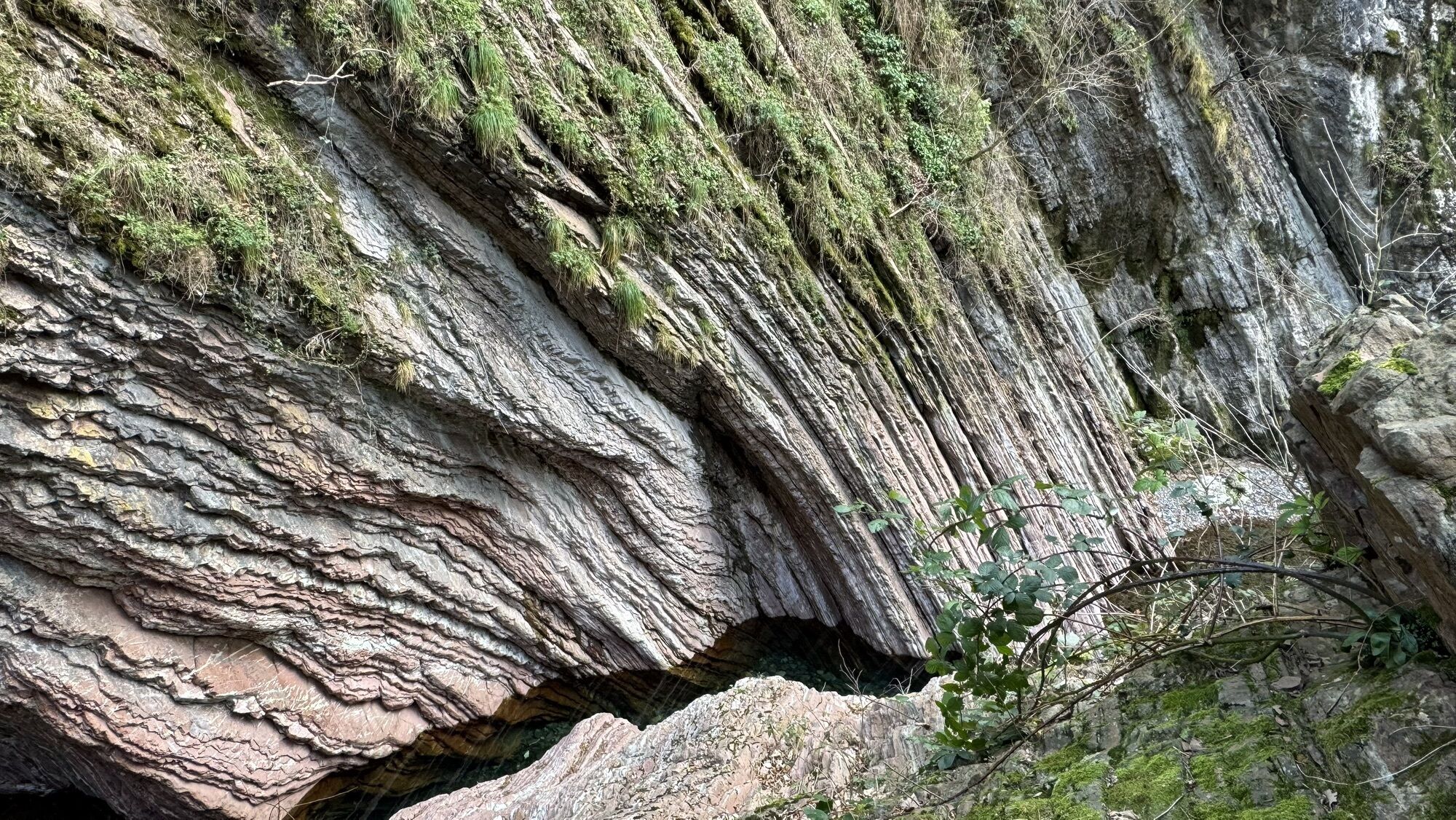
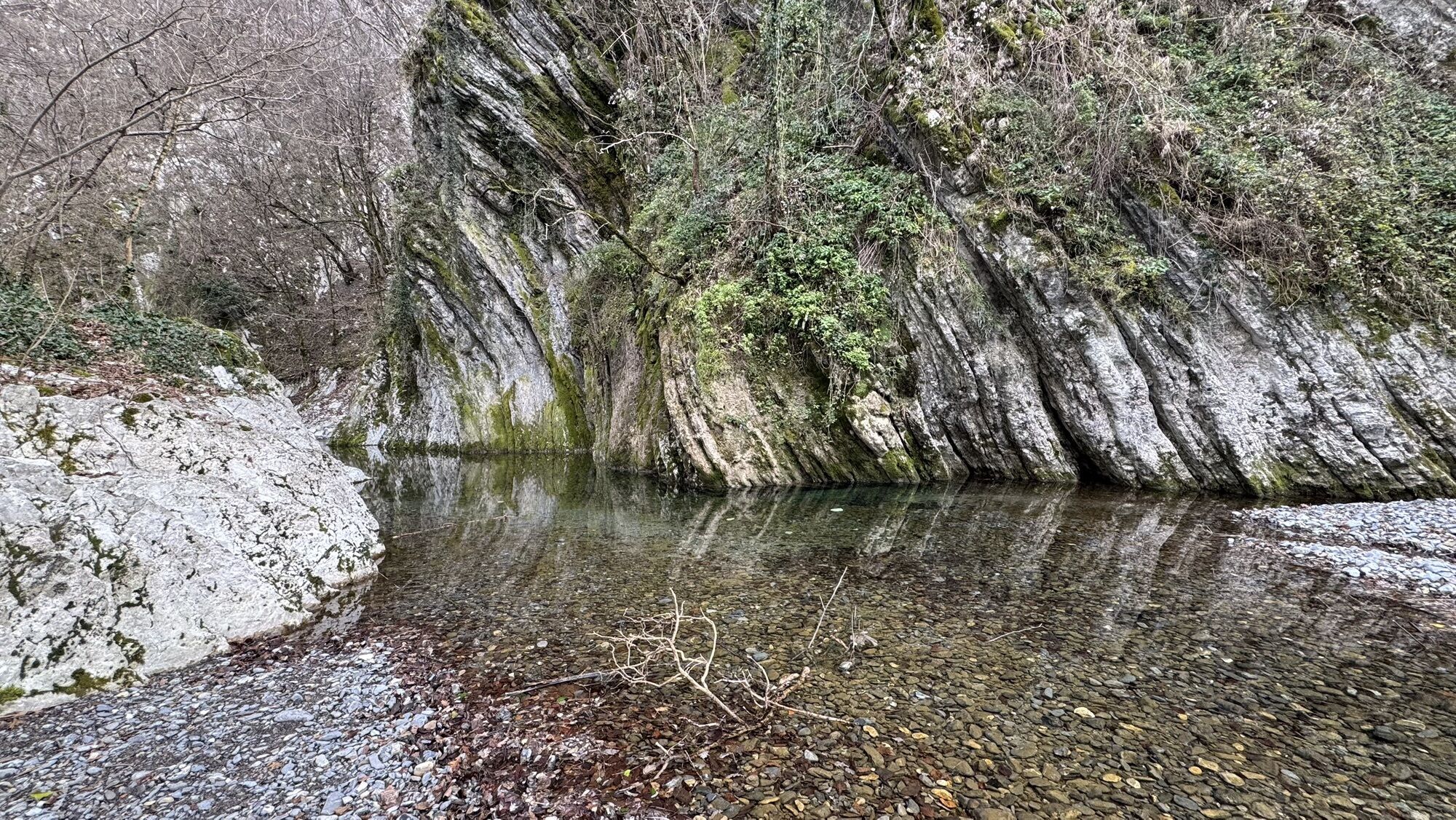
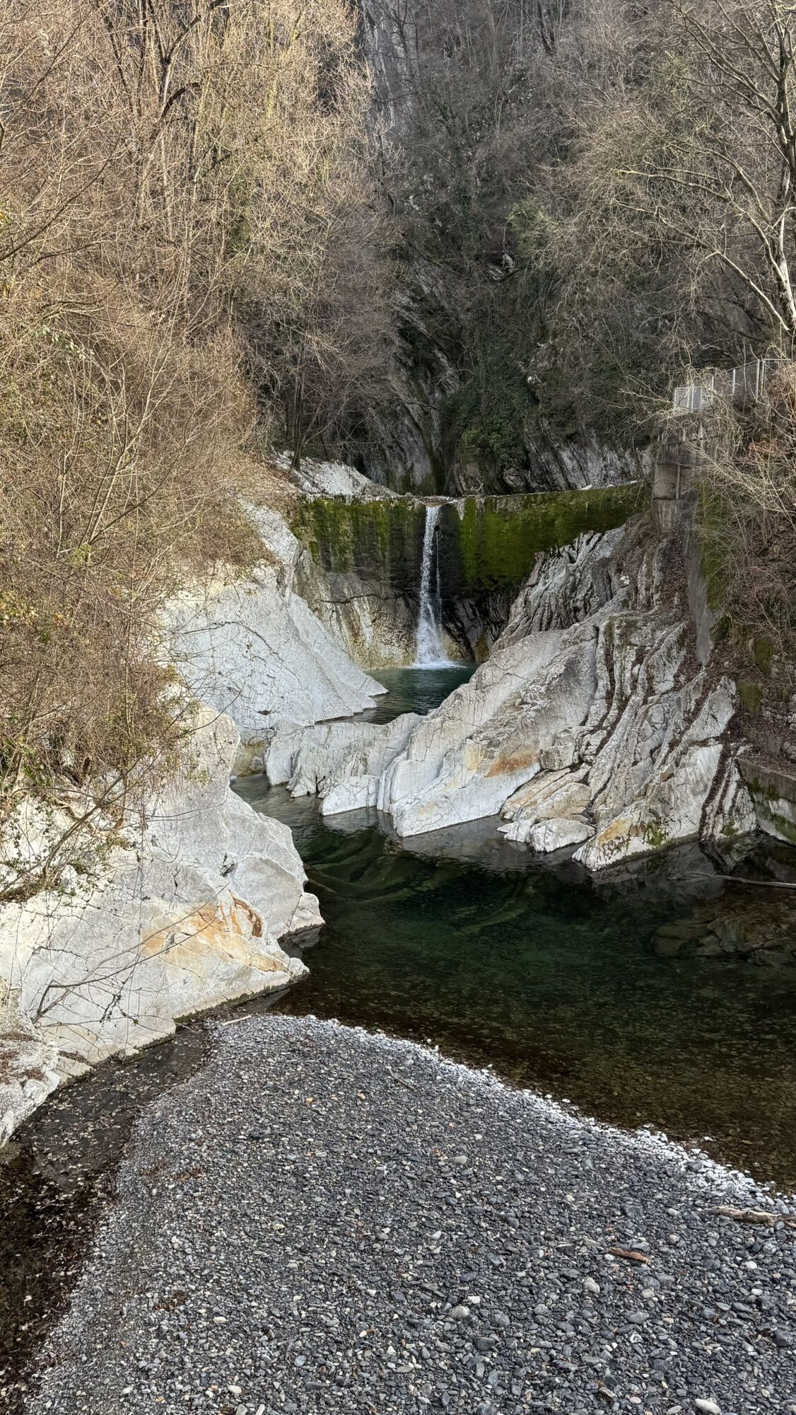
Photos from our users
-

 © Marco MusioCreated on 01.01.2025
 -
 © Marco MusioCreated on 01.01.2025
 -
 © Marco MusioCreated on 01.01.2025
 -
 © Marco MusioCreated on 01.01.2025
 -
 © Marco MusioCreated on 01.01.2025
 -
 © Marco MusioCreated on 01.01.2025
 -
 © Marco MusioCreated on 01.01.2025
 -
 © Marco MusioCreated on 01.01.2025
 -
 © Marco MusioCreated on 01.01.2025


Route
Chiesa Santi Giorgo e Vittore
(348 m)
Place of worship
4.3 km
Oratorio della Beata Vergine delle Grazie
(207 m)
Place of worship
14.5 km
Chiesa dei Santi Giacomo e Filippo
(210 m)
Place of worship
21.1 km
Chiesa dei Santi Nazaro e Celso
(207 m)
Place of worship
26.2 km
Oratorio di San Giuseppe
(595 m)
Place of worship
35.9 km
Chiesa dell'Ascensione
(669 m)
Place of worship
54.3 km
Chiesa di San Giovanni Evangelista
(482 m)
Place of worship
61.7 km
Route
Stabio - Chiesa Santi Giorgo e Vittore - Chiesa dell'Ascensione - San Siro
heavy
Cycling
69.79
km
Stabio
(352 m)
Village
0.1 km
Colombera
(340 m)
Settlement
1.4 km
Genestrerio
(343 m)
Village
1.8 km
Mendrisio
(354 m)
City
3.4 km
Chiesa di Sant'Apollonia
(348 m)
Place of worship
3.7 km
Chiesa Santi Giorgo e Vittore
(348 m)
Place of worship
4.3 km
Coldrerio
(351 m)
Village
4.3 km
Alla Costa
(314 m)
Corridor/terrain
5.2 km
Pobbia
(254 m)
Settlement
6.5 km
Chiasso
(230 m)
City
9.4 km
Vacallo
(367 m)
Village
10.8 km
Pizzamiglio
(248 m)
Settlement
10.8 km
Maslianico
(228 m)
Village
11.6 km
Izumi Sushi
(213 m)
Restaurant
12.3 km
Como
(200 m)
City
13.7 km
Cernobbio
(207 m)
Village
14.3 km
Oratorio della Beata Vergine delle Grazie
(207 m)
Place of worship
14.5 km
Sant'Andrea
(224 m)
Neighbourhood
14.7 km
Rovenna
(437 m)
Village
15.3 km
Vergonzano
(220 m)
Settlement
16.9 km
Casarevolo
(314 m)
Neighbourhood
17.2 km
Crotti
(235 m)
Settlement
17.3 km
Casarico
(370 m)
Settlement
17.5 km
Vignola
(242 m)
Settlement
17.6 km
Borgo
(250 m)
Village
17.7 km
Cascata del Pizzallo
(266 m)
Waterfall
17.8 km
Vighinzano
(308 m)
Neighbourhood
17.8 km
Pincirola
(364 m)
Neighbourhood
17.9 km
Piodee
(333 m)
Neighbourhood
17.9 km
Somaino
(374 m)
Neighbourhood
18.1 km
Proo
(338 m)
Neighbourhood
18.1 km
Roiano
(303 m)
Neighbourhood
18.2 km
Luscesino
(214 m)
Settlement
18.2 km
Creolino
(359 m)
Neighbourhood
18.3 km
Tosnacco
(316 m)
Settlement
18.3 km
Carisciano
(367 m)
Neighbourhood
18.6 km
Pangino
(243 m)
Neighbourhood
19.3 km
Cavadino
(329 m)
Settlement
19.6 km
Urio
(199 m)
Village
19.6 km
Santa Marta
(304 m)
Neighbourhood
20.0 km
Somaina
(350 m)
Settlement
20.0 km
Chiesa dei Santi Giacomo e Filippo
(210 m)
Place of worship
21.1 km
Carate
(226 m)
Village
21.1 km
Ponte
(217 m)
Neighbourhood
21.6 km
Chiesa di San Giuseppe
(207 m)
Place of worship
21.6 km
Soldino
(232 m)
Settlement
22.2 km
Ticeè
(283 m)
Neighbourhood
22.3 km
Laglio
(207 m)
Village
22.4 km
Chiesa di San Giorgio
(204 m)
Place of worship
22.4 km
Belvedere Giancarlo Venelli
(198 m)
Viewpoint
22.7 km
Cappella di San Rocco
(204 m)
Place of worship
22.7 km
Germanello
(260 m)
Village
22.9 km
La Locanda Del Cantiere
(216 m)
Restaurant
23.3 km
Osteria Vecchio Molo
(216 m)
Restaurant
23.3 km
Torriggia
(260 m)
Village
23.7 km
Chiesa di San Vittore
(207 m)
Place of worship
25.1 km
Carpino
(328 m)
Neighbourhood
25.8 km
Brienno
(198 m)
Ferry landing stage
26.2 km
Chiesa dei Santi Nazaro e Celso
(207 m)
Place of worship
26.2 km
Chiesa dell'Immacolata
(227 m)
Place of worship
26.7 km
Crotto dei Platani
(205 m)
Restaurant
28.2 km
Argegno
(201 m)
Village
29.9 km
Muronico
(375 m)
Village
30.9 km
Chiesa di Sant'Anna
(406 m)
Place of worship
32.4 km
Sant'Anna
(402 m)
Settlement
32.4 km
Hotel Ristorante La Griglia
(406 m)
Restaurant
32.4 km
Macchero
(452 m)
Settlement
34.3 km
Occagno
(607 m)
Village
35.4 km
Retegno
(584 m)
Settlement
35.6 km
Oratorio di San Giuseppe
(595 m)
Place of worship
35.9 km
Auvrascio
(594 m)
Settlement
35.9 km
Ristorante Bellavista
(589 m)
Restaurant
36.6 km
Cerano d'Intelvi
(544 m)
Village
38.2 km
Chiesa di San Tommaso
(556 m)
Place of worship
38.5 km
Castiglione d'Intelvi
(581 m)
Village
39.4 km
Selve
(630 m)
Settlement
39.7 km
Santi Quirico e Giuditta
(662 m)
Place of worship
40.3 km
Veglio
(650 m)
Settlement
40.8 km
Chiesa di San Maurizio
(833 m)
Place of worship
43.4 km
Casasco d'Intelvi
(847 m)
Village
43.4 km
Piano delle Alpi
(970 m)
Corridor/terrain
46.5 km
Pianella
(998 m)
Corridor/terrain
49.9 km
Cassino
(733 m)
Corridor/terrain
52.5 km
Muggio
(661 m)
Village
53.7 km
Ristorante Stella
(660 m)
Restaurant
53.7 km
Marenca
(680 m)
Corridor/terrain
54.1 km
Chiesa dell'Ascensione
(669 m)
Place of worship
54.3 km
Cabbio
(667 m)
Settlement
54.5 km
Ristorante Della Posta
(642 m)
Restaurant
54.5 km
Osteria Cervo
(661 m)
Restaurant
54.6 km
Vallera
(674 m)
Settlement
55.3 km
San Siro
(597 m)
Place of worship
57.1 km
Bruzella
(593 m)
Settlement
57.2 km
Caneggio
(555 m)
Village
58.9 km
Sant'Antonio
(568 m)
Corridor/terrain
59.3 km
Grotto Del Tiro
(551 m)
Restaurant
59.9 km
Chiesa di San Giovanni Evangelista
(482 m)
Place of worship
61.7 km
Morbio Superiore
(452 m)
Village
61.8 km
Cantun Sura
(450 m)
Neighbourhood
63.0 km
Castel San Pietro
(442 m)
Village
63.0 km
Loverciano
(438 m)
Settlement
63.6 km
Salorino
(473 m)
Village
64.6 km
Cappella Franchini
(368 m)
Place of worship
64.9 km
Mendrisio
(354 m)
City
65.1 km
Osteria del Ponte
(339 m)
Restaurant
66.9 km
Genestrerio
(343 m)
Village
68.0 km
Colombera
(340 m)
Settlement
68.5 km
Stabio
(352 m)
Village
69.8 km
No reviews yet
Popular tours in the neighbourhood
-
4.7
Sentiero del Monte Generoso (SwitzerlandMobility 635)
mediumHiking 9.22 km -
4.6
Abendwanderung
mediumHiking 8.01 km -
4.5
Lenno - Val Perlana
mediumHiking 11.7 km -
5.0
Triangolo Lariano esplorativo
lightMountainbike 19.8 km -
3.0
Bellavista - Monte Generoso
lightHiking 2.60 km -
S.Salvatore
lightHiking 15.0 km -
4.0
Alpe del viceré - monte Palanzone
mediumHiking 11.2 km -
5.0
Valle di Muggio
mediumHiking 14.2 km -
5.0
Parks trail of Mendrisiotto
mediumHiking 19.5 km -
5.0
Morcote - San Salvatore
mediumHiking 9.95 km
Hiking & Tracking

Over 550.000 tour suggestions, detailed maps and an intuitive route planner make the app a must-have for all nature enthusiasts.

Don't miss out on offers and inspiration for your next holiday
Subscribe to the newsletter
Error
An error has occurred. Please try again.
Thank you for your registration
Your e-mail address has been added to the mailing list.
Tours throughout Europe
Austria
Switzerland
Germany
Italy
Slovenia
France
Netherlands
Belgium
Poland
Liechtenstein
Czechia
Slovakia
Spain
Croatia
Bosnia and Herzegovina
Luxembourg
Andorra
Portugal
Iceland
United Kingdom
Ireland
Greece
Albania
North Macedonia
Malta
Norway
Montenegro
Moldova
Kosovo
Hungary
San Marino
Romania
Estonia
Latvia
Belarus
Cyprus
Lithuania
Serbia
Bulgaria
Monaco
Denmark
Sweden
Finland