


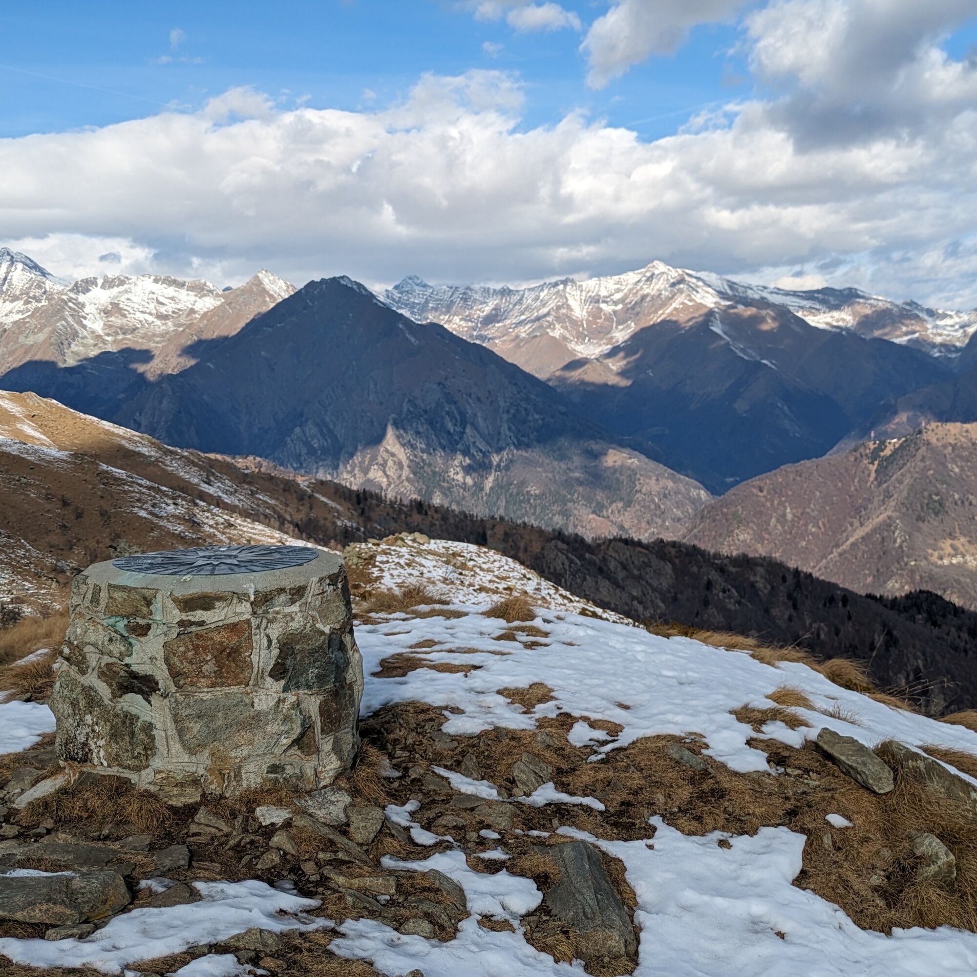
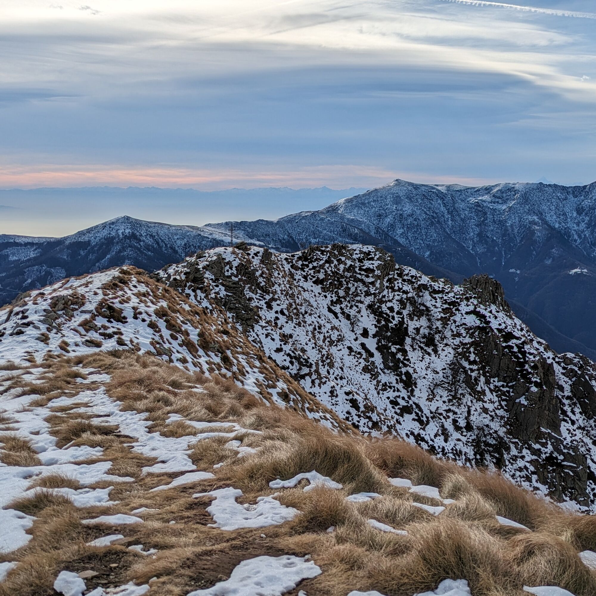
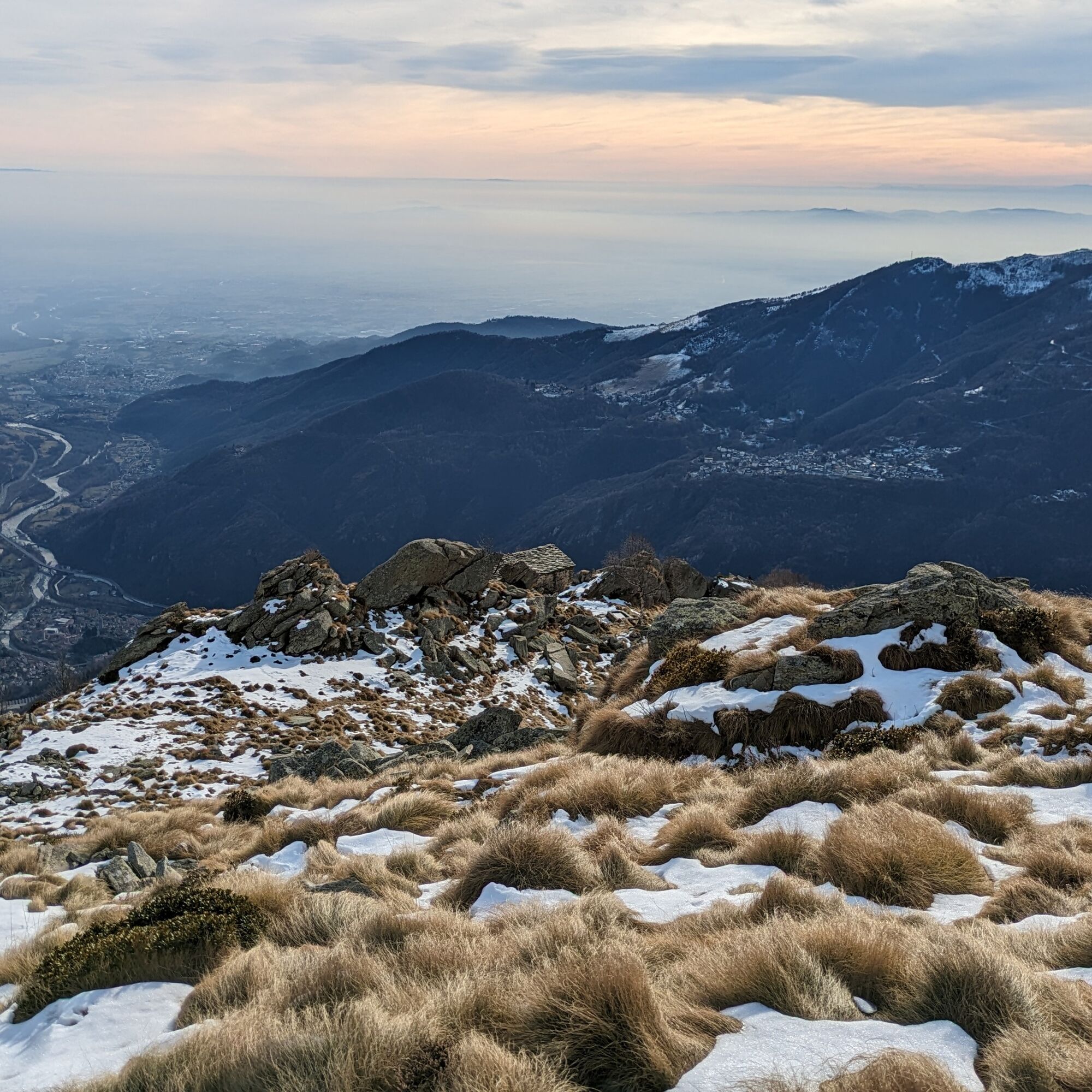
Punta Arbella is quite an isolated peak rising just above Pont Canavese between the Soana Valley and Ribordone Valley: this allows enjoying a fantastic 360-degree view on the surrounding peaks.
The first...
Punta Arbella is quite an isolated peak rising just above Pont Canavese between the Soana Valley and Ribordone Valley: this allows enjoying a fantastic 360-degree view on the surrounding peaks.
The first part of the route goes through invading groves (hazels and birches) with some large beech specimens. In the second part the Nivolaj and Colmetto high pastures are crossed, featuring historic stone and wood buildings. Near Alpe Colmetto there is also a characteristic drinking trough made from a single hollowed stone block.
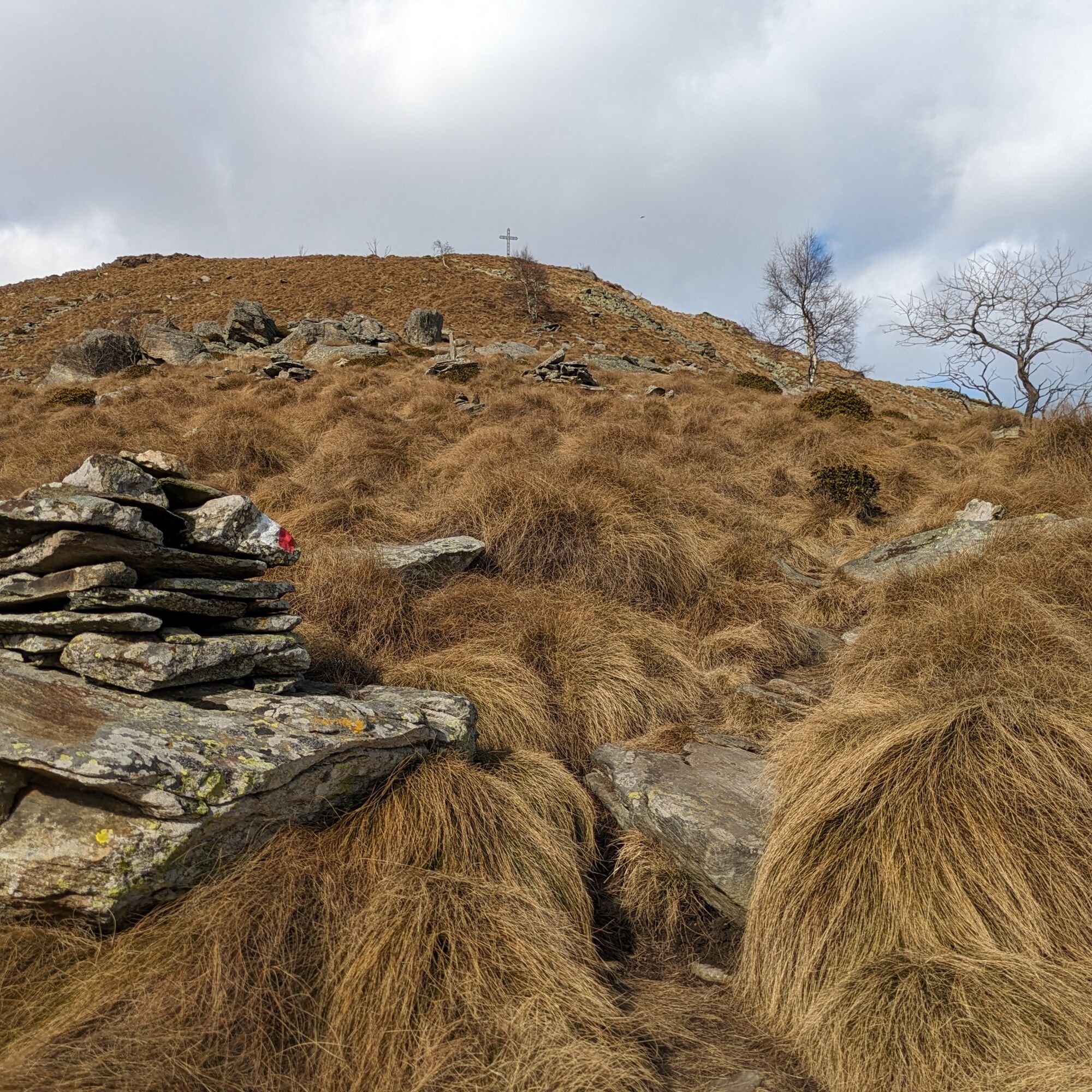
The upper part climbs the sunny ridge of the mountain, in open spaces among alpine meadows and pastures, up to the subpeak where there is an iron cross, the summit book and, in a niche, a small wooden Madonna. Continuing along a short stretch of easy ridge you reach the real summit where a wind rose is placed.

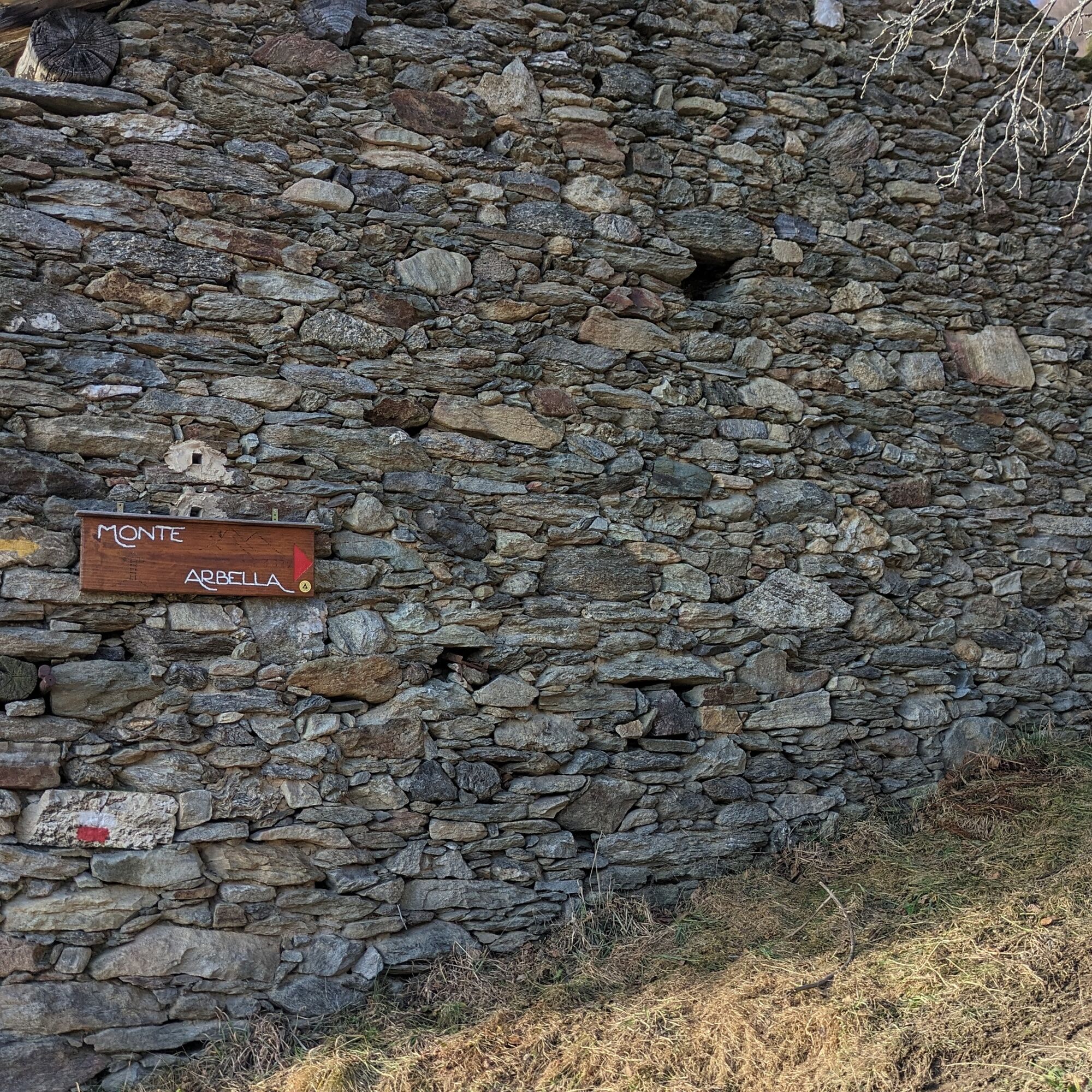

Signs indicating the start of the trail are found on the wall of an old house upon entering the hamlet. Then go straight up and, having reached a first grassy plateau, head towards a low building on the edge of the woods where the power line arrives. The path then continues uphill through the woods, reaches the Lumberto houses (pass between the two buildings) and continues to Pian Russa (here the Fraternali map is inaccurate, but the red marks are clear). Then follow the path that leads to Alpe Nivolaj.
After passing the huts, the path continues diagonally to the slope and reaches the ridge shared with the Ribordone valley. Then climb the crest and shortly after you reach the junction with the path coming up from Frachiamo. Keep right and continue climbing until you reach the Colmetto huts. From here you begin to see the cross of the subpeak: once you reach that point continue for a few hundred meters until the true summit.
The descent is along the ascent route.
Yes
Yes
Non-slip sole footwear is recommended, wind/rain protection, a warm layer, hat and sunglasses.
There are no refreshment points along the route, so you need to stock up on water and food.
From Pont Canavese, follow the provincial road of the Soana valley, just before the tunnel turn sharply left (signs for Lutta, Poetti, Monte Arbella). Pass all the hamlets and arrive at Campidaglio where the road ends.
At the end of the road or just before the hamlet Campidaglio
For more information on Canavese visit the portal turismoincanavese.com
Popular tours in the neighbourhood
- 5,0
VALCHIUSELLA Loop Fondo - Tissone - Tallorno
mediumHiking5,08 km ALPETTE Monte Soglio and cima Mares from Balmassa
mediumHiking10,9 kmFONDO Alpe Balme Fondo and Tallorno
mediumMountainbike13,1 kmSPARONE The ancient mule track of Frachiamo and the Rocca di Sparone
mediumHiking6,17 kmPONT CANAVESE Val Soana
mediumLong distance cycling28,2 kmCASTELLAMONTE Sacred Valley Loop - Lower Valchiusella
mediumCycling27,8 kmRock, Madonna of the Snow, Val Mill, Levone
mediumMountainbike18,9 kmVALPERGA Anello del Sacro Monte di Belmonte
mediumHiking10,3 kmSant'Anna Boschi and its Castelletti
lightHiking5,23 kmROCCA CANAVESE In the vineyards of Pedimonte
mediumMountainbike18,0 km
Hiking & Tracking


Don't miss out on offers and inspiration for your next holiday
Your e-mail address has been added to the mailing list.