


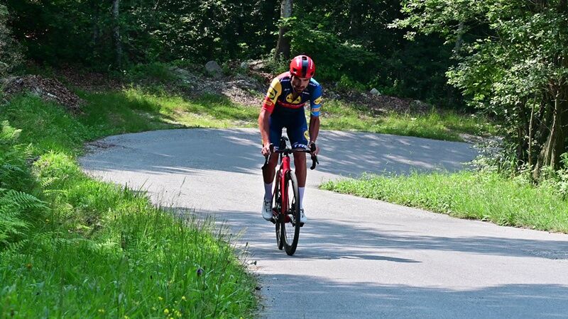
After less than two kilometers from the entrance, an 11 percent section heralds as the 9 km of uphill set mainly in the woods and full of hairpin bends.
In all, this climb, which connects the territory...
After less than two kilometers from the entrance, an 11 percent section heralds as the 9 km of uphill set mainly in the woods and full of hairpin bends.
In all, this climb, which connects the territory of the province of Turin with that of Cuneo, joining precisely Bibiana and Bagnolo Piemonte, measures 8.9 km and has an average gradient of 9.4 percent.
After the start section to gain altitude with less pronounced gradients, in the next 6.5 kilometers the average is 10.6 percent.
Along the succession of curves under the chestnut trees there are but very short portions to take a breather, so much so that three kilometers from the summit there are 500 meters at 12% with a peak of 14%. In the next 500-meter segments the gradients are 11 and 10 percent, respectively.
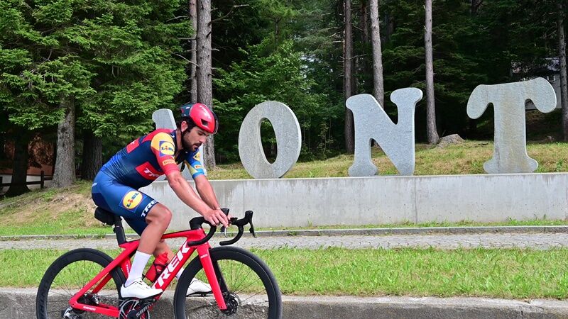
Having earned the well-deserved souvenir photo in front of the maxi stone inscription of Montoso, at 1,248 meters, you can still climb up to the ski resort of Rucas, extending the route by 5.5 kilometers and 500 meters of elevation gain.

Appropriate clothing and equipment are recommended.
Before embarking on any hike, it is advisable to consult weather reports or ask for information at local Tourism Offices.
It is good practice not to embark on a hike alone, always notify your destination.
Do not throw garbage into the environment but take it with you, picking up any garbage left by others.
The hiking times given are approximate and may vary depending on weather conditions and your own ability.
From Turin take the A55 highway to Pinerolo, then follow the SP 161 Val Pellice road for about 11 km to Bricherasio. Continuing in the direction of Luserna San Giovanni, you will reach the junction for Bibiana on the left. Following the signs, after about 1 km you reach the town square and the starting point of the itinerary.
To get to Bibiana, after reaching Pinerolo by bus or train, it is possible to take the bus of the Arriva or Cavourese companies that go all the way to the center of town.
Several free parking lots are located at the village center of Bibiana.
For all details and updates on the route you can visit the UPSLOWTOUR website or the LIVE INFO section. Before embarking on any hike you are advised to consult weather reports or ask for information at local Tourism Offices. Do not throw garbage into the environment but take it with you picking up any garbage left by others.
Average slope 9.44 %
Maximum slope 15.9 %
There are several bars and restaurants on arrival in Montoso
Popular tours in the neighbourhood
- 5,0
BOBBIO PELLICE Upslowtour - Loop 2 of the refuges
heavyCycling37,6 km LUSERNA S. G. Upslowtour - Luserna Stone Loop 9
mediumCycling38,1 kmFrom Torre Pellice to Bars d'la tajola (and Mount Castlus).
mediumHiking4,40 kmPath of the Invincibles
mediumHiking19,1 kmWalk of the Freedom Lighthouse
lightHiking3,60 kmBRICHERASIO Upslowtour - Loop 13 of the Ridges
mediumCycling38,2 kmVILLAR PELLICE Upslowtour - Invincibles Loop 5
mediumCycling17,7 kmVILLAR PELLICE Upslowtour - Comba dei Carbonieri Loop 4
mediumCycling21,3 kmPath of Winged People
mediumHiking7,65 kmFrom Lusernetta to Villafranca
lightMountainbike56,4 km
Hiking & Tracking


Don't miss out on offers and inspiration for your next holiday
Your e-mail address has been added to the mailing list.