Bernrain - Evang.-Ref. Kirche Erlen - Alte Kirche - St. Johannes
medium
Navigate
Navigate
Get this tour on your mobile
Bernrain - Evang.-Ref. Kirche Erlen - Alte Kirche - St. Johannes
medium
Racing
56,70
km
Scan the QR code and start navigation in the bergfex app

Hiking & Tracking


Distance
56,70
km
Duration
02:58
h
Ascent
553
m
Sea level
397 -
572
m
Track download
Bernrain - Evang.-Ref. Kirche Erlen - Alte Kirche - St. Johannes
medium
Racing
56,70
km


Photos from our users
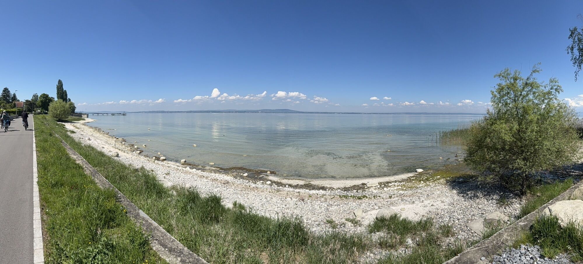
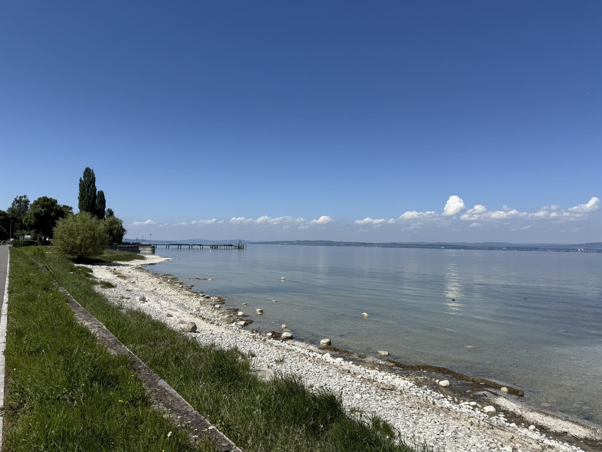
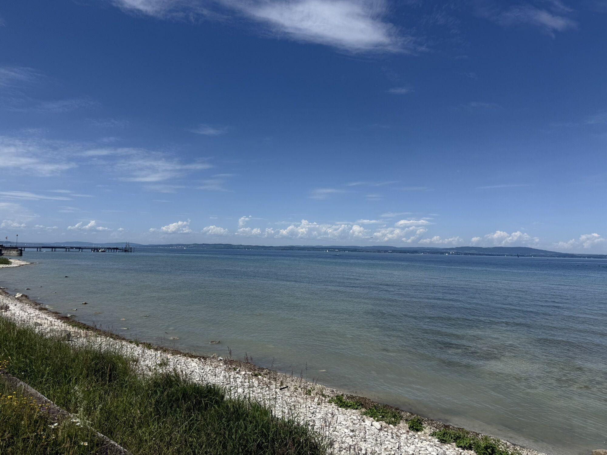
Route
Constance
(405 m)
City
0,3 km
Evang.-Ref. Kirche Erlen
(459 m)
Place of worship
16,1 km
Reformierte Kirche
(449 m)
Place of worship
26,9 km
Neukirch (Egnach)
(448 m)
Village
27,0 km
St. Johannes
(407 m)
Place of worship
32,3 km
Uttwil
(419 m)
Village
37,3 km
Constance
(405 m)
City
55,6 km
Route
Bernrain - Evang.-Ref. Kirche Erlen - Alte Kirche - St. Johannes
medium
Racing
56,70
km
Bernrain
(461 m)
Railway station
0,0 km
Constance
(405 m)
City
0,3 km
Kreuzlingen
(397 m)
City
0,4 km
Bätershausen
(509 m)
Settlement
1,7 km
Dippishausen
(533 m)
Settlement
3,2 km
Oftershausen
(542 m)
Settlement
3,5 km
Siegershausen
(546 m)
Village
3,8 km
Altishausen
(570 m)
Settlement
5,1 km
Heimenlachen
(559 m)
Settlement
6,5 km
Restaurant Sonne
(552 m)
Restaurant
7,4 km
Berg TG
(549 m)
Village
7,4 km
Frohheim
(550 m)
Restaurant
7,6 km
Kehlhof
(515 m)
Settlement
8,5 km
Opfershofen TG
(445 m)
Village
10,1 km
Uerenbohl
(464 m)
Settlement
11,4 km
Sulgen
(463 m)
Village
11,8 km
Ochsen
(463 m)
Restaurant
12,0 km
Hessenreuti
(461 m)
Settlement
13,6 km
Riedt b. Erlen
(461 m)
Village
14,5 km
Erlen
(448 m)
Village
15,4 km
Evang.-Ref. Kirche Erlen
(459 m)
Place of worship
16,1 km
Traubenquartier
(455 m)
Settlement
16,4 km
Eppishausen
(463 m)
Settlement
16,5 km
Biessenhofen
(464 m)
Village
17,9 km
Amriswil
(443 m)
City
20,9 km
Evang.-Ref. Kirche Amriswil
(452 m)
Place of worship
20,9 km
Neuhof
(442 m)
Settlement
22,6 km
Sulzwiese
(432 m)
Settlement
23,3 km
Dornhof Gastronomie GmbH
(445 m)
Restaurant
24,6 km
Steinebrunn
(449 m)
Village
24,8 km
Ackermannshub
(431 m)
Settlement
25,6 km
Reformierte Kirche
(449 m)
Place of worship
26,9 km
Schäfliplatz
(448 m)
Neighbourhood
27,0 km
Neukirch (Egnach)
(448 m)
Village
27,0 km
Restaurant Traube
(448 m)
Restaurant
27,0 km
Rossini
(412 m)
Restaurant
28,1 km
Neukirch-Egnach
(412 m)
Railway station
28,2 km
Neuhaus
(404 m)
Neighbourhood
29,0 km
Egnacher Hof
(406 m)
Restaurant
29,0 km
Egnach
(403 m)
Village
29,1 km
Mooswiesen
(402 m)
Neighbourhood
29,3 km
Seewiesenzelg
(400 m)
Neighbourhood
29,5 km
Salmsach
(400 m)
Village
30,1 km
Im Bahnhof
(399 m)
Neighbourhood
31,6 km
Romanshorn
(399 m)
Railway station
31,6 km
Seepark
(398 m)
Neighbourhood
32,1 km
Alte Kirche
(407 m)
Place of worship
32,2 km
St. Johannes
(407 m)
Place of worship
32,3 km
Romanshorn
(401 m)
City
32,8 km
Pfingstgemeinde Romanshorn
(412 m)
Place of worship
33,3 km
Evangelisch-Methodistische Kirche
(414 m)
Place of worship
33,3 km
Zum scharfen Eck
(417 m)
Restaurant
34,5 km
Holzenstein
(413 m)
Settlement
34,6 km
Riedern
(419 m)
Settlement
35,2 km
Uttwiler Stübli
(404 m)
Restaurant
37,3 km
Uttwil
(419 m)
Village
37,3 km
Uttwil
(406 m)
Railway station
37,5 km
Restaurant Royal
(408 m)
Restaurant
38,0 km
Kesswil
(412 m)
Village
39,1 km
Baslerhof
(402 m)
Settlement
42,1 km
Altnau
(409 m)
Railway station
45,1 km
Breeme
(416 m)
Settlement
46,0 km
Landschlacht
(412 m)
Village
46,8 km
Restaurante Pizzeria Trinacria
(406 m)
Restaurant
47,0 km
Münsterlingen
(412 m)
Village
48,1 km
Scherzingen
(421 m)
Village
48,9 km
Scheidweg
(412 m)
Corridor/terrain
49,1 km
Bottighofen
(413 m)
Village
51,2 km
Rüüti
(432 m)
Settlement
51,8 km
Lengwil
(503 m)
Village
52,8 km
Güetli
(495 m)
Settlement
53,3 km
Constance
(405 m)
City
55,6 km
Kreuzlingen
(397 m)
City
55,6 km
Egelshofen
(422 m)
Neighbourhood
55,7 km
Bernrain
(461 m)
Railway station
56,7 km
No reviews yet
Webcams of the tour
Romanshorn
Konstanz - Sport Gruner
Konstanz Fährehafen
Bootshafen Seegarten Kreuzlingen
Weinfelden Stelzenhof
Staad, Segler-Verein Staad
Webcam vom LAGO Shopping-Center in Konstanz am Bodensee
Güttingen
Steigenberger Inselhotel
Steigenberger Inselhotel
Steigenberger Inselhotel
Restaurant Pier Uttwil
Hafen Romanshorn
Steigenberger Inselhotel
Staad, Segler-Verein Staad
Popular tours in the neighbourhood
- 4,0
Vom Bahnhof Konstanz entlang des Bodenseeufers zur Insel Mainau
mediumHiking10,4 km - 4,0
Hagnauer und Immenstaader Obst- und Weinwanderweg
lightHiking16,2 km Durch den Gehautobel nach Meersburg - Wandern mit Genuss
mediumHiking10,4 kmAuf die Räder, fertig. Urlaub! Die Bodensee-Radstory AUF EIN GRÜEZI IN DIE SCHWEIZ
heavyCycling71,9 km- 4,8
Meersburg - Rebgut Haltnau - Schlosskirche - Kapelle "Zum Frieden"
mediumHiking10 km 200723 Hudelmoss
lightHiking5,81 km- 4,5
Meersburg - Rebgut Haltnau - Schlosskirche - Kapelle "Zum Frieden"
mediumHiking11,3 km Uhldingen-Mühlhofen nach Meersburg
lightSUP5,44 km- 5,0
Home Tour
lightHiking8,16 km - 5,0
Stetten - Aufricht - See - Runde
lightHiking4,80 km
Hiking & Tracking

Over 550.000 tour suggestions, detailed maps and an intuitive route planner make the app a must-have for all nature enthusiasts.

Don't miss out on offers and inspiration for your next holiday
Subscribe to the newsletter
Error
An error has occurred. Please try again.Thank you for your registration
Your e-mail address has been added to the mailing list.
Tours throughout Europe
Austria Switzerland Germany Italy Slovenia France Netherlands Belgium Poland Liechtenstein Czechia Slovakia Spain Croatia Bosnia and Herzegovina Luxembourg Andorra Portugal Iceland United Kingdom Ireland Greece Albania North Macedonia Malta Norway Montenegro Moldova Kosovo Hungary San Marino Romania Estonia Latvia Belarus Cyprus Lithuania Serbia Bulgaria Monaco Denmark Sweden Finland