


Starting from the Aprica Sports Hall continue uphill along via Magnolta until you cross the bridge over the Aprica stream and then descend briefly on via Clef. At the first fork turn left and go up for...
Starting from the Aprica Sports Hall continue uphill along via Magnolta until you cross the bridge over the Aprica stream and then descend briefly on via Clef. At the first fork turn left and go up for a short stretch on a road that changes from asphalted to dirt after a right curve. There you will immediately find the first descriptive panel created by Aprica primary school children.
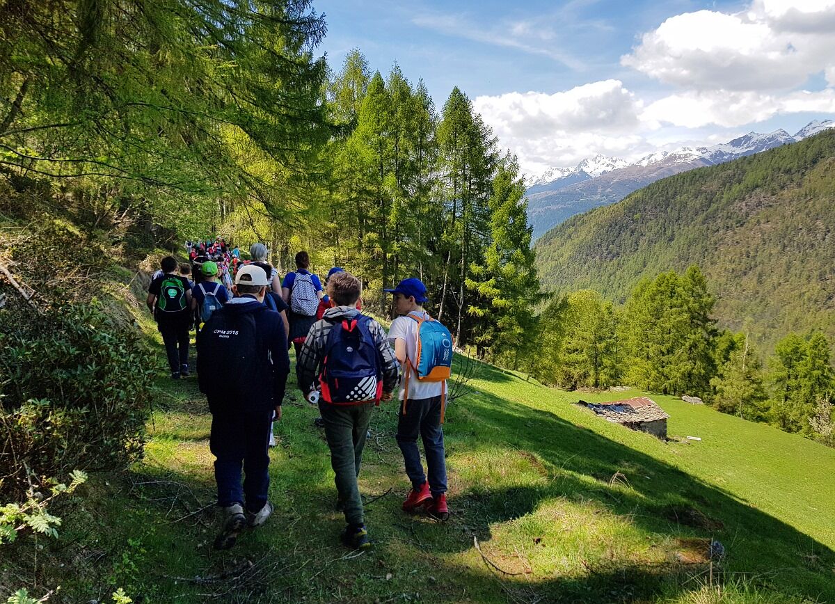
Along this simple and panoramic route, suitable for children, several panels are placed where the children summarized all the useful information for organizing a safe mountain walk. The first section gradually climbs in altitude and the view over Valtellina and the Rhaetian Alps distracts us from the effort. Once you reach the Corna Bassa locality, where some tables are available for breaks, the road starts climbing with some hairpin bends that lead to the huts of Corna Alta.
At the fork at the third hairpin bend, we turn left towards east and continue until joining the road ascending to Magnolta (trail 326). From this point, we descend to the left, following the downhill road that, passing the Magnolta “pistone”, leads back to Aprica. Descending after crossing the Aprica stream, the road changes from dirt to asphalt and returns to the starting point. (The last stretch has a fork on the right leading to the fitness trail)
To reach the start of the trail, head toward the municipal swimming pool of Aprica along via Magnolta (Magnolta cable car departure).
From the pool continue on via Magnolta, cross the bridge over the Aprica stream and start descending on via Clef.
After a short stretch, at the first fork, turn left and proceed until reaching the first pole indicating the start of the trail.
Yes
Yes
Standard hiking equipment. Trekking boots are recommended.
- always use proper equipment and clothing
- assess your physical condition and that of those walking with you
- carefully consider the conditions of the terrain
- observe and prevent weather changes
- consider daylight hours and estimate travel time
- enthusiasm must never cloud necessary caution
In the center of Aprica on Corso Roma or reach directly, following via Magnolta, the municipal swimming pool of Aprica.
Popular tours in the neighbourhood
- 4,3
Rifugio Curo’ e lago del Barbellino - lago naturale del Barbellino - lago Gelt
heavyHiking26,4 km - 4,0
Valbondione-Curò
mediumHiking7,02 km - 5,0
32.05 Poschiavo - Tirano, Trans Altarezia Bike
mediumMountainbike29,1 km Bergwanderung zum «See des Verrückten» - Kurz Version
Hiking11,4 km33.10 Le Prese - Tirano, Via Albula / Bernina
mediumHiking14,6 kmIl Sentiero delle Marmitte
heavyHiking3,68 kmMiralago - Tirano Durch via Valposchiavo talauswärts nach Italien
Hiking11,7 kmMarian Way of the Alps Eastern Route - Grosotto Tirano Stage
mediumPilgrimage17,8 kmRund Wanderung Cavaione-Giümelin-Cavione
mediumHiking15,9 kmLago del Barbellino
mediumHiking19,2 km
Hiking & Tracking


Don't miss out on offers and inspiration for your next holiday
Your e-mail address has been added to the mailing list.