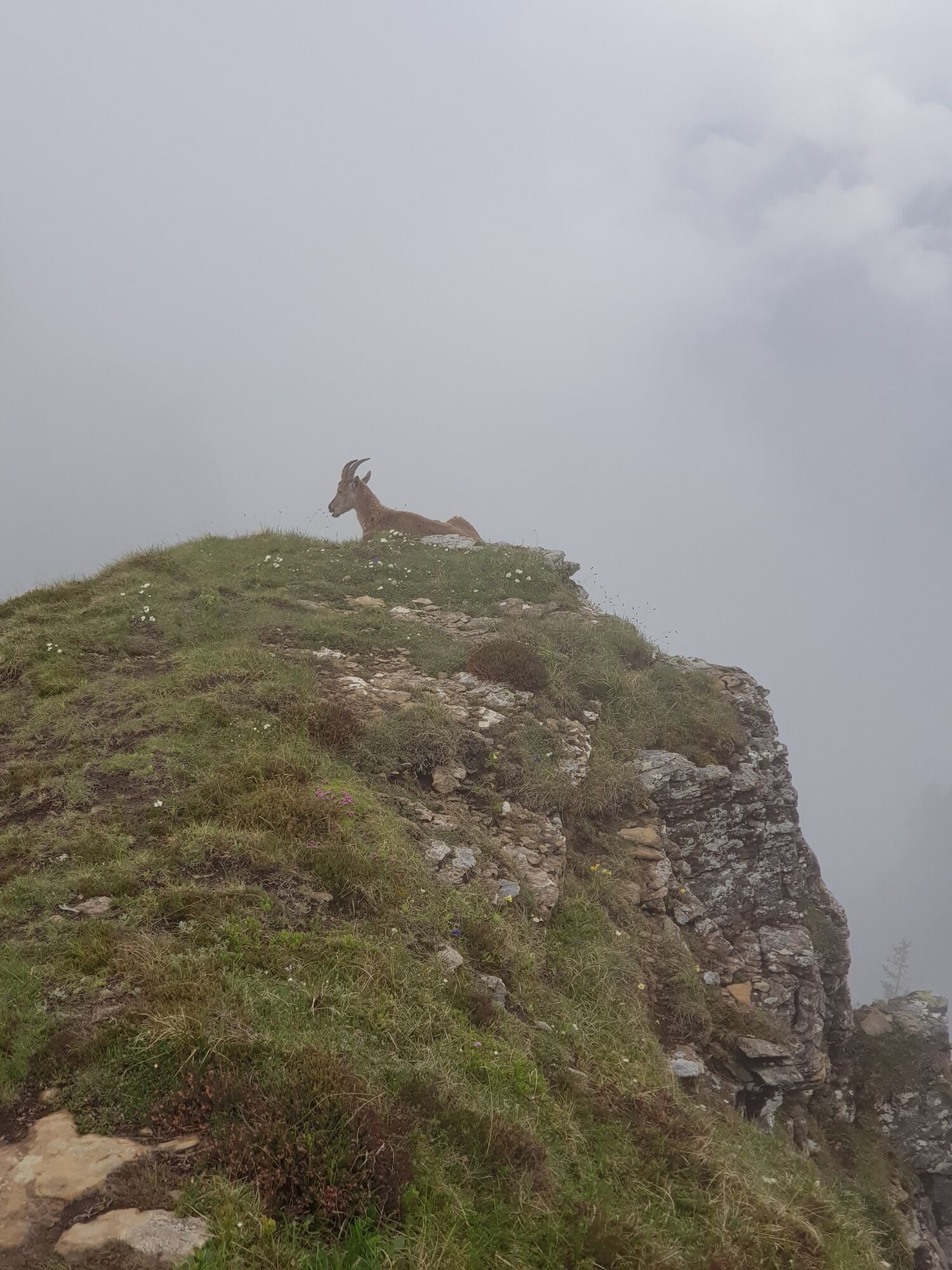
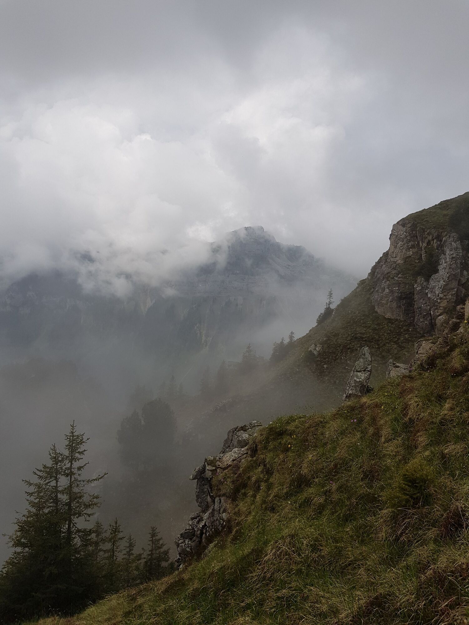
Wanderung Habkern - Gemmenalphorn - Niederhorn
medium
Navigate
Navigate
Get this tour on your mobile
Wanderung Habkern - Gemmenalphorn - Niederhorn
medium
Hiking
10.77
km
Scan the QR code and start navigation in the bergfex app

Hiking & Tracking


Distance
10.77
km
Duration
05:00
h
Ascent
898
m
Sea level
1,135 -
2,048
m
Track download
Wanderung Habkern - Gemmenalphorn - Niederhorn
medium
Hiking
10.77
km


Route
Zäundli
(1,108 m)
Neighbourhood
0.0 km
Habkern
(1,074 m)
Village
0.1 km
Moosgaden
(1,146 m)
Neighbourhood
0.1 km
Bühl
(1,085 m)
Neighbourhood
0.3 km
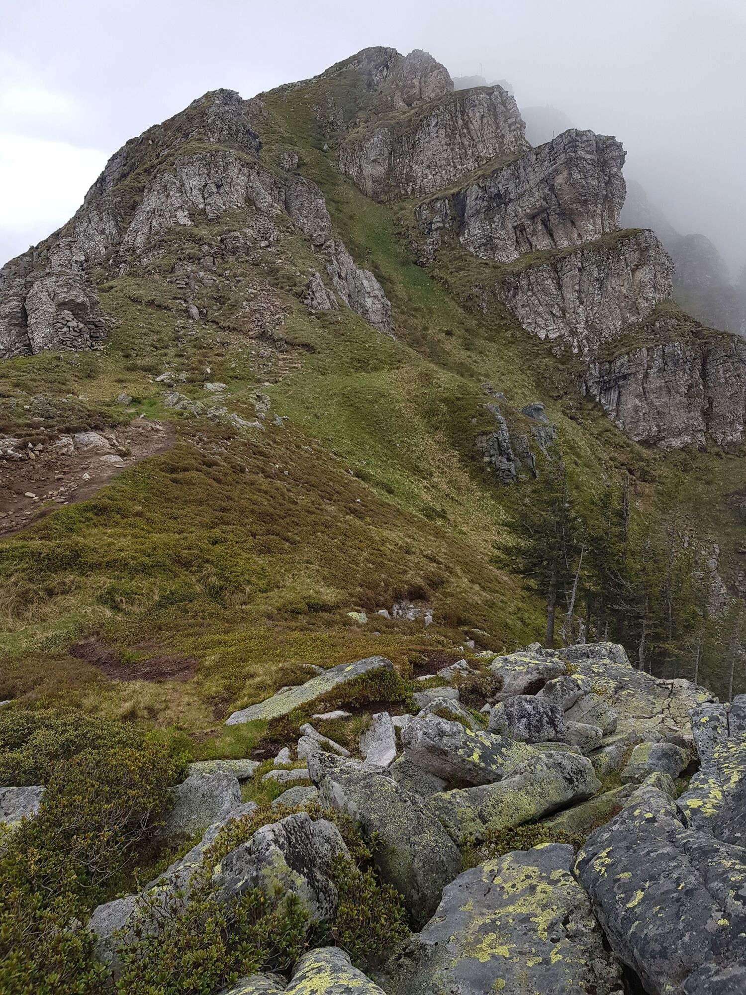
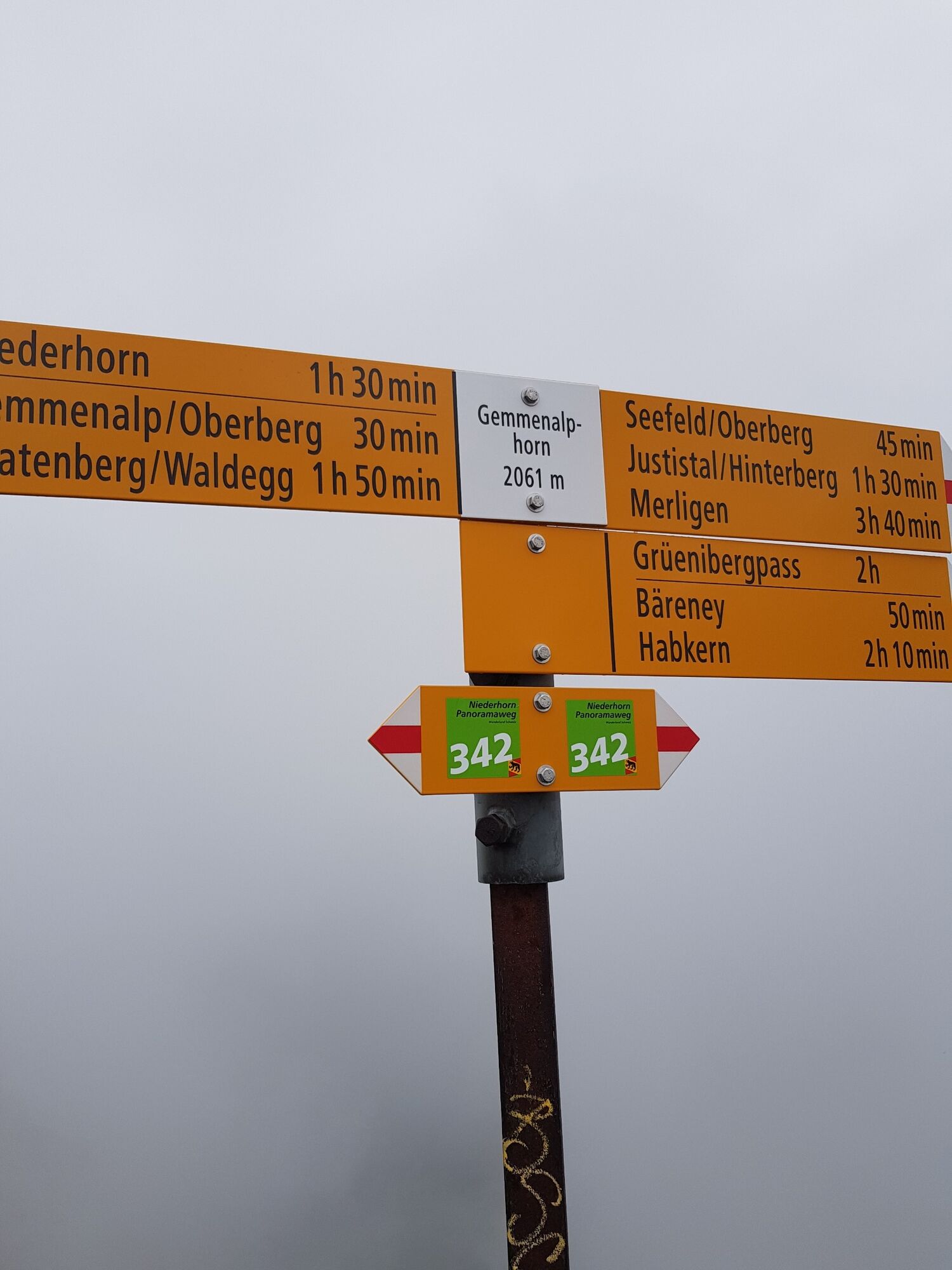
Gemmenalphorn
(2,061 m)
Summit
6.7 km
Burgfeldstand
(2,063 m)
Summit
8.3 km
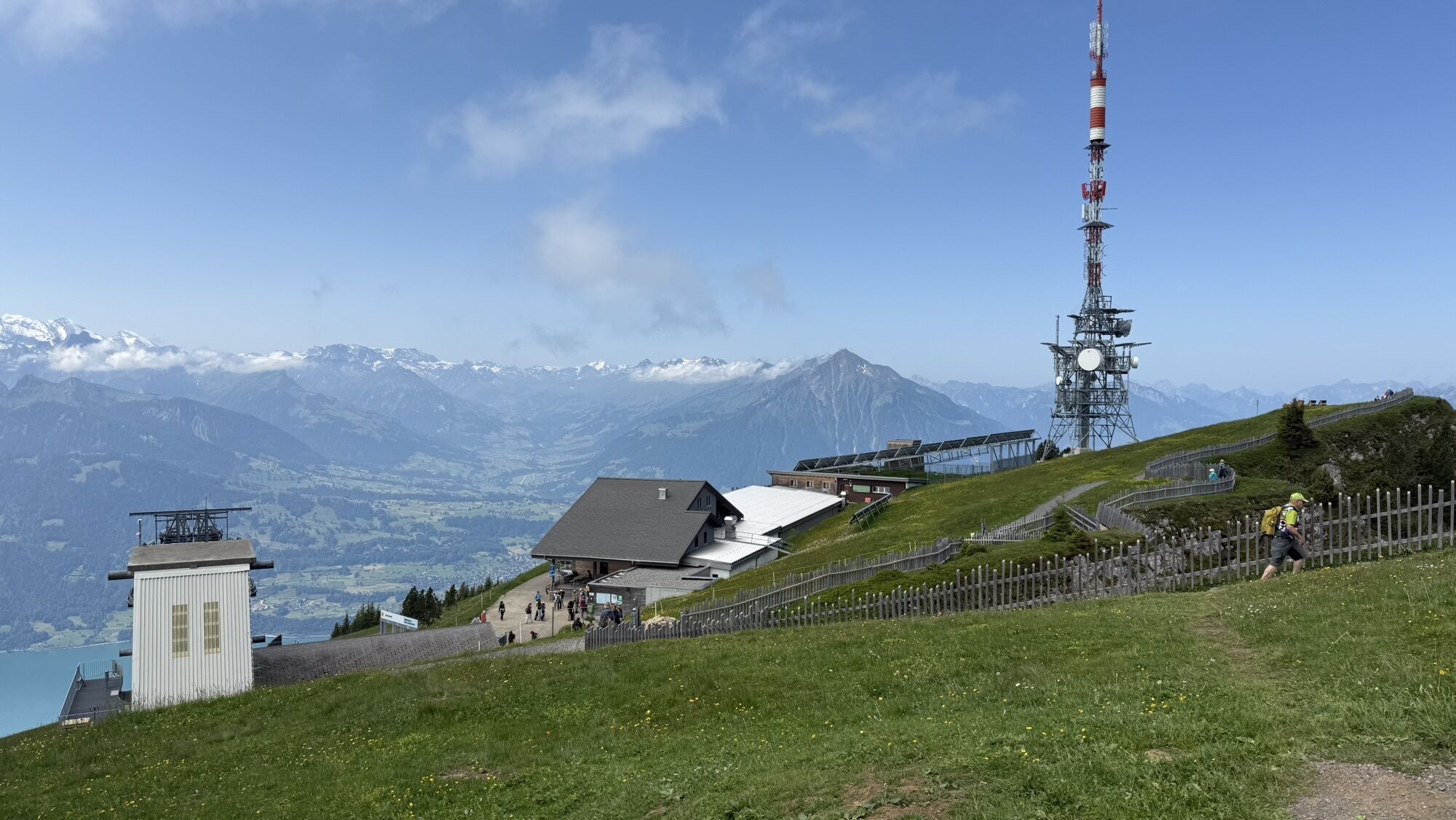
Niederhorn
(1,963 m)
Summit
10.4 km
Route
Wanderung Habkern - Gemmenalphorn - Niederhorn
medium
Hiking
10.77
km
Zäundli
(1,108 m)
Neighbourhood
0.0 km
Fahrenbühl
(1,107 m)
Neighbourhood
0.0 km
Traubenegg
(1,103 m)
Neighbourhood
0.0 km
Holzmatte
(1,084 m)
Neighbourhood
0.0 km
Habkern
(1,074 m)
Village
0.1 km
Im Holz
(1,064 m)
Neighbourhood
0.1 km
Neuenstadel
(1,114 m)
Neighbourhood
0.1 km
Moosgaden
(1,146 m)
Neighbourhood
0.1 km
Bin Öuste
(1,159 m)
Neighbourhood
0.2 km
Bärenmatte
(1,087 m)
Neighbourhood
0.2 km
Bühl
(1,085 m)
Neighbourhood
0.3 km
Lehn
(1,084 m)
Neighbourhood
0.4 km
Haltmatte
(1,082 m)
Neighbourhood
0.5 km
Stutzmad
(1,418 m)
Neighbourhood
2.2 km
Gemmenalphorn
(2,061 m)
Summit
6.7 km
Burgfeldstand
(2,063 m)
Summit
8.3 km
Niederhorn
(1,963 m)
Summit
10.4 km
Bergrestaurant Niederhorn
(1,935 m)
Restaurant
10.7 km
Niederhorn
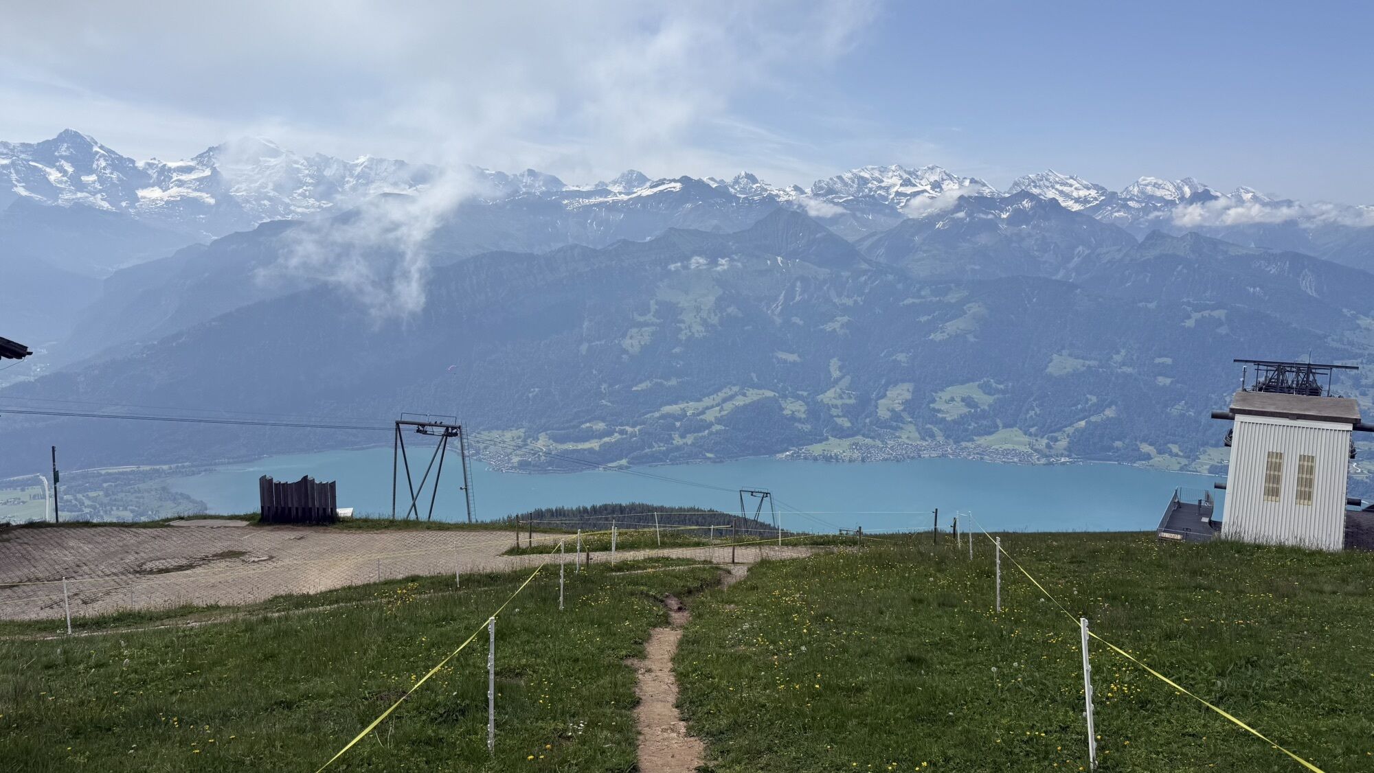
(1,935 m)
Gondola station
10.8 km

Route information
Steep passage
Yes
Geological highlights
Yes
Summit tour
Yes
One-way tour
Yes
Gondola/cable car
Yes
Equipment
gute Wanderschuhe
Arrival information
Arrival
mit dem Zug nach Interlaken West, dann Bus nach Habkern, Station Zäundli
Valuations
5
(1)
4
(1)
3
(0)
2
(0)
1
(0)
Popular tours in the neighbourhood
- 3.6
Sieben Hengste
heavyHiking13.7 km - 5.0
Schynige Platte - Faulhorn - First
heavyHiking16.8 km Vom Brienzer Rothorn bis Interlaken
heavyHiking21.1 km- 5.0
Rundweg Interlaken-Harder Kulm
lightHiking10.9 km - 4.9
Augstmatthorn
lightHiking10.9 km - 3.0
Morgenberghorn
mediumHiking9.60 km - 4.6
Mülenen - Glogghore - Niesen - Niesen Kulm
heavyHiking7.86 km - 3.8
Lobhornhütte / Sulseewli
mediumHiking7.14 km - 2.4
Aeschiried - Suldtal - Pochtenfall - Brunni - Greberegg - Aeschiried
mediumHiking13.8 km - 4.0
Niederhorn-Oberburgfeld-Gemmenalp Oberberg-Waldegg
Hiking9.60 km
Hiking & Tracking

Over 550.000 tour suggestions, detailed maps and an intuitive route planner make the app a must-have for all nature enthusiasts.

Don't miss out on offers and inspiration for your next holiday
Subscribe to the newsletter
Error
An error has occurred. Please try again.Thank you for your registration
Your e-mail address has been added to the mailing list.
Tours throughout Europe
Austria Switzerland Germany Italy Slovenia France Netherlands Belgium Poland Liechtenstein Czechia Slovakia Spain Croatia Bosnia and Herzegovina Luxembourg Andorra Portugal Iceland United Kingdom Ireland Greece Albania North Macedonia Malta Norway Montenegro Moldova Kosovo Hungary San Marino Romania Estonia Latvia Belarus Cyprus Lithuania Serbia Bulgaria Monaco Denmark Sweden Finland