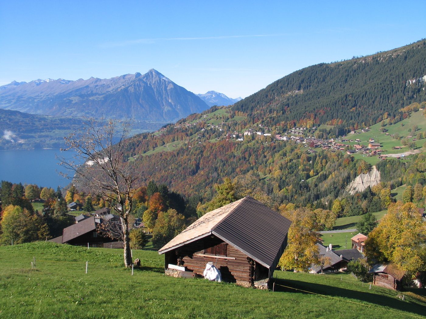
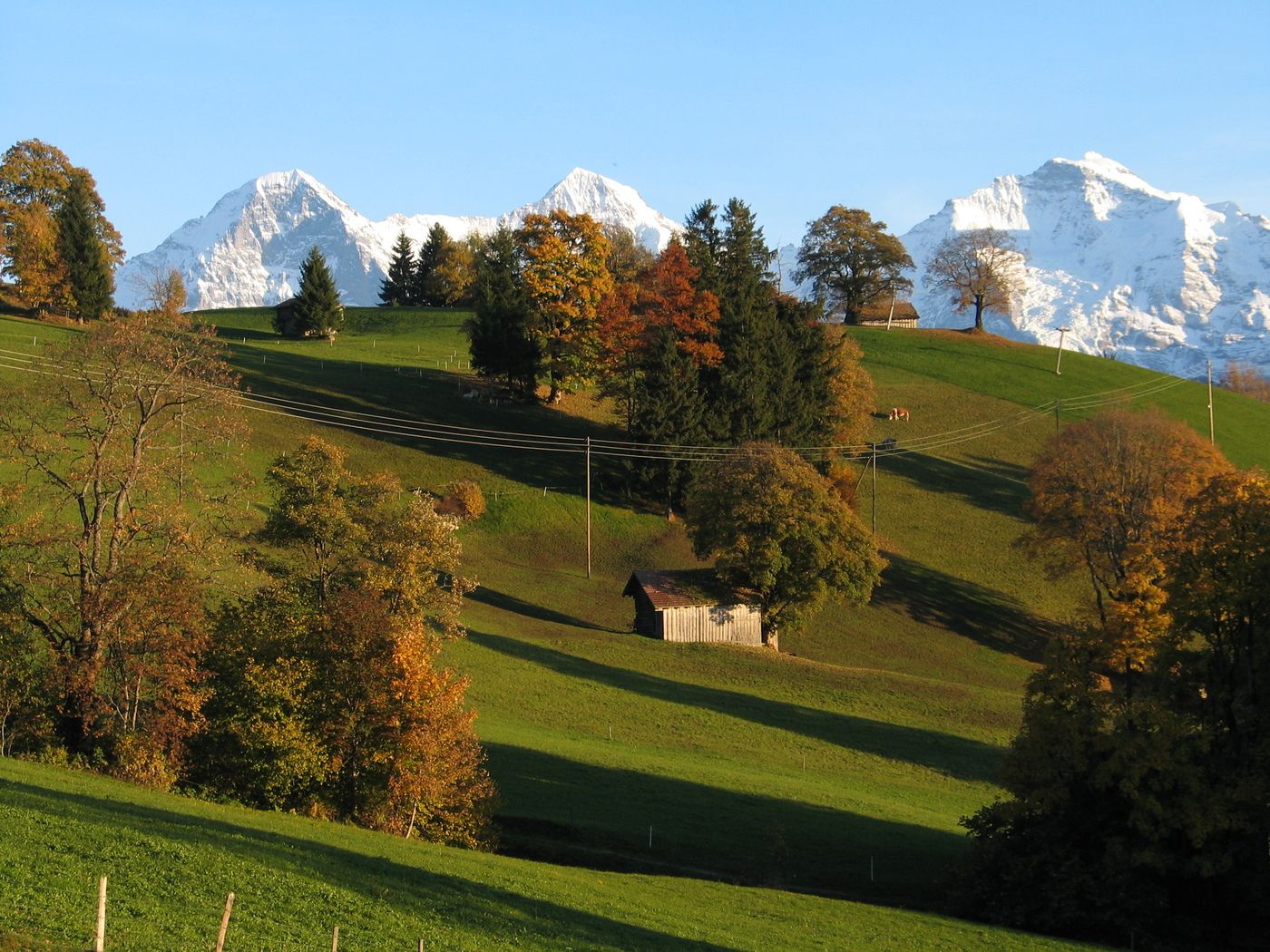
Beatenberg-Waldegg-Habkern
Cycling
Navigate
Navigate
Get this tour on your mobile
Beatenberg-Waldegg-Habkern
Cycling
24.90
km
Scan the QR code and start navigation in the bergfex app

Hiking & Tracking


Distance
24.90
km
Duration
01:30
h
Ascent
716
m
Sea level
1,063 -
1,439
m
Track download
Beatenberg-Waldegg-Habkern
Cycling
24.90
km


Rundtour mehrheitlich auf Asphaltstrasse. Schöner Hohenweg zwischen Habkern und Beatenberg.
Route
Kirche St. Beat
(1,156 m)
Place of worship
4.4 km
Kirche Beatenberg
(1,146 m)
Place of worship
4.5 km
Bort
(1,085 m)
Settlement
20.6 km
Moos
(1,054 m)
Neighbourhood
23.4 km
Städeli
(1,018 m)
Neighbourhood
24.0 km
Bärenmatte
(1,087 m)
Neighbourhood
24.4 km
Holzmatte
(1,084 m)
Neighbourhood
24.8 km
Route
Beatenberg-Waldegg-Habkern
Cycling
24.90
km
Beatenberg
(1,121 m)
Gondola station
0.0 km
Buffet
(1,119 m)
Restaurant
0.1 km
Beatenberg
(1,225 m)
Village
2.7 km
Teuffi
(1,145 m)
Settlement
3.3 km
Kirche St. Beat
(1,156 m)
Place of worship
4.4 km
Kirche Beatenberg
(1,146 m)
Place of worship
4.5 km
Burgfeld Bistro
(1,170 m)
Restaurant
5.6 km
Regina
(1,203 m)
Restaurant
8.6 km
Waldegg
(1,227 m)
Neighbourhood
9.4 km
Holzflüe
(1,300 m)
Corridor/terrain
15.9 km
Bort
(1,085 m)
Settlement
20.6 km
Eggetli
(1,076 m)
Neighbourhood
23.0 km
Beim Bach
(1,055 m)
Neighbourhood
23.2 km
Halte
(1,073 m)
Neighbourhood
23.4 km
Moos
(1,054 m)
Neighbourhood
23.4 km
Haltmatte
(1,082 m)
Neighbourhood
23.6 km
An der Matte
(1,057 m)
Neighbourhood
23.7 km
Lehn
(1,084 m)
Neighbourhood
23.9 km
Städeli
(1,018 m)
Neighbourhood
24.0 km
Bühl
(1,085 m)
Neighbourhood
24.0 km
Balkenmoos
(1,030 m)
Neighbourhood
24.1 km
Gruebi
(1,049 m)
Neighbourhood
24.3 km
Bärenmatte
(1,087 m)
Neighbourhood
24.4 km
Im Holz
(1,064 m)
Neighbourhood
24.6 km
Gasthof Bären
(1,068 m)
Restaurant
24.7 km
Traubenegg
(1,103 m)
Neighbourhood
24.7 km
Holzmatte
(1,084 m)
Neighbourhood
24.8 km
Habkern
(1,074 m)
Village
24.8 km
Fahrenbühl
(1,107 m)
Neighbourhood
24.8 km
Neuenstadel
(1,114 m)
Neighbourhood
24.8 km
No reviews yet
Popular tours in the neighbourhood
-
3.6
Sieben Hengste
heavyHiking 13.7 km -
5.0
Schynige Platte - Faulhorn - First
heavyHiking 16.8 km -
Vom Brienzer Rothorn bis Interlaken
heavyHiking 21.1 km -
5.0
Rundweg Interlaken-Harder Kulm
lightHiking 10.9 km -
4.9
Augstmatthorn
lightHiking 10.9 km -
3.0
Morgenberghorn
mediumHiking 9.60 km -
4.7
Mülenen - Glogghore - Niesen - Niesen Kulm
heavyHiking 7.86 km -
3.8
Lobhornhütte / Sulseewli
mediumHiking 7.14 km -
2.8
Aeschiried - Suldtal - Pochtenfall - Brunni - Greberegg - Aeschiried
mediumHiking 13.8 km -
4.0
Niederhorn-Oberburgfeld-Gemmenalp Oberberg-Waldegg
Hiking 9.60 km

Hiking & Tracking

Over 550.000 tour suggestions, detailed maps and an intuitive route planner make the app a must-have for all nature enthusiasts.

Don't miss out on offers and inspiration for your next holiday
Subscribe to the newsletter
Error
An error has occurred. Please try again.
Thank you for your registration
Your e-mail address has been added to the mailing list.
Tours throughout Europe
Austria
Switzerland
Germany
Italy
Slovenia
France
Netherlands
Belgium
Poland
Liechtenstein
Czechia
Slovakia
Spain
Croatia
Bosnia and Herzegovina
Luxembourg
Andorra
Portugal
Iceland
United Kingdom
Ireland
Greece
Albania
North Macedonia
Malta
Norway
Montenegro
Moldova
Kosovo
Hungary
San Marino
Romania
Estonia
Latvia
Belarus
Cyprus
Lithuania
Serbia
Bulgaria
Monaco
Denmark
Sweden
Finland