Hegau volcanoes
medium
Racing
Navigate
Navigate
Get this tour on your mobile
Map
Hegau volcanoes
medium
Racing
85,23 km
Scan the QR code and start navigation in the bergfex app
QR Code
Hiking & Tracking
Hiking & Tracking
Download for iOS
Download for Android

Hegau volcanoes

Distance
85,23 km
Duration
05:00 h
Ascent
804 m
Sea level
396 - 694 m

Level of difficulty: 3

Track download
Map
Hegau volcanoes
medium
Racing
85,23 km

You cross the Bodanrück and then gradually work your way up into the hinterland of Lake Constance.

85 kilometers

950 meters of elevation

max. 12% gradient


Route
Kapelle
(442 m)
Place of worship
9,6 km
St. Georg
(543 m)
Place of worship
17,7 km
St. Otmar
(410 m)
Place of worship
27,5 km
Pfarrkirche Sankt Barbara
(659 m)
Place of worship
48,9 km
Wallfahrtskirche St. Maria
(673 m)
Place of worship
56,3 km
Krieger-Kapelle
(688 m)
Place of worship
62,0 km
Heiligkreuzkapelle
(444 m)
Place of worship
78,2 km
Route
Map
Hegau volcanoes
medium
Racing
85,23 km
Radolfzell am Bodensee
(404 m)
City
0,0 km
Markelfingen
(405 m)
Village
3,3 km
Charisma
(408 m)
Restaurant
3,9 km
Gemeinmerkerhöfe
(437 m)
Settlement
6,9 km
Kaltbrunn
(433 m)
Village
9,5 km
Bunte Kuh
(436 m)
Restaurant
9,6 km
Kapelle
(442 m)
Place of worship
9,6 km
Freudental
(514 m)
Village
11,9 km
Landgasthof Adler
(508 m)
Restaurant
11,9 km
Langenrain
(532 m)
Village
13,7 km
St. Georg
(543 m)
Place of worship
17,7 km
Liggeringen
(542 m)
Village
17,8 km
Schachenhorn Stüble
(399 m)
Restaurant
25,7 km
Ludwigshafen
(405 m)
Village
26,8 km
Kapelle St. Anna
(409 m)
Place of worship
26,9 km
St. Otmar
(410 m)
Place of worship
27,5 km
Bonndorf
(554 m)
Village
31,7 km
Walpertsweiler
(557 m)
Settlement
34,1 km
Winterspüren
(494 m)
Village
36,3 km
Sonnenberg
(596 m)
Settlement
39,1 km
Ursaul
(605 m)
Settlement
40,4 km
Freie evangelische Gemeinde Stockach
(617 m)
Place of worship
40,4 km
Zoznegg
(602 m)
Village
43,4 km
Mühlweiler
(578 m)
Settlement
44,9 km
Mühlingen
(598 m)
Village
46,0 km
Mainwangen
(652 m)
Village
47,7 km
Pfarrkirche Sankt Barbara
(659 m)
Place of worship
48,9 km
Gallmannsweil
(667 m)
Village
49,2 km
Heudorf im Hegau
(636 m)
Village
54,5 km
Gasthaus Kreuz
(634 m)
Restaurant
54,6 km
Wallfahrtskirche St. Maria
(673 m)
Place of worship
56,3 km
Gasthaus Adler
(670 m)
Restaurant
56,4 km
Rorgenwies
(671 m)
Village
56,5 km
Reute im Hegau
(634 m)
Village
58,9 km
Landgasthaus Schwanen
(639 m)
Restaurant
59,1 km
Honstetten
(667 m)
Village
61,6 km
Krieger-Kapelle
(688 m)
Place of worship
62,0 km
Eigeltingen
(484 m)
Village
69,0 km
Kreuz Dünnelestube
(473 m)
Restaurant
73,7 km
Wiechs
(471 m)
Village
73,9 km
Evangelische Friedenskirche
(463 m)
Place of worship
75,6 km
Steißlingen
(463 m)
Village
76,5 km
Heiligkreuzkapelle
(444 m)
Place of worship
78,2 km
Königreichssaal
(402 m)
Place of worship
82,9 km
Radolfzell
(400 m)
Railway station
84,9 km
Radolfzell am Bodensee
(404 m)
City
85,0 km
Description of the

Enjoy the beautiful landscape and peaceful places between Untersee and Obersee and in the hinterland of Lake Constance.

Technology
3 / 6
Condition
4 / 6
Landscape
4 / 6
Experience
5 / 6
Best time of year
Jan
Feb
Mar
Apr
May
Jun
Jul
Aug
Sep
Oct
Nov
Dec
Author
The tour Hegau volcanoes is provided by outdooractive.com.
Logo
Share tour
Map
Hegau volcanoes
medium
Racing
85,23 km
Error
An error has occurred. Please try again.
Route information
Route

Start from Radolfzell station 1.8 km eastwards, turn right at the roundabout towards Markelfingen. In Markelfingen turn left towards the Wild and Leisure Park Kaltbrunn. Continue straight ahead in Kaltbrunn. In Langenrain turn left towards Liggeringen. In town, do not follow the turning main road but continue straight towards Bodman. Go downhill via Dettelbachstraße to a junction, here turn right towards Bodman.  At the town entrance immediately turn left again to continue to Ludwigshafen. Follow the main road north there and at the town's edge turn right uphill towards Bonndorf, Winterspüren. In the center of Winterspüren turn right onto Linzgaustraße towards Mahlspüren. After 500 m turn left and follow the bike route to Ursaul. At the Ursaul junction turn right towards Zoznegg.  In Zoznegg town center turn left onto Bahnhofstraße towards Mühlingen and continue to Mainwangen. In Mainwangen turn left towards Gallmannsweil. From here continue towards Heudorf in the Hegau, crossing the B14 on an asphalt path. In Heudorf near the church turn left towards Rorgenwies, there in the town center turn left again and leave the town on Weilerstraße. At the second junction turn right towards Reute and continue to Honstetten. Here turn left onto Oberdorfstraße and again left onto Engener Straße. Over Wasserburger Hof to the junction at the bridge, here turn left towards Eigeltingen. In Eigeltingen turn left onto the main street, then the next right to Langenstein and via Wiechs to Steißlingen. In Steißlingen go south on Singener Straße to the intersection with Lange Straße, here turn right and after about 200 m right towards Radolfzell. At the traffic light in Radolfzell turn left, then after 300 m take the first exit right at the roundabout towards the station, your starting point.

Equipment

A bicycle helmet, enough drinks, and provisions should always be with you.

Arrival information
Arrival

to Radolfzell station

Public transport

Train to Radolfzell station

Parking

Parking near the station

Additional information & tips
Level of difficulty

3

Tips

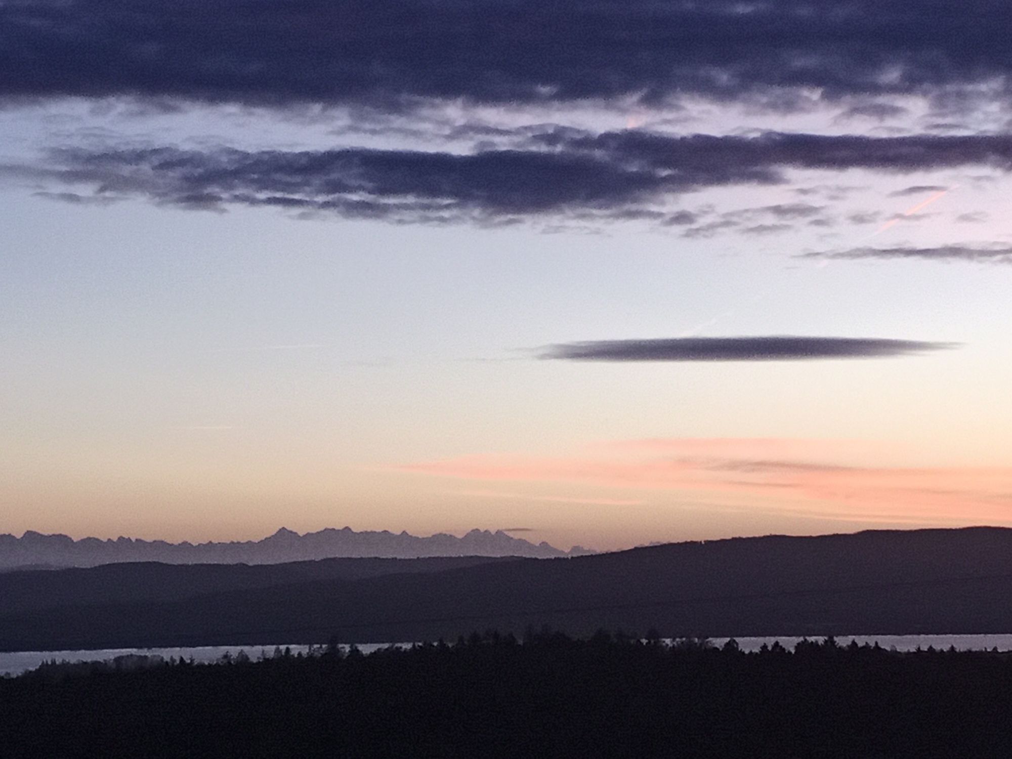
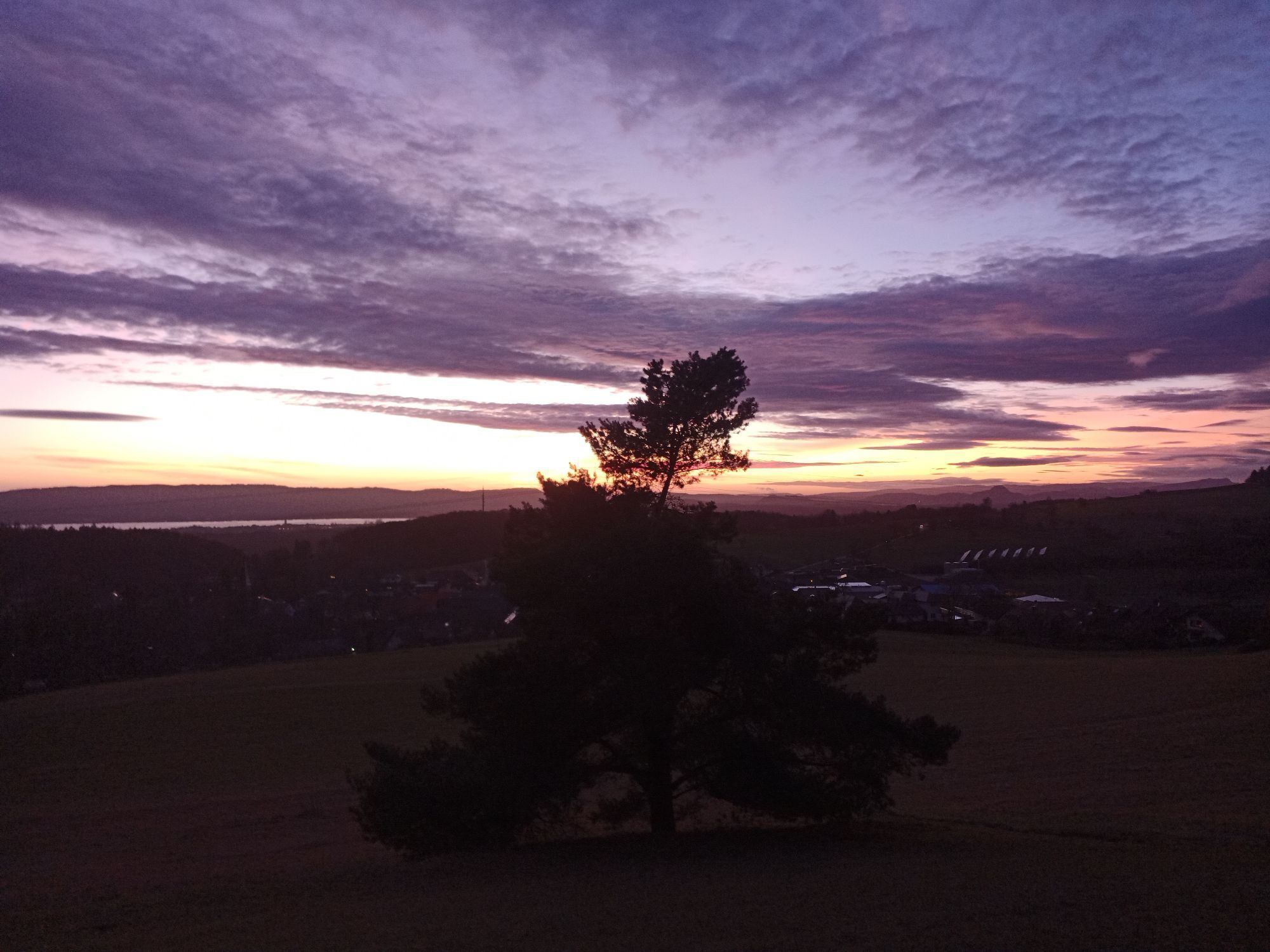
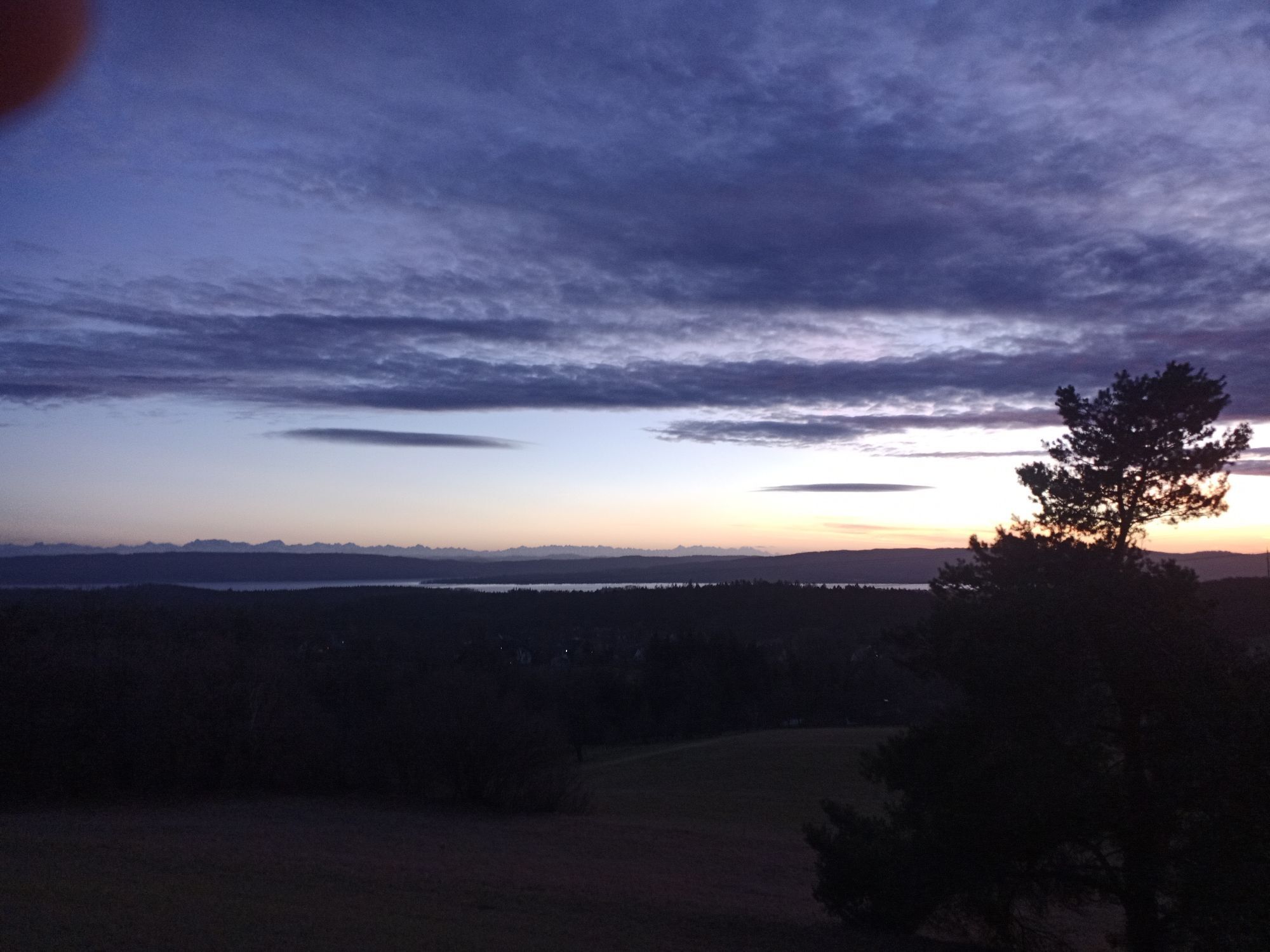
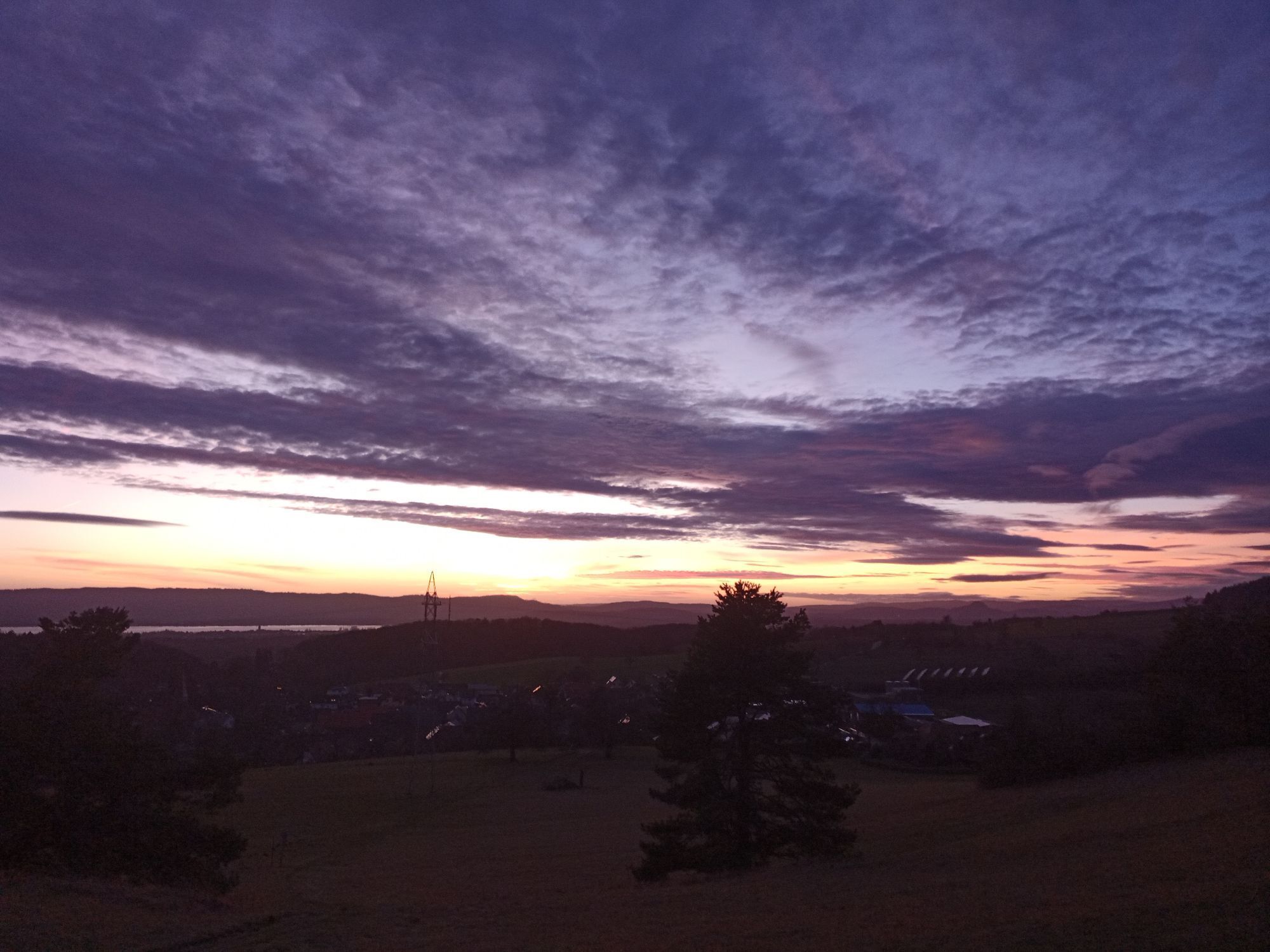
Everything at a glance: The view from the heights near Eckartsbrunn over Lake Constance, Hegau volcanic cones, and the Swiss Alps. 

No reviews yet
Write a review

Reviews help other users choose their next adventure. Please only rate the tour, not the weather or your snack.

Select one of the stars to rate the tour
Bad tour
Weak tour
Mediocre tour
Good tour
Excellent tour
bergfex logoGet the insightAlways live on site with over 9,500 webcams. As a Pro user, you can now see the corresponding webcams for many tours in the tours app from bergfex. This allows you to view the current conditions directly.
Hiking & Tracking

Hiking & Tracking

download for iOSdownload for Android
Hiking & Tracking
Over 550.000 tour suggestions, detailed maps and an intuitive route planner make the app a must-have for all nature enthusiasts.
Hiking & Tracking