Winter
Summer
Weather
Webcams
Accommodations
Tours
Search history
Search suggestions
No results found
Search
Tours
Home
Summer Österreich
Tyrol
Tours
420-hippach-sidanalm-rastkogelhuette.gpx
Ski resorts
Snow parks
Cross-country skiing
Weather
Webcams
Snow reports
Accommodations
Offers
Sports provider
Events
Summer
Tours
420-hippach-sidanalm-rastkogelhuette.gpx
Mountainbike
Bookmark
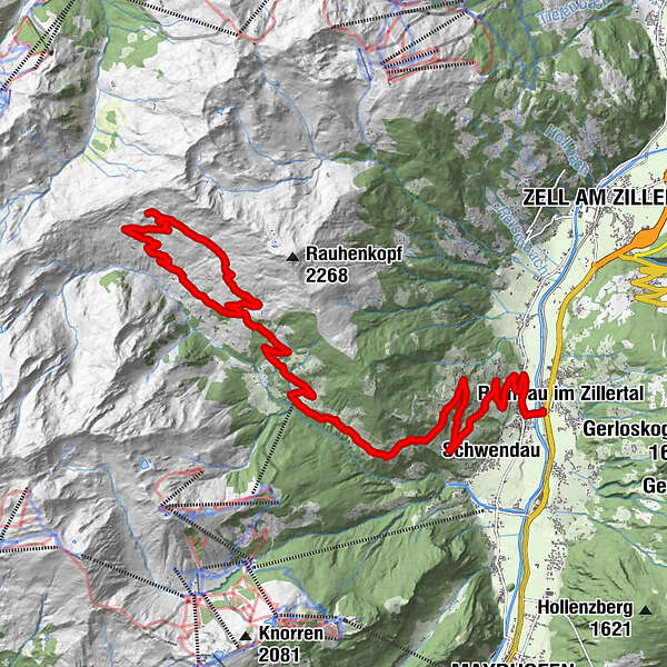
Map
show
hide
Print
Tour data
19.99
km
588 - 2,117
m
Distance
1,562
hm
429
hm
Ascent
-
Duration
Lina Fischer
created am 19.07.2019
22
Views
(Status: unofficial)
Highest point
2,117 m
Report tour
GPS Downloads
GPX
GPS Exchange Format (XML)
KML
Google Earth, Google Maps
QR Download Codes for Mobile Phones
420-hippach-sidanalm-rastkogelhuette.gpx
QR Codes - tour download for cell phones
GPX
KML
Other tours in the regions
Mayrhofen - Hippach
179
Hippach
38
Popular tours in the area
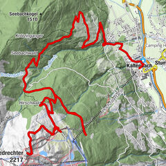
Bike & Hike Zillertaler Höhenstraße - Gedrechter
Mountainbike
25.84
km |
1902
hm |
05:55
h
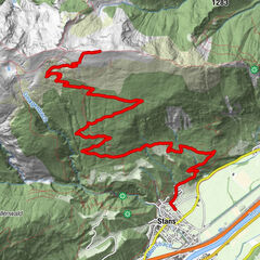
Stanser Joch - anstrengend aber lohnend!
difficult
Mountainbike
13.09
km |
1209
hm |
04:00
h
Vomp: Hinterhorn-, Walder-, und Ganalm
Mountainbike
27.56
km |
930
hm |
02:30
h
Mayrhofen - Zillergrund - Bärenbad
Mountainbike
17.69
km |
910
hm |
02:30
h
No entries found.
The search is currently not available.
Please refine your search.
Local search results
(<= 25km)
More results
(> 25km)
%count% Search results
%name%
%type%
%elevation%
%population%
%lpButton%