Winter
Summer
Weather
Webcams
Accommodations
Tours
Search history
Search suggestions
No results found
Search
Tours
Home
Summer Österreich
Salzburg
Tours
Wirpitschsee
Ski resorts
Snow parks
Cross-country skiing
Weather
Webcams
Snow reports
Accommodations
Offers
Sports provider
Events
Summer
Tours
Wirpitschsee
Hiking
Bookmark
Map
show
hide
Print
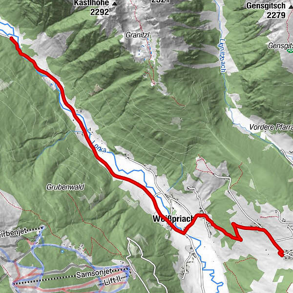
Tour data
7.8
km
1,092 - 1,296
m
Distance
225
hm
123
hm
Ascent
00:45
h
Duration
Franz Bader
created am 19.07.2019
9
Views
(Status: unofficial)
Highest point
1,296 m
Report tour
GPS Downloads
GPX
GPS Exchange Format (XML)
KML
Google Earth, Google Maps
QR Download Codes for Mobile Phones
Wirpitschsee
QR Codes - tour download for cell phones
GPX
KML
Other tours in the regions
Katschberg Lieser-Maltatal
2570
Lungau - Ferienregion
870
Weißpriach
206
Popular tours in the area
Höchstein (2.543 m)
difficult
Hiking
11.25
km |
805
hm |
06:00
h
Preber summit tour
difficult
Hiking
7.6
km |
1405
hm |
04:00
h
Schladming - Hochgolling
difficult
Hiking
20.64
km |
1731
hm |
10:30
h
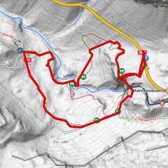
Johanneswasserfall-Rundweg
medium
Hiking
1.91
km |
110
hm |
02:00
h
No entries found.
The search is currently not available.
Please refine your search.
Local search results
(<= 25km)
More results
(> 25km)
%count% Search results
%name%
%type%
%elevation%
%population%
%lpButton%