Winter
Summer
Weather
Webcams
Accommodations
Tours
Search history
Search suggestions
No results found
Search
Tours
Home
Summer Österreich
Tyrol
Tours
Hainzenberg, Tirol
Ski resorts
Snow parks
Cross-country skiing
Weather
Webcams
Snow reports
Accommodations
Offers
Sports provider
Events
Summer
Tours
Hainzenberg, Tirol
Hiking
Bookmark
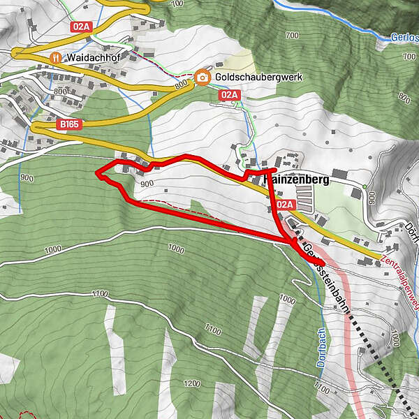
Map
show
hide
Print
Tour data
1.8
km
904 - 947
m
Distance
45
hm
24
hm
Ascent
00:37
h
Duration
Carsten54
created am 21.07.2019
6
Views
(Status: unofficial)
Highest point
947 m
Report tour
GPS Downloads
GPX
GPS Exchange Format (XML)
KML
Google Earth, Google Maps
QR Download Codes for Mobile Phones
Hainzenberg, Tirol
QR Codes - tour download for cell phones
GPX
KML
Other tours in the regions
Zillertal
1347
Zell am Ziller
334
Popular tours in the area
Kreuzjoch
medium
Hiking
6.09
km |
758
hm |
04:30
h
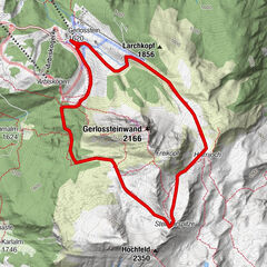
Bergtour: Gerlossteinwand (2.166 m)
medium
Hiking
5.83
km |
523
hm |
03:30
h
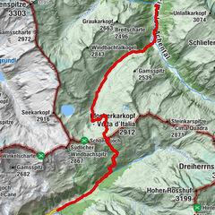
Krimmler Tauern (pass)
difficult
Hiking
18.4
km |
894
hm |
06:30
h
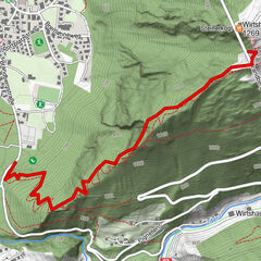
Steinerkogl
medium
Hiking
2.26
km |
532
hm |
01:30
h
No entries found.
The search is currently not available.
Please refine your search.
Local search results
(<= 25km)
More results
(> 25km)
%count% Search results
%name%
%type%
%elevation%
%population%
%lpButton%