Winter
Summer
Weather
Webcams
Accommodations
Tours
Search history
Search suggestions
No results found
Search
Tours
Home
Summer Österreich
Styria
Tours
Proleber Berg
Ski resorts
Snow parks
Cross-country skiing
Weather
Webcams
Snow reports
Accommodations
Offers
Sports provider
Events
Summer
Tours
Proleber Berg
Hiking
Bookmark
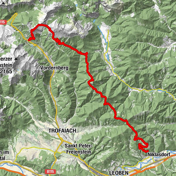
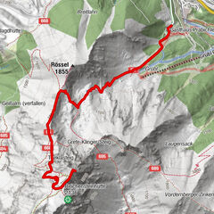
Map
show
hide
Print
Tour data
35.1
km
- 1,908
m
Distance
1,752
hm
2,208
hm
Ascent
08:58
h
Duration
Robert Werner
created am 21.07.2019
3
Views
(Status: unofficial)
Highest point
1,908 m
Report tour
GPS Downloads
GPX
GPS Exchange Format (XML)
KML
Google Earth, Google Maps
QR Download Codes for Mobile Phones
Proleber Berg
QR Codes - tour download for cell phones
GPX
KML
Other tours in the regions
Erzberg Leoben
2527
Hochschwab
1271
Tragöß - Grüner See
471
Popular tours in the area
Trofaiach: Gößeck
medium
Hiking
11.6
km |
1282
hm |
06:00
h
Hochschwab
difficult
Hiking
20.4
km |
1600
hm |
08:30
h
Hochalm - Maria Schnee from "Kühberger"
medium
Hiking
10.38
km |
776
hm |
04:00
h
Eisenerzer Reichenstein
medium
Hiking
4.32
km |
855
hm |
04:30
h
No entries found.
The search is currently not available.
Please refine your search.
Local search results
(<= 25km)
More results
(> 25km)
%count% Search results
%name%
%type%
%elevation%
%population%
%lpButton%