- Brief description
-
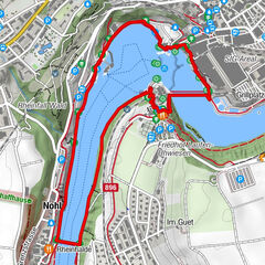
This circular route is ideal for your visit to the Rhine Falls - right next to the spectacular Rhine Falls is an attractive region.
- Difficulty
-
medium
- Rating
-
- Starting point
-
Dachsen railway station
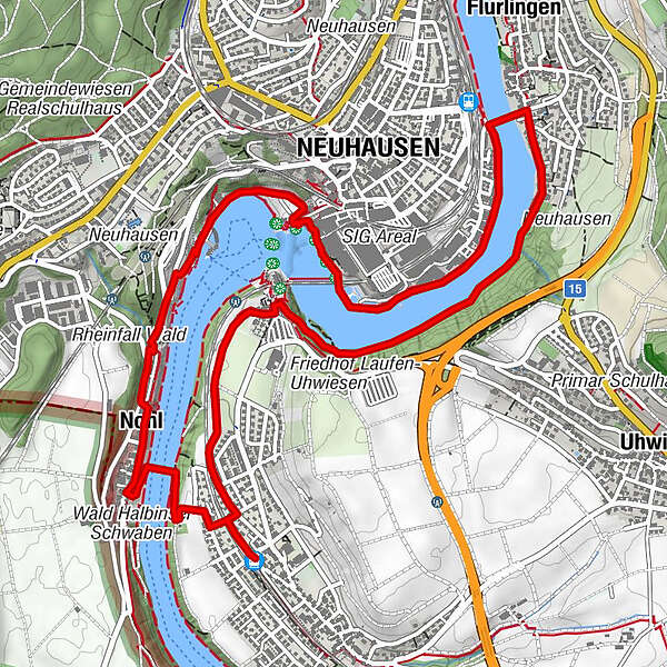
- Route
-
Dachsen (400 m)Nohl1.1 kmNeuhausen (410 m)2.5 kmRhine Falls2.6 kmGrillplatz Rheinquai3.3 kmFlurlingen (413 m)4.2 kmSchaffhausen (403 m)4.2 kmEv. ref. Kirche Laufen am Rheinfall6.1 kmLaufen-Uhwiesen6.3 kmNohl6.7 kmDachsen (400 m)7.1 km
- Best season
-
JanFebMarAprMayJunJulAugSepOctNovDec
- Description
-
The starting point is the railway station in the municipality of Dachsen.
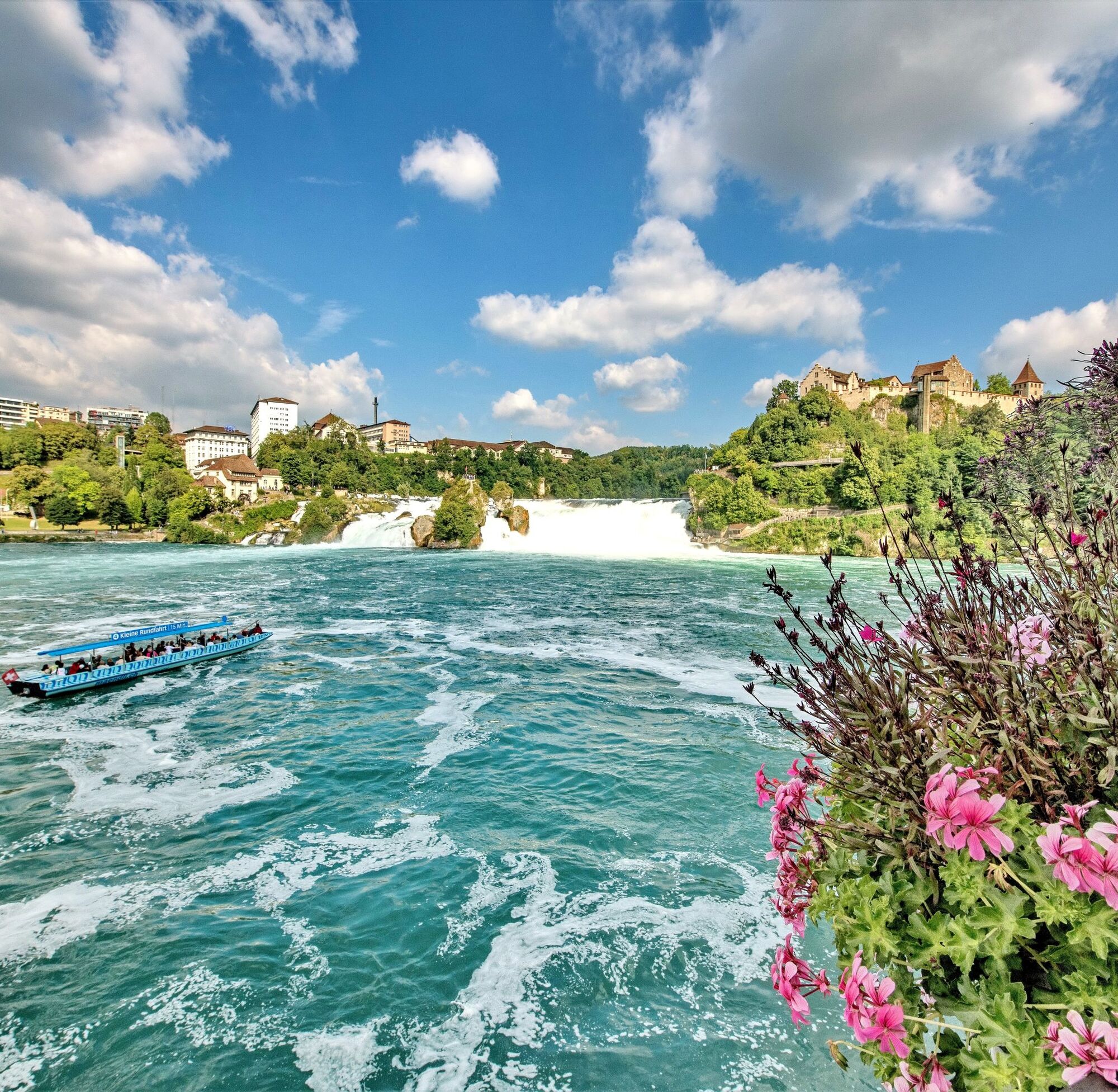
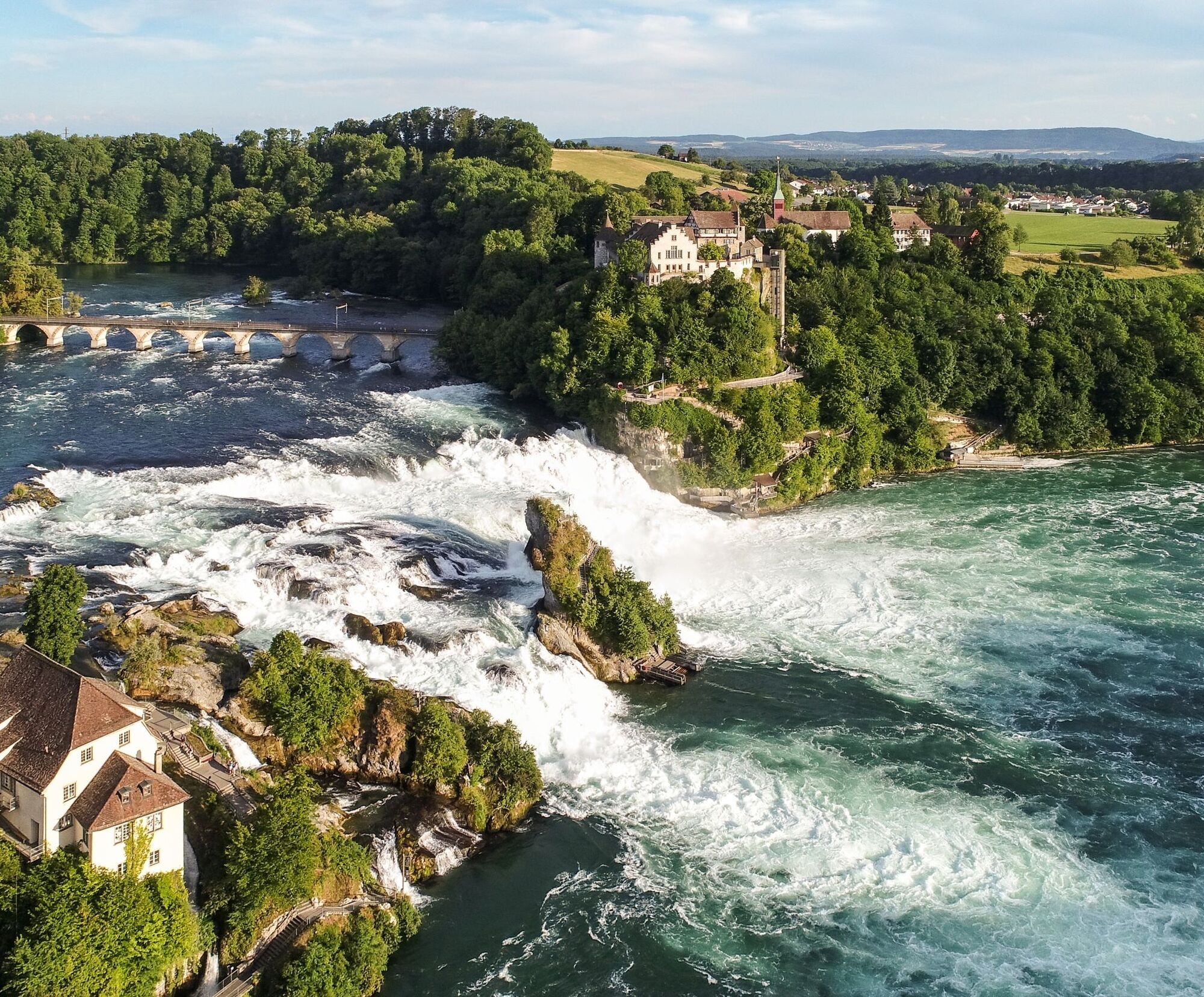
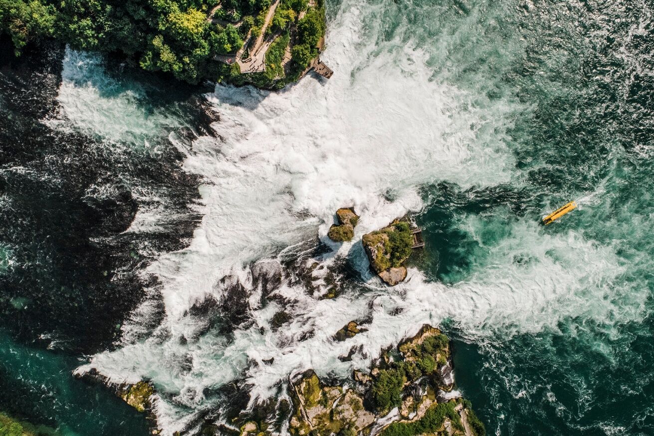
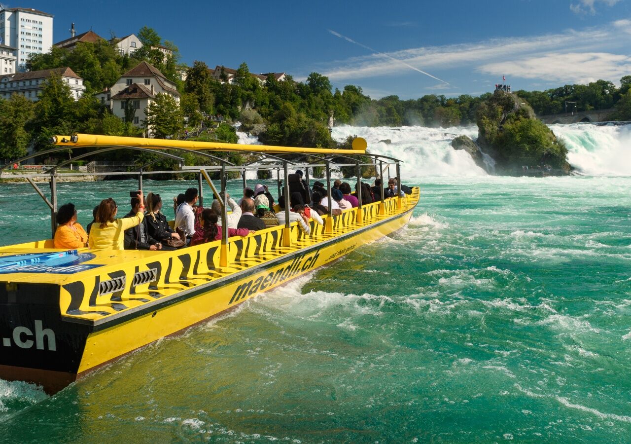
The trail runs along the beautiful banks of the Rhine as far as the Rhine Falls, the largest waterfall in Europe.
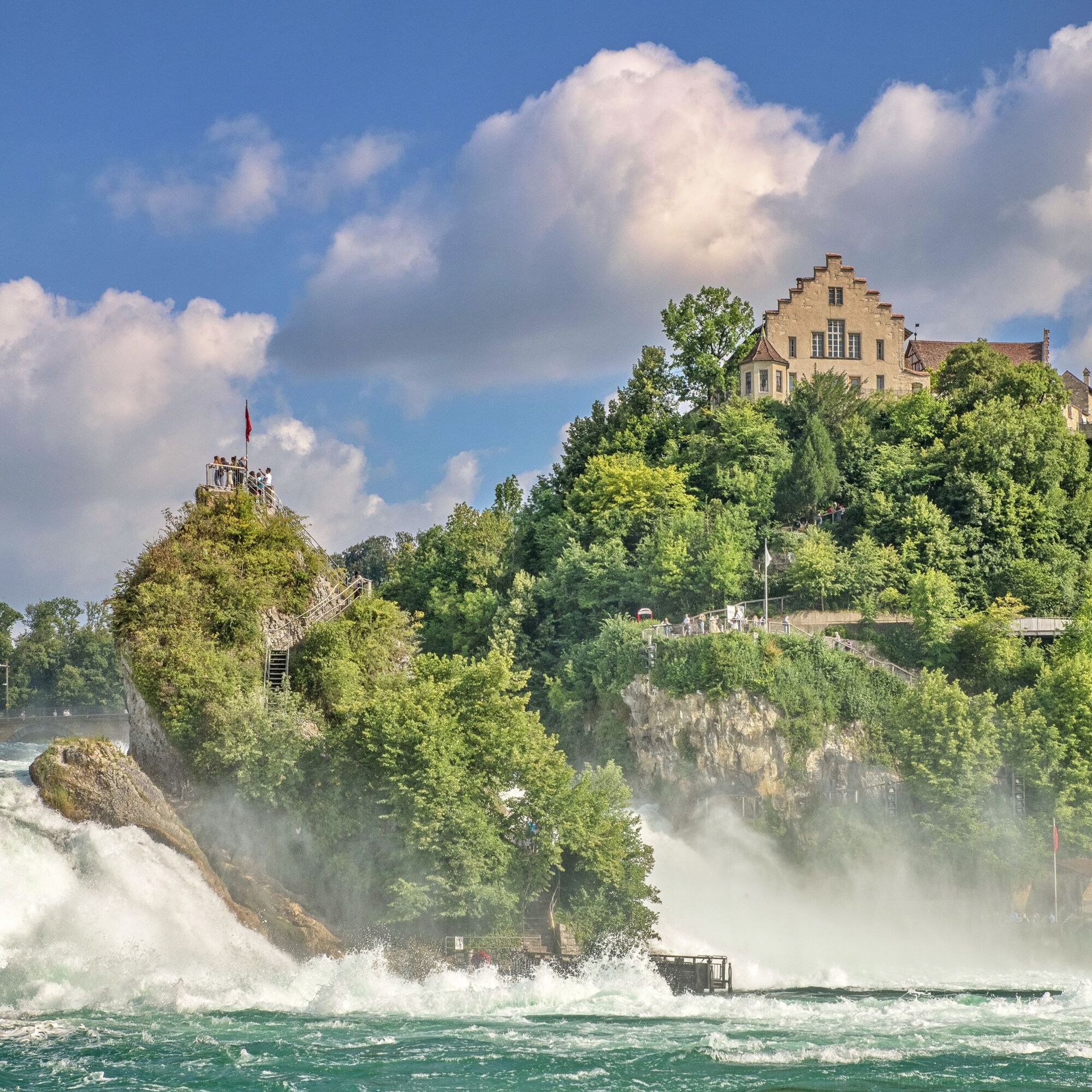
Laufen Castle, which is enthroned right next to the Rhine Falls, presents itself majestically.
After visiting the Rhine Falls and the attractions on offer there, you return to the starting point, this time on the other side of the Rhine.
- Directions
-
Rhine Falls - Nohl - Dachsen - Flurlingen - Neuhausen - Rhine Falls
- Highest point
- 407 m
- Endpoint
-
Dachsen railway station
- Height profile
-
 © outdooractive.com
 - Equipment
-
Comfortable shoes, drinks and snacks for in between.
- Tips
-
A boat trip to Mittelfelsen or to Rheinau.
You can find more tips here: Rhine Falls
- Additional information
- Directions
- Public transportation
- Parking
-
Car parks are available at the Rhine Falls (subject to charges). Follow the signs.

-

-
AuthorThe tour SwitzerlandMobility 896: Rhine Falls circular route is used by outdooractive.com provided.


General info
-
SchaffhauserLand
1027
-
Zürcher Weinland
521
-
Neuhausen am Rheinfall
154