- Brief description
-
A perfect afterwork tour for those living in Zurich.
- Difficulty
-
medium
- Rating
-
- Starting point
-
Zurich Burgwies Tram Stop
- Route
-
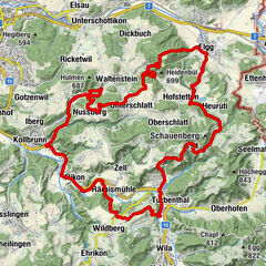
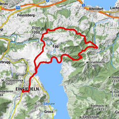
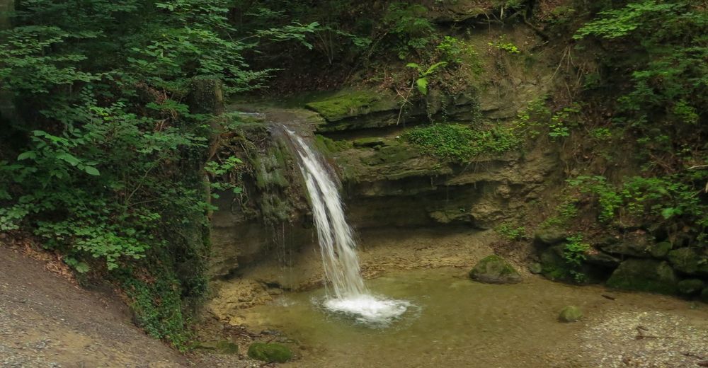
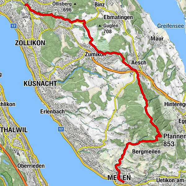
Zurich (408 m)Der Wilde Kaiser2.8 kmSennhof4.5 kmZumikon (620 m)6.3 kmForch8.7 kmGasthof Krone Forch8.8 kmAesch9.0 kmVorder-Guldenen11.5 kmPfannenstiel (853 m)13.4 kmAlpenblick15.1 kmToggwil15.3 kmMeilener Dorfbach-Wasserfall I17.0 kmMeilener Dorfbach-Wasserfall II17.1 kmMeilener Dorfbach-Wasserfall III17.1 kmMeilener Dorfbach-Wasserfall IV17.7 kmFuchsloch18.4 kmMeilen (420 m)18.5 kmMeilen (420 m)18.7 km
- Best season
-
JanFebMarAprMayJunJulAugSepOctNovDec
- Description
-
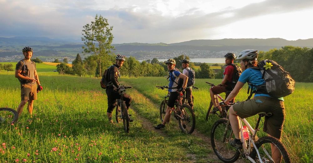
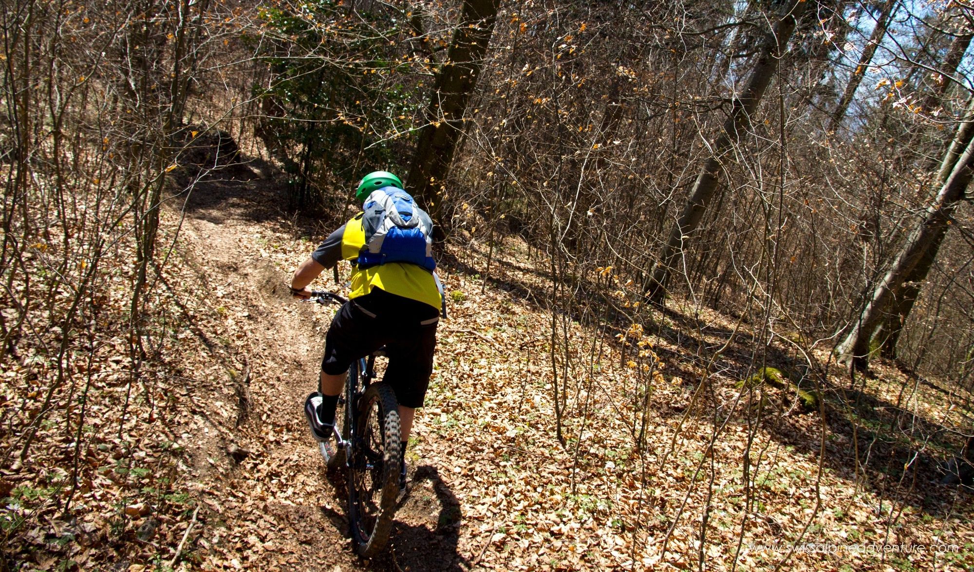
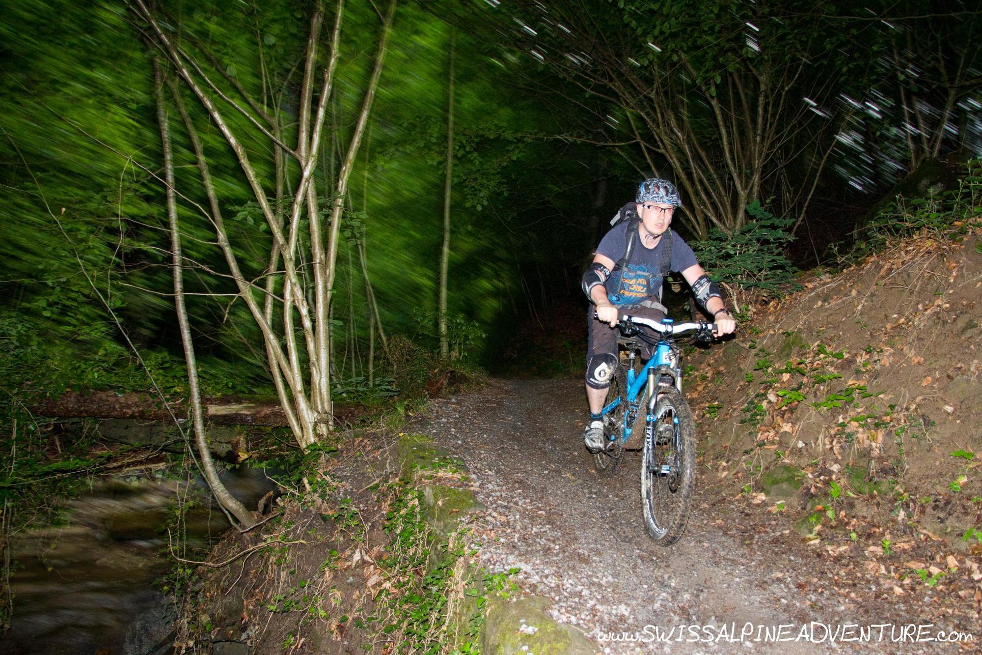
Within minutes of leaving Burgwies it is hard to believe that you are so close to the Zurich city centre. As you climb along the Warenbach stream you feel like you are in another world. The tour continues along past Forch with nice views over the Griefensee before reaching the top of Pfannenstiel and dropping back down to Meilen and the shores of lake Zurich. This is a pleasant tour which is perfect to leave the stress of a hard working day behind during the summer months.
- Directions
-
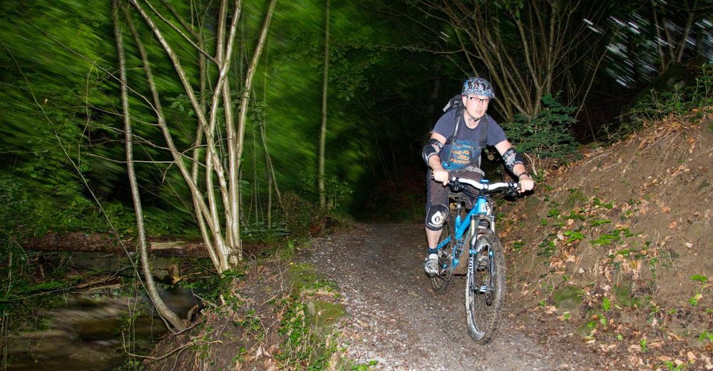
From Burgwies turn left (if coming from Zurich) and take the small street past the Restaurant Burgwies. Take the second street to the right (should have yellow hiking signs for Zollikerberg) which will turn into a single trail along the side of a stream after about 100m. Keep following this stream up hill (it always stays on your right) for about 2.5lm until it comes out on a road close to a sawmill at Trichtenhausen after a particularly steep but short climb.
At Trichtehausen turn left and follow the road downhill for about 100m and turn right just before you cross the bridge. Follow this dirt road uphill towards Sennhof. Here you will crosss the main road between Zollikerberg and Binz and take the small paved road to Zumikon.
In Zumikon keep going straight until you get to a dirt road entering the woods. Follow the yellow signposts for the "Forch Denkmal". Pass the Monument (Denkmal) and then ride downhill to the main road staying left until you get to a bridge over the Autobahn. Cross the Autobahn and take the next left and go immediately right up Guldenenstrasse. About 400m up this street there is a dirt road/trail that climbs quite steeply up almost parralel with the road. Keep following this as it crosses the road 3 times before bringing you to Vorderer Guldenen. At the farmhouse at Vorder Guldenen turn right and keep going up the paved road after about 500m it turns 90 degrees to the right and enters the woods. At the next junction the road becomes unpaved, turn left here and ride about 1km to the top of Pfannenstiel. There is a three way dirt road juntion here with a singletrail climbing into the woods to the right.
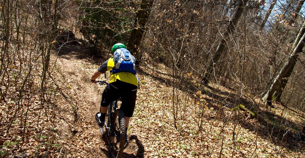
Climb this singletrail for about 100m, then in the small clearing take the trail to your left and follow it down to a fireroad, take a left at the fire road and turn right onto the first singletrail you see.
At the bottom of that trail turn left onto the fireroad and follow it around to the right, you pass an open field on the right hand side, shortly after the woods restarts on the right take the second singletrail on your right.
From here the trail crosses fireroads but restarts almost directly across the road. After the second fireroad you will pass a small bike park with some jumps. Right after the jumps there is a steep gully going downhill, you need to drop into this gully on its right hand side to avoid falling into a drainage ditch, as you drop down the gully there are a few different lines, it pays to look well ahead to see where the line you are following will take you. In the past there used to be some north shore sections here but as of spring 2010 these sections were no longer there and the most difficult sections involved roots and one very small jump.
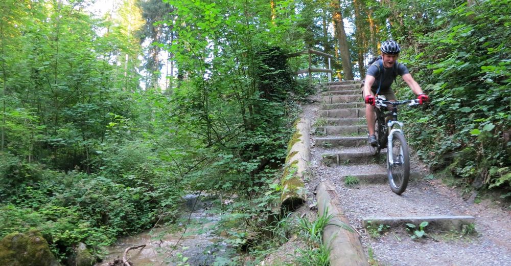
When you come out the end of this section go straight across the fireroad, into a narrow walking trail, after 50m the walking trail goes left and the bike trail continues straight down between two trees. Follow this trail down to the end, and continue down to Toggwil. In Toggwil take the Meilener Tobelweg down to the train station in Meilen. - Highest point
- 857 m
- Endpoint
-
Meilen Train Station
- Height profile
-
 © outdooractive.com
 - Equipment
-
Any kind of mountain bike is suitable for this ride, however the steps at the bottom of the Meilener Tobelweg are going to be quite challenging on Cross Country style bikes with high saddles.
- Safety instructions
-
The steps towards the bottom of the Meilener Tobelweg can be quite dangerous.
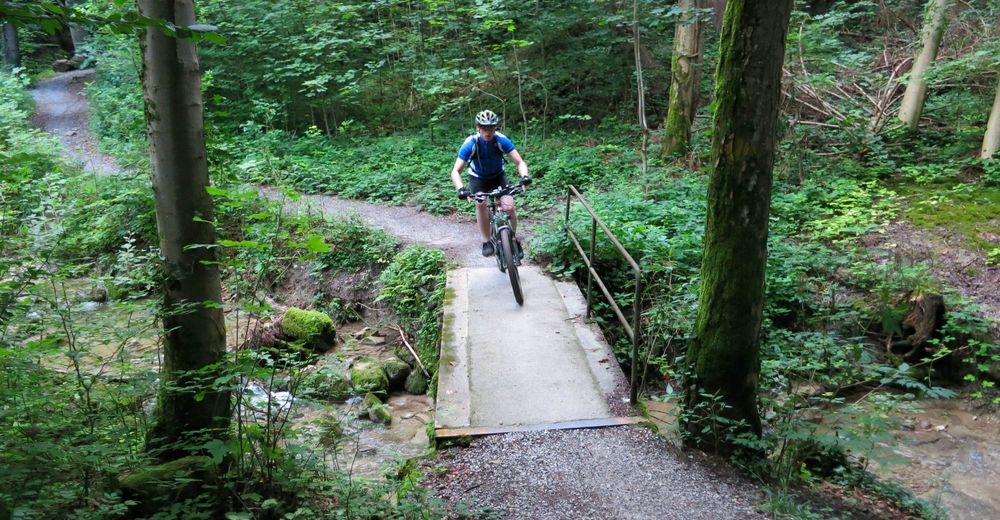
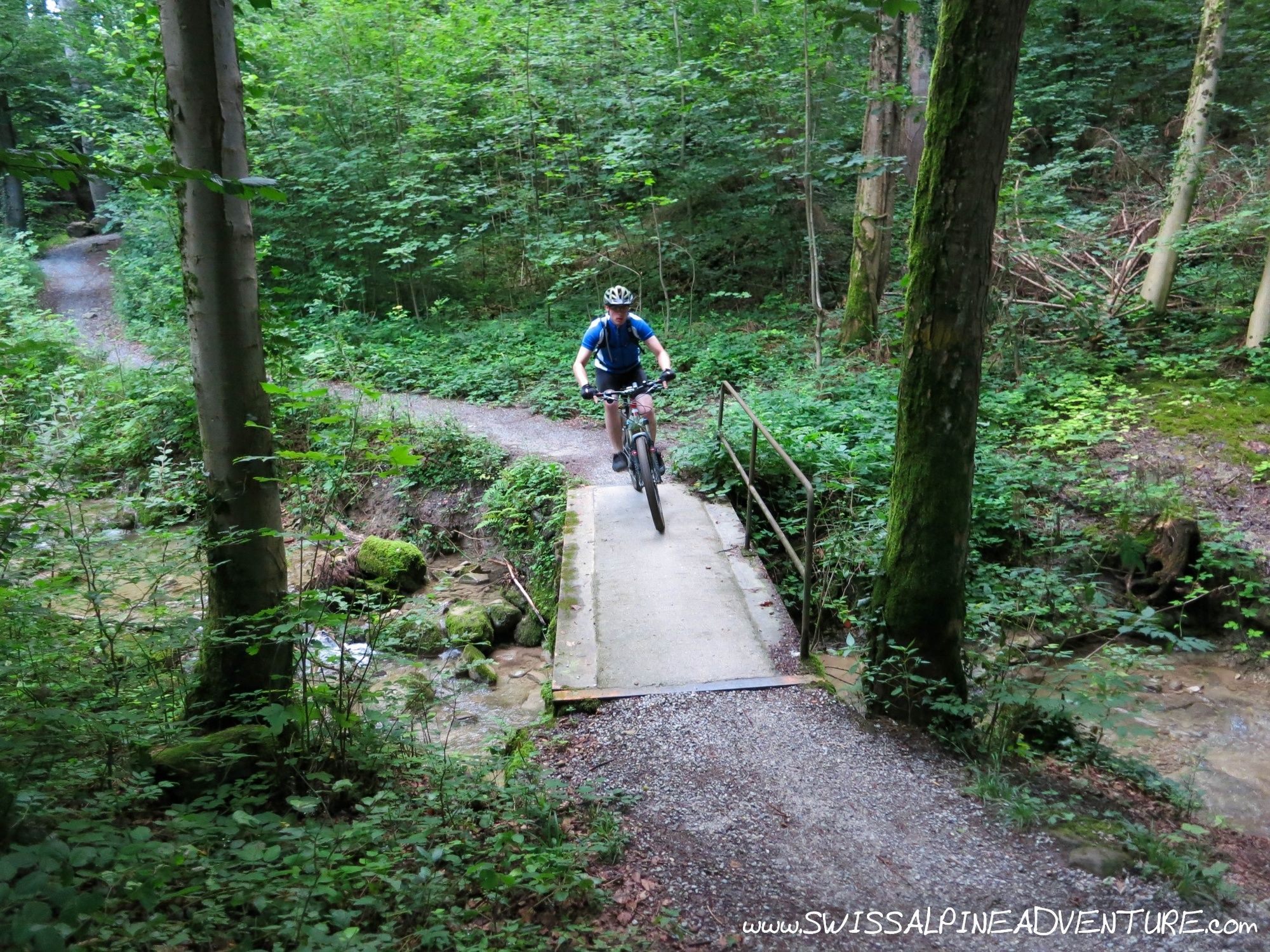
Care should be taken when riding along the Tobelwegs (Trails by the side of the streams) as there are many hikers, runners and dog walkers.
The Tobelweg trails are sometimes very narrow with a reasonable drop to one side.
- Tips
-
A great after work ride which can be finished with a drink by the lake in Meilen and a train back to Zurich.
- Additional information
- Directions
-
From Zurich Stadelhofen ride up the Tram 11 and S18 lines until you get to Burgwies. (Tram Museum and Migros on the right hand side).
- Public transportation
- Parking
-
There is a car park close to the Psychiatric University Clinic which is about 5 minutes bike ride from Burgwies. This tour is however best done using public transport.


-

-
AuthorThe tour Pfannenstiel is used by outdooractive.com provided.