© Österreich Werbung / Charly Schwarz
- Brief description
-
Erkunden Sie den Kahlenberg
- Difficulty
-
difficult
- Rating
-
- Route
-
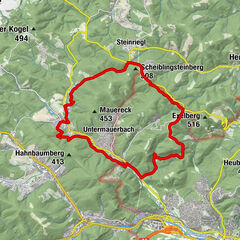
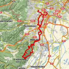
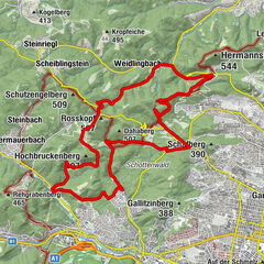
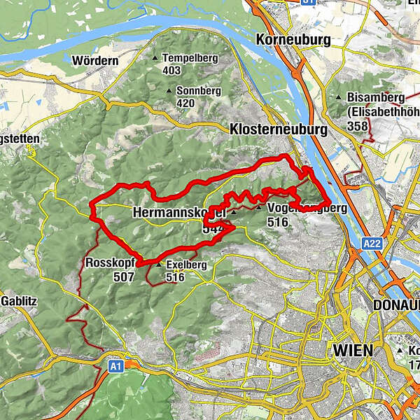
Pfarrkirche St. Georg0.1 kmKahlenbergerdorf0.1 kmVienna (542 m)0.6 kmJosefsdorf2.6 kmSt. Josef2.7 kmJosefinenhütte3.7 kmGrüass Di a Gott Wirt13.3 kmZwei Gehängte14.7 kmZwei Gehängte (447 m)15.0 kmHameau (465 m)15.9 kmRosskopf (507 m)18.2 kmSchutzengelberg (509 m)20.1 kmScheiblingsteinberg (509 m)21.7 kmSteinriegl22.8 kmHeuberg (477 m)23.5 kmWindischhütte25.2 kmEschenplatzl27.4 kmKammersberg (392 m)29.3 kmWeidling32.3 kmPfarrkirche St. Peter u. Paul32.5 kmPizzeria Di Sara32.6 kmKlosterneuburg33.7 kmPfarrkirche St. Leopold34.5 kmFlamingo37.6 kmKahlenbergerdorf38.6 kmVienna (542 m)38.8 km
- Best season
-
JanFebMarAprMayJunJulAugSepOctNovDec
- Highest point
- 505 m
- Endpoint
-
Kahlenberg
- Height profile
-


- Author
-
The tour Kahlenbergerdorf-Strecke is used by outdooractive.com provided.
GPS Downloads


General info
Refreshment stop
Insider tip
Other tours in the regions
-
Wienerwald
291
-
Wien und Umgebung
206
-
Klosterneuburg
78