
- Brief description
-
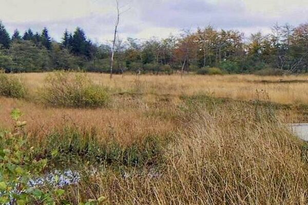
Raw and untouched, this landscape is a challenge to body and mind. This hike takes you deep into the wood and up to the edge of Kutenhart Fen.
- Difficulty
-
medium
- Rating
-
- Starting point
-
Petergensfeld car park. At the parking lot down the street. GPS coordinates: 50,646 - 6,176
- Route
-
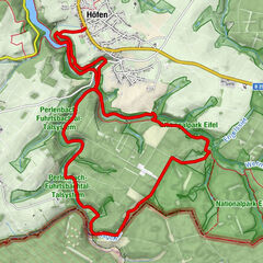
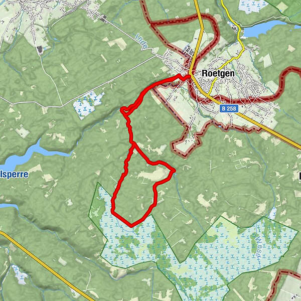
Petergensfeld0.4 kmKapelle Reinartzhof8.5 kmPetergensfeld14.9 km
- Best season
-
JanFebMarAprMayJunJulAugSepOctNovDec
- Description
-
Somehow, you feel reminded of heath landscapes or tundra zones in more northern countries. In this hot August the Eschbach has run dry. We follow the dried-up river bed towards the source and push ahead into natural surroundings that seem to get wilder and wilder.
The tall ferns and grasses already herald the heath landscape that flourishes in the east of the High Fens. A particularly barren area that people seem to avoid. After a bend, we come to the remains of the Reinartzhof, whose landholdings lay on the edge of the fens.
In 1953, a particularly heavy snowstorm cut the farms off from the world outside and the inhabitants had to be provided for by helicopter. In fact, the agricultural business was never to recover completely. 5 years later the farms in the catchment area of the Weser dam were dispossessed to protect the quality of the water. Since then, nature has regained control of the former hamlet, and absolute silence now reigns.
- Directions
-
Hiking in the junction system:
Follow the hiking route nodes: 32 > 95 > 38 > 21 > 87 > 98 > 92 > 37 > 90 > 93 > 87 > 21 > 95 > 32
More information: https://www.ostbelgien.eu/en/walking/hiking-route-planer
- Highest point
- 517 m
- Endpoint
-
Petergensfeld car park.
- Height profile
-
 © outdooractive.com
 - Equipment
-
Waterproof hiking boots must be provided! Pack drinks and a small refreshment.
- Safety instructions
-
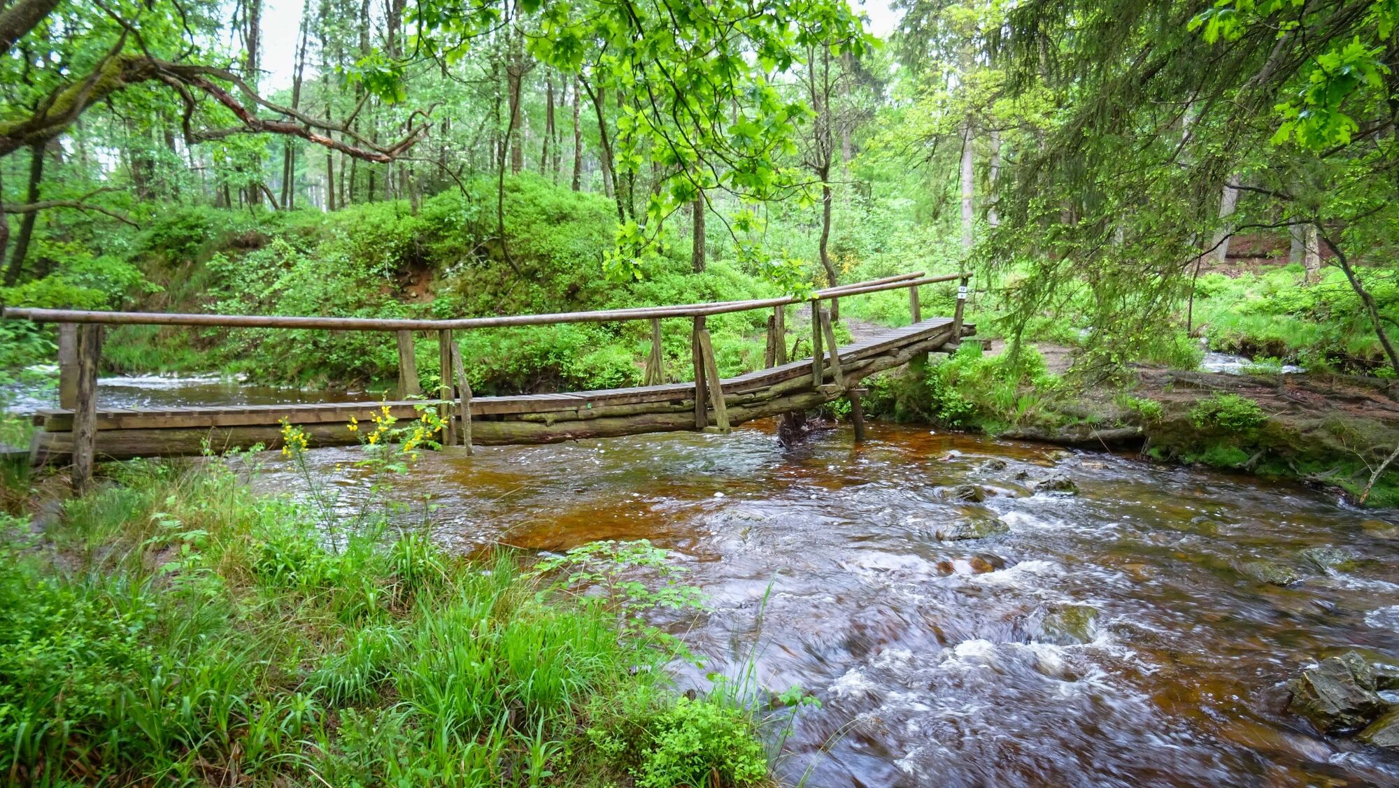
A long, very pleasant hike with sporting challenges along the streams. Difficult paths along the Venns.
Dogs are not allowed on this hike.
- Tips
-
Highlights along the way are the Reinartzhof, the Kutenhart-Venn, the Eschbach and the Weser Valley.
- Additional information
- Directions
-
Please use the route planner.
- Public transportation
- Parking
-
Take the Raeren-Roetgen road to the right in the direction of the shooting range.


- Author
-
The tour Pleasure tour 21 – Another world is used by outdooractive.com provided.


General info
-
Eifel & Aachen
1426
-
Hohes Venn
602
-
Roetgen
258