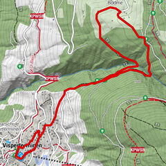
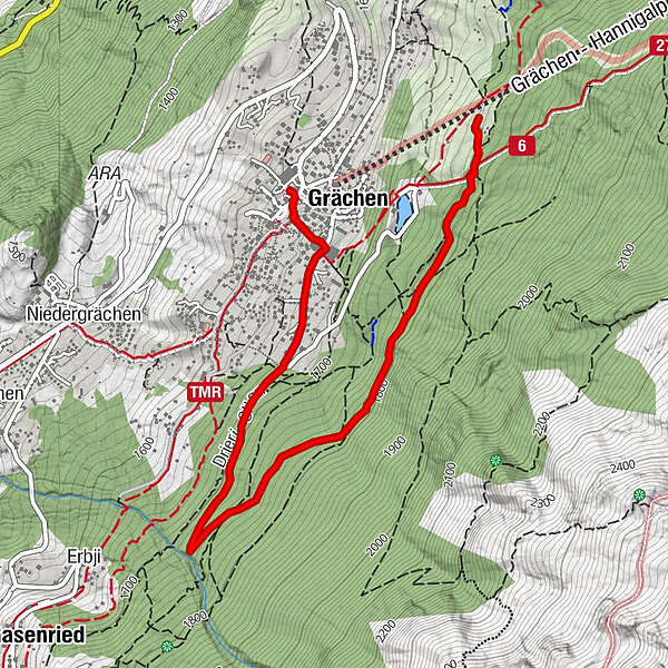
Winter hiking trail: Grächen - Alpen Sport Resort-Eggeri-Äbnet


- Brief description
-
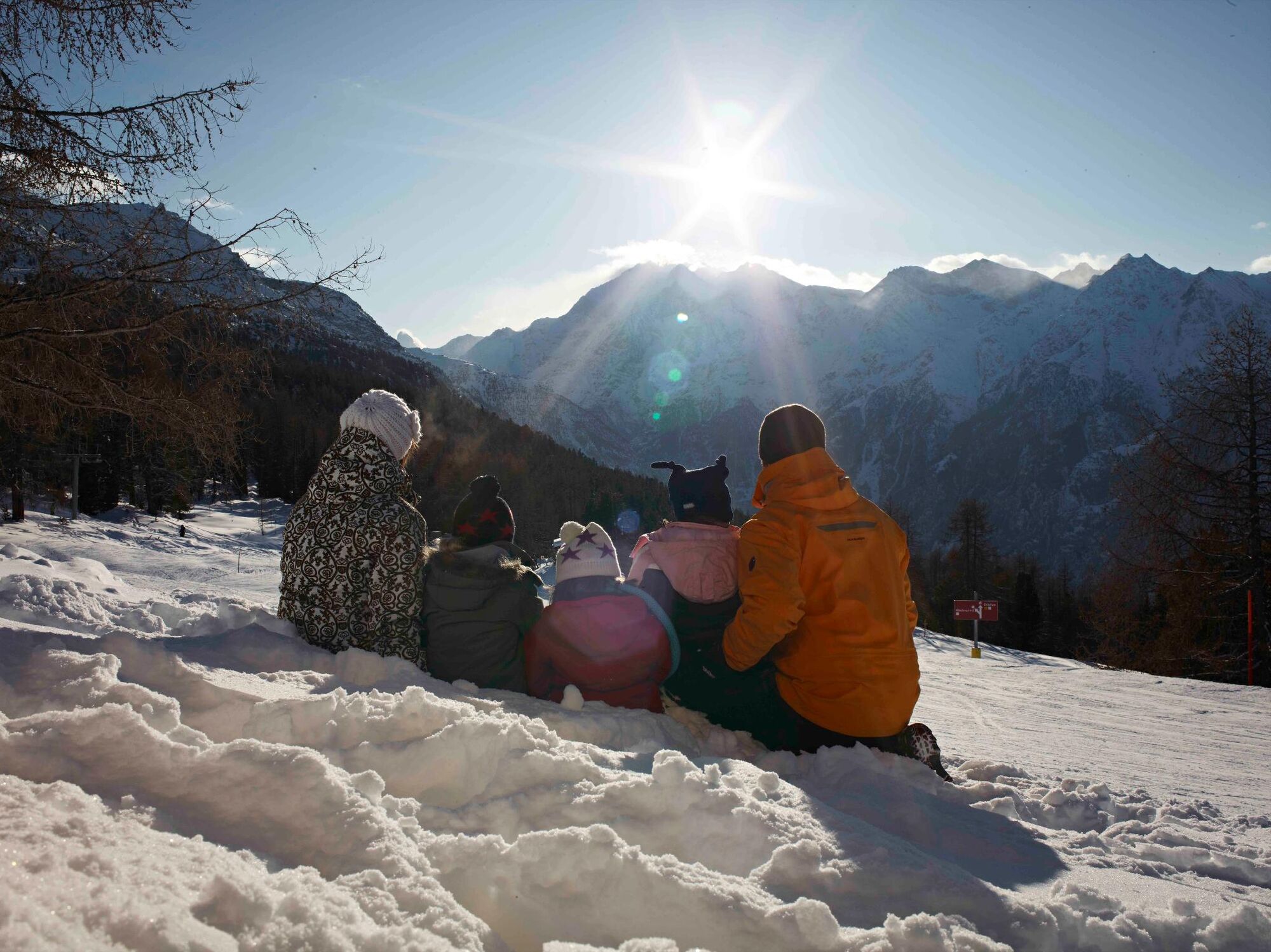
Relaxing winter hiking trail above Grächen
- Difficulty
-
easy
- Rating
-
- Starting point
-
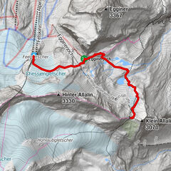
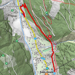
Grächen
- Route
-
Grächen0.3 km
- Best season
-
AugSepOctNovDecJanFebMarAprMayJunJul
- Description
-
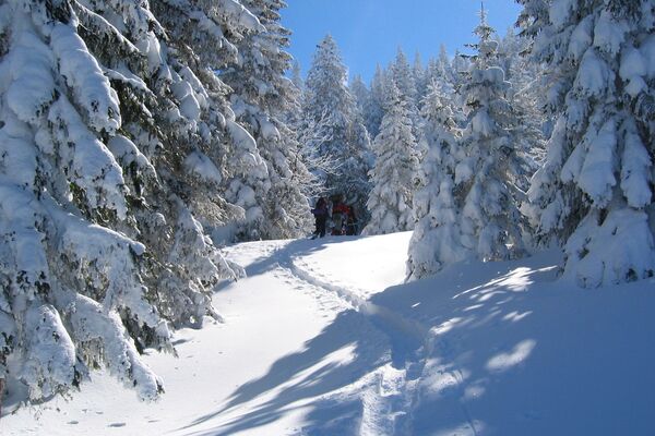
Beautiful hike in varied surroundings with fantastic views.
- Directions
-
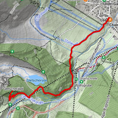
Away from the ski slopes, the slightly ascending path leads you from the village centre past the sports centre. Let your eyes wander from the ice rink to the wintry mountain village surrounded by a breathtaking mountain backdrop. Follow the road to the edge of the forest. Here you decide to leave the road and follow the path straight ahead into the forest until you reach the Drieri and Eggeri irrigation channels. Walk along these water channels through the enchanting winter forest to the exit portal of the magic water on Alpe Äbnet.
- Highest point
- 1,786 m
- Endpoint
-
Alpe Äpnet
- Height profile
-
 © outdooractive.com
 - Equipment
-
We recommend:
good footwear clothing suitable for the weather: always carry a waterproof jacket hat or cap sunscreen bottle for water picnic camera binoculars (optional) hiking poles (optional) - Safety instructions
-
Use of the trails and the information on this website is at hikers’ own risk. Local conditions may entail changes to routes. Grächen tourisme accepts no liability for the accuracy and completeness of information on this website.
For all hikes:
Bring a map. Download full description of this route including large-scale map by clicking on «Print» icon, top right of this page. Use marked trails only, and observe all signposting – for your own safety, to safeguard grazing animals and to avoid disturbing wildlife. Close gates after passing through. Please be considerate to other trail users, and to the plants and animals. Do not leave any waste in nature.For mountain hikes:
Take extra care protecting yourself from the sun at altitude. UV radiation can be exceptionally strong, even in cloudy weather. Plan hike carefully: take into consideration fitness level of each participant, weather forecast and season. Weather conditions can change quickly in the mountains, without warning. Appropriate clothing is therefore essential, along with adequate supplies of food and water. In uncertain weather, turn back in good time. - Directions
-
- Rhône Valley: Via Martigny - Visp to Grächen / St. Niklaus
- Car transport Lötschberg: Via Kandersteg - Goppenstein - Visp to Grächen / St. Niklaus (bls.ch/e/autoverlad/)
- Car transport Furka: Via Andermatt - Realp - Oberwald - Brig - Visp to Grächen / St. Niklaus (Car transport Furka)
- Tessin/Simplon: Via Lugano - Centovalli - Domodossola - Brig - Visp to Grächen / St. Niklaus (Car transport Simplon)
- Public transportation
-
From Visp you take the train to St. Niklaus. There you change to the bus, which gets you to Grächen every half hour. On weekends a direct bus operates from Visp to Grächen.
- Parking
-
Parking spaces in Grächen: The car park Millegga is located by the village entrace in Grächen. Price per day (for covered parking space): CHF 15.00
Private Parking space provider:
Amstutz Trudy
Tel. +41 (0)27 956 13 35
Jeiziner Leon
Tel. +41 (0)27 956 16 31
Hotel Alpha
Tel. +41 (0)27 956 13 01
- Author
-
The tour Winter hiking trail: Grächen - Alpen Sport Resort-Eggeri-Äbnet is used by outdooractive.com provided.


General info
-
Oberwallis
308
-
Unterbäch
162
-
Grächen - St. Niklaus
27