
- Brief description
-
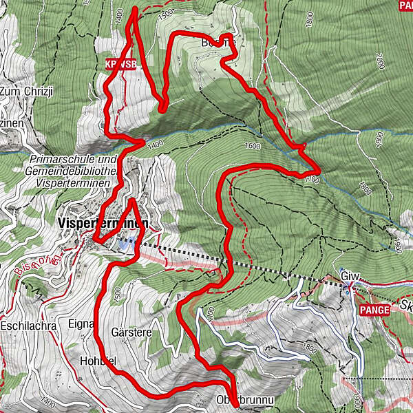
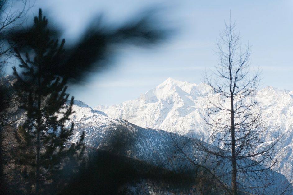
The Tärbiner winter hiking trail does a circuit around the village of Visperterminen.
- Difficulty
-
medium
- Rating
-
- Starting point
-
Visperterminen
- Route
-
Restaurant Spycher0.1 kmKapelle: Verkündigung un Maria0.1 kmKapelle: Maria besuch Elisabeth0.4 kmEgga2.2 kmUnnerbrunnu2.6 kmOberbrunnu2.6 kmBodme6.5 kmRestaurant Spycher9.8 kmVisperterminen (1,391 m)9.9 kmRestaurant Heida9.9 km
- Best season
-
AugSepOctNovDecJanFebMarAprMayJunJul
- Description
-
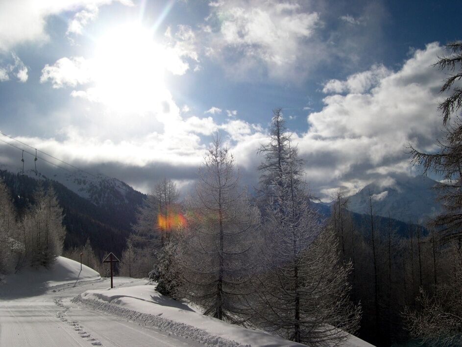
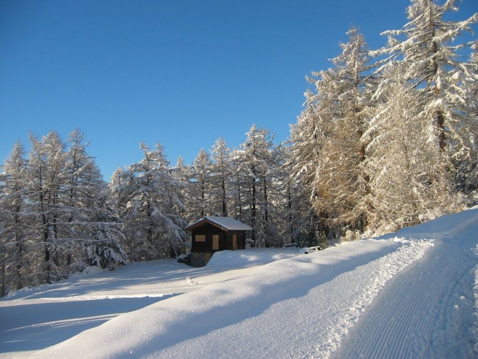
Head south on the almost flat toboggan run until you reach Brunnu, enjoying the incredible panorama on the way as you go. Continue in a northerly direction and passing a chairlift before plunging into the Gärsteru forest. When you get to Muttji, the highest point on the hike, continue to Bodma with its beautiful view of the surrounding landscape. From here, return to Visperterminen where you can take a well-deserved break.
- Directions
-
The hike starts above the village of Visperterminen and leads towards Brunnu along a road closed to cars. From here, continue through the idyllic Gärsteru forest to the famous chapel. Once you reach the hamlet of Bodma, enjoy the view over the Saaser and Mattertal valleys.
- Highest point
- 1,680 m
- Endpoint
-
Visperterminen
- Height profile
-
 © outdooractive.com
 - Equipment
-
We recommend:
goodfootwear clothing suitable for the weather: always carry a waterproof jacket hat or cap sunscreen bottle for water, picnic camera hikingpoles (optional) printout of this hike (click “Print” icon, top right, to download) - Safety instructions
-
Use of the trails and the information on this website is at hikers’ own risk. Local conditions may entail changes to routes. Valais/Wallis Promotion accepts no liability for the accuracy and completeness of information on this website.
Bring a map. Download full description of this route including large-scale map by clicking on “Print” icon, top right of this page. Use marked trails only, and observe all signposting – for your own safety, to safeguard grazing animals and to avoid disturbing wildlife. Please be considerate to other trail users, and to the plants and animals. Do not leaveanywaste in nature. Take extra care protecting yourself from the sun at altitude. UV radiation can be exceptionally strong, even in cloudy weather. Plan hike carefully: take into consideration fitness level of each participant, weather forecast and season. Weather conditions can change quickly in the mountains, without warning. Appropriate clothing is therefore essential, along with adequate supplies of food and water. In uncertainweather, turn back in good time. Do not venture onto glaciers without a mountain guide. Take note of the warning signs that point out the constant danger, especially the danger of avalanches. Inform others of planned route, and whenever possible, avoid going alone. - Tips
-
Don't forget your sunglasses. Walk in a southerly direction and enjoy the sun on your face.
- Additional information
- Directions
-
Take the A9 motorway and cantonal road 9 to Visp. Follow the signs to Visperterminen and take Terbinerstrasse through Unterstalden and Oberstalden to Visperterminen.
- Public transportation
-
Visperterminen can be reached with ease from Visp using post bus 524. The hike starts from the Visperterminen bus terminus.
- Parking
-
There are numerous public parking spots available in the center of Visperterminen.
- Author
-
The tour Tärbiner winter trail is used by outdooractive.com provided.


General info
-
Oberwallis
303
-
Rund um Visp
144
-
Visperterminen
23