
- Brief description
-
In the heart of the Val Ferret, this route links La Fouly to the small hamlet of Branche d’en Haut.
- Difficulty
-
medium
- Rating
-
- Starting point
-
Bus stop La Fouly
- Route
-
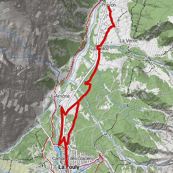
Auberge de la FoulyLa FoulyEdelweiss0.0 kmL'Amône1.1 kmCafé Restaurant du Dolent3.4 kmPrayon3.5 kmLa Seiloz4.2 kmLa Fouly5.8 km
- Best season
-
AugSepOctNovDecJanFebMarAprMayJunJul
- Description
-
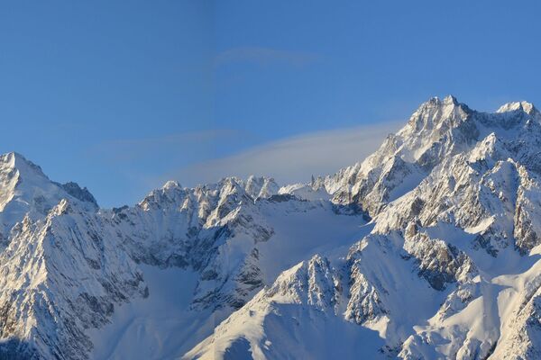
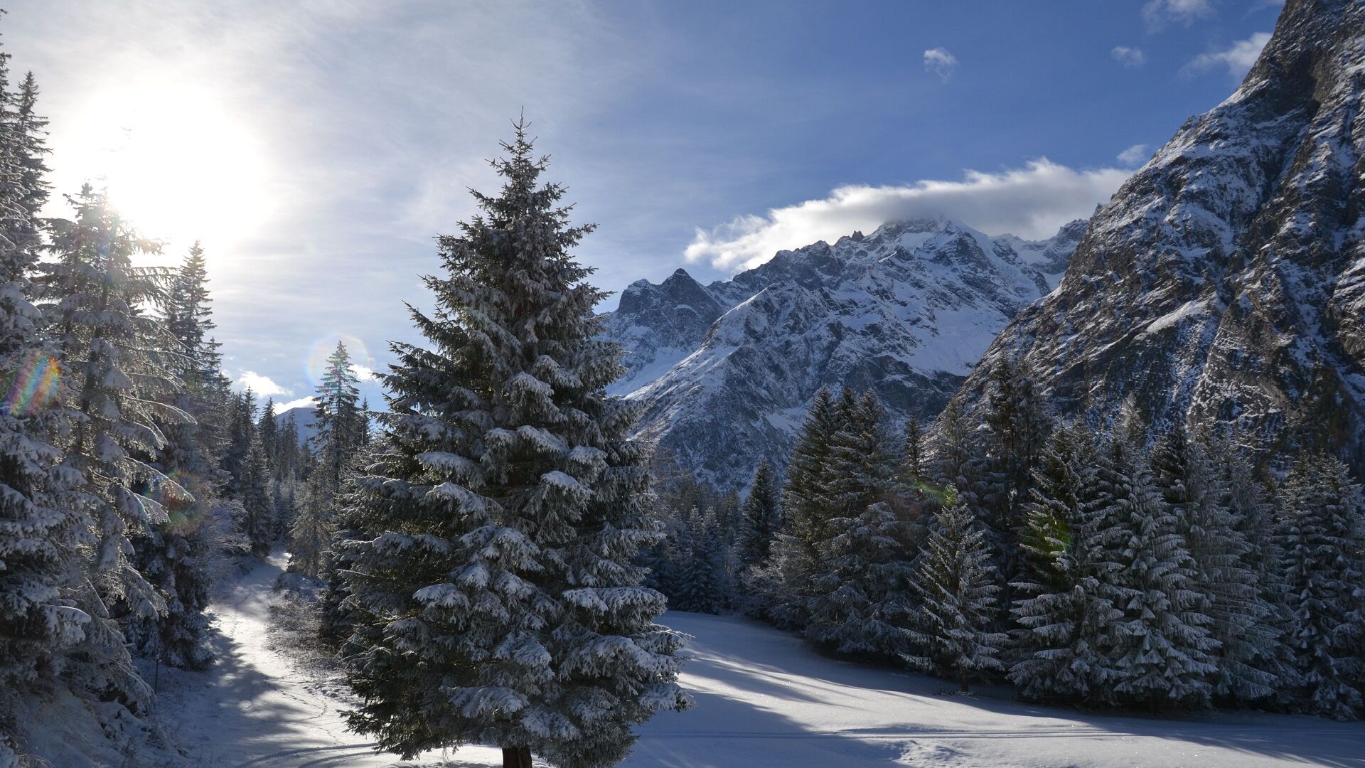
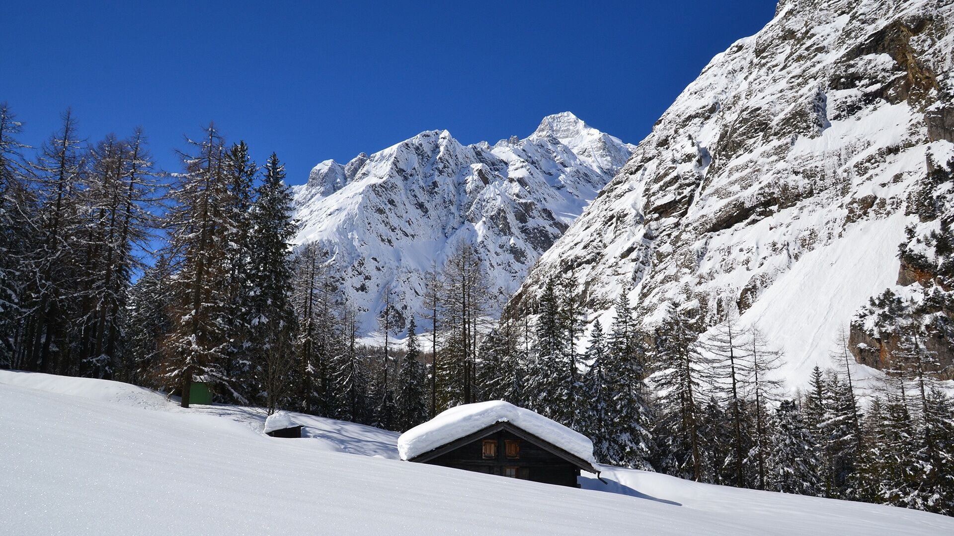
From La Fouly, you’ll bypass the pretty little hamlets typical of the Val Ferret, through forests and across pastures in a magnificent mountain setting in which you’ll spot the Dalle de l’Amône, well-known to climbers. On the way back south, where the borders between France, Italy and Switzerland converge and the Mont Dolent, which is on the border between France, Italy and Switzerland, the majestic Mont Dolent becomes visible in the background.
Halfway along the route, you’ll reach the hamlet of Prayon. Once here, you have a choice: taking a break at the Dolent café/restaurant, then returning along the same path; or at the junction, remaining on the mountain side of the cantonal road, or getting the bus back from Prayon.
- Directions
-
From the centre of La Fouly, take the road north to the Grand Hôtel du Val Ferret. Just after the big car park, continue west along the road that descends to the edge of the water catchment and north to the right and through the forest. Opposite a chalet on the northern edge of the forest, turn east, climb up to the cantonal road and cross it carefully. From there, continue through meadows, over two rivers and through the middle of the chalets at La Seilo.
Now walk to the cantonal road and over the bridge, and then immediately east and north-east through the scattered chalets of Prayon, and continue downhill to the north-west, where you reach the cantonal road, the bus stop and the Café-Restaurant de Prayon.
The first part of the way back is via the same route. After crossing the bridge and the two rivers again, the trail branches off slightly uphill to the south and leads through the forest to the village entrance of La Fouly. Follow the main road to the centre of the resort.
- Highest point
- 1,600 m
- Endpoint
-
Bus stop La Fouly
- Height profile
-
 © outdooractive.com
 - Equipment
-
We recommend:
• good footwear
• clothing suitable for the weather: always carry a waterproof jacket
• hat or cap
• sunscreen
• bottle for water, picnic
• camera
• hikingpoles (optional)
• printout of this hike (click “Print” icon, top right, to download)
- Safety instructions
-
Use of the trails and the information on this website is at hikers’ own risk. Local conditions may entail changes to routes. The Pays du St-Bernard accepts no liability for the accuracy and completeness of information on this website.
• Bring a map. Download full description of this route including large-scale map by clicking on “Print” icon, top right of this page.
• Use marked trails only, and observe all signposting – for your own safety, to safeguard grazing animals and to avoid disturbing wildlife.
• Please be considerate to other trail users, and to the plants and animals. Do not leaveanywaste in nature.
• Take extra care protecting yourself from the sun at altitude. UV radiation can be exceptionally strong, even in cloudy weather.
• Plan hike carefully: take into consideration fitness level of each participant, weather forecast and season.
• Weather conditions can change quickly in the mountains, without warning. Appropriate clothing is therefore essential, along with adequate supplies of food and water. In uncertainweather, turn back in good time.
• Do not venture onto glaciers without a mountain guide.
• Take note of the warning signs that point out the constant danger, especially the danger of avalanches.
• Inform others of planned route, and whenever possible, avoid going alone.
- Tips
-
La Fouly and the various hamlets along the way were originally pastures with small chalets (“mayens” in French), used during the spring and autumn for livestock grazing.
- Additional information
- Directions
-
Take the 22-Gd-St-Bernard motorway exit in Martigny. Stay on the right, on the E27 to Chamonix/Gd-St-Bernard/Verbier/Martigny-Expo. After the tunnel which bypasses Martigny, follow the signs for Grand-Saint-Bernard/Italy. Turn off the main road in Orsières and follow the signs to La Fouly/Val Ferret.
- Public transportation
- Parking
-
There is a large, free car park on the way into La Fouly.
- Author
-
The tour N. 12 - La Fouly-Prayon is used by outdooractive.com provided.