- Brief description
-
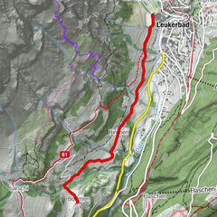
Walk with a variety of scenery involving a fair degree of climbing and descending connecting St-Luc to its ski area
- Difficulty
-
medium
- Rating
-
- Starting point
-
St-Luc
- Route
-
Saint-Luc (1,655 m)0.0 kmCabane Bella-Tola (2,346 m)8.0 km
- Description
-
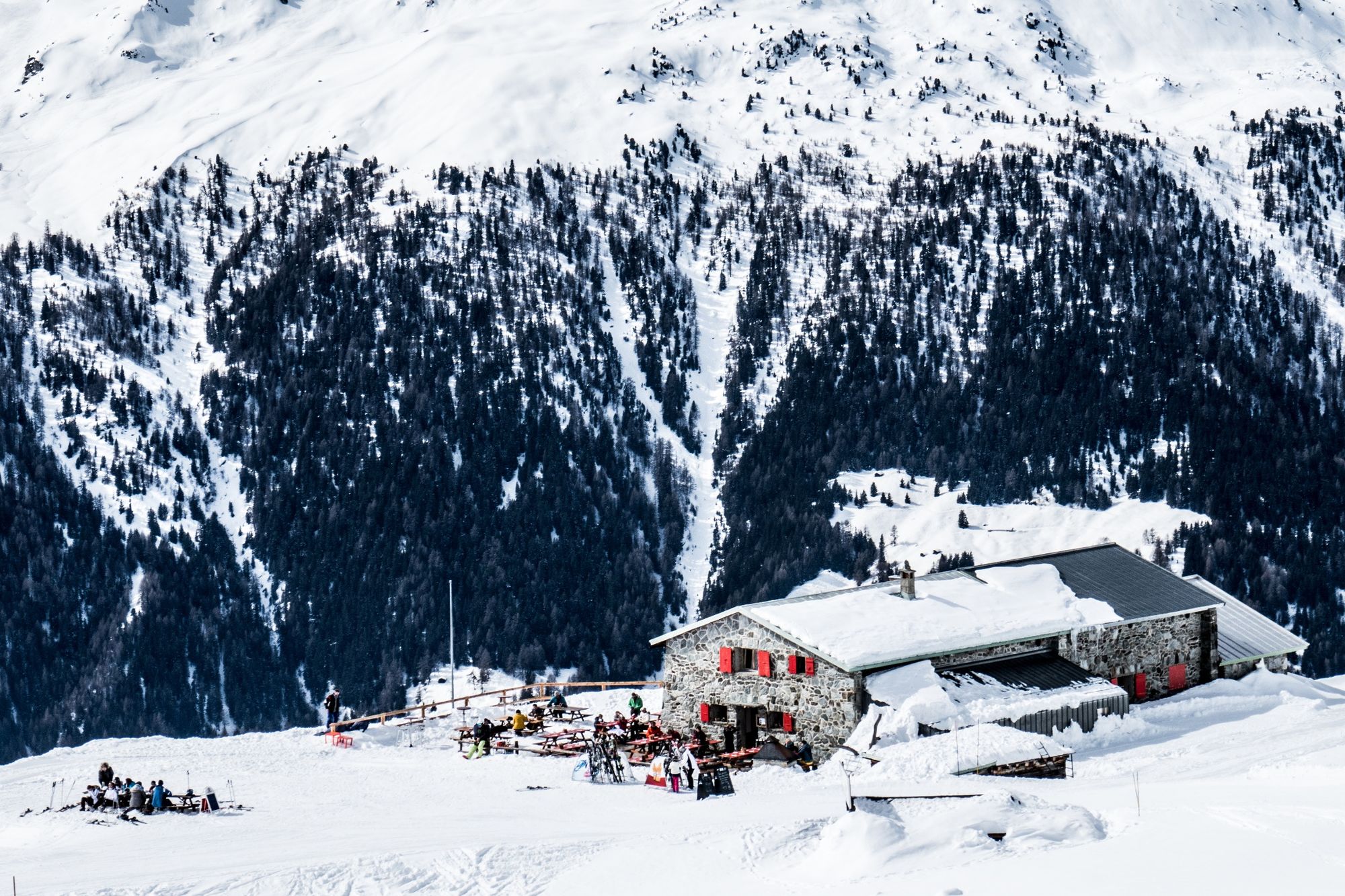
Pleasant first section winding through the forest. The second section goes through completely different scenery and leads gently up to the Bella Tola mountain lodge
- Directions
-
From St-Luc village center, take the direction of the Chemin de Prosper leading to the forest road that gently slopes up to Tignousa. With just a small extra effort you can reach the Bella Tola Mountain Hut, at the end of this rather strenuous but refreshing climb.
- Highest point
- 2,348 m
- Endpoint
-
Cabane Bella-Tola
- Height profile
-
 © outdooractive.com
 - Equipment
-
Good, waterproof footwear
Hiking poles
Warm winter clothing appropriate for the weather - Safety instructions
-
Tourist Offices cannot be held responsible in the case of accidents. For your safety, check the weather and snow conditions before setting out on these trails. Observe the signs and prohibitions (piste closures and risk of avalanche). If you are not suf ficiently knowledgeable to choose your trail according to your ability, you are strongly advised to hire a professional guide.
- Tips
-
For shorter alternatives :
1/ Start from the La Forêt Car Park avoiding the section on the road
2/ Stop at Tignousa Mountain Restaurant.
-

-
AuthorThe tour St-Luc - Cabane Bella Tola n°2 is used by outdooractive.com provided.


General info
-
Oberwallis
308
-
Sierre Anniviers
122
-
Vissoie
54