
- Brief description
-
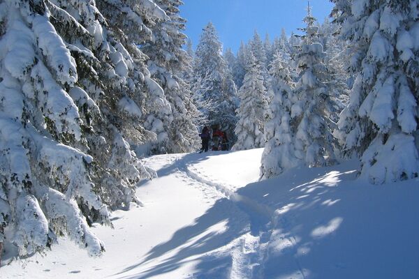
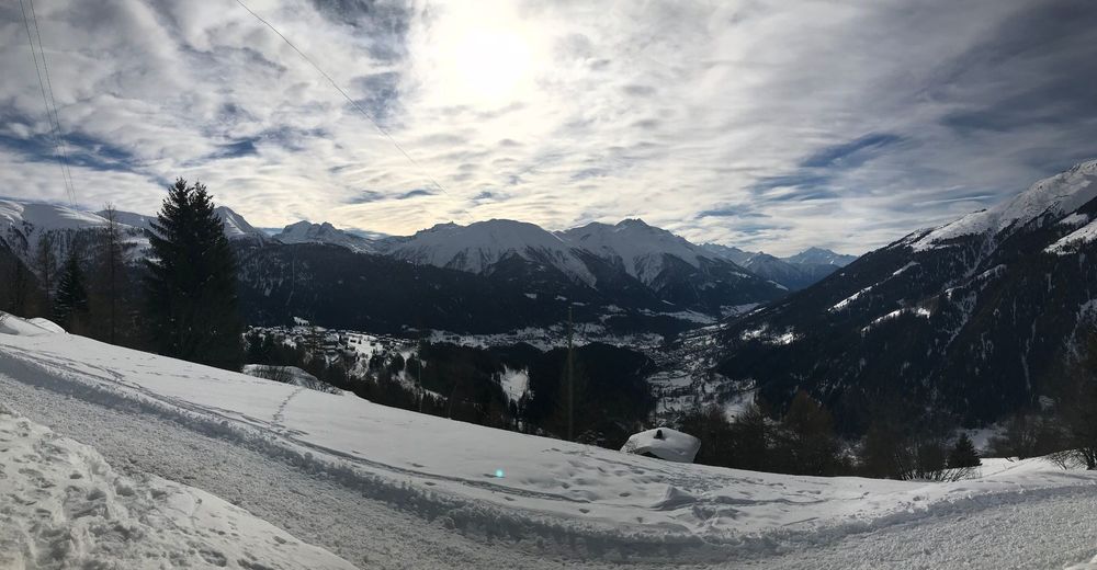
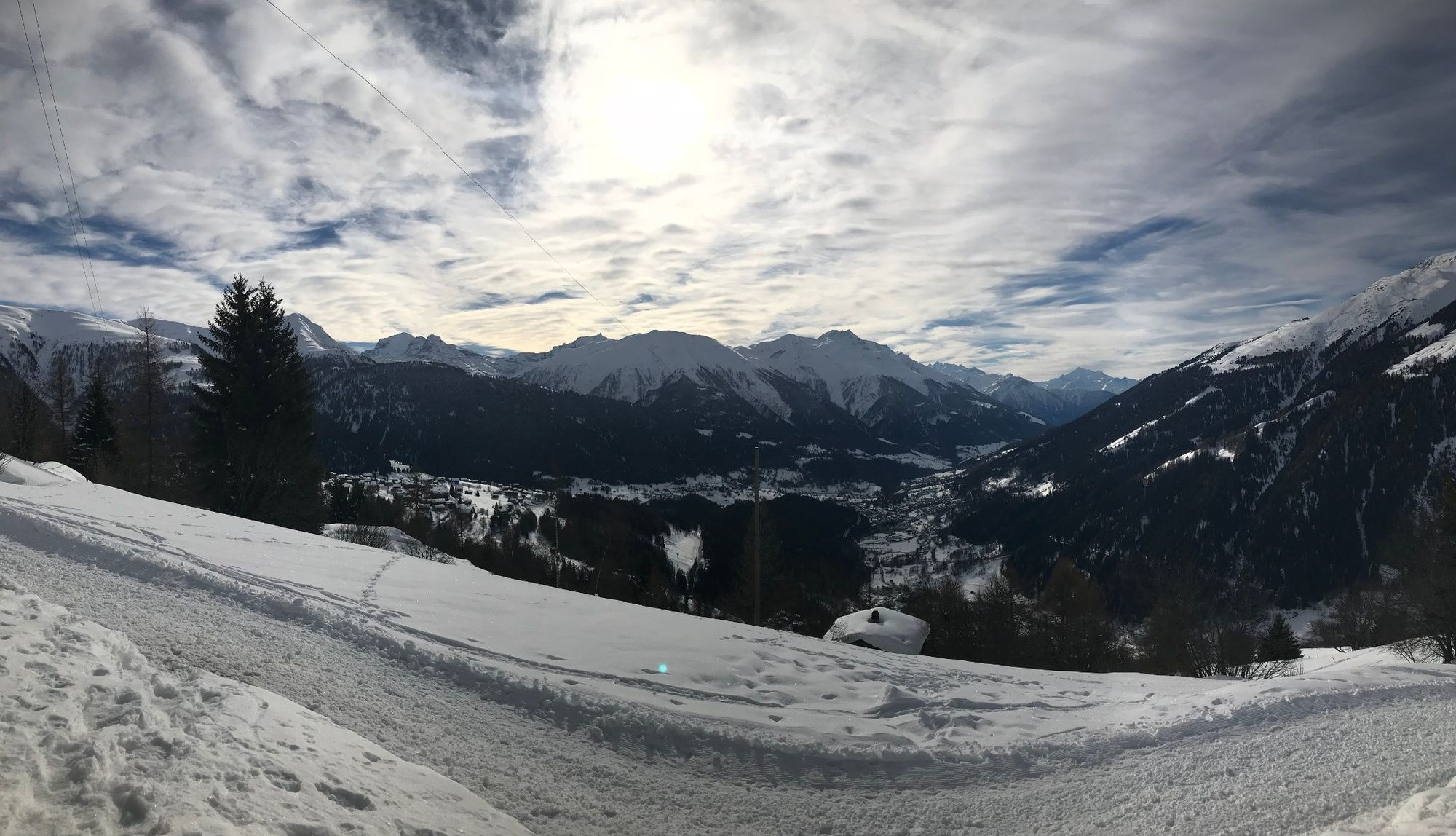
Wonderful winter hike with a fantastic view over the Fieschertal valley. The trail leads through the hamlet of Ried and over the Stollen, one of the most beautiful vantage points in the region.
- Difficulty
-
medium
- Rating
-
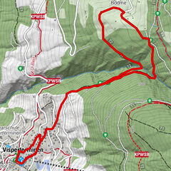
- Route
-
Ried2.1 km
- Best season
-
AugSepOctNovDecJanFebMarAprMayJunJul
- Description
-
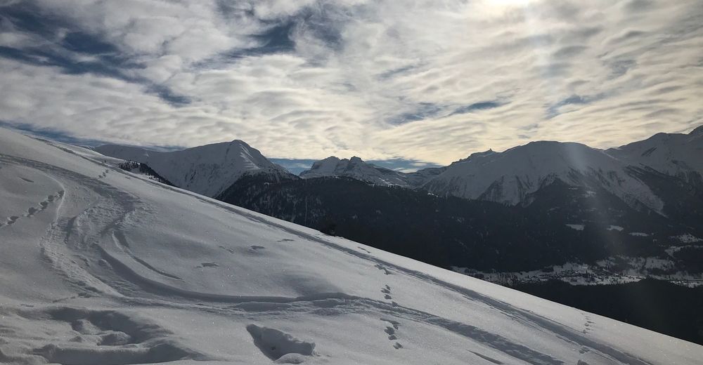
The old village of Bellwald is situated on a mountain promontory with panoramic views of two valleys: the Goms (upper Rhone Valley) and the Fiesch Valley. This enchanting winter hike leads west of the resort over the sunny, southwest-facing slopes with views of the Fieschertal valley. The terrain is mostly open and promises first-class views of the entire region where the two valleys meet.
The Fieschertal was formed in prehistoric times by the mighty Fiesch glacier, which has since retreated further into the valley. However, with a length of almost 15 kilometres, the glacier north of Bellwald is still the second longest in the Alps and one of the jewels of the UNESCO World Heritage "Swiss Alps Jungfrau-Aletsch".
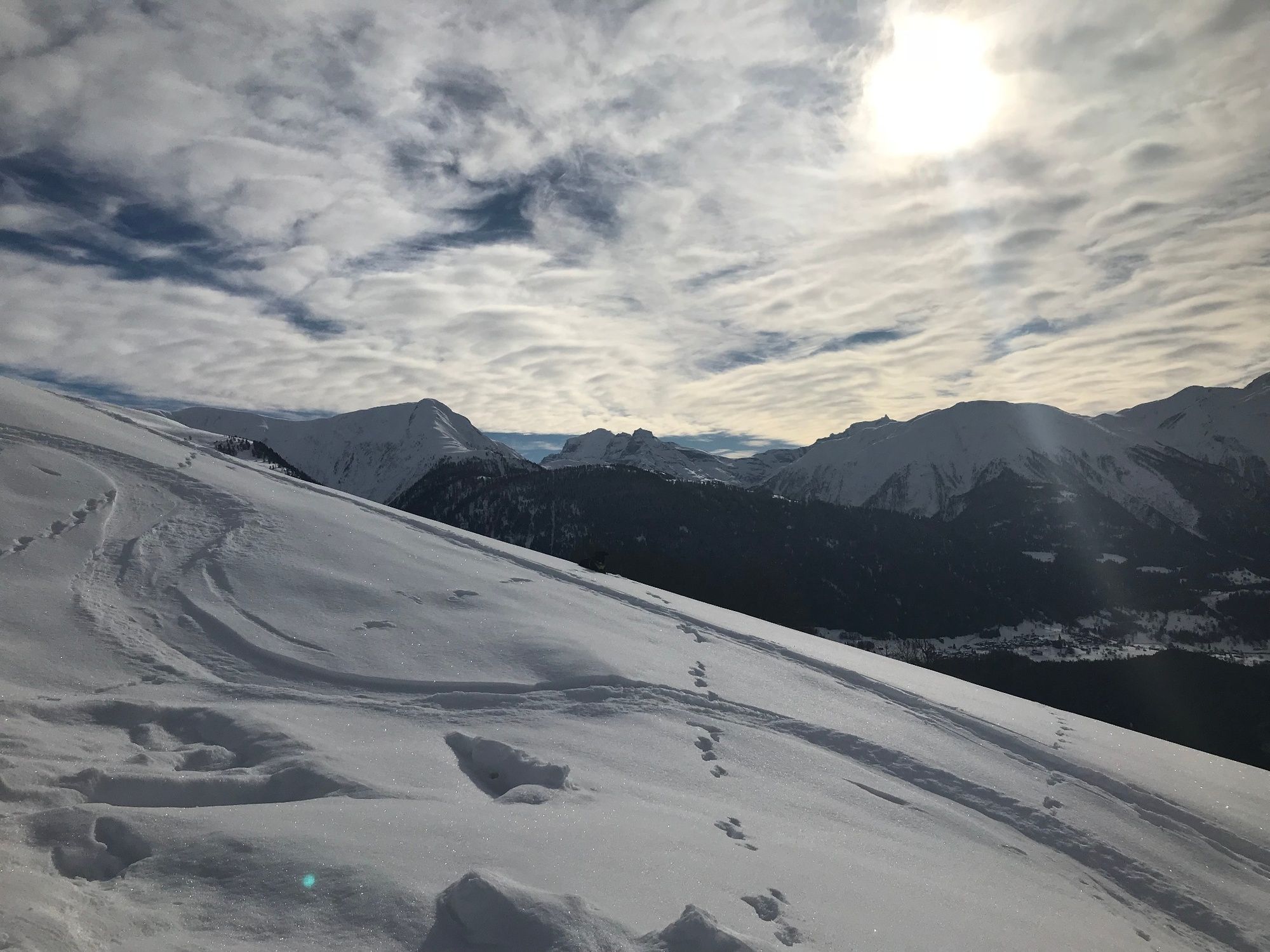
From Gassen, the trail leads gently downhill, first northwest and then southeast to the lowest point of the route: the sleepy hamlet of Ried with its historic chapel. From here, the trail climbs back up to Gassen.
- Directions
-
The hike begins at the top edge of the resort and leads gently down the Fieschertal valley. At the outermost point, the route turns left with a hairpin bend and descends the valley to Ried, where it runs along the upper edge of the hamlet (make a detour to the right here to explore the main alley with the old chapel). A short, steep climb brings you back to the starting point of the hike.
- Highest point
- 1,701 m
- Endpoint
-
Bellwald - Gassen
- Height profile
-
 © outdooractive.com
 - Equipment
-
Sturdy footwear
- Tips
-
Take a few minutes to stroll through the main alley of Ried and marvel at the old chapel.
- Directions
-
From Sion/Sitten: After leaving the motorway in Sierre, stay on the cantonal road until Naters. Then drive through Mörel, Unterdeisch, Lax and Fiesch. After 6 km turn left to Fürgangen. Drive through Fürgangen and follow the road to Bellwald.
From Bern: Take the motorway towards Kandersteg: Exit 19 Spiez/Faulensee. Follow the signs to the Kandersteg car transport. After the car transport, drive to Gampel/Steg. At the roundabout turn right towards Visp/Brig/Naters. Then drive through Naters, Mörel, Unterdeisch, Lax and Fiesch. After 6 km turn left to Fürgangen. Drive through Fürgangen and follow the road to Bellwald.
From Zurich: Take the motorway in the direction of Gotthard. Then take the exit to the Furkapass. You can either cross the Furka Pass (only in the summer months) or take the car train in Realp. You arrive in Oberwald. Continue until you cross the Mühlebach gallery. Then turn right towards Fürgangen. Drive through Fürgangen and follow the road to Bellwald.
- Public transportation
-
From Zurich, Bern, Basel, Geneva or Lausanne with the SBB via Visp to Brig. In Brig, change to the Matterhorn Gotthard Bahn and take it to the Fürgangen-Bellwald stop. There you change to the Fürgangen cable car, which takes you directly to the village centre. From the village centre, a short walk uphill awaits you. Just follow the signs in the direction of the sports field. This will take you to Holzer Sport within 10 minutes.
- Parking
-
Bellwald has two large car parks.
The Basper car park is located at the bottom of the village. This car park is free of charge.
The second car park is near the valley station of the mountain railway. There are two large parking areas here, both of which are chargeable
-

-
AuthorThe tour Bellwald Stollen is used by outdooractive.com provided.


General info
-
Aletsch Arena
176
-
Goms
45
-
Bellwald
20