
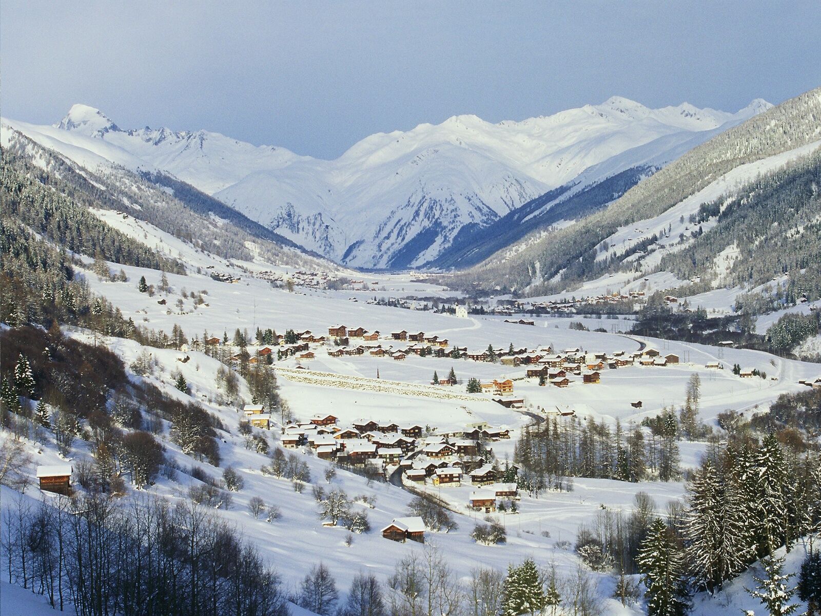
- Brief description
-
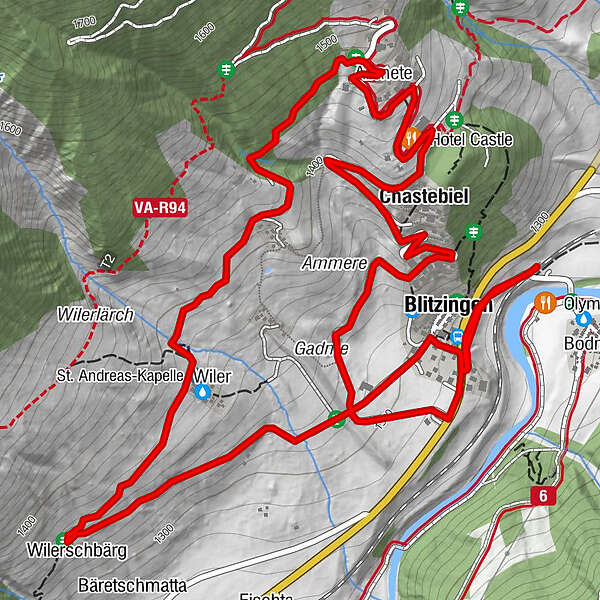
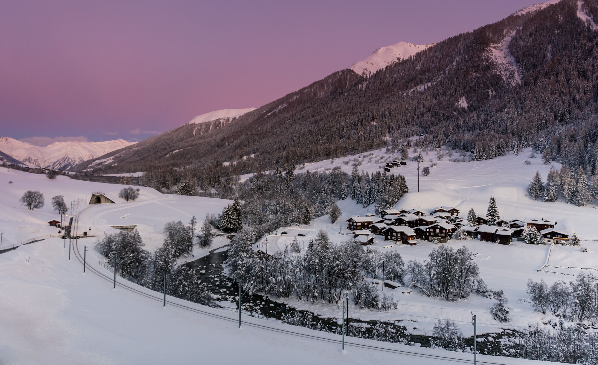
The Chastebiel circular trail leads up to the historic castle hill above Blitzigen. A spectactular panoramic view of Rhone valley awaits you here.
- Difficulty
-
easy
- Rating
-
- Starting point
-
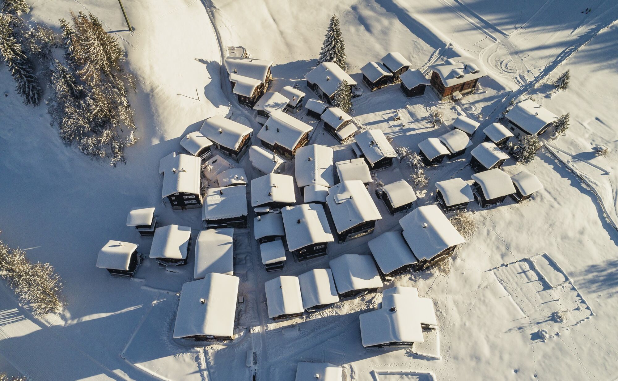
Blitzingen, station
- Route
-
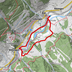
Zum guten Freund0.1 kmBlitzingen (1,290 m)0.2 kmNiederwald (1,251 m)1.3 kmWiler1.7 kmAmmere2.3 kmÄbmete3.0 kmHotel Castle3.4 kmChastebiel3.6 kmGadme4.7 km
- Best season
-
AugSepOctNovDecJanFebMarAprMayJunJul
- Description
-
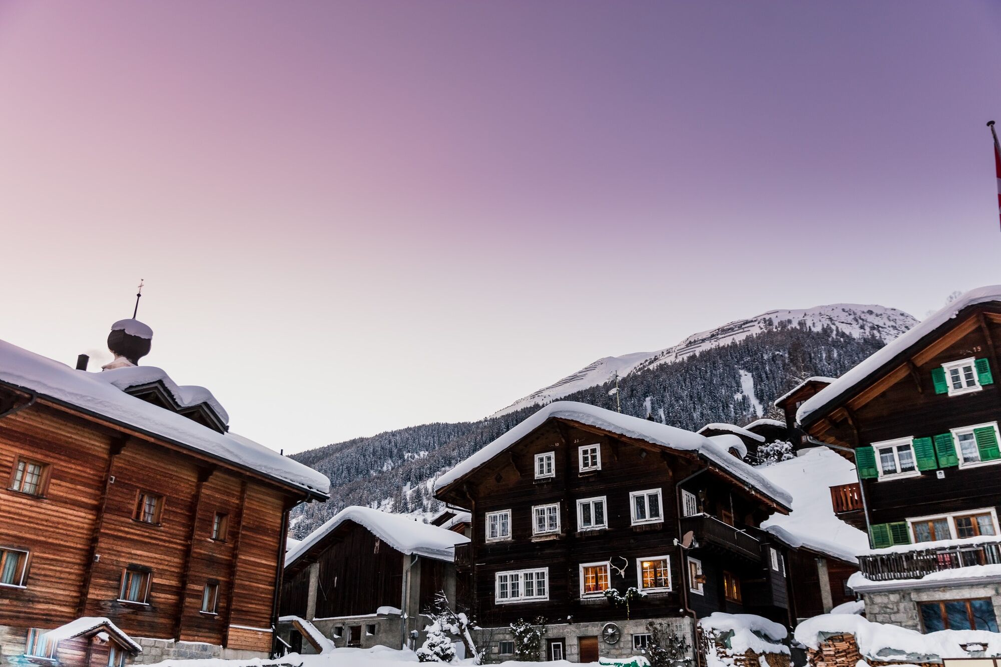
The attractive winter hiking trail leads into the sunny and panoramic area of Chastebiel. The ascent is made from Blitzingen on a gentle gradient past the two dreamy hamlets of Ammeren and Wiler.
The pause on the Chastebiel is worthwhile. From here you have a fantastic view of the entire Goms high valley. On the now wooded hill stands the ruins of the pilgrimage site Maria vom Guten Rate, which was destroyed by an earthquake.
On the low-traffic access road, you return to Blitzingen via several hairpin bends.
- Directions
-
Blitzingen - Wilerfurg - Fura - Loch - Amselschlüecht - Wilerriggi - Wiligerbode - Wiler - Wiligerlöüwena - Gadmebiel - Bonacher - Ammere - Raafloch - Uf der Biela - Flieli - Äbmete - Chaschtebiel - Hangendacher - Helgine - Echstebiel Egguti - Bächi - Schlüecht - Blitzingen
- Highest point
- 1,475 m
- Endpoint
-
Blitzingen, station
- Height profile
-
 © outdooractive.com
 - Equipment
-
We recommend good snowshoes:
Good footwear and sturdy poles
Detailed map or information material with good tour preparation
Weatherproof (waterproof and windproof) warm clothing and headgear
Sunglasses
Good sun protection, even in cloudy weather. UV rays at high altitudes can be very strong, especially in winter.
Provisions for your day in the great outdoors - Safety instructions
-
The use of the winter hiking trails is at your own risk. Obergoms Tourismus AG disclaims all liability and assumes no responsibility for the accuracy and completeness of the information on this website.
Take a map with you or download the complete description of the route with a large-scale map. Use only signposted paths and observe all markings and signs - for your own safety, for the protection of the landscape and in respect for wildlife. Be considerate of other users. Take your rubbish and that of others with you.
Weather conditions in the mountains can change very quickly and without warning. Adequate clothing and provisions (food and drink) are very important. If the weather is unstable, it is better to turn around early. Carry additional sun protection with you. UV rays at high altitudes can be very strong, especially in winter, even when the sky is overcast.
Plan your tour carefully and in detail. Inform yourself in advance about the current conditions (avalanche danger, cross-country ski runs, winter hiking trails, snow trails and road conditions) and weather conditions. The winter sports report provides you with valuable information from the region.
- Tips
-
Take a break at the Hotel Restaurant Castle and enjoy the views of the Goms valley with a coffee or a hot chocolate.
- Additional information
-
Winter sports report at www.obergoms.ch/winter-report
Time table www.sbb.ch
Telephone number of rescue service: 144
Avalanche bulletin and snow situation at www.slf.ch - Directions
-
From Brig follow cantonal road No 19 (Furkastrasse) to Blitzingen. The Goms valley is also easily accessible from direction Zurich / Lucerne via Andermatt – car transport Furka. The Alpine passes Furka, Grimsel and Nufenen are closed in winter.
The timetables for the car transport Furka can be found at www.matterhorngotthardbahn.ch
- Public transportation
- Parking
-
Public parking spaces are available in the vicinity of the railway station or in the village of Blitzingen. Follow the local parking guidance system.


- Author
-
The tour Circular track Chastebiel is used by outdooractive.com provided.


General info
-
Aletsch Arena
185
-
Goms
54
-
Bellwald
29


")
 Fiescheralp zur Riederalp")