- Brief description
-
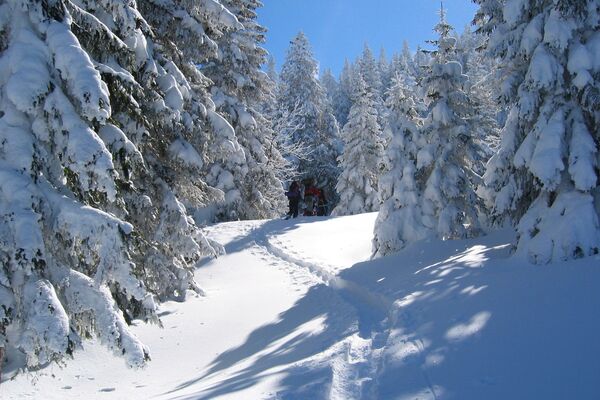
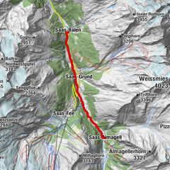
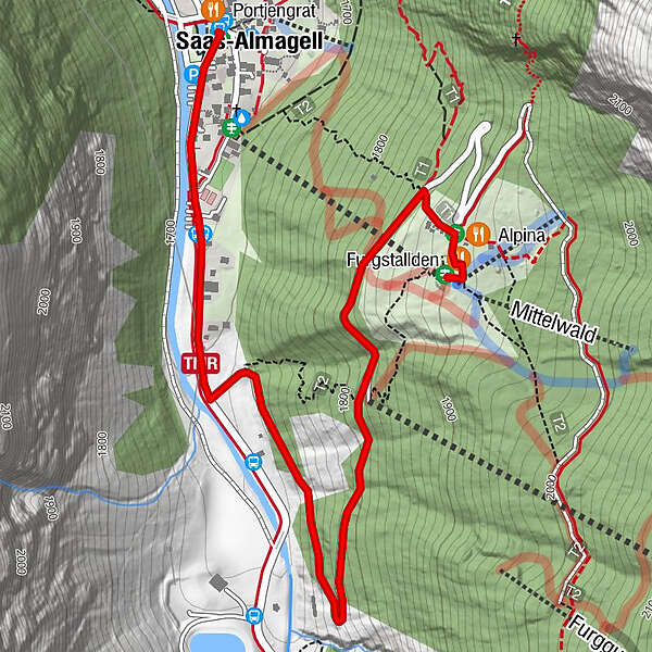
This gentle trail leads through the forest to Furggstalu (Furggstalden) and offers unique views over the far end of the Saas Valley and Saas-Almagell.
- Difficulty
-
easy
- Rating
-
- Starting point
-
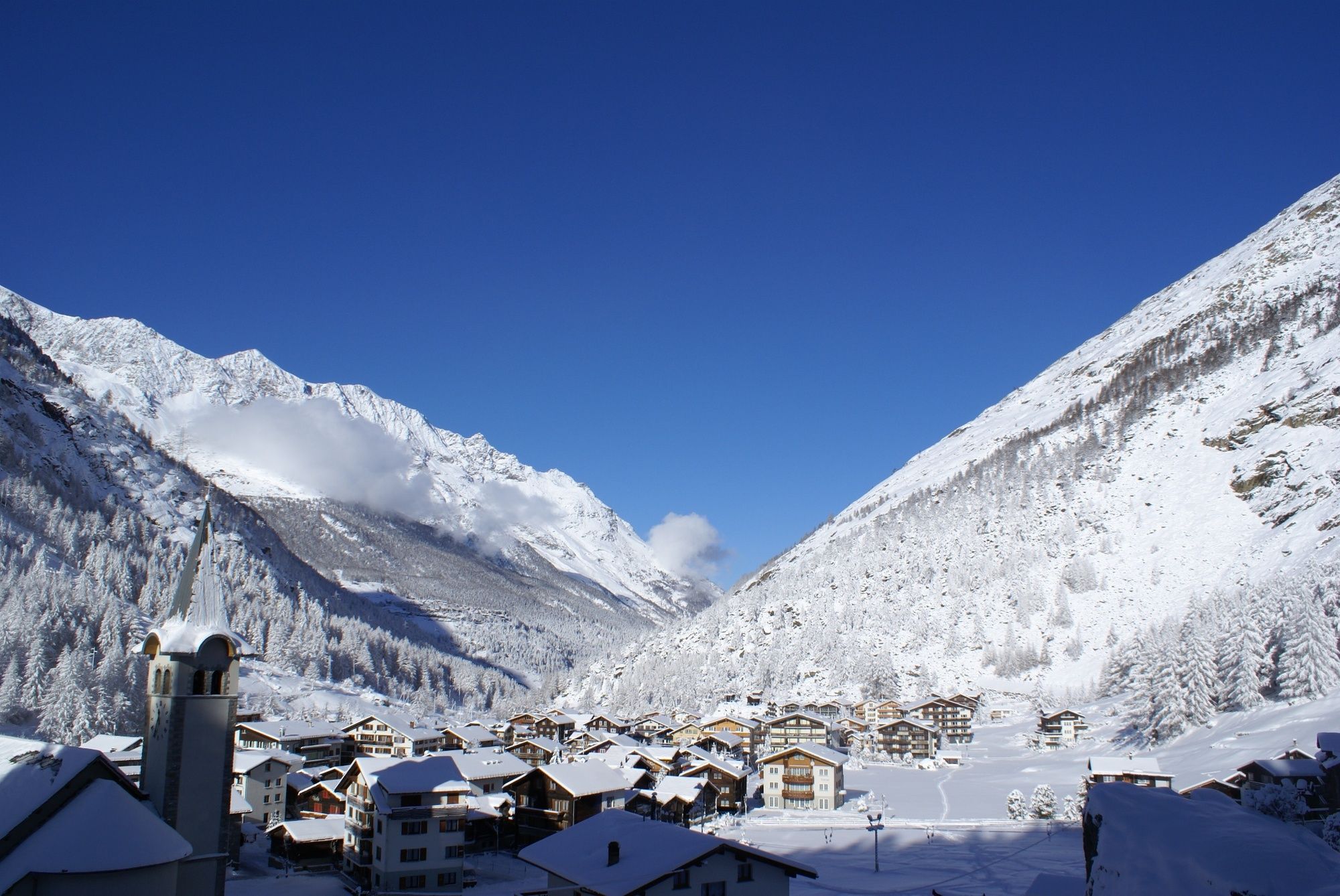
Saas-Almagell, Vllage place
- Route
-
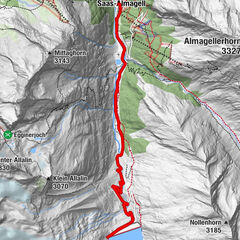
PortjengratSaas-Almagell0.0 kmMattmarkblick0.1 kmHeidbodme1.9 kmAlpina2.5 kmFurggstalden2.6 km
- Best season
-
AugSepOctNovDecJanFebMarAprMayJunJul
- Description
-
From the village square, the trail follows the road towards Mattmark in a southerly direction. After about 800 metres, the trail turns right and up the mountain to the sledging slope. After the first sharp bend, the route continues through the snowy forest, past Heidbodmen valley station on the right, and briefly across the ski slope. After the second sharp bend, the trail heads towards the hamlet of Furggstalu, where the chairlift mountain station is located. Once there, you can head to one of two restaurants - Furggstalden or Alpina - for a break and a bite to eat.
You can then make your way back down the mountain by chairlift. - Directions
-
Saas-Almagell - chair lift station Heidbodme - Furggstalden
- Highest point
- 1,905 m
- Endpoint
-
Furggstalden, Saas-Almagell
- Height profile
-
 © outdooractive.com
 - Equipment
-
Good footwear
Warm, adapted clothing
Headgear
Sun protection
Gloves
Tea/water bottle
Provisions / Catering
Binoculars (optional)
Photo camera
Hiking poles (optional)
Map/ printout of the trail (click on "Print" to download) - Safety instructions
-
Use of the trails and the information on this website is at hikers’ own risk. Local conditions may entail changes to routes.
Bring a map. Download full description of this route including large-scale map by clicking on “Print” icon, top right of this page. Use marked trails only, and observe all signposting – for your own safety, to safeguard grazing animals and to avoid disturbing wildlife. Please be considerate to other trail users, and to the plants and animals. Do not leaveanywaste in nature. Take extra care protecting yourself from the sun at altitude. UV radiation can be exceptionally strong, even in cloudy weather. Plan hike carefully: take into consideration fitness level of each participant, weather forecast and season. Weather conditions can change quickly in the mountains, without warning. Appropriate clothing is therefore essential, along with adequate supplies of food and water. In uncertainweather, turn back in good time. Do not venture onto glaciers without a mountain guide. Take note of the warning signs that point out the constant danger, especially the danger of avalanches. Inform others of planned route, and whenever possible, avoid going alone. Please note that this trail is also used as a sledging slope and crosses the ski slope. Pay attention to the operating times of the Furggstalden chairlift. - Additional information
- Directions
-
Kantonsstrasse to Visp, at the roundabout at the land bridge south towards Saas-Fee & Zermatt. From Raron first roundabout, second exit before Visp south through the Vispertal tunnel. At the ‘Killerhof’ roundabout (after Stalden) second exit towards Saas-Fee. At the crossing in Saas-Grund (after the church), turn left towards Saas-Almagell. Follow the road until Saas-Amagell.
- Public transportation
- Parking
-
Public car park on the right site after tourist office.
- Author
-
The tour Winter Hike Furggstalden is used by outdooractive.com provided.


General info
-
Aletsch Arena
176
-
Saastal
57
-
Saas-Almagell
19