© Champéry Tourisme

- Brief description
-
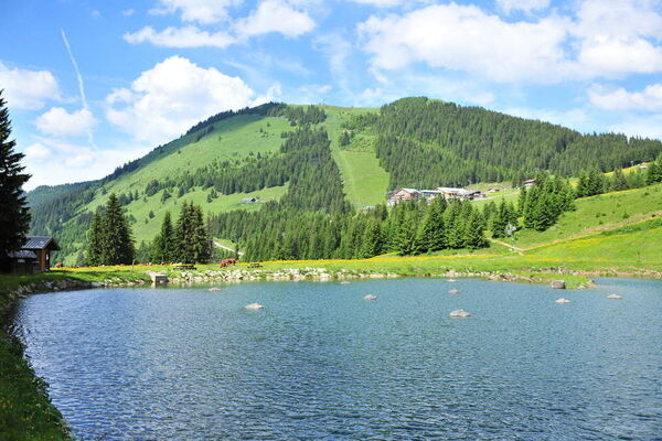
Cool off on the banks of the rushing Vièze River in the shady valley below Champéry.
- Difficulty
-
easy
- Rating
-
- Starting point
-
Champéry, train station AOMC, stop téléphérique
- Route
-
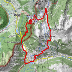
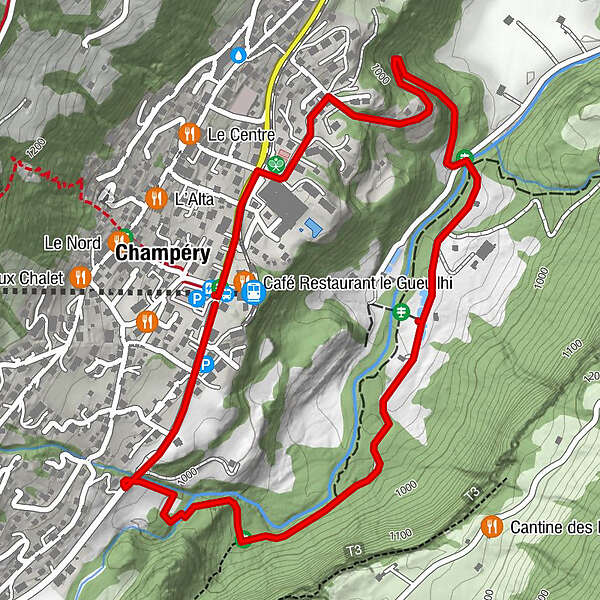
Champéry (1,050 m)3.4 km
- Best season
-
JanFebMarAprMayJunJulAugSepOctNovDec
- Description
-
This lovely, easy walk winds down through the forest just below Champéry, crossing the Vièze river over a charming wooden bridge. Just a stone's throw from the cascading river, tranquil trout pools nestle in the sun-dappled shadows of the forest's edge, sheltering all kinds of aquatic wildlife.
Walk along the road from the cable-car in the direction of Grand Paradis. After 500m, turn right to cross under the road and take the trail that leads to the river. Follow the path through the forest and along the river to the trout pools. From Souscex, cross over the old stone bridge and climb back up to Champéry on the gravel road. - Highest point
- 1,032 m
- Endpoint
-
Champéry, train station AOMC, stop téléphérique
- Height profile
-
 © outdooractive.com
 - Additional information
-
APIDAE tourism data updated on 05/12/2022 by "Région Dents du Midi SA".
Spotted an error? Write to the owner with the following information:
File name: Champéry - Progrès - Souscex - Champéry | Record identifier: 886617 | URL (link) for this Outdooractive page.

-

-
AuthorThe tour Champéry - Progrès - Souscex - Champéry is used by outdooractive.com provided.
GPS Downloads


General info
Refreshment stop
Other tours in the regions
-
Portes du Soleil
974
-
Région Dents du Midi
581
-
Champéry
190