
- Brief description
-
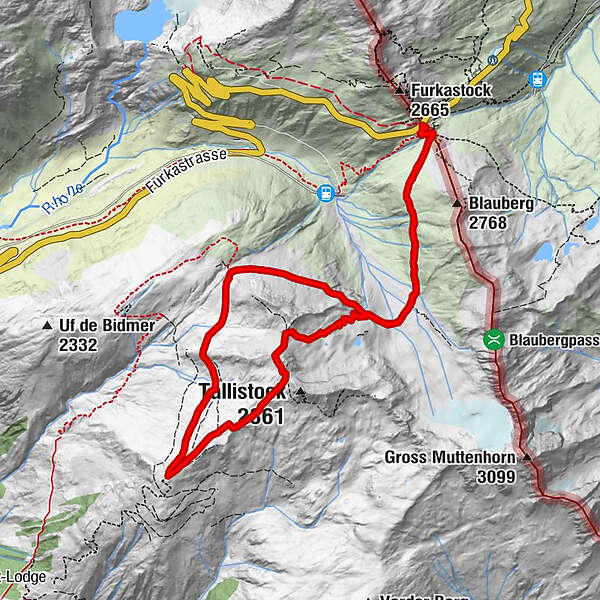
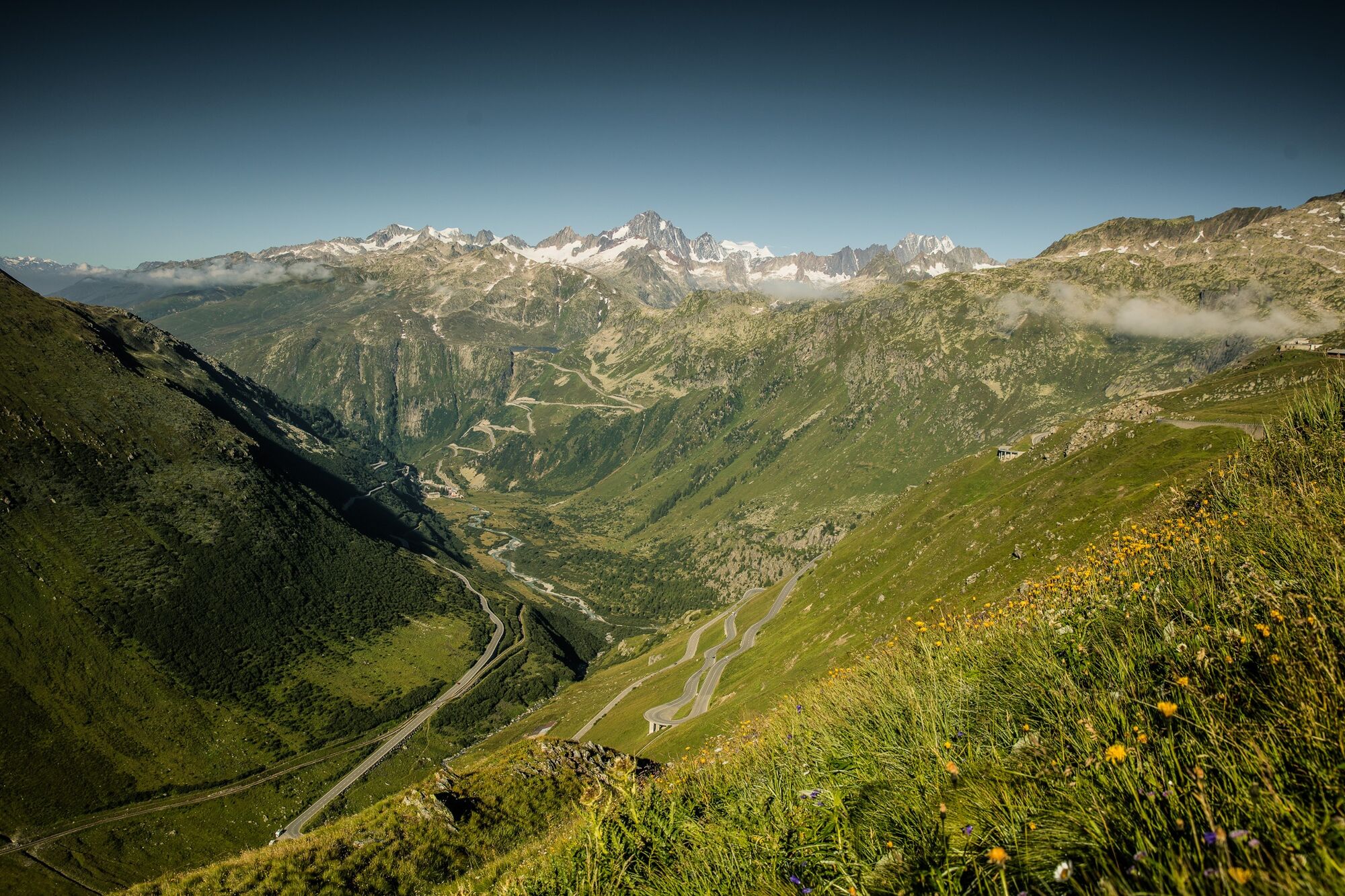
Round tour with a unique view of the Rhone Glacier, Lake Grimsel and the Obergoms
- Difficulty
-
medium
- Rating
-
- Starting point
-
Furkapass, Pass height
- Best season
-
JanFebMarAprMayJunJulAugSepOctNovDec
- Description
-
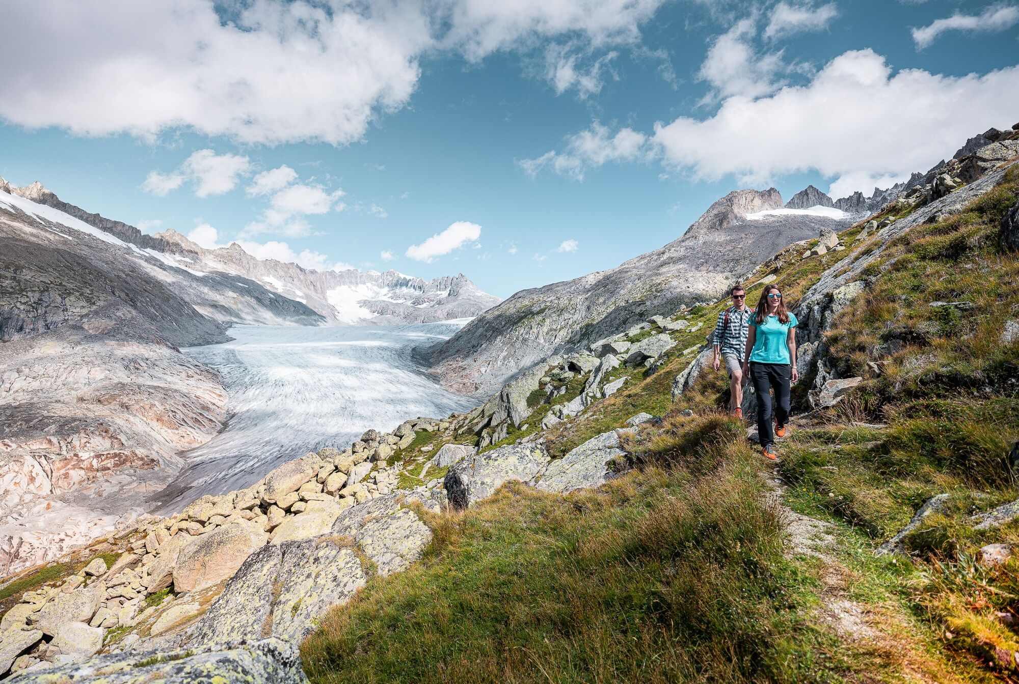
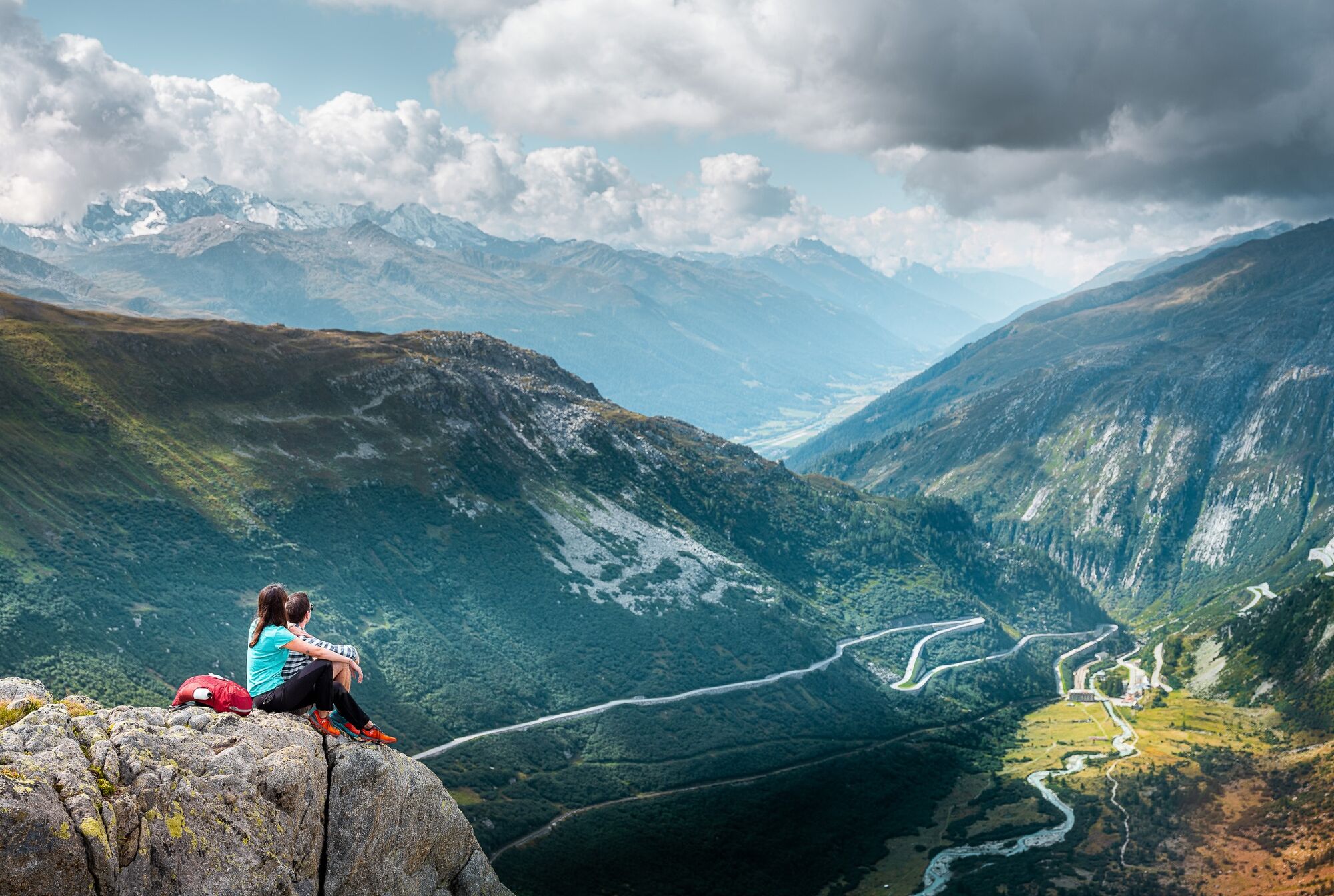
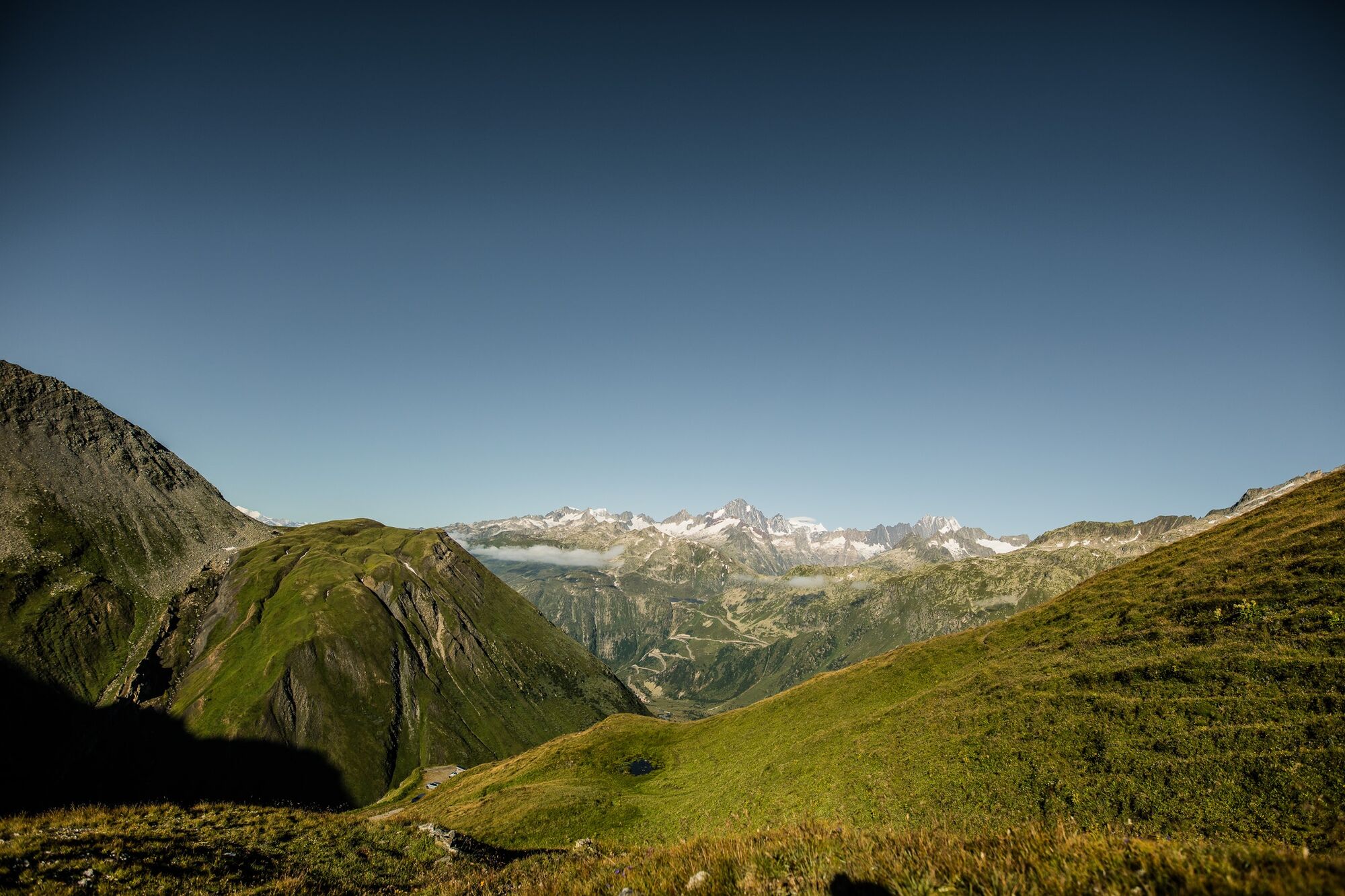
This circular trail begins at the Furka Pass and leads first leisurely, then steeper up to the Tällilücke. It continues uphill for a short distance until the Tällistock. Afterwards the tour leads over the Tälli ridge down to Gale and via Liessland back to the starting point.
IMPORTANT: The bridge Muttbach (military road Furkapass direction Tälligrat) can no longer be set due to climate change (foundations of the bridge are shifting). On site, however, you will find a small diversions signalled with cairns - so crossing the stream is possible.
- Directions
-
We start our tour at the Furka Pass and hike south along the marked path. We cross the many small arms of the Mussbach stream and soon find ourselves at a crossroads where we keep left. A path now leads steeply up to the Tällilücke and further left, then at the highest point of the tour right to the Tälligrat.
At the crossroads in Gale we turn right, after we cross the Lengesbach and circle the Tällilücke now on the northeast side. At the following fork we turn right and reach the crossroads which we already know from the ascent. Then we take the familiar path back to the Furka pass.
- Highest point
- 2,761 m
- Endpoint
-
Furkapass, Pass height
- Height profile
-
 © outdooractive.com
 - Equipment
-
We recommend:
Good footwear and walking sticks
Sun and rain protection and warm clothing
Detailed map or information material with good tour preparation
Provisions for your day in the great outdoors
Pocket pharmacy and mobile phone for emergencies - Safety instructions
-
The use of the hiking trails is at your own risk. Obergoms Tourismus AG disclaims all liability and assumes no responsibility for the accuracy and completeness of the information on this website.
Take a map with you or download the complete description of the route with a large-scale map. Use only signposted paths and observe all markings and signs - for your own safety, for the protection of the landscape and in respect for wildlife. Be considerate of other users. Take your rubbish and that of others with you.
Weather conditions in the mountains can change very quickly and without warning. Adequate clothing and provisions (food and drink) are very important. If the weather is unstable, it is better to turn around early. Carry additional sun protection with you. UV rays at high altitudes can be very strong, even when the sky is overcast.
Plan your tour carefully and in detail. Inform yourself in advance about the current conditions and weather conditions. The summer sports report provides you with valuable information from the region.
- Tips
-
Alternatively you can descend from Gale via Hungerberg directly to Oberwald.
- Additional information
- Directions
- Public transportation
-
The regional trains of the Matterhorn Gotthard Railway take you from Brig to Oberwald in 1h 23 min. The Goms valley is also easily accessible from the Zurich / Lucerne via Andermatt and the Furka base tunnel.
In Oberwald, change to the PostAuto Furkapass-Linie to the stop Furka Passhöhe.
The timetables for all trains and busses can be found at www.sbb.ch.
- Parking
-
Parking at the Furka Pass


- Author
-
The tour Roundtrail Furkapass - Tällistock is used by outdooractive.com provided.