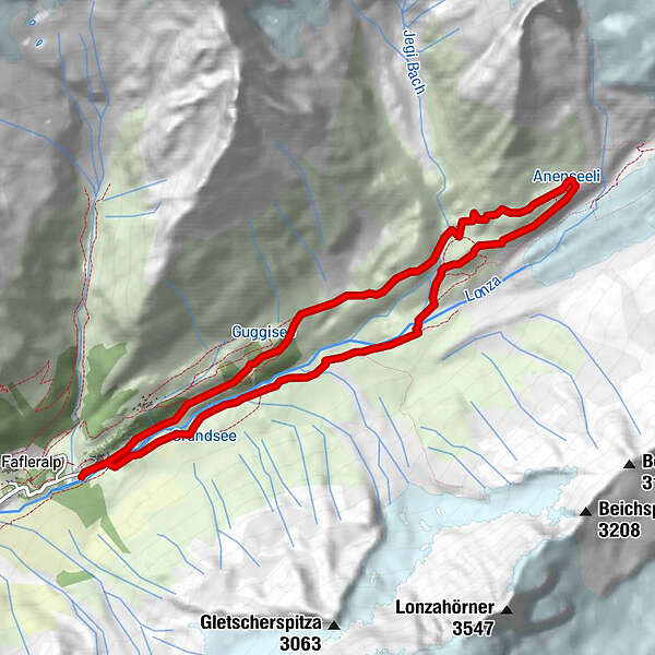
Tour data
10.21km
1,771
- 2,369m
1,184hm
1,184hm
03:30h
- Brief description
-
Wildromantische Wanderung im hintersten Teil des Lötschentals (auch als 2-Tagestour möglich).
- Difficulty
-
medium
- Rating
-
- Starting point
-
Parkplatz Fafleralp
- Route
-
Gletscherstafel0.2 kmPeter Tscherrig Anenhütte4.8 kmGletscherstafel9.9 km
- Best season
-
JanFebMarAprMayJunJulAugSepOctNovDec
- Highest point
- 2,369 m
GPS Downloads


Trail conditions
Asphalt
Gravel
Meadow
Forest
Rock
Exposed
Other tours in the regions
-
Oberwallis
1881
-
Lötschental
1069
-
Blatten
134