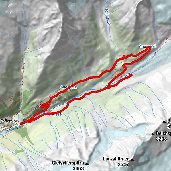
Tour data
12.57km
1,773
- 2,377m
1,290hm
04:00h
- Brief description
-
Ein Themen- und Lehrpfad zu Klima und Gletscherlandschaft.
- Rating
-
- Starting point
-
Parkplatz Fafleralp
- Route
-
Gletscherstafel0.2 kmPeter Tscherrig Anenhütte7.1 kmGuggistafel11.1 kmGletscherstafel12.3 km
- Highest point
- 2,377 m
GPS Downloads


Trail conditions
Asphalt
Gravel
Meadow
Forest
Rock
Exposed
Other tours in the regions
-
Oberwallis
1871
-
Lötschental
1064
-
Blatten
130