
- Brief description
-
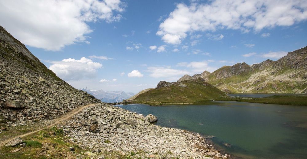
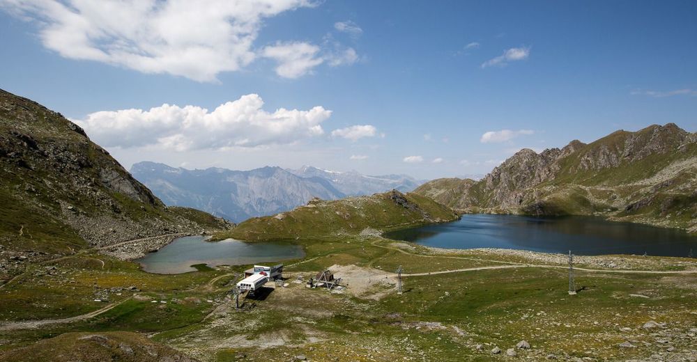
This hike between Savoleyres and Les Ruinettes takes you into the heart of idyllic mountain scenery, where you can discover the Lac des Vaux and its enchanting reflective waters.
- Difficulty
-
medium
- Rating
-
- Starting point
-
Savoleyres
- Route
-
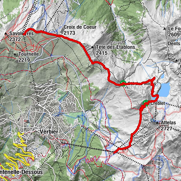
SavoleyresCroix de Coeur (2,173 m)1.1 kmCroix de Coeur1.2 kmLes Ruinettes8.6 kmLe Mouton Noir8.7 km
- Best season
-
JanFebMarAprMayJunJulAugSepOctNovDec
- Description
-
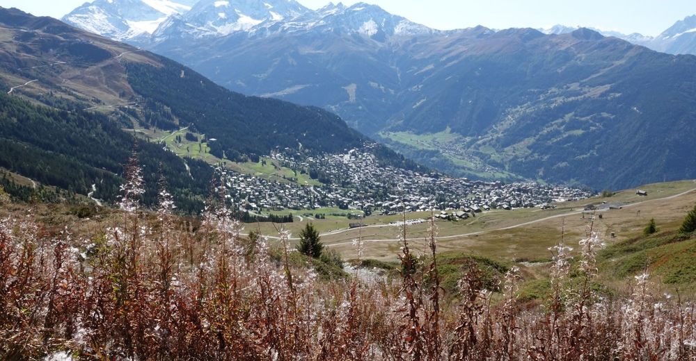
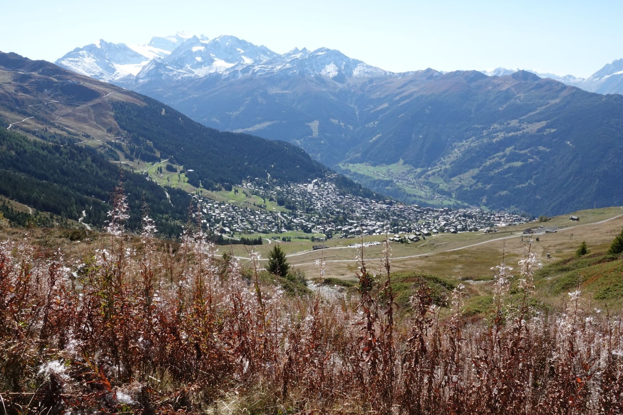
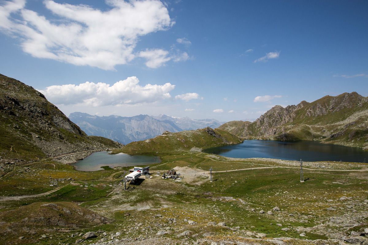
Dazzling views await you throughout this hike, which overlooks the famous Verbier resort and offers a splendid panorama of the Rhône Valley, Val de Bagnes and the Combins and Mont Blanc massifs. Located at 2,343 metres in altitude, Savoleyres is the starting point for your hike. Stroll towards Croix-de-Cœur and walk along the mountain ridge until Col des Mines, before admiring the valley of the Lac des Vaux, whose waters are known for their clear reflections of the surrounding summits. This is the ideal spot to stop for a picnic before tackling the Col du Creblet ascent that winds around Mont Rogneux. After a long descent you’ll reach Les Ruinettes, where a cable car will take you back to Verbier.
- Directions
-
A cable car will take you from the resort of Verbier to Savoleyres station, where your hike will begin. Walk along the path heading eastwards along the ridge and then walk down towards the Col de la Croix-de-Cœur before climbing up towards Tête des Établons. The path winds around Mont Rogneux, offering spectacular views of Verbier and Val de Bagnes below. Next, climb towards the Col des Mines, where the path passes along the northern side of the crest, and then walk uphill to discover a group of three sparkling alpine lakes – the Lac des Vaux and two small adjacent lakes – a true high point of the hike. Your route continues by climbing the Col du Creblet, the last ascent before a long descent towards Les Ruinettes, where a cable car will take you back to the Verbier resort.
- Highest point
- 2,629 m
- Endpoint
-
Les Ruinettes
- Height profile
-
 © outdooractive.com
 - Equipment
-
We recommend:
good footwear clothing suitable for the weather: always carry a waterproof jacket hat or cap sunscreen bottle for water picnic camera binoculars (optional) hiking poles (optional) printout of this hike (click “Print” icon, to download)For certain walks:
Swimwear - Safety instructions
-
Use of the trails and the information on this website is at hikers’ own risk. Local conditions may entail changes to routes. Valais/Wallis Promotion accepts no liability for the accuracy and completeness of information on this website.
For all hikes:
Bring a map. Download full description of this route including large-scale map by clicking on “Print” icon, top right of this page. Use marked trails only, and observe all signposting – for your own safety, to safeguard grazing animals and to avoid disturbing wildlife. Close gates after passing through. Please be considerate to other trail users, and to the plants and animals. Do not leave any waste in nature.For mountain hikes:
Take extra care protecting yourself from the sun at altitude. UV radiation can be exceptionally strong, even in cloudy weather. Plan hike carefully: take into consideration fitness level of each participant, weather forecast and season. Weather conditions can change quickly in the mountains, without warning. Appropriate clothing is therefore essential, along with adequate supplies of food and water. In uncertain weather, turn back in good time.For high-altitude hikes:
Inform others of the route you plan to take. Whenever possible, avoid going alone. Do not venture onto glaciers without a mountain guide. Take note of the warning signs that point out the constant danger in river beds and along watercourses below dams and reservoirs: water levels may rise rapidly without warning. - Tips
-
Check out the impressive aerobatic displays on the ridge near Croix-de-Cœur, a very popular spot with paragliders and gliders.
- Additional information
- Directions
-
Take the A9/E62 to Martigny. Follow signs for Grand-Saint-Bernard until Sembrancher, and then turn off towards Verbier.
- Public transportation
-
If travelling by train, take the Simplon Railway to Martigny and then take the “RegionAlps” train to Le Châble. To get to Verbier, you have the choice of taking the PostBus or one of the ski lifts. From Verbier, you can reach Savoleyres by cable car.
- Parking
-
Le Châble boasts a large car park with 755 spaces right next to the ski lifts, while five different car parks give visitors plenty of parking opportunities in the resort of Verbier.

- Author
-
The tour Lac des Vaux is used by outdooractive.com provided.


General info
-
Thyon les Collons
1426
-
Verbier
334
-
La Tzoumaz - Mayens de Riddes
65