


- Brief description
-
Discover Isérables, its history and its architecture as this route takes you through fields, forests and rocks linked by gates and footbridges.
- Difficulty
-
difficult
- Rating
-
- Starting point
-
Riddes
- Route
-
Riddes (491 m)0.4 kmEglise d'Isérables5.6 kmEglise d'Isérables9.3 kmIsérables9.4 km
- Best season
-
JanFebMarAprMayJunJulAugSepOctNovDec
- Description
-
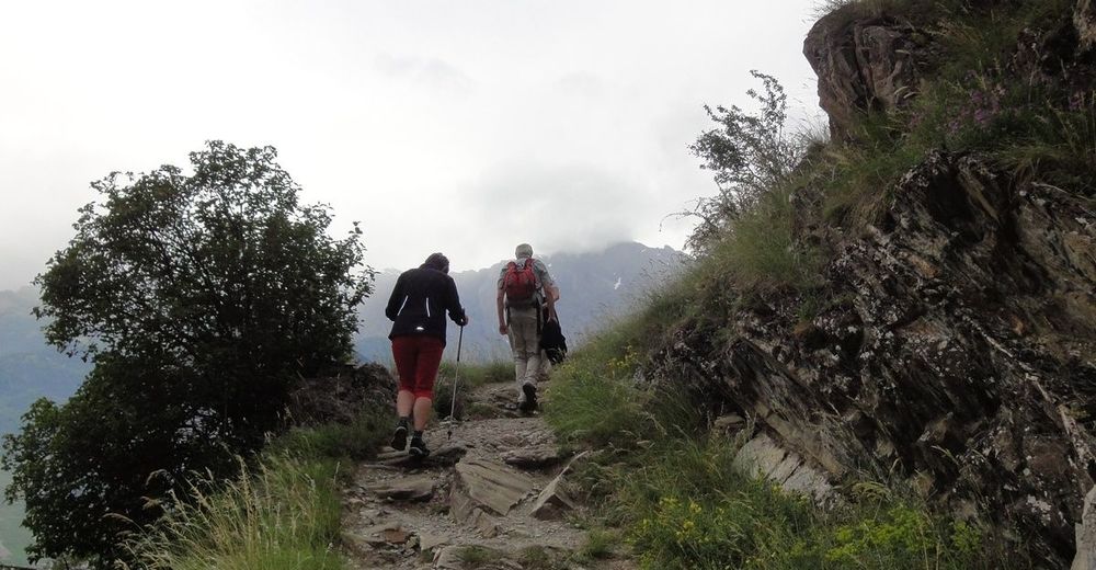
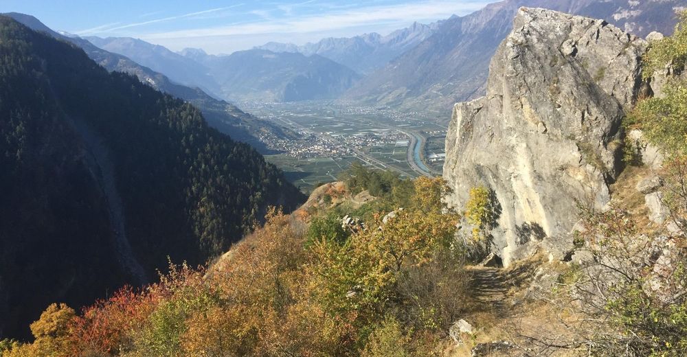
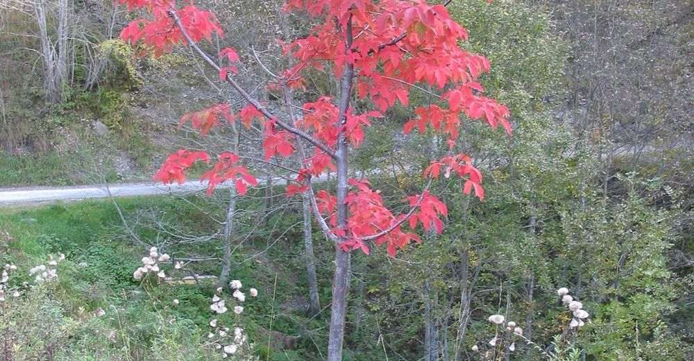
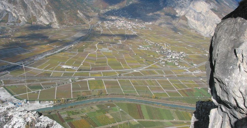
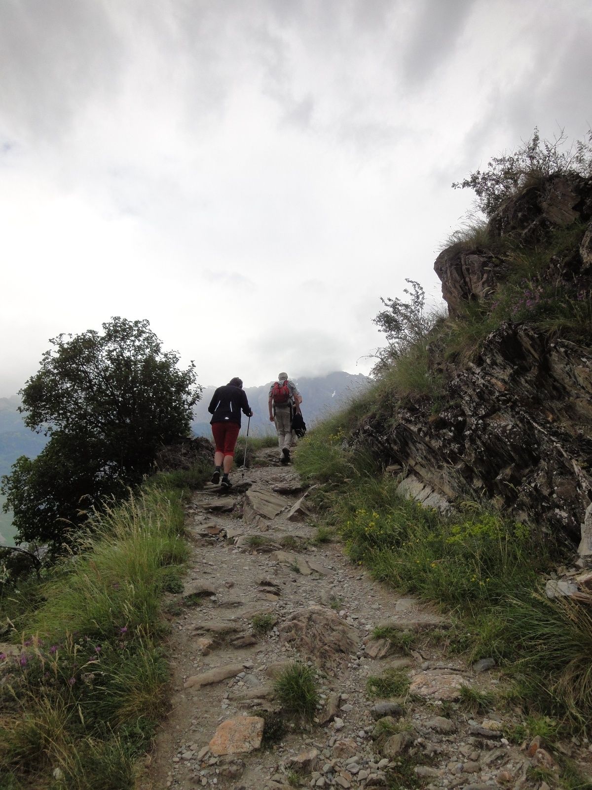
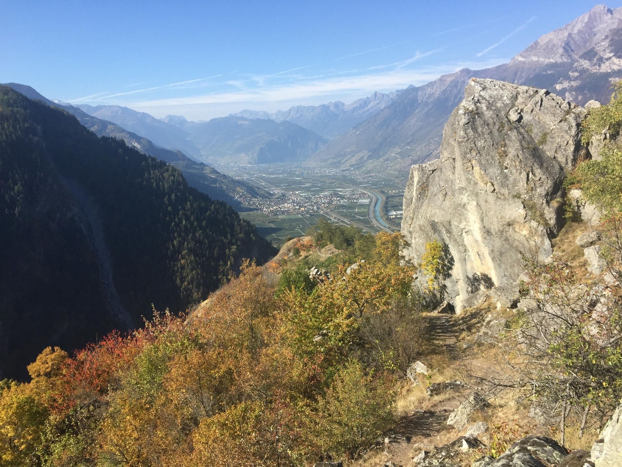
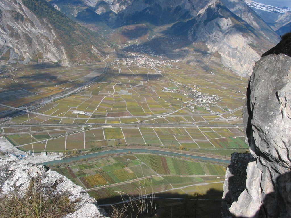
Crossing through meadows, bordering apricot trees and skirting the edge of forests, the Voie des Érables trail boasts commanding views of the Rhône Valley. The twelve information boards dotted along the route from Isérables add an extra dimension to the hike, offering interesting insights into the history and nature of these locations. Discover traditional raccard granaries, drystone walls and even grain-growing terraces along the trail. With its hillside path, the Voie des Érables trail is a very easy and charming walk, not least thanks to stunning colours of the maple trees that give the trail its name.
- Directions
-
Starting from Riddes, take the hiking trail departing from Pied du Mont and scale the numerous hairpin bends up to the village of Isérables. Once you’ve reached the village centre, follow the information boards for the Voie des Érables trail, which is made up of two loops which can be combined. Shortly before you reach the museum, make your way downhill towards the magnificent raccards and walk a short stretch along the tarmacked road, which gradually transforms into a path bordered by apricot trees and offering magnificent views of the Rhône Valley and the Muveran mountains. The path then climbs through the maple tree forest to a playground and then the top of the village, before descending again to the centre. Walk along the ice rink and continue your ascent in the shade of the trees before following a gravel path along the stream. Next, turn off to the left onto a small, partially shaded path, which will take you to a main road leading to the village centre.
- Highest point
- 1,191 m
- Endpoint
-
Isérables
- Height profile
-
 © outdooractive.com
 - Equipment
-
We recommend:
good footwear clothing suitable for the weather: always carry a waterproof jacket hat or cap sunscreen bottle for water picnic camera binoculars (optional) hiking poles (optional) printout of this hike (click «Print» icon, to download)For certain walks:
Swimwear - Safety instructions
-
Use of the trails and the information on this website is at hikers’ own risk. Local conditions may entail changes to routes. Valais/Wallis Promotion accepts no liability for the accuracy and completeness of information on this website.
For all hikes:
Bring a map. Download full description of this route including large-scale map by clicking on «Print» icon, top right of this page. Use marked trails only, and observe all signposting – for your own safety, to safeguard grazing animals and to avoid disturbing wildlife. Close gates after passing through. Please be considerate to other trail users, and to the plants and animals. Do not leave any waste in nature.For mountain hikes:
Take extra care protecting yourself from the sun at altitude. UV radiation can be exceptionally strong, even in cloudy weather. Plan hike carefully: take into consideration fitness level of each participant, weather forecast and season. Weather conditions can change quickly in the mountains, without warning. Appropriate clothing is therefore essential, along with adequate supplies of food and water. In uncertain weather, turn back in good time.For high-altitude hikes:
Inform others of the route you plan to take. Whenever possible, avoid going alone. Do not venture onto glaciers without a mountain guide. Take note of the warning signs that point out the constant danger in river beds and along watercourses below dams and reservoirs: water levels may rise rapidly without warning. - Tips
-
Visit the museum of Isérables, which houses historical documents, objects and tools centred around adapting to life on the slopes.
- Additional information
- Directions
-
On the A9 motorway, take exit 24 Riddes/Saillon/Chamoson/Leytron, then take the cantonal road towards the village of Riddes.
- Public transportation
-
From Geneva or Brig, take the train to Riddes, then walk in the direction of the cable car, located a few hundred meters from the station.
- Parking
-
Leave your car at the cable car park in Riddes.

- Author
-
The tour La Voie des Erables is used by outdooractive.com provided.


General info
-
Thyon les Collons
1440
-
Verbier
341
-
La Tzoumaz - Mayens de Riddes
65


