
- Brief description
-
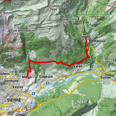
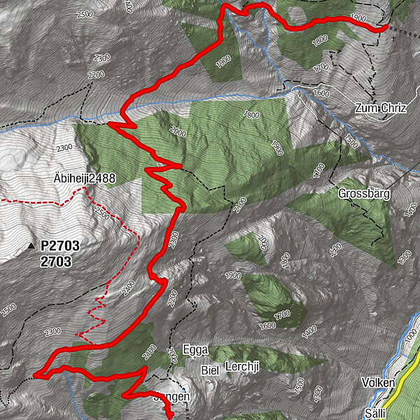
This hike starts above Embd in Schalb and winds its way along the heights of the Mattertal until Jungen, finishing at the Jungersee lake next to the new restaurant.
- Difficulty
-
medium
- Rating
-
- Starting point
-
Schalb
- Route
-
Jungen6.8 km
- Best season
-
JanFebMarAprMayJunJulAugSepOctNovDec
- Description
-
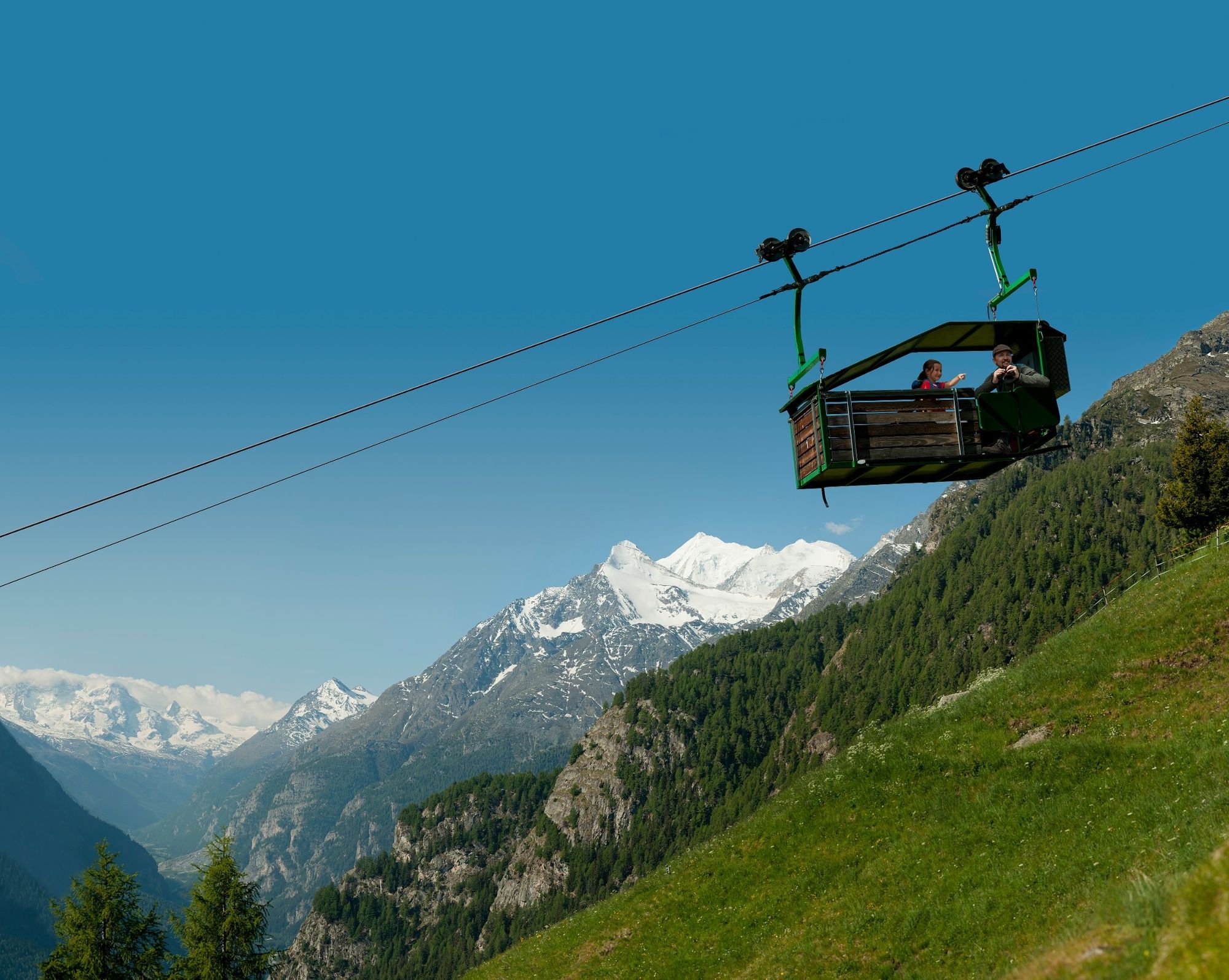
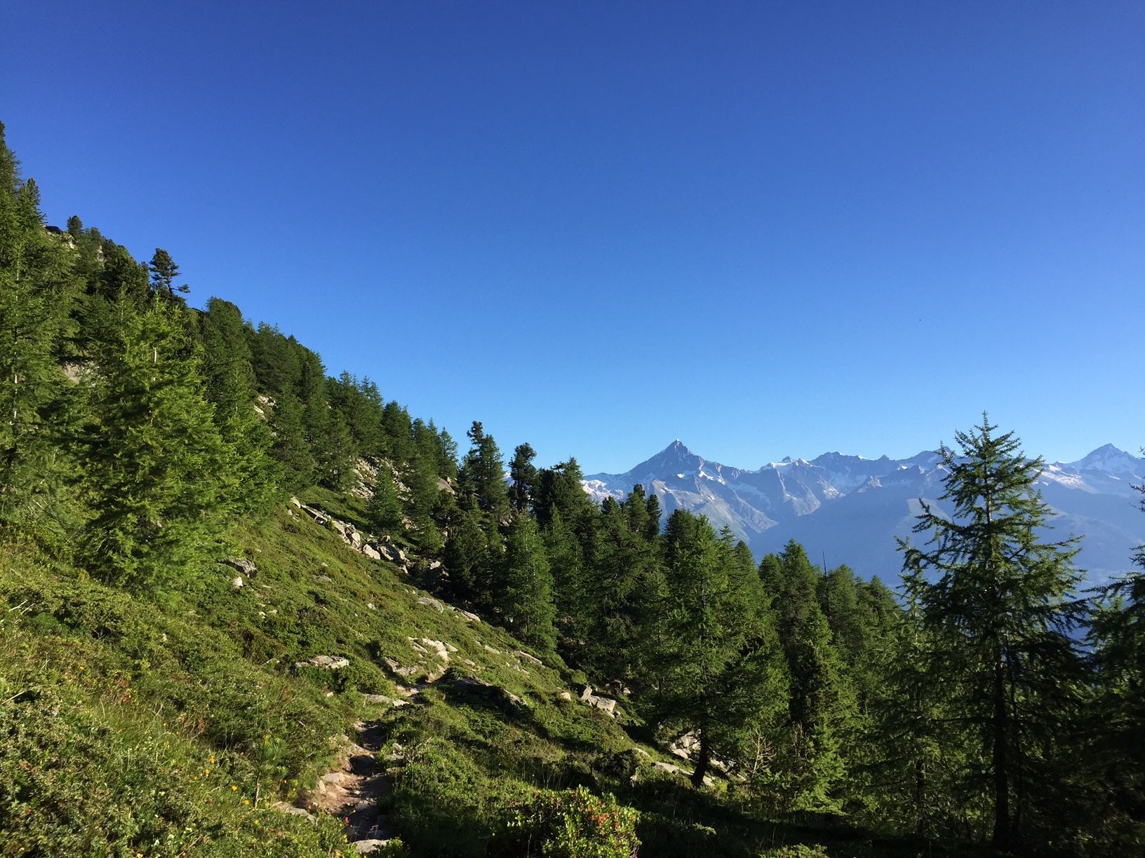
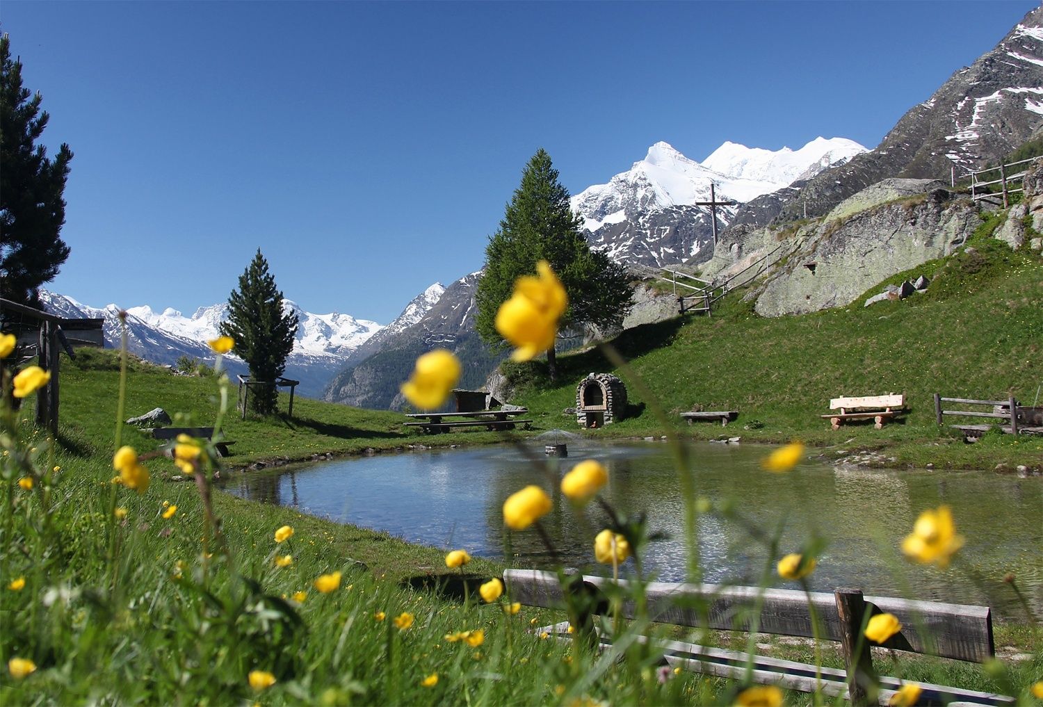
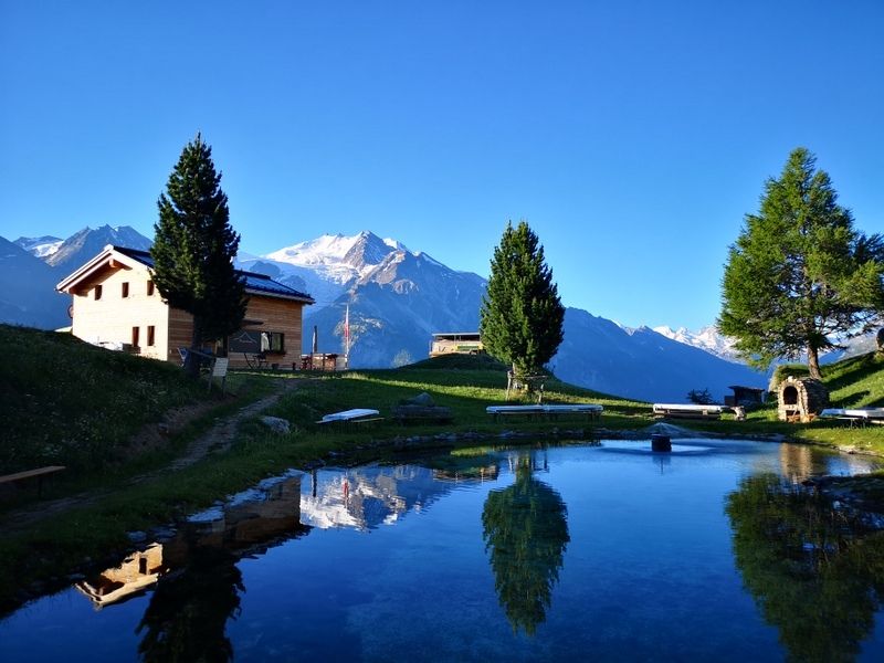
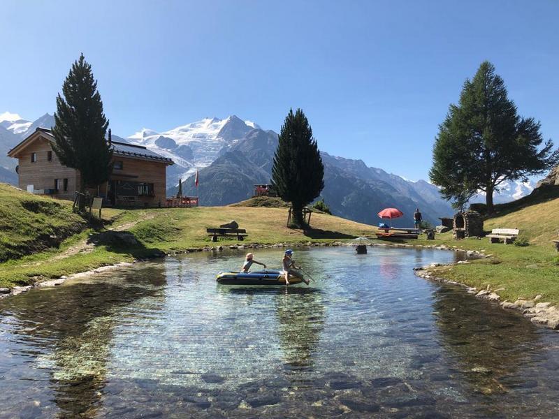
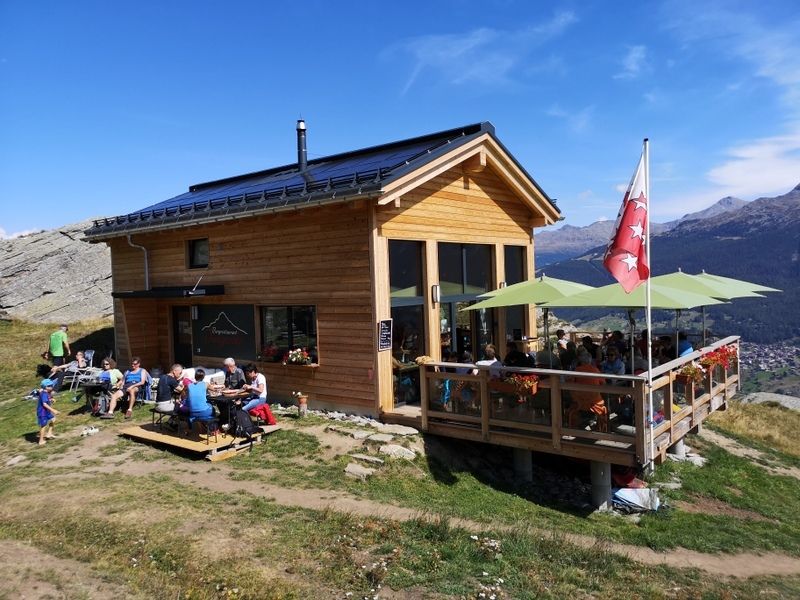
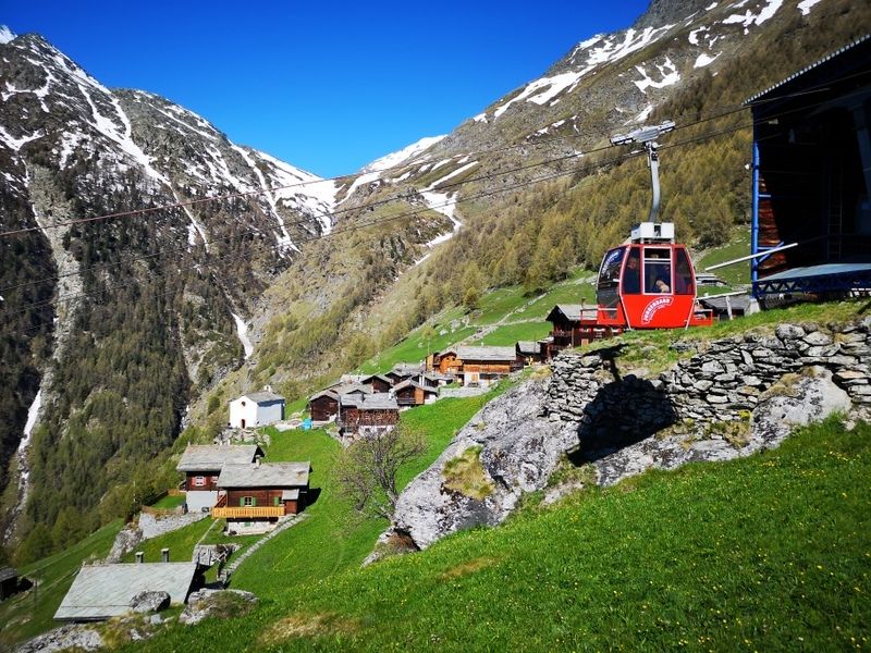
Enjoy splendid views of the surrounding landscapes throughout the entire hike. The route starts high up in the air, in the form of two successive cable car ascents. On your way up, time will stand still as you find yourself being truly bowled over by the views of the Mattertal. Once you arrive at the small mountain lake in Jungen, stop off for refreshments on the terrace of the new restaurant, which boasts uninterrupted views of the valley towards Zermatt.
- Directions
-
This route is very well marked thanks to signs dotted along the path. The hike starts with an initial ascent by cable car from Kalpetran to Embd, followed by a second cable car, one-of-a-kind as it is partially open-topped, linking Embd to Schalb. When you reach the top, cross the Embdbach and then follow the path towards Jungen and its completely renovated restaurant. To finish off your hike, take the cable car down into the valley to the village of St. Niklaus, where you can marvel at Switzerland’s largest St Nicholas every winter. Lastly, take the Matterhorn Gotthard Bahn to return to your starting point.
- Highest point
- 2,354 m
- Endpoint
-
Jungu
- Height profile
-
 © outdooractive.com
 - Equipment
-
We recommend:
good footwear clothing suitable for the weather: always carry a waterproof jacket hat or cap sunscreen bottle for water picnic camera binoculars (optional) hiking poles (optional) printout of this hike (click “Print” icon, to download)For certain walks:
Swimwear - Safety instructions
-
Use of the trails and the information on this website is at hikers’ own risk. Local conditions may entail changes to routes. Valais/Wallis Promotion accepts no liability for the accuracy and completeness of information on this website.
For all hikes:
Bring a map. Download full description of this route including large-scale map by clicking on “Print” icon, top right of this page. Use marked trails only, and observe all signposting – for your own safety, to safeguard grazing animals and to avoid disturbing wildlife. Close gates after passing through. Please be considerate to other trail users, and to the plants and animals. Do not leave any waste in nature.For mountain hikes:
Take extra care protecting yourself from the sun at altitude. UV radiation can be exceptionally strong, even in cloudy weather. Plan hike carefully: take into consideration fitness level of each participant, weather forecast and season. Weather conditions can change quickly in the mountains, without warning. Appropriate clothing is therefore essential, along with adequate supplies of food and water. In uncertain weather, turn back in good time.For high-altitude hikes:
Inform others of the route you plan to take. Whenever possible, avoid going alone. Do not venture onto glaciers without a mountain guide. Take note of the warning signs that point out the constant danger in river beds and along watercourses below dams and reservoirs: water levels may rise rapidly without warning. - Tips
-
To finish off your hike, visit Jungen’s new restaurant, where delicious dishes and magnificent views of the valley of Zermatt are on offer.
- Directions
-
From Visp, follow signs for Zermatt. After the Stägjitschugge tunnel, turn right towards Kalpetran, then follow the cantonal road to the carpark near the sports field in Kalpetran, where you ride the cable car to Embd, and then a gondola up to Schalb. As the walk ends in Jungen, it is best to drive to Kalpetran and park there, and after the walk return to Kalpetran by public transport.
- Public transportation
-
Regular train services from throughout Switzerland serve Visp; here, change onto a train of the Matterhorn Gotthard Bahn railway to continue as far as Kalpetran. A conventional cable car then takes you up to Embd, where a second, semi-open cable car offers an atmospheric ride up to Schalb. At the end of the walk, ride another cable car from Jungen down to St. Niklaus. From here, the Matterhorn Gotthard Bahn railway offers regular services to Visp and Brig, with onward connections throughout Switzerland.
- Parking
-
Free parking in Kalpetran.
- Author
-
The tour Höhenweg Schalb-Jungu is used by outdooractive.com provided.


General info
-
Oberwallis
1880
-
Moosalpregion
941
-
Embd
140