


- Brief description
-
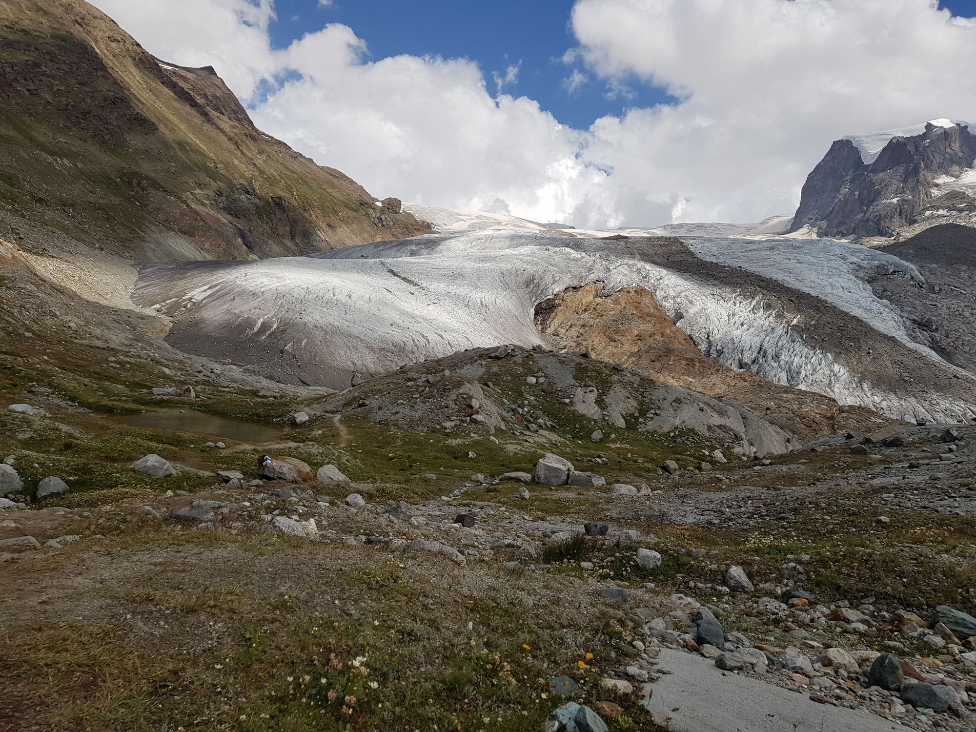
Glacier trekking to the Monte Rosa hut is a unique experience. Instead of a standard hiking trail, the route leads you over glaciers and moraines.
- Difficulty
-
difficult
- Rating
-
- Starting point
-
Rotenboden (2,815 m)
- Route
-
Rotenboden (2,819 m)Monte Rosa Hütte (2,883 m)8.0 km
- Best season
-
JanFebMarAprMayJunJulAugSepOctNovDec
- Description
-
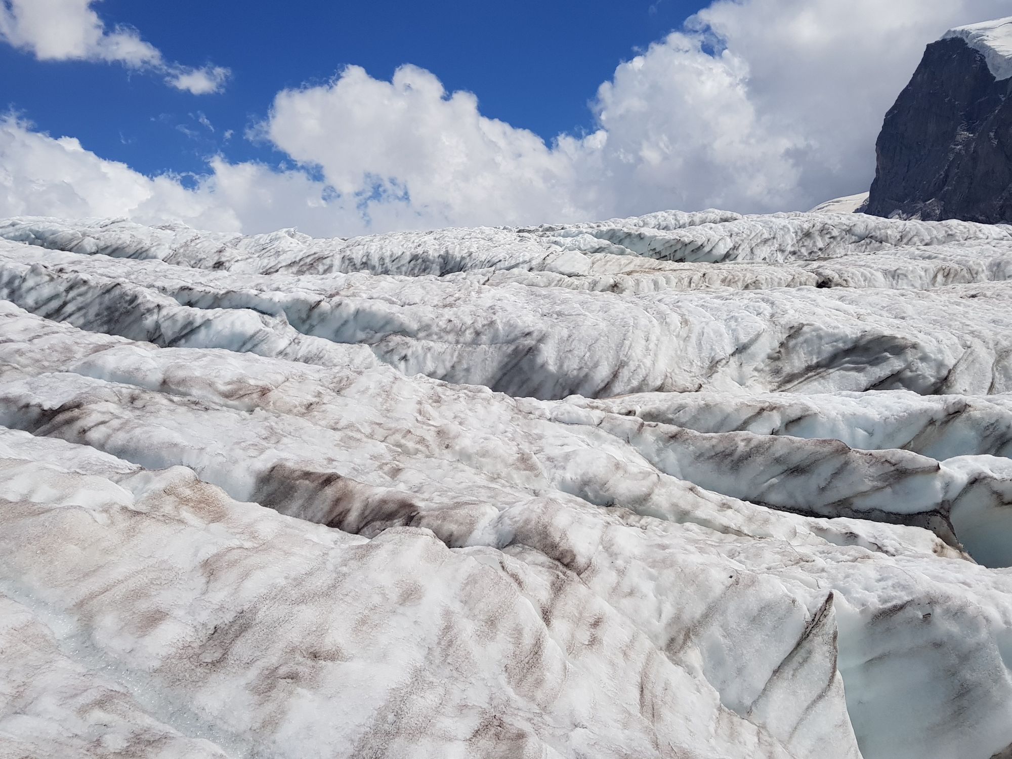
When you head off glacier trekking armed with your crampons, you enter a different world. A cool wind blows continually and it cracks, crashes and rushes inside the glacier; rivers split the glacier in a constant process.
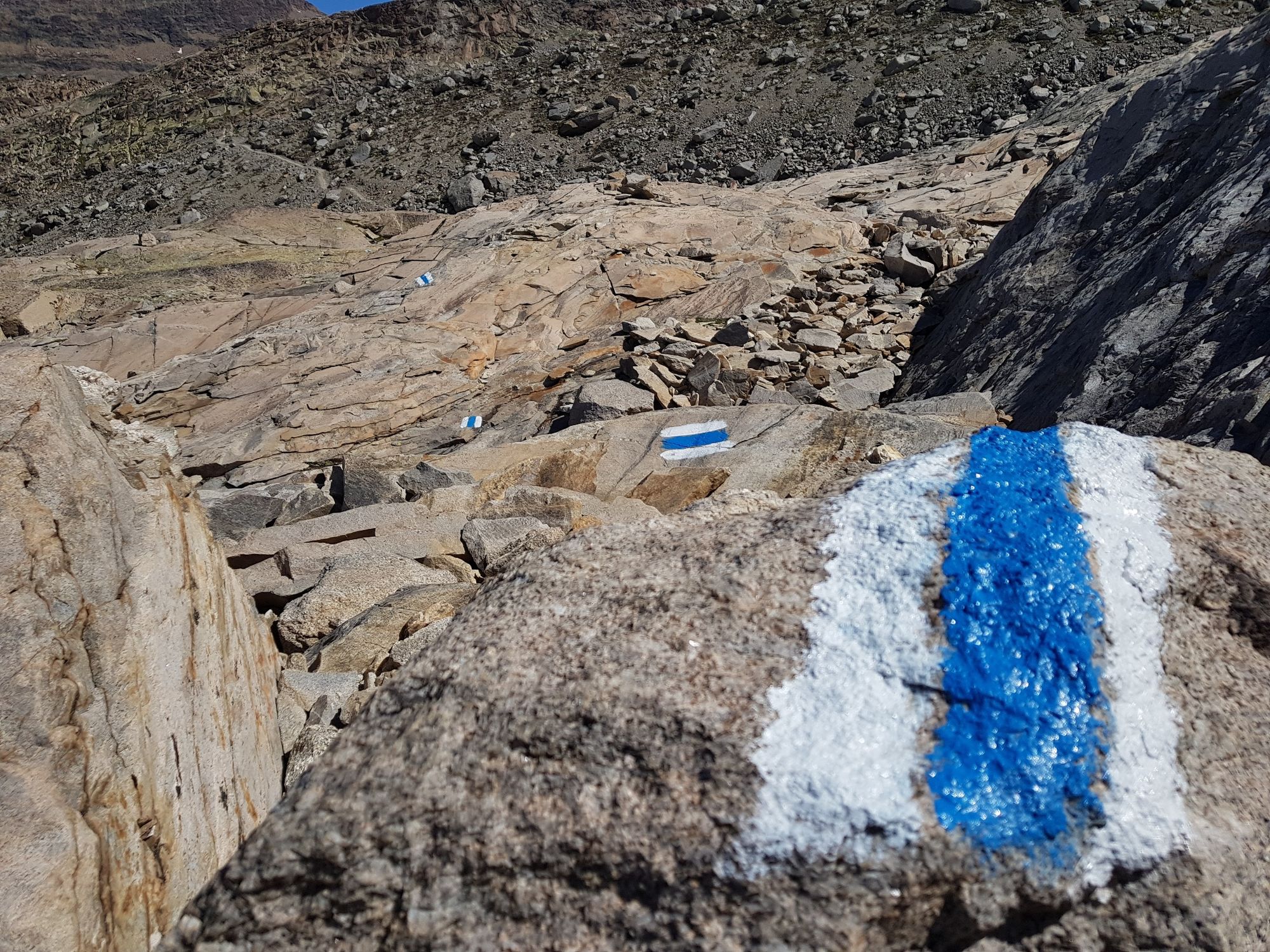
The trekking tour starts at Rotenboden and leads along the extended lateral moraine on an easily accessible hiking trail. At the next signpost, the path leads straight ahead to the Gorner Glacier. There is a slight ascent on the glacier, making crampons essential. The path is marked with blue and white signposts. After the glacier, the Panorama Trail continues over three moraines to the Monte Rosa hut.
The Gorner Glacier is the second-longest in the Alps, after the Aletsch Glacier. This steadily flowing sea of ice has been melting at a phenomenal pace for years. The melting process is resulting in great changes on and in the glacier. Until just a few years ago, hikers could walk comfortably across the glacier to the Monte Rosa hut with little risk. Today, conditions have become unstabler, and so hikers are recommended to undertake the trek with a mountain guide.
Bookable trips in summer with mountain guide (bookable through the office of Zermatters) Crampons required The trail is classified as an alpine hiking T4 trail on the SAC scale An overnight stay at the Monta Rosa hut is only possible with advance reservation - Directions
-
Rotenboden - Monte Rosa hut (route across glacier marked with flags)
(Hiking time for the walk back: approx. 3.5 h)
This hike is marked on the signposts as “Gletschertrekking Monte Rosa Hütte”.
Note: The old trail will continue to be maintained, so hikers can enjoy a circular route.
- Highest point
- 2,899 m
- Endpoint
-
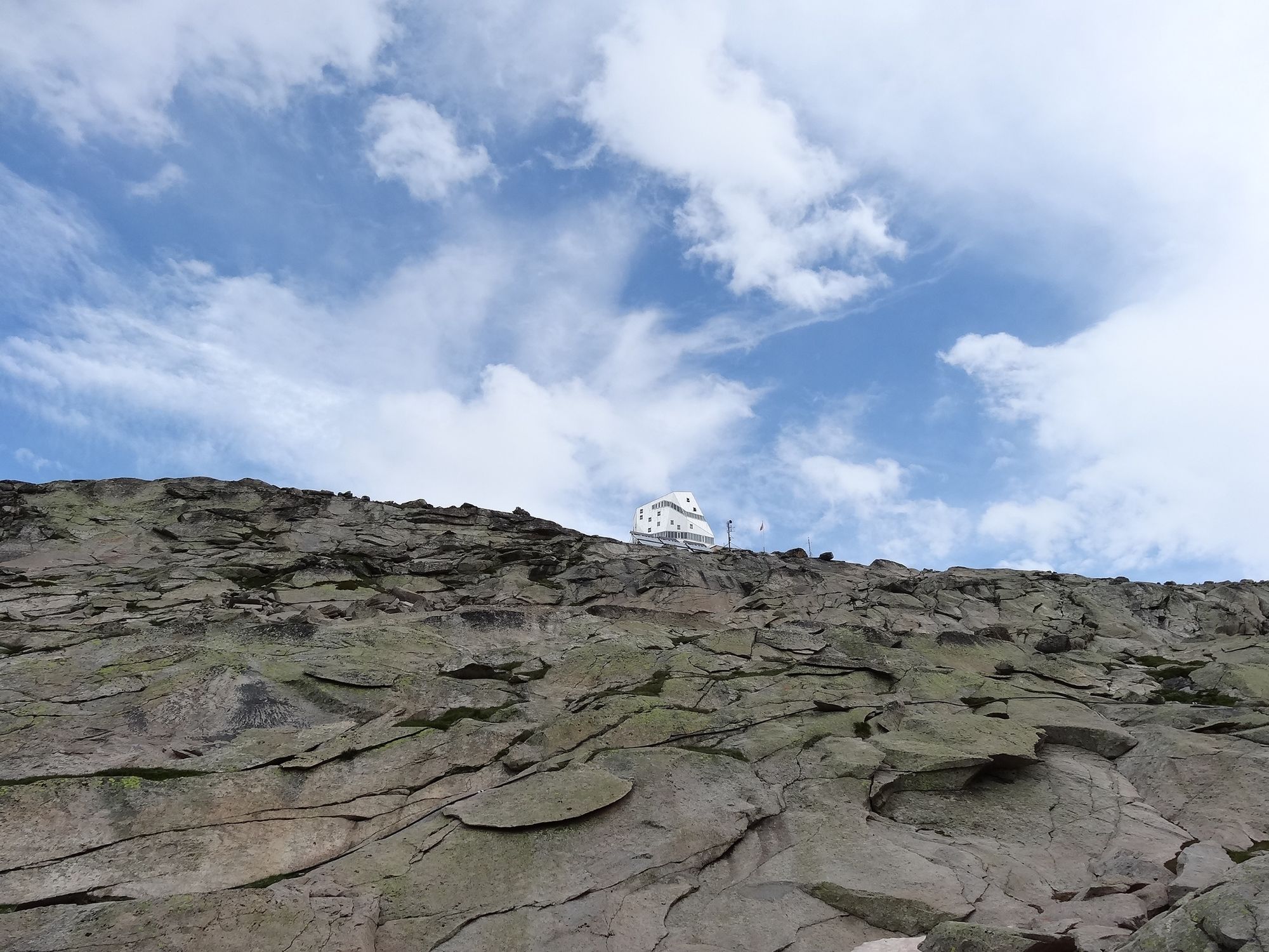
Monte Rosa Hut (2,883 m)
- Height profile
-
 © outdooractive.com
 - Equipment
-
We recommend:
Good mountain boots Crampons Hiking poles (optional) Clothing suitable for the weather (always carry a waterproof)Note: The crossings to the glacier and the glacier passages are constantly changing and often very tricky. Good climbing boots and crampons are essential. Sticks or ice axes can be helpful and it's a good idea to take a rope. Good stamina is also important.
- Safety instructions
-
Plan every mountain tour carefully and adapt to participants’ fitness level as well as the weather and season. Weather conditions can change quickly in the mountains. Appropriate clothing is therefore essential, along with adequate supplies of food and water. In uncertain weather, turn back in good time. Inform others of planned route, and whenever possible avoid going alone. Do not leave the marked routes; do not venture onto glaciers without a mountain guide. It is forbidden to walk on the ski pistes. Please be considerate to other walkers and to plants and animals. Take note of the warning signs drawing attention to the constant danger in river beds and along watercourses below dams and reservoirs.
Important! Difficulty level T4 – the route is difficult. Glacier traverse. Unsuitable for inexperienced mountain hikers. We recommend the services of a mountain guide. Return hiking time 6-7 hours.
- Tips
-
Please contact the Monte Rosa Hut for the most up-to-date information on trail conditions.
The route leads across the glacier. Recommended: book a mountain guide.
Instead of returning from the Monte Rosa hut on the same day, this modern hut has 120 beds for overnight stays.
Learn interesting facts about the climate on the train ride. To the audio stories
- Additional information
- Directions
-
Zermatt is car-free. Private vehicles are permitted only as far as Täsch (5 km before Zermatt). The Täsch–Zermatt road is closed to the public.
Onward travel to Zermatt is either by private taxi or shuttle train. Trains depart every 20 minutes; the journey takes about 12 minutes, and ends at the Bahnhofplatz in Zermatt. - Public transportation
-
By train to the Matterhorn village: 3½ hours from Zürich airport or 4 hours from Geneva airport. Change at Visp onto the Matterhorn Gotthard Bahn (Matterhorn Gotthard Railway). From Visp, the railway leads through the Mattertal valley past idyllic small villages to Zermatt.
Zermatt is also the start and finish point for the world-famous Glacier Express panoramic train journey (Zermatt to St. Moritz or Davos). - Parking
-
Täsch has car parks with both covered and open-air parking – e.g. at the Matterhorn Terminal or privately operated facilities.
Onward travel: see “Getting there”.


- Author
-
The tour Glacier trek to the Monte Rosa Hut (Nr. 21a) is used by outdooractive.com provided.


General info
-
Unterwallis
1196
-
Mattertal
555
-
Zermatt
154


