


- Brief description
-
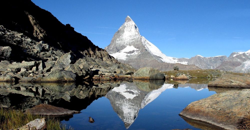
This path leads to a photographic site in a class of its own: the Riffelsee with reflection of the Matterhorn, a small rock in the little lake, pristine nature all around. The ultimate idyll!
- Difficulty
-
easy
- Rating
-
- Starting point
-
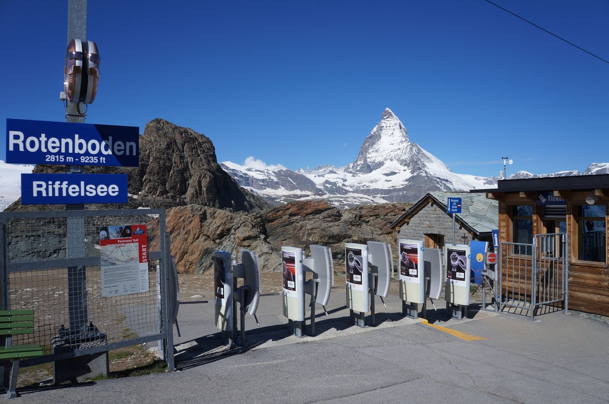
Rotenboden (2,815 m)
- Route
-
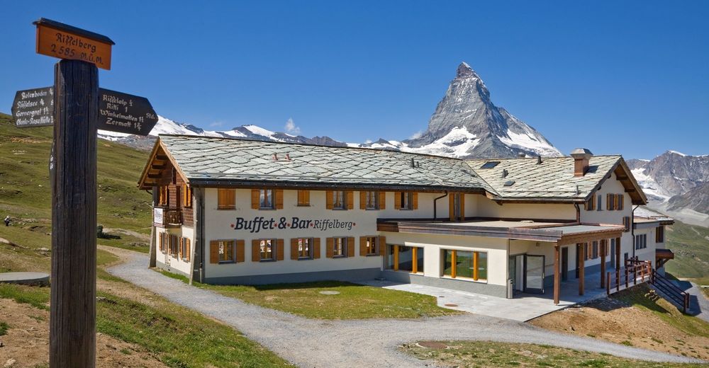
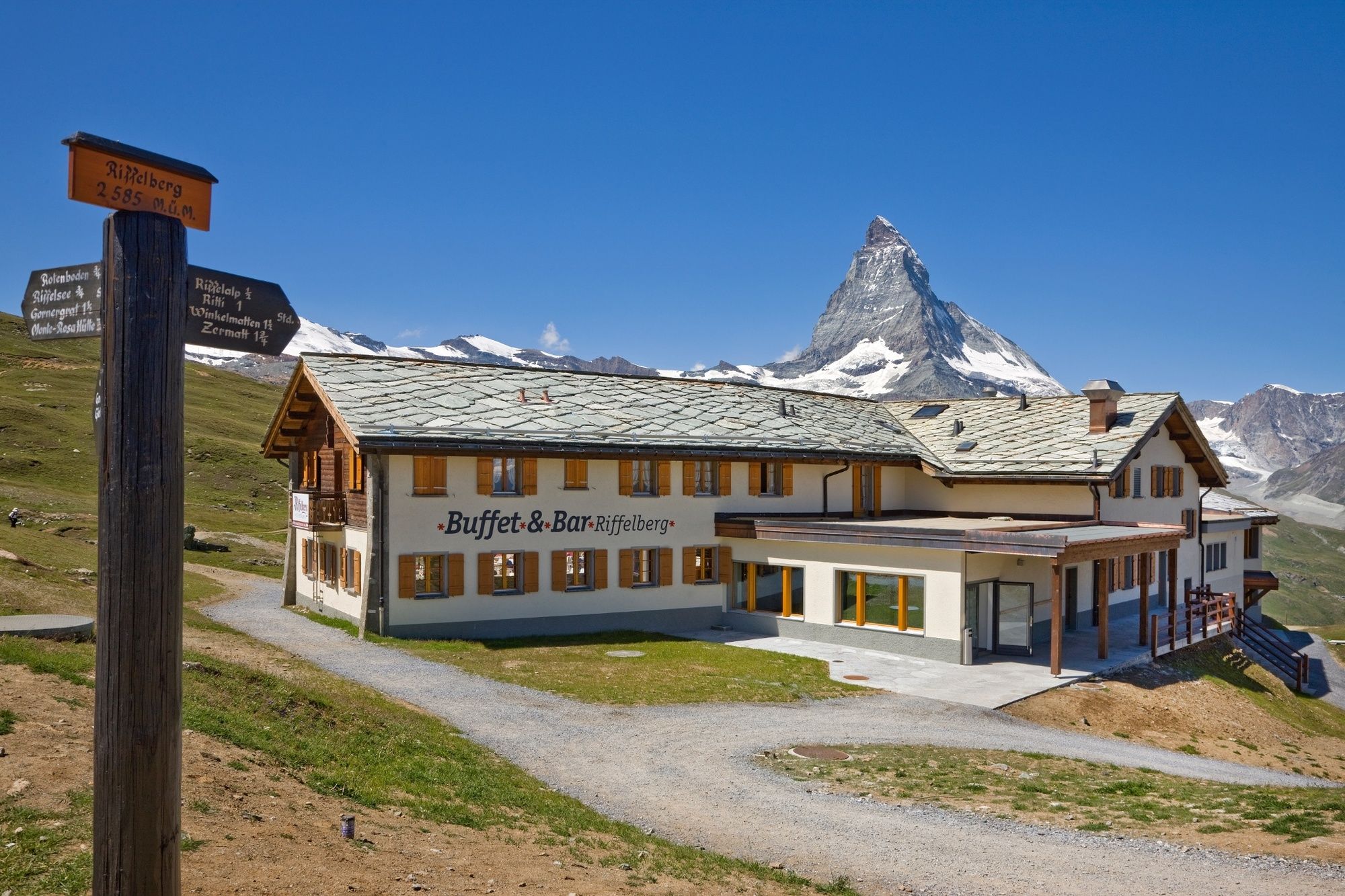
Rotenboden (2,819 m)Kapelle Riffelberg Bruder Klaus2.5 kmBuffet & Bar Riffelberg2.9 kmRiffelberg (2,582 m)2.9 km
- Best season
-
JanFebMarAprMayJunJulAugSepOctNovDec
- Description
-
The surface of the Riffelsee lake is usually still, and so ideal for taking photos. This pristine alpine landscape promises visitors a complete break from daily reality at lower altitudes. The play of light and shadow among the clouds in the sky, the vast horizon, the views of the highest mountains in the Alps: all have an inspiring effect on visitors. “I’m coming back,” they say. “For sure.”
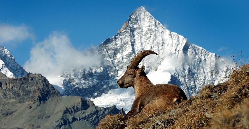
Riffelsee lake: the most beautiful of photographic subjects, with reflection of the Matterhorn Appropriate for children from age 4 On the Riffelhorn: climbing routes for experts Wealth of alpine flora Depending on season, wild animals can be seen (ibex in the Gaggenhaupt region) - Directions
-
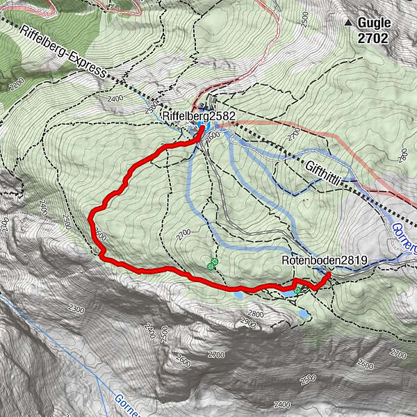
Rotenboden - Riffelsee - Riffelberg (extension possible via Mark Twain Weg or Swiss Topwalk trails)
(Hiking time in reverse direction: approx. 1h 15)
This hike is marked on the signposts as “Riffelseeweg”.
- Highest point
- 2,808 m
- Endpoint
-
Riffelberg (2,582 m)
- Height profile
-
 © outdooractive.com
 - Equipment
-
We recommend:
Good footwear Hiking poles (optional) Clothing suitable for the weather (always carry a waterproof) - Safety instructions
-
Plan every mountain tour carefully and adapt to participants’ fitness level as well as the weather and season. Weather conditions can change quickly in the mountains. Appropriate clothing is therefore essential, along with adequate supplies of food and water. In uncertain weather, turn back in good time. Inform others of planned route, and whenever possible avoid going alone. Do not leave the marked routes; do not venture onto glaciers without a mountain guide. Please be considerate to other walkers and to plants and animals. Take note of the warning signs drawing attention to the constant danger in river beds and along watercourses below dams and reservoirs.
Caution! In spring the path may not be passable because of snow.
- Tips
-
Consider first riding all the way up to the Gornergrat on the Gornergrat Bahn cog railway. The view from the observation platform: a breathtaking panorama of glaciers and mountains, including 29 peaks above 4,000 m. Then ride back to Rotenboden.
- Directions
-
Zermatt is car-free. Private vehicles are permitted only as far as Täsch (5 km before Zermatt). The Täsch–Zermatt road is closed to the public.
Onward travel to Zermatt is either by private taxi or shuttle train. Trains depart every 20 minutes; the journey takes about 12 minutes, and ends at the Bahnhofplatz in Zermatt. - Public transportation
-
By train to the Matterhorn village: 3½ hours from Zürich airport or 4 hours from Geneva airport. Change at Visp onto the Matterhorn Gotthard Bahn (Matterhorn Gotthard Railway). From Visp, the railway leads through the Mattertal valley past idyllic small villages to Zermatt.
Zermatt is also the start and finish point for the world-famous Glacier Express panoramic train journey (Zermatt to St. Moritz or Davos). - Parking
-
Täsch has car parks with both covered and open-air parking – e.g. at the Matterhorn Terminal or privately operated facilities.
Onward travel: see “Getting there”.


- Author
-
The tour Riffelsee Lake Trail (Nr. 21) is used by outdooractive.com provided.


General info
-
Unterwallis
1196
-
Mattertal
555
-
Zermatt
154


