


- Brief description
-
Every mountain hiker dreams of spotting edelweiss in the alpine pastures. Here that dream comes true. Along this trail, walkers even spot these beautiful flowers at eye level. The walk leads to one of the finest vantage points in the Zermatt region.
- Difficulty
-
difficult
- Rating
-
- Starting point
-
Zermatt (1,620 m)
- Route
-
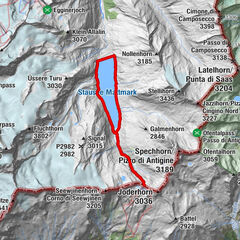
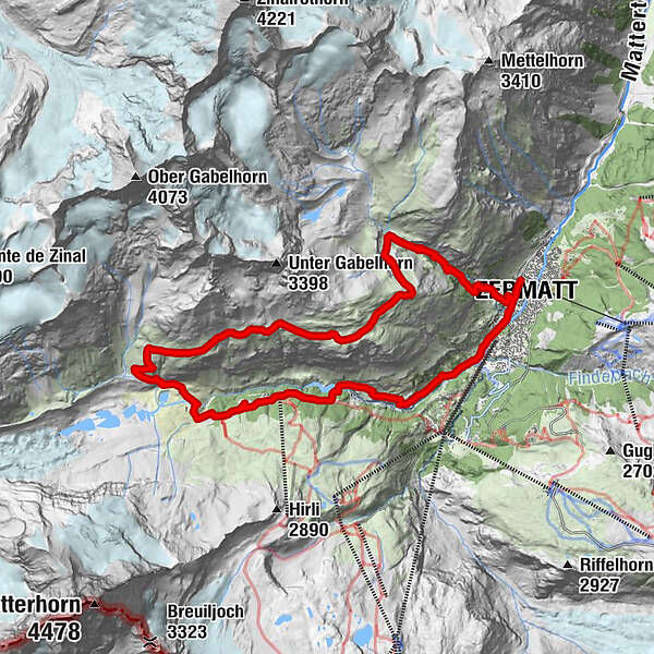
Zermatt (1,608 m)0.2 kmBerggasthaus Trift (2,337 m)3.9 kmZmuttbachfall11.7 kmStafelalp13.6 kmStafel (2,139 m)14.0 kmBiel14.5 kmZmutt16.8 kmRestaurant Jägerstube16.9 kmKirche St. Mauritius20.1 kmZermatt (1,608 m)20.3 km
- Best season
-
JanFebMarAprMayJunJulAugSepOctNovDec
- Description
-
The edelweiss can be admired at a variety of habitats in the Zermatt mountains. It won’t grow on ground formed of crystalline rock, but it flourishes on calcareous sediments – despite the often harsh conditions. The fleecy hairs help protect the flowers from solar radiation, frost and aridity. The seeds require exposure to frost before they can germinate the following year.
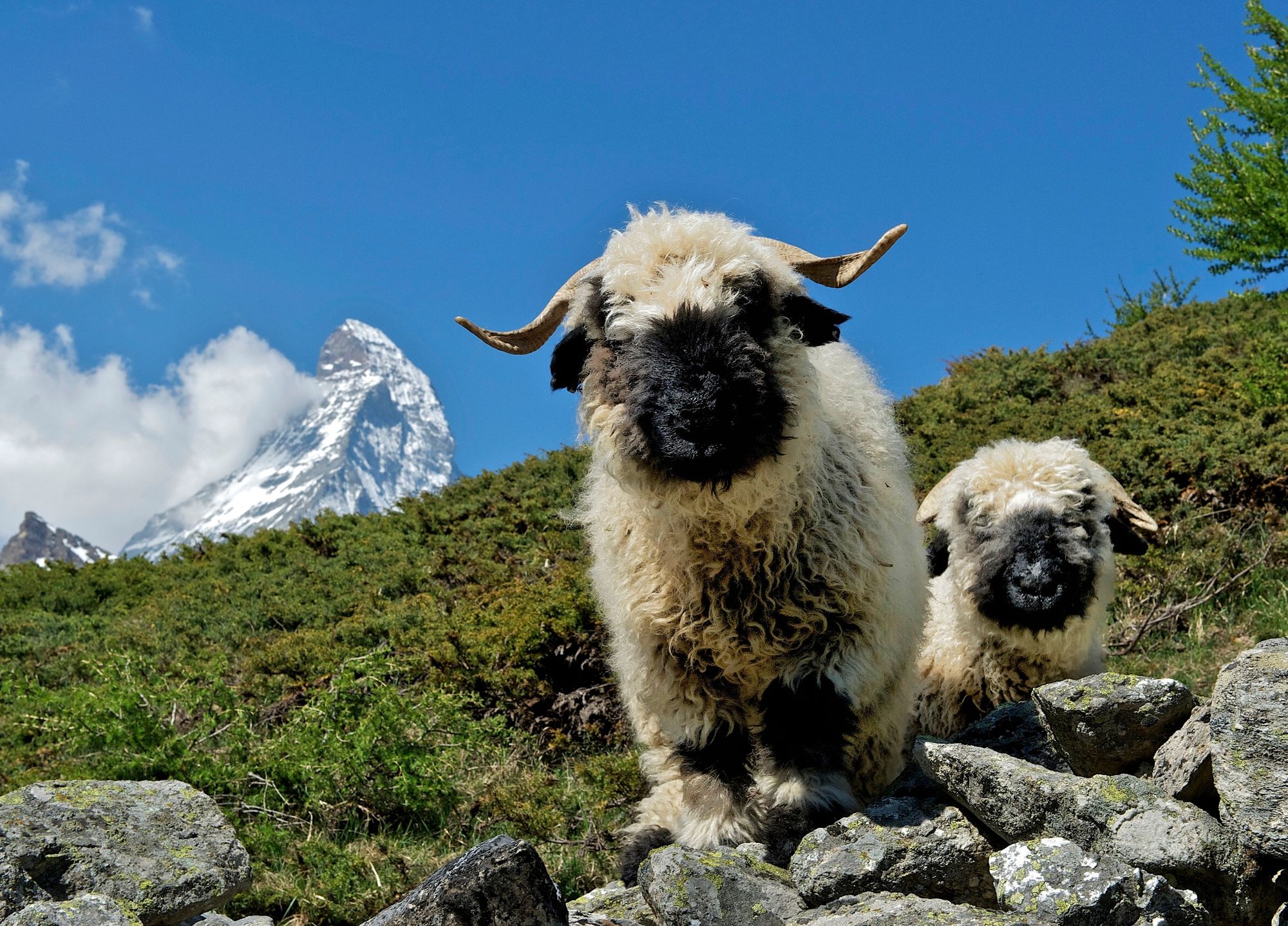
Edelweiss: a protected plant Information panels about the plants along the way Between the Gasthaus Edelweiss and the Berggasthaus Trift hotels: edelweiss at eye level (right-hand side) Unusual view of the Monte Rosa massif Possible encounters with Valais Blacknose sheep and Valais Blackneck goats
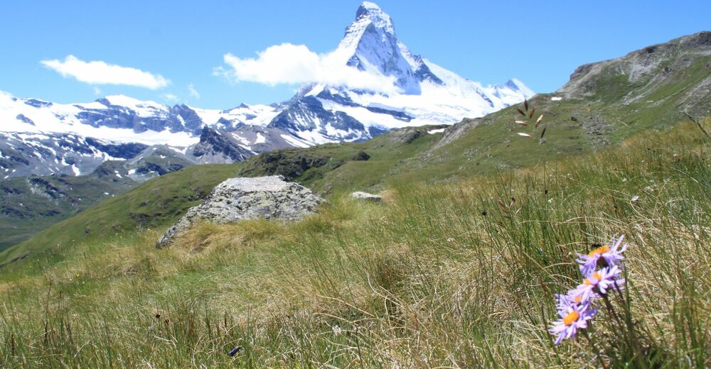
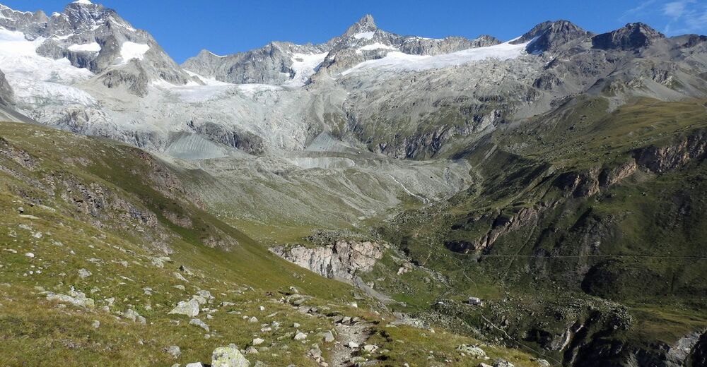
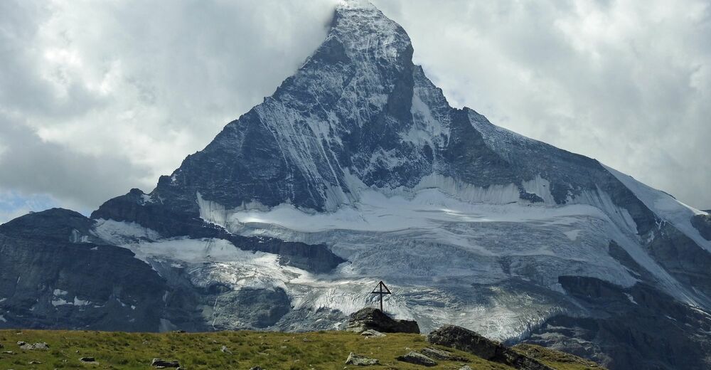
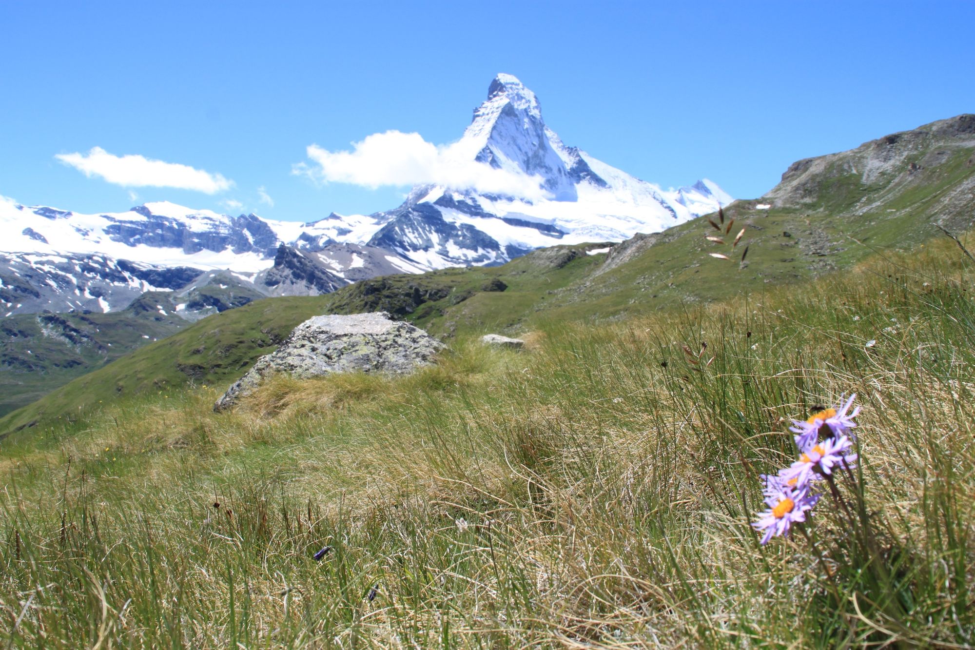
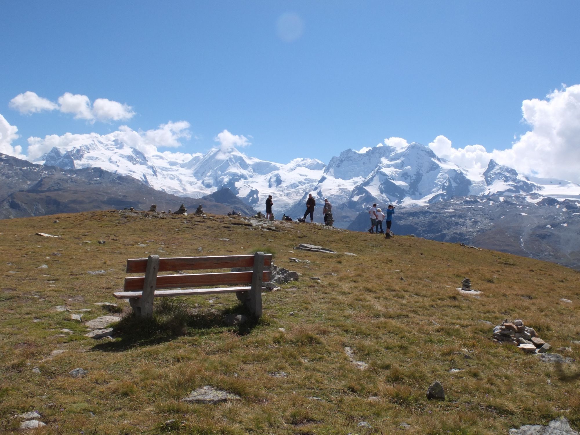
Hikers on this trail experience a magical moment on the climb up to Trift as the pinnacle of the Matterhorn emerges unexpectedly from behind a hilltop. Who’ll spot it first? The path then continues to one of Zermatt’s finest viewpoints, at Höhbalmen. The panorama is breathtaking: the north face of the Matterhorn with the Zmuttgrat ridge, the Breithorn, Liskamm and the Monte Rosa massif. - Directions
-
Zermatt (station) - Alterhaupt (Edelweiss) - Trift - Höhbalmen - Zmutt - Zermatt (station)
(Hiking time in reverse direction: approx. 7h 20)
This hike is marked on the signposts as “Edelweissweg Höhbalmen”.
- Highest point
- 2,741 m
- Endpoint
-
Zermatt (1,620 m)
- Height profile
-
 © outdooractive.com
 - Equipment
-
We recommend:
Good footwear Hiking poles (optional) Clothing suitable for the weather (always carry a waterproof) - Safety instructions
-
Plan every mountain tour carefully and adapt to participants’ fitness level as well as the weather and season.
Weather conditions can change quickly in the mountains. Appropriate clothing is therefore essential, along with adequate supplies of food and water. In uncertain weather, turn back in good time.
Inform others of planned route, and whenever possible avoid going alone.
Do not leave the marked routes; do not venture onto glaciers without a mountain guide.
Please be considerate to other walkers and to plants and animals.
Take note of the warning signs drawing attention to the constant danger in river beds and along watercourses below dams and reservoirs. - Tips
-
Please do not feed the Valais Blackneck goats or the Valais Blacknose sheep.
At Höhbalmen and on towards Hohliecht: keep an eye open for eagles, which occasionally circle in the skies above. - Additional information
- Directions
-
Zermatt is car-free. Private vehicles are permitted only as far as Täsch (5 km before Zermatt). The Täsch–Zermatt road is closed to the public.
Onward travel to Zermatt is either by private taxi or shuttle train. Trains depart every 20 minutes; the journey takes about 12 minutes, and ends at the Bahnhofplatz in Zermatt. - Public transportation
-
By train to the Matterhorn village: 3½ hours from Zürich airport or 4 hours from Geneva airport. Change at Visp onto the Matterhorn Gotthard Bahn (Matterhorn Gotthard Railway). From Visp, the railway leads through the Mattertal valley past idyllic small villages to Zermatt.
Zermatt is also the start and finish point for the world-famous Glacier Express panoramic train journey (Zermatt to St. Moritz or Davos). - Parking
-
Täsch has car parks with both covered and open-air parking – e.g. at the Matterhorn Terminal or privately operated facilities.
Onward travel: see “Getting there”.


- Author
-
The tour Edelweiss Trail (Höhbalmen) (Nr. 30) is used by outdooractive.com provided.


General info
-
Unterwallis
1197
-
Mattertal
555
-
Zermatt
154