

- Brief description
-
This hike at the foot of the glaciers passes by two mountain huts in the Champex-Lac region and offers a spectacular view of the Mont Blanc massif.
- Difficulty
-
difficult
- Rating
-
- Starting point
-
La Breya
- Route
-
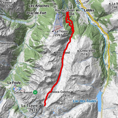
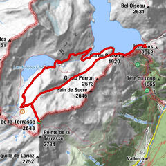
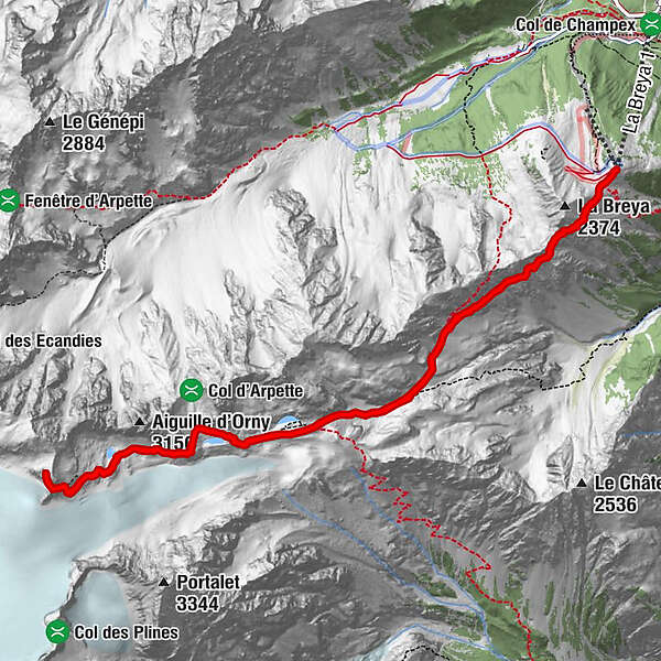
Cabane d'Orny (2,831 m)4.5 kmCabane du Trient (3,170 m)6.6 kmCabane d'Orny (2,831 m)8.7 km
- Best season
-
JanFebMarAprMayJunJulAugSepOctNovDec
- Description
-
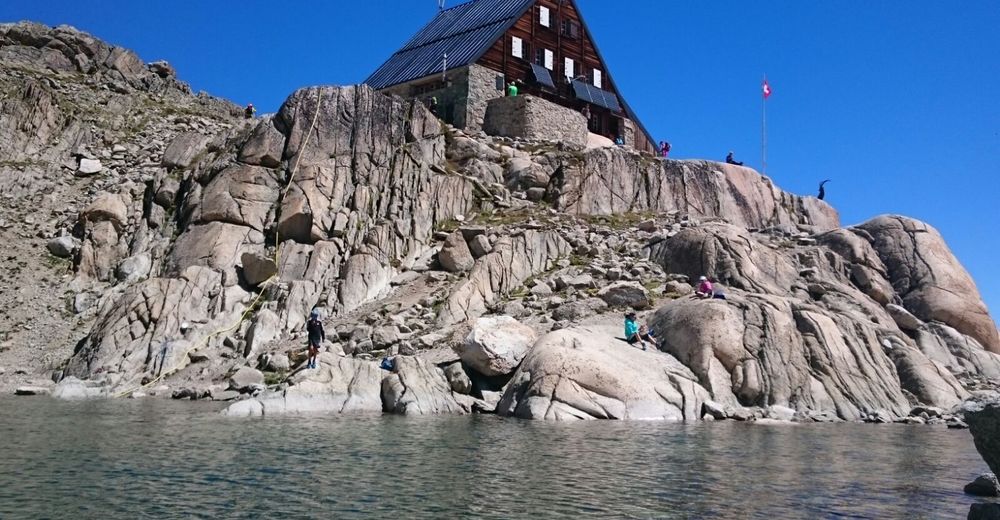
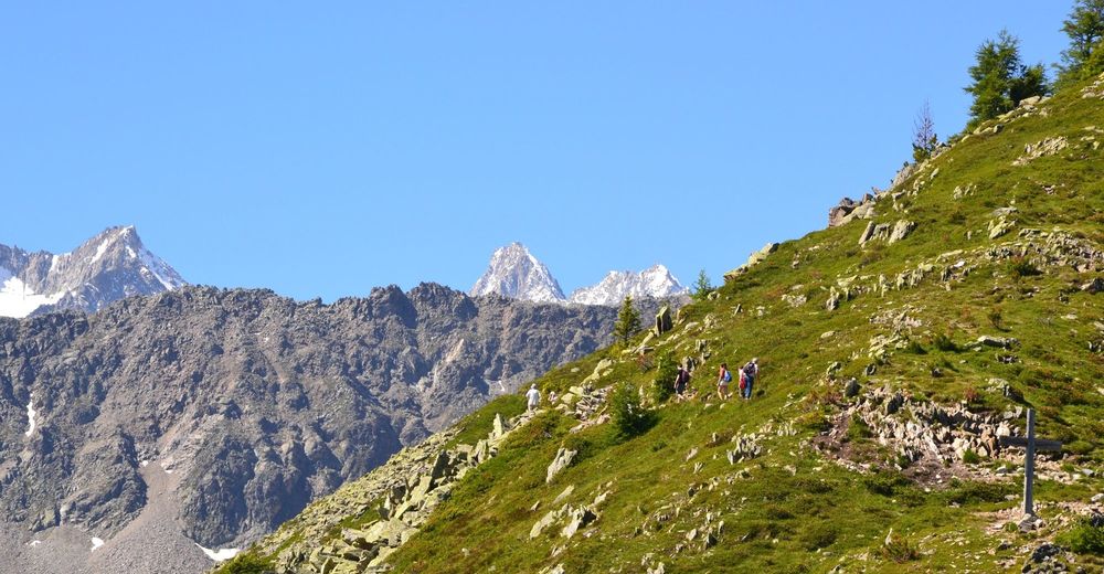
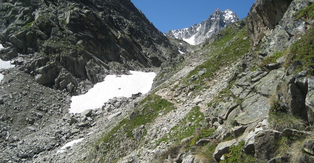
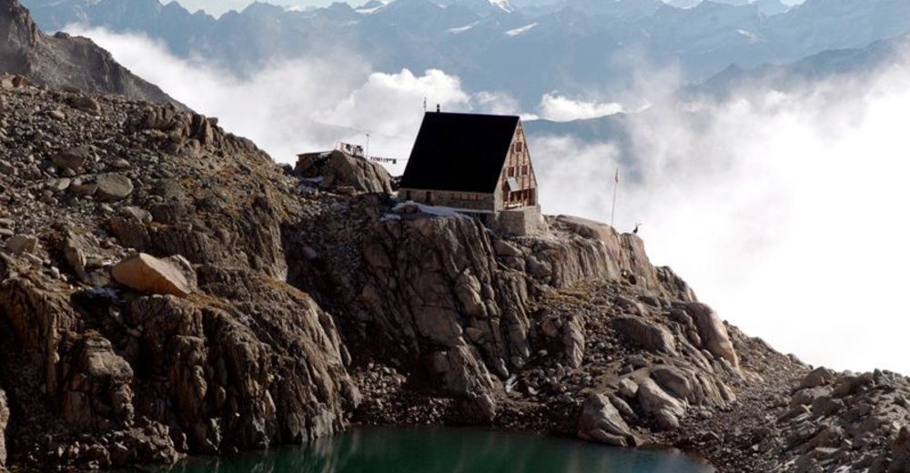
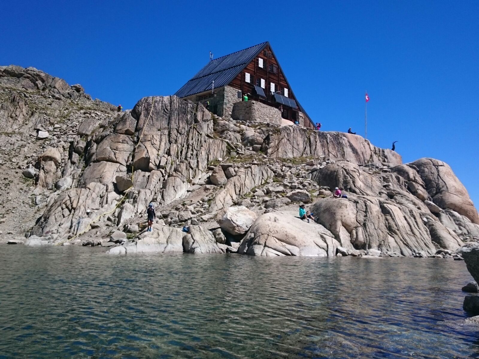
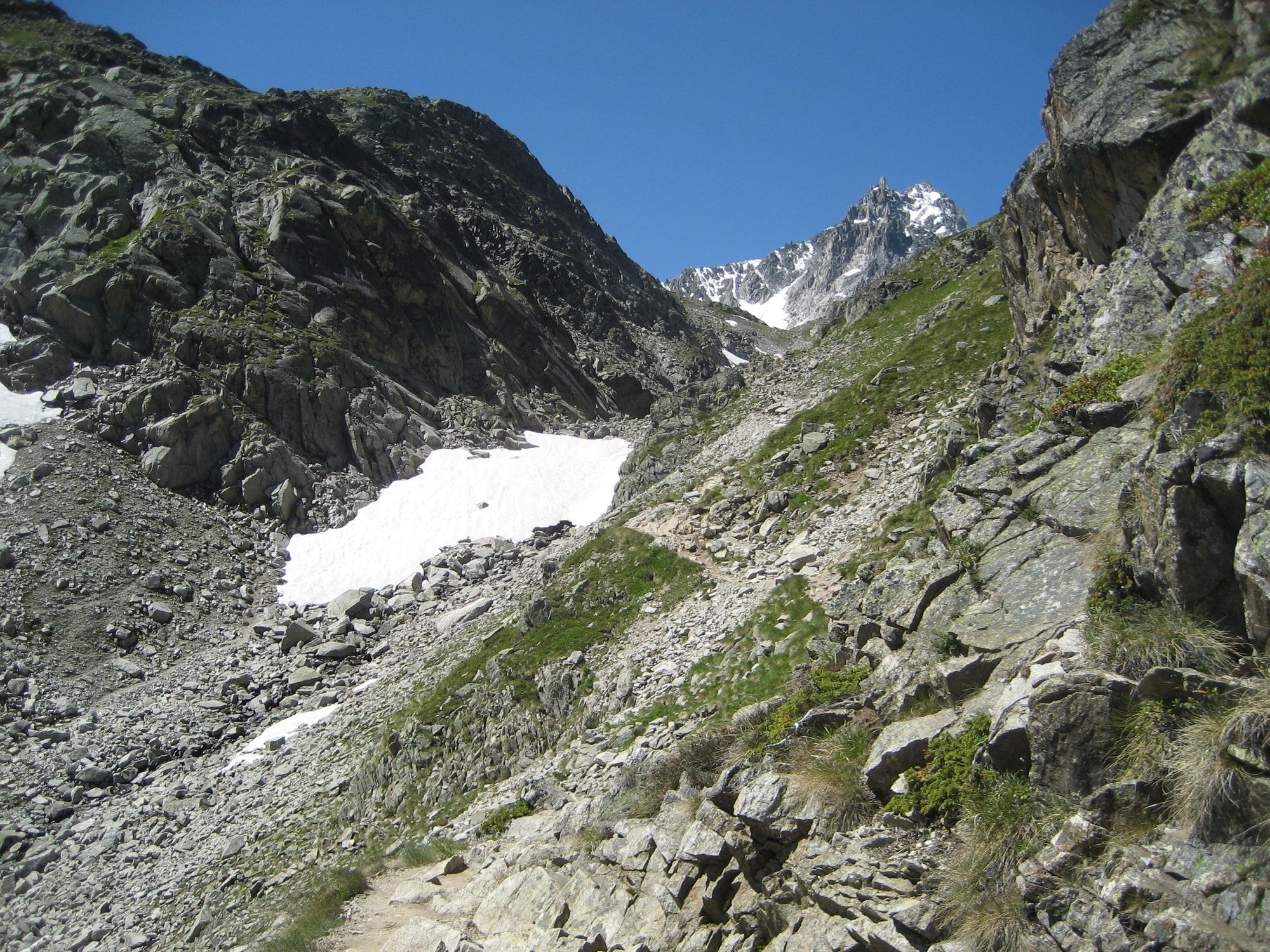
Experienced hikers will enjoy this demanding hike through a wild and fascinating natural landscape. Begin your ascent with a chairlift journey up to La Breya, during which you can enjoy the vast panorama stretching from Lake Geneva to the Grand Combin. You then follow a path whose narrow and elevated opening section is sure to please hikers with a love of heights. Continue to the moraine of the Orny Glacier, then on to the mountain hut that shares its name. It is recognizable thanks to the bronze ibex that stands at the base of a mast adorned with the Swiss flag. The hike continues across the scree and along the glacier before zigzagging through a final, relatively steep climb up to the Trient mountain hut. Your efforts are then rewarded with a magnificent view of the Trient plateau and the Mont Blanc massif. The return journey follows the same path, with the option of making your way down via the Val d’Arpette or heading back to La Breya. Those looking for more of a challenge can finish the hike on foot instead of taking the chairlift.
- Directions
-
From Champex, take the La Breya chairlift and follow the signs to Orny mountain hut. The initial section follows a narrow path next to a steep drop that opens up as it climbs towards the ridge and then crosses a broad slope overlooking the Combe d’Orny valley. It then follows the moraine along the Orny Glacier to the cabin of the same name, where you can take your first well-earned break. The route continues across the scree and on the glacier. After passing the lake, head downhill on the compact surface of the Orny Glacier and continue on the snow, following the signage as well as the numerous traces left by the rope routes that have passed through the region. You should not leave the trail under any circumstances and should not hesitate to give up if you are unsure about the weather or conditions on the glacier. Arrows painted on rocks will show you when to leave the glacier and climb the base of the Pointe d’Orny. After a final climb on a very steep slope you’ll arrive at the Trient mountain hut, where the panorama from the terrace will quickly make you forget all the effort you’ve put in. It takes four to five hours to hike the full route and reach this second mountain hut. For the return journey, you have the choice between following the same route in reverse or continuing the hike across the Val d’Arpette. If you take the first option, the La Breya chairlift may be closed if you get back too late, in which case you would have to make the final downhill section on foot.
- Highest point
- 3,155 m
- Endpoint
-
La Breya
- Height profile
-
 © outdooractive.com
 - Equipment
-
We recommend:
good footwear clothing suitable for the weather: always carry a waterproof jacket hat or cap sunscreen bottle for water picnic camera binoculars (optional) hiking poles (optional) printout of this hike (click «Print» icon, to download)For certain walks:
Swimwear - Safety instructions
-
Use of the trails and the information on this website is at hikers’ own risk. Local conditions may entail changes to routes. Valais/Wallis Promotion accepts no liability for the accuracy and completeness of information on this website.
For all hikes:
Bring a map. Download full description of this route including large-scale map by clicking on «Print» icon, top right of this page. Use marked trails only, and observe all signposting – for your own safety, to safeguard grazing animals and to avoid disturbing wildlife. Close gates after passing through. Please be considerate to other trail users, and to the plants and animals. Do not leave any waste in nature.For mountain hikes:
Take extra care protecting yourself from the sun at altitude. UV radiation can be exceptionally strong, even in cloudy weather. Plan hike carefully: take into consideration fitness level of each participant, weather forecast and season. Weather conditions can change quickly in the mountains, without warning. Appropriate clothing is therefore essential, along with adequate supplies of food and water. In uncertain weather, turn back in good time.For high-altitude hikes:
Inform others of the route you plan to take. Whenever possible, avoid going alone. Do not venture onto glaciers without a mountain guide. Take note of the warning signs that point out the constant danger in river beds and along watercourses below dams and reservoirs: water levels may rise rapidly without warning. - Tips
-
On the way back, take the opportunity to try the La Breya ziplines, located at the cable car mountain station of the same name. At 540m and 520m respectively, they combine to form the longest zipline installation in French-speaking Switzerland.
- Additional information
- Directions
-
A9 motorway to Martigny, then E27 towards Gd-St-Bernard to Les Valettes, then follow "Champex".
- Public transportation
-
Access by train to Orsières, then by bus to Champex, chairlift. The Breya chairlift is open every day from mid-June to mid-September.
- Parking
-
Large free parking lot from the Breya chairlift


- Author
-
The tour Orny and Trient mountain huts is used by outdooractive.com provided.


General info
-
Portes du Soleil
974
-
Pays du Saint-Bernard
323
-
Champex-Lac
104