Face to face with the Matterhorn from Rotenboden to the Riffelalp


- Brief description
-
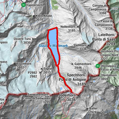
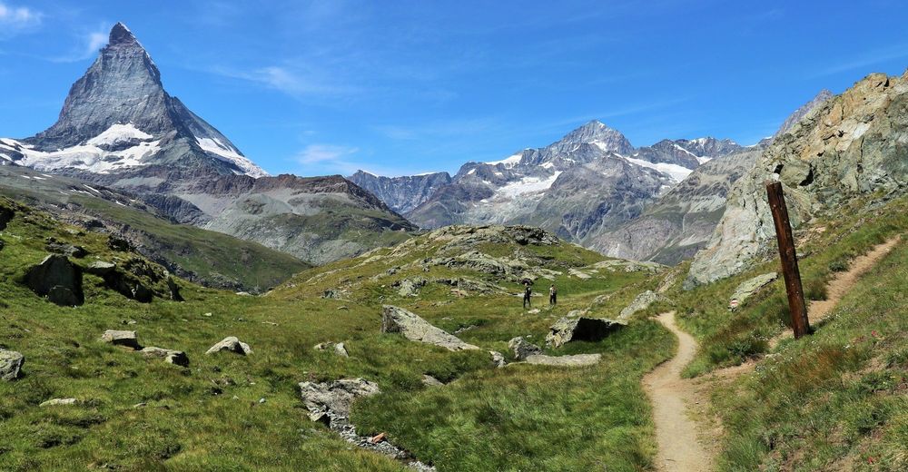
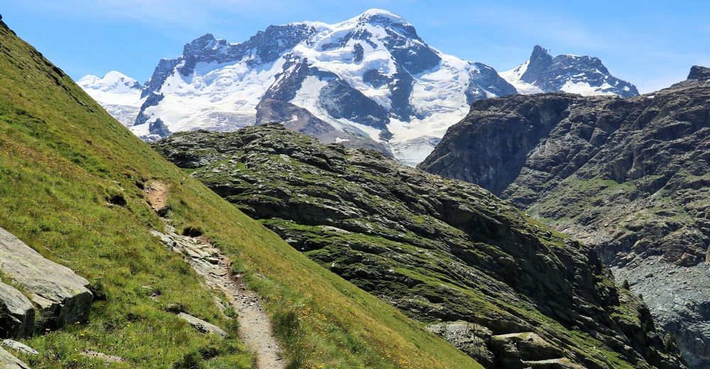
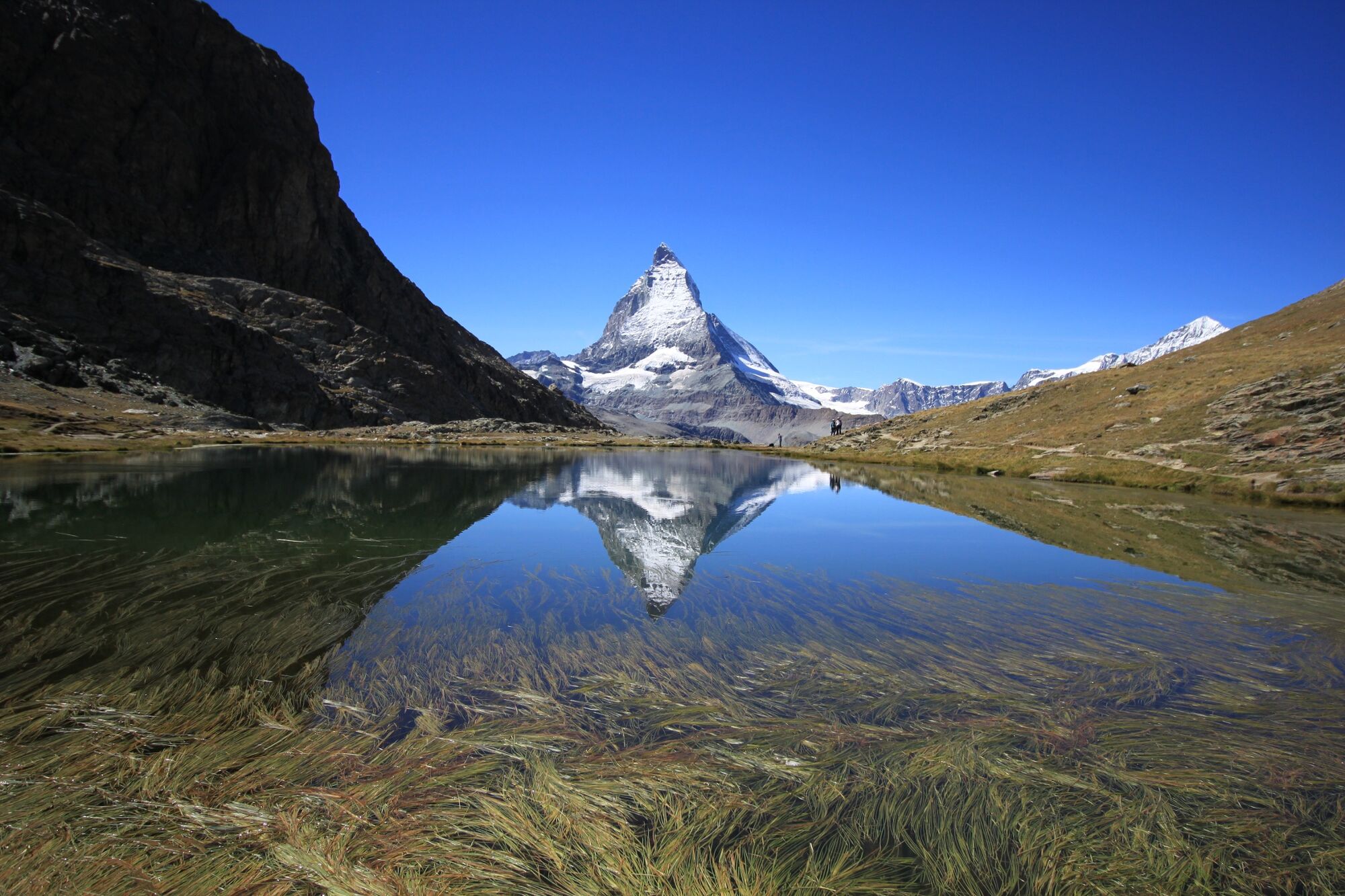
A pleasant hike starting at the Gornergrat railway station at Rotenboden (2,815m) to Riffelalp (2,211m). The path takes walkers past the Riffelsee lake with its incomparable reflection of the Matterhorn and, in the lower part of the hike, diverse alpine flora.
- Difficulty
-
medium
- Rating
-
- Starting point
-
Rotenboden station (2815 m.a.s.l.)
- Route
-
Rotenboden (2,819 m)0.0 kmRiffelalp (2,222 m)5.4 kmAl Bosco5.4 kmRiffelalp5.8 km
- Best season
-
JanFebMarAprMayJunJulAugSepOctNovDec
- Description
-
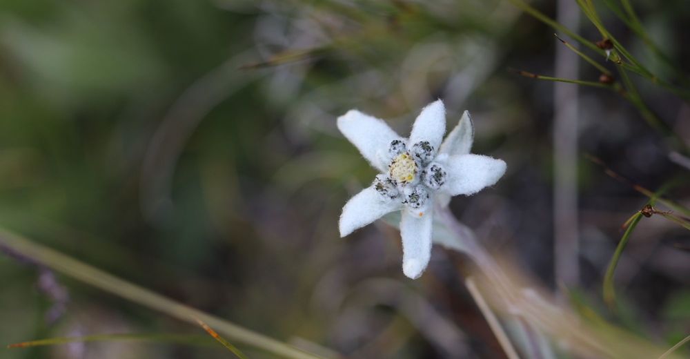
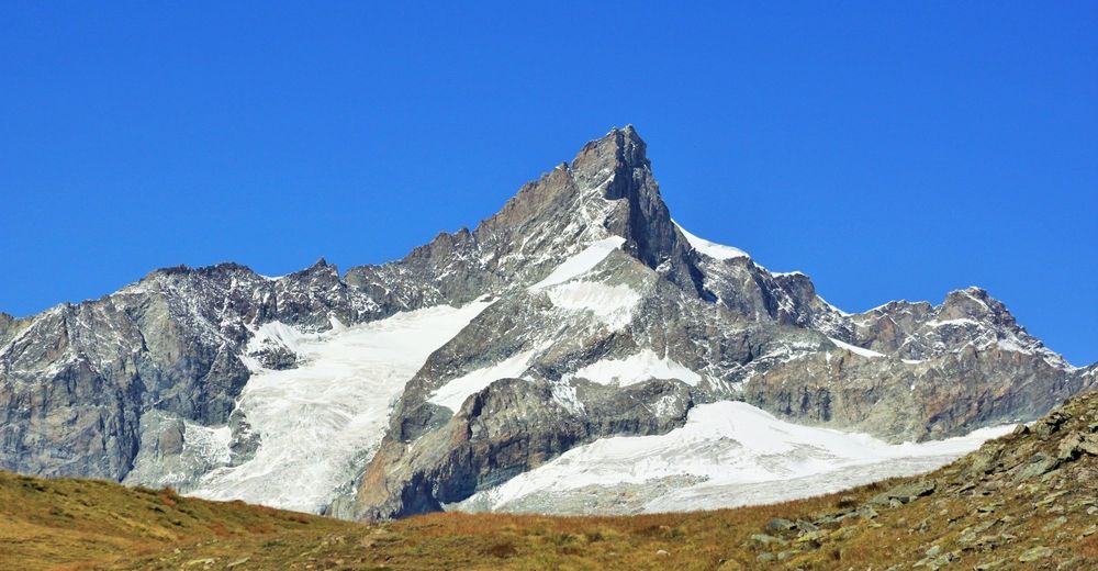
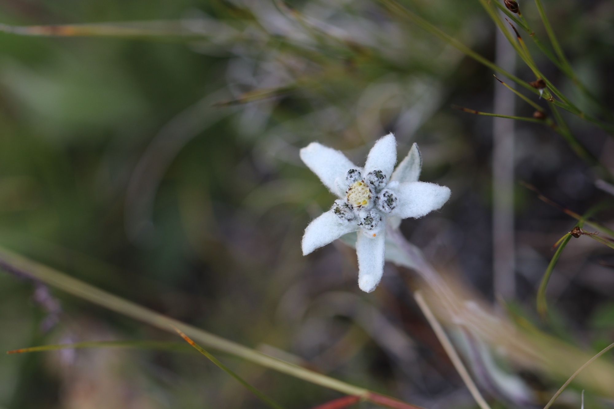
Not far from the Rotenboden railway station you have a view of the Riffelsee lake and after about 15 minutes walkers reach the first highlight on the trail – the idyllic mountain lake with a perfect reflection of the Matterhorn on its surface. The path now goes downwards, heading towards the Matterhorn where the exceptional view of the many 4,000-metre peaks is an astonishing sight, even for seasoned hikers. Keep an eye out for alpine flowers and you might be lucky enough to spot that most famous alpine flower, the edelweiss. From facing the Matterhorn the path turns north-westwards through open country after about 30 minutes, offering a view towards the Weisshorn and then the path becomes a gentle downwards slope through meadows and a little wood to Riffelalp. Riffelalp is has a long history; the Hotel Riffelalp was built back in 1884. Many famous people spent time here before it was sadly destroyed by fire in 1961. Almost forty years later the new Riffelalp Resort 2222 was built. Another witness of bygone days is Europe’s highest tram running between the hotel and railway station, now reopened and carefully restored in 2001, exactly as it used to be. From Riffelalp the path is level and goes through an arven-pine forest to Riffelalp station.
- Directions
-
The start for this hike is at the Gornergrat railway’s Rotenboden station (2,815m) going south. After a short walk the Riffelsee lake comes into view, and several small paths lead here. From the Riffelsee lake you follow the signposts in the direction of Gagenhaupt/Riffelalp, generally in the direction of the Matterhorn. After Gagenhaupt the path goes on towards the Riffelalp. Maybe you will catch sight of some edelweiss and other beautiful alpine flowers along the wayside. From Dristelen the walk goes on southwards in the direction ‘Dossen’ to a height of 2,290m. The walk continues along the mainly flat path to Riffelalp. Once you get there you have various possibilities for refreshments for example at the restaurant Alphitta or the Al Bosco in the Riffelalp Resort. Going back from Riffelalp (2,222m) you get to the Gornergrat railway’s Riffelalp station at 2,211m via a lovely arven-pine forest in about 5 minutes.
Of course, you can do the walk the other way around as an upwards route which prolongs the walking time by about two and a quarter hours.
- Highest point
- 2,811 m
- Endpoint
-
Riffelalp station (2211 m.a.s.l.)
- Height profile
-
 © outdooractive.com
 - Equipment
-
We recommend:
good footwear clothing suitable for the weather: always carry a waterproof jacket hat or cap sunscreen bottle for water picnic camera binoculars (optional) hiking poles (optional) printout of this hike (click “Print” icon, to download) - Safety instructions
-
Use of the trails and the information on this website is at hikers’ own risk. Local conditions may entail changes to routes. The Matterhorn Gotthard Bahn accepts no liability for the accuracy and completeness of information on this website.
Bring a map. Download full description of this route including large-scale map by clicking on “Print” icon, top right of this page. Use marked trails only, and observe all signposting – for your own safety, to safeguard grazing animals and to avoid disturbing wildlife. Close gates after passing through. Please be considerate to other trail users, and to the plants and animals. - Tips
-
Walkers really must capture a photo of world-famous reflection of the Matterhorn on the waters of the Riffelsee lake.
With luck you could catch a glimpse of the bearded vulture, whose eyrie is at the back of the Riffelhorn.
Just before the end of your walk the Alphitta beckons walkers to try some home-made specialities and enjoy a relaxing break.
- Additional information
-
Are you travelling to Zermatt by public transport? If you are travelling by public transport for several days, it is worth using the Adventure Card. This gives you 2-5 days of free travel on a large train and post bus network as well as discounts on mountain railways.
Further information:
Tickets Gornergrat Railway Adventure Card Tourist information Zermatt - Directions
-
Zermatt is car-free. We recommend travelling to Zermatt by public transport via Visp.
- Public transportation
-
With the Matterhorn Gotthard Railway from Visp to Zermatt. In Zermatt with the Gornergrat Railway to Rotenboden station. After the hike, the return journey on the Gornergrat Railway takes you from the Riffelalp station (2211m) to Zermatt.
- Parking
-
Zermatt is car-free. The Matterhorn Terminal Täsch in Täsch is a covered multi-storey car park - under one roof with the Täsch railway station, where you can change directly to the Zermatt Shuttles. We generally recommend travelling by public transport via Visp.


- Author
-
The tour Face to face with the Matterhorn from Rotenboden to the Riffelalp is used by outdooractive.com provided.
General info
-
Unterwallis
1192
-
Mattertal
555
-
Zermatt
154