

- Brief description
-
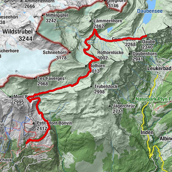
Trekking from Aminona to Gemmi
- Difficulty
-
difficult
- Rating
-
- Starting point
-
Aminona
- Route
-
Hameau de Colombire0.0 kmCave du Sex1.9 kmRothornlücke (3,002 m)10.9 kmLämmerenhütte14.6 kmGemmipass (2,268 m)18.4 km
- Best season
-
JanFebMarAprMayJunJulAugSepOctNovDec
- Description
-
An extremely demanding trekking, which should not be taken lightly. In any case one of the most beautiful tours ever and worth the effort.
- Highest point
- 3,083 m
- Endpoint
-
Gemmi
- Height profile
-
 © outdooractive.com

- Author
-
The tour Trekking Aminona-Gemmi is used by outdooractive.com provided.
GPS Downloads


Other tours in the regions
-
Oberwallis
1872
-
Leuk/Leukerbad
1028
-
Inden VS
286


